See 165th Street, Queens, on the map
Directions to 165th Street (Queens) with public transportation
The following transit lines have routes that pass near 165th Street
 Bus:
Bus: - Train:
- Subway:
How to get to 165th Street by bus?
Click on the bus route to see step by step directions with maps, line arrival times and updated time schedules.
How to get to 165th Street by train?
Click on the train route to see step by step directions with maps, line arrival times and updated time schedules.
How to get to 165th Street by subway?
Click on the subway route to see step by step directions with maps, line arrival times and updated time schedules.
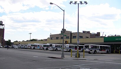
Bus stations near 165th Street in Queens
- Guy R Brewer Bl /Linden Bl,10 min walk,
Train stations near 165th Street in Queens
- St.Albans,26 min walk,
- Locust Manor,28 min walk,
Subway stations near 165th Street in Queens
- Jamaica Center - Parsons/Archer [E,J,Z],37 min walk,
- 169 St [F],44 min walk,
Bus lines to 165th Street in Queens
- Q111,Cedarhurst Peninsula Bl Via Brewer Bl Via 147 Av,
- Q113,Limited Far Rockaway Seagirt Bl Via Brewer Bl/Nassau Expwy,
- Q114,Limited Far Rockaway Seagirt Bl Via Brewer Bl,
What are the closest stations to 165th Street?
The closest stations to 165th Street are:
- Guy R Brewer Bl /Linden Bl is 772 yards away, 10 min walk.
- St.Albans is 2194 yards away, 26 min walk.
- Locust Manor is 2371 yards away, 28 min walk.
- Jamaica Center - Parsons/Archer [E,J,Z] is 3161 yards away, 37 min walk.
- 169 St [F] is 3729 yards away, 44 min walk.
Which bus lines stop near 165th Street?
These bus lines stop near 165th Street: Q111, Q113, Q114.
Which train lines stop near 165th Street?
These train lines stop near 165th Street: BABYLON, LONG BEACH.
Which subway lines stop near 165th Street?
These subway lines stop near 165th Street: E, J.
What’s the nearest train station to 165th Street in Queens?
The nearest train station to 165th Street in Queens is St.Albans. It’s a 26 min walk away.
What’s the nearest bus stop to 165th Street in Queens?
The nearest bus stop to 165th Street in Queens is Guy R Brewer Bl /Linden Bl. It’s a 10 min walk away.
See 165th Street, Queens, on the map
Public Transit to 165th Street in Queens
Wondering how to get to 165th Street in Queens, United States? Moovit helps you find the best way to get to 165th Street with step-by-step directions from the nearest public transit station.
Moovit provides free maps and live directions to help you navigate through your city. View schedules, routes, timetables, and find out how long does it take to get to 165th Street in real time.
Looking for the nearest stop or station to 165th Street? Check out this list of stops closest to your destination: Guy R Brewer Bl /Linden Bl; St.Albans; Locust Manor; Jamaica Center - Parsons/Archer [E,J,Z]; 169 St [F].
Bus:Train:Subway:
Want to see if there’s another route that gets you there at an earlier time? Moovit helps you find alternative routes or times. Get directions from and directions to 165th Street easily from the Moovit App or Website.
We make riding to 165th Street easy, which is why over 1.5 million users, including users in Queens, trust Moovit as the best app for public transit. You don’t need to download an individual bus app or train app, Moovit is your all-in-one transit app that helps you find the best bus time or train time available.
For information on prices of bus, subway and train, costs and ride fares to 165th Street, please check the Moovit app.
Use the app to navigate to popular places including to the airport, hospital, stadium, grocery store, mall, coffee shop, school, college, and university.
165th Street Address: 165th St, Jamaica, NY, USA street in Queens
Attractions near 165th Street
N Y City Developments,117-19 165th Street,166 Foch,11724 166th Street,Foch Blvd,Clean Rite Center,Queens Dialysis Center (Davita Dialysis Center),NYCHA - Baisley Park Houses,Top Clean 2,Joseph P Addabbo Family Health Care,Baisley Deli,Royal Fried Chicken,Wine & Liquor,Foch Blvd Smith,Foch Blvd & 167th,Foch Smith,167th Smith,167th Foch,Smith St Bishop Curtis G Norton Sr Dr,Guy R Brewer BlvdHow to get to popular attractions in Queens with public transit
Nathan's Famous,Veselka, Manhattan,The Meatball Shop,Peter Luger Steak House,I-80 (Interstate 80), Paterson, Nj,Mad Dog & Beans Mexican Cantina, Manhattan,MTA Subway - 42nd St / Bryant Park (B / D/F / M/7), Manhattan,SoHo, Manhattan,Hill Country Chicken, Manhattan,5 Napkin Burger, Manhattan,Top of The Standard, Manhattan,Grimaldi's Pizzeria,Stamford Transportation Center : Bus / Train (STM) Metro North & Amtrak, Stamford, Ct,Time Life, Manhattan,Jing Fong Restaurant 金豐大酒樓, Manhattan,Central Park SummerStage, Manhattan,Tom & Jerry's, Manhattan,Red Rooster, Manhattan,Gramercy Tavern, Manhattan,Barrage, ManhattanGet around Queens by public transit!
Traveling around Queens has never been so easy. See step by step directions as you travel to any attraction, street or major public transit station. View bus and train schedules, arrival times, service alerts and detailed routes on a map, so you know exactly how to get to anywhere in Queens.
When traveling to any destination around Queens use Moovit's Live Directions with Get Off Notifications to know exactly where and how far to walk, how long to wait for your line, and how many stops are left. Moovit will alert you when it's time to get off — no need to constantly re-check whether yours is the next stop.
Wondering how to use public transit in Queens or how to pay for public transit in Queens? Moovit public transit app can help you navigate your way with public transit easily, and at minimum cost. It includes public transit fees, ticket prices, and costs. Looking for a map of Queens public transit lines? Moovit public transit app shows all public transit maps in Queens with all bus, subway or train routes and stops on an interactive map.
Queens has 3 transit type(s), including: bus, subway or train, operated by several transit agencies, including MTA Subway, Metro-North Railroad, LIRR, PATH, Shore Line East, MTA Bus Company, MTA New York City Transit - Express routes, MTA Bus, NJ Transit, NYC Ferry, NICE bus, Bee-Line Bus, NJ Transit Rail, NJ Transit Rail and Norwalk Transit District