Directions to AT&T Park station (Soma, Sf) with public transit
The following transit lines have routes that pass near AT&T Park
How to get to AT&T Park station by bus?
Click on the bus route to see step by step directions with maps, line arrival times and updated time schedules.
How to get to AT&T Park station by train?
Click on the train route to see step by step directions with maps, line arrival times and updated time schedules.
How to get to AT&T Park station by BART?
Click on the BART route to see step by step directions with maps, line arrival times and updated time schedules.
Light Rail stations near AT&T Park in Soma, Sf
- King St & 2nd St, 3 min walk,
- Fourth St & Brannan Northbound, 10 min walk,
Bus stops near AT&T Park in Soma, Sf
- King St & 2nd St, 3 min walk,
- 3rd St & Brannan St, 4 min walk,
- 4th @ Library (Caltrain), 6 min walk,
- Townsend St & 4th St, 6 min walk,
- 3rd St & Bryant St, 9 min walk,
Train station near AT&T Park in Soma, Sf
- San Francisco, 6 min walk,
Bus lines to AT&T Park station in Soma, Sf
- N BUS, Townsend and 5th St,
- N OWL, Ocean Beach,
- T BUS, Chinatown,
- 15, Sutter & Sansome,
- 30, Caltrain Depot,
- 45, Lyon + Greenwich,
- 91, West Portal Station,
- EAST, 1200 4th,
- TC, Long Bridge Street and El Dorado Street,
- WEST, Owens @ Gene Friend,
- 31, Ocean Beach,
- 8, Bayshore,
- 8AX, Bayshore A Express,
- 8BX, Bayshore B Express,
What are the closest stations to AT&T Park?
The closest stations to AT&T Park are:
- King St & 2nd St is 174 yards away, 3 min walk.
- 3rd St & Brannan St is 315 yards away, 4 min walk.
- San Francisco is 458 yards away, 6 min walk.
- 4th @ Library (Caltrain) is 488 yards away, 6 min walk.
- Townsend St & 4th St is 493 yards away, 6 min walk.
- 3rd St & Bryant St is 711 yards away, 9 min walk.
- Fourth St & Brannan Northbound is 756 yards away, 10 min walk.
Which bus lines stop near AT&T Park?
These bus lines stop near AT&T Park: 15, 31, 45, 8BX, TC.
Which train line stops near AT&T Park?
LOCAL WEEKDAY (San Francisco)
Which BART lines stop near AT&T Park?
These BART lines stop near AT&T Park: RED, YELLOW.
Which light rail line stops near AT&T Park?
N (Caltrain)
What’s the nearest light rail station to AT&T Park in Soma, Sf?
The nearest light rail station to AT&T Park in Soma, Sf is King St & 2nd St. It’s a 3 min walk away.
What’s the nearest train station to AT&T Park in Soma, Sf?
The nearest train station to AT&T Park in Soma, Sf is San Francisco. It’s a 6 min walk away.
What’s the nearest bus station to AT&T Park in Soma, Sf?
The nearest bus station to AT&T Park in Soma, Sf is King St & 2nd St. It’s a 3 min walk away.
What time is the first light rail to AT&T Park in Soma, Sf?
The N is the first light rail that goes to AT&T Park in Soma, Sf. It stops nearby at 5:01 AM.
What time is the last light rail to AT&T Park in Soma, Sf?
The N is the last light rail that goes to AT&T Park in Soma, Sf. It stops nearby at 12:27 AM.
What time is the first train to AT&T Park in Soma, Sf?
The LOCAL WEEKDAY is the first train that goes to AT&T Park in Soma, Sf. It stops nearby at 4:55 AM.
What time is the last train to AT&T Park in Soma, Sf?
The LOCAL WEEKDAY is the last train that goes to AT&T Park in Soma, Sf. It stops nearby at 12:48 AM.
What time is the first bus to AT&T Park in Soma, Sf?
The N OWL is the first bus that goes to AT&T Park in Soma, Sf. It stops nearby at 3:00 AM.
What time is the last bus to AT&T Park in Soma, Sf?
The 91 is the last bus that goes to AT&T Park in Soma, Sf. It stops nearby at 3:36 AM.
See AT&T Park, Soma, Sf, on the map
Public Transit to AT&T Park in Soma, Sf
Wondering how to get to AT&T Park in Soma, Sf, United States? Moovit helps you find the best way to get to AT&T Park with step-by-step directions from the nearest public transit station.
Moovit provides free maps and live directions to help you navigate through your city. View schedules, routes, timetables, and find out how long does it take to get to AT&T Park in real time.
Looking for the nearest stop or station to AT&T Park? Check out this list of stops closest to your destination: King St & 2nd St; 3rd St & Brannan St; San Francisco; 4th @ Library (Caltrain); Townsend St & 4th St; 3rd St & Bryant St; Fourth St & Brannan Northbound.
Bus: 15, 31, 45, 8BX, TC, N BUS, N OWL, T BUS, 30, 91, EAST, WEST, 8, 8AX.Train: LOCAL WEEKDAY, EXPRESS, LIMITED, WEEKEND LOCAL.BART: RED, YELLOW.Light Rail: N.
Want to see if there’s another route that gets you there at an earlier time? Moovit helps you find alternative routes or times. Get directions from and directions to AT&T Park easily from the Moovit App or Website.
We make riding to AT&T Park easy, which is why over 1.5 million users, including users in Soma, Sf, trust Moovit as the best app for public transit. You don’t need to download an individual bus app or train app, Moovit is your all-in-one transit app that helps you find the best bus time or train time available.
For information on prices of bus, light rail, train and BART, costs and ride fares to AT&T Park, please check the Moovit app.
Use the app to navigate to popular places including to the airport, hospital, stadium, grocery store, mall, coffee shop, school, college, and university.
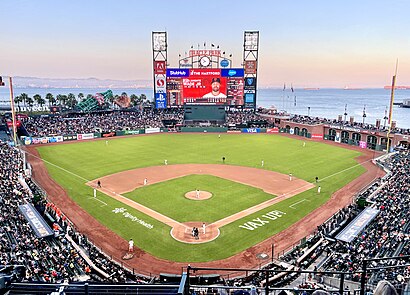
AT&T Park Address: 24 Willie Mays Plz street in Soma, Sf
Places Near AT&T Park (Soma, Sf)
How to get to popular places in San Francisco - San Jose, CA with public transit
Get around Soma, Sf by public transit!
Traveling around Soma, Sf has never been so easy. See step by step directions as you travel to any attraction, street or major public transit station. View bus and train schedules, arrival times, service alerts and detailed routes on a map, so you know exactly how to get to anywhere in Soma, Sf.
When traveling to any destination around Soma, Sf use Moovit's Live Directions with Get Off Notifications to know exactly where and how far to walk, how long to wait for your line, and how many stops are left. Moovit will alert you when it's time to get off — no need to constantly re-check whether yours is the next stop.
Wondering how to use public transit in Soma, Sf or how to pay for public transit in Soma, Sf? Moovit public transit app can help you navigate your way with public transit easily, and at minimum cost. It includes public transit fees, ticket prices, and costs. Looking for a map of Soma, Sf public transit lines? Moovit public transit app shows all public transit maps in Soma, Sf with all Bus, Train, BART, Light Rail, Ferry and Cable Car routes and stops on an interactive map.
San Francisco - San Jose, CA has 6 transit type(s), including: Bus, Train, BART, Light Rail, Ferry and Cable Car, operated by several transit agencies, including MUNI, BART, VTA, Muni Metro, SF Cable Car, AC Transit, Golden Gate Transit, County Connection, Marin Transit, Capitol Corridor, SamTrans, Sonoma County Transit, Stanford Marguerite Shuttle, Caltrain and SANTAROSA