Directions to Arena México station (Azcapotzalco) with public transit
The following transit lines have routes that pass near Arena México
How to get to Arena México station by bus?
Click on the bus route to see step by step directions with maps, line arrival times and updated time schedules.
How to get to Arena México station by metro?
Click on the metro route to see step by step directions with maps, line arrival times and updated time schedules.
Bus stops near Arena México in Azcapotzalco
- Eje 1 Sur Dr. Río de La Loza - Dr. Lucio, 3 min walk,
- Avenida Doctor Río de La Loza - Calle Rafael Lucio, 3 min walk,
- Claudio Bernard, 188, 3 min walk,
- Eje Vial Eje 1 Poniente (Avenida Cuauhtemoc), 39, 4 min walk,
- Cuauhtémoc, 5 min walk,
- Avenida Cuauhtémoc, 15, 5 min walk,
- Avenida Chapultepec - Doctor Río de La Loza, 6 min walk,
- Avenida Chapultepec 75, 7 min walk,
Metro stations near Arena México in Azcapotzalco
- Niños Héroes, 10 min walk,
- Cuauhtémoc, 13 min walk,
- Doctores, 15 min walk,
Bus lines to Arena México station in Azcapotzalco
- 19A, Metro Tacuba Por Fray Servando - Metro Pantitlan,
- 19B, Pemex Por Fray Servando - Metro Pantitlan,
- 19C, Calle 81 - Metro Chapultepec,
- 19D, Tacuba - Central de Abastos,
- 19E, Metro Chapultepec - Central de Abastos,
- 19G, Periférico - Balneario,
- 19H, Metro Tacuba - Calle 81,
- 19I, Base Cetram Pantitlan,
- 5, Metro Tacuba,
- RUTA 22, Reforma,
- 108, Metro Taxqueña Por Eje Central Lazaro Cardenas,
- 150, Metro Tacuba,
- 151, Central de Abasto,
- 153, Ciudad Deportiva,
- 154, Metro Pantitlan,
- 155, Metro Aeropuerto,
- 119, Metro Cuauhtemoc,
- RUTA 29, Metro Cu,
- 146, Margarita Maza de Juarez,
- 1, Pueblo Sta Cruz Atoyac - Indios Verdes,
What are the closest stations to Arena México?
The closest stations to Arena México are:
- Eje 1 Sur Dr. Río de La Loza - Dr. Lucio is 121 meters away, 3 min walk.
- Avenida Doctor Río de La Loza - Calle Rafael Lucio is 127 meters away, 3 min walk.
- Claudio Bernard, 188 is 163 meters away, 3 min walk.
- Eje Vial Eje 1 Poniente (Avenida Cuauhtemoc), 39 is 246 meters away, 4 min walk.
- Cuauhtémoc is 271 meters away, 5 min walk.
- Avenida Cuauhtémoc, 15 is 293 meters away, 5 min walk.
- Avenida Chapultepec - Doctor Río de La Loza is 365 meters away, 6 min walk.
- Avenida Chapultepec 75 is 464 meters away, 7 min walk.
- Niños Héroes is 668 meters away, 10 min walk.
- Doctores is 1072 meters away, 15 min walk.
Which bus lines stop near Arena México?
These bus lines stop near Arena México: 151, 155, 19E, 19G, 3.
Which metro lines stop near Arena México?
These metro lines stop near Arena México: 1, 3.
What’s the nearest metro station to Arena México in Azcapotzalco?
The nearest metro station to Arena México in Azcapotzalco is Niños Héroes. It’s a 10 min walk away.
What’s the nearest bus station to Arena México in Azcapotzalco?
The nearest bus stations to Arena México in Azcapotzalco are Eje 1 Sur Dr. Río de La Loza - Dr. Lucio, Avenida Doctor Río de La Loza - Calle Rafael Lucio and Claudio Bernard, 188. The closest one is a 3 min walk away.
What time is the first metro to Arena México in Azcapotzalco?
The 1 is the first metro that goes to Arena México in Azcapotzalco. It stops nearby at 5:01 AM.
What time is the last metro to Arena México in Azcapotzalco?
The 8 is the last metro that goes to Arena México in Azcapotzalco. It stops nearby at 12:33 AM.
What time is the first bus to Arena México in Azcapotzalco?
The 3 is the first bus that goes to Arena México in Azcapotzalco. It stops nearby at 4:00 AM.
What time is the last bus to Arena México in Azcapotzalco?
The 3 is the last bus that goes to Arena México in Azcapotzalco. It stops nearby at 12:48 AM.
See Arena México, Azcapotzalco, on the map
Public Transit to Arena México in Azcapotzalco
Wondering how to get to Arena México in Azcapotzalco, México? Moovit helps you find the best way to get to Arena México with step-by-step directions from the nearest public transit station.
Moovit provides free maps and live directions to help you navigate through your city. View schedules, routes, timetables, and find out how long does it take to get to Arena México in real time.
Looking for the nearest stop or station to Arena México? Check out this list of stops closest to your destination: Eje 1 Sur Dr. Río de La Loza - Dr. Lucio; Avenida Doctor Río de La Loza - Calle Rafael Lucio; Claudio Bernard; Eje Vial Eje 1 Poniente (Avenida Cuauhtemoc); Cuauhtémoc; Avenida Cuauhtémoc; Avenida Chapultepec - Doctor Río de La Loza; Avenida Chapultepec 75; Niños Héroes; Doctores.
Bus: 151, 155, 19E, 19G, 3, 19A, 19B, 19C, 19D, 5, RUTA 22, 108, 150, 119.Metro: 1, 3, 8.
Want to see if there’s another route that gets you there at an earlier time? Moovit helps you find alternative routes or times. Get directions from and directions to Arena México easily from the Moovit App or Website.
We make riding to Arena México easy, which is why over 1.5 million users, including users in Azcapotzalco, trust Moovit as the best app for public transit. You don’t need to download an individual bus app or train app, Moovit is your all-in-one transit app that helps you find the best bus time or train time available.
For information on prices of bus and metro, costs and ride fares to Arena México, please check the Moovit app.
Use the app to navigate to popular places including to the airport, hospital, stadium, grocery store, mall, coffee shop, school, college, and university.
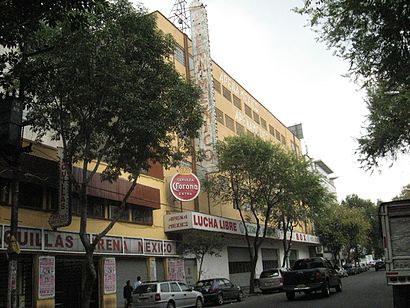
Arena México Address: Calle Doctor Lavista street in Azcapotzalco
Popular routes to Arena México station, Azcapotzalco
Places Near Arena México (Azcapotzalco)
How to get to popular places in Ciudad de Mexico with public transit
Get around Azcapotzalco by public transit!
Traveling around Azcapotzalco has never been so easy. See step by step directions as you travel to any attraction, street or major public transit station. View bus and train schedules, arrival times, service alerts and detailed routes on a map, so you know exactly how to get to anywhere in Azcapotzalco.
When traveling to any destination around Azcapotzalco use Moovit's Live Directions with Get Off Notifications to know exactly where and how far to walk, how long to wait for your line, and how many stops are left. Moovit will alert you when it's time to get off — no need to constantly re-check whether yours is the next stop.
Wondering how to use public transit in Azcapotzalco or how to pay for public transit in Azcapotzalco? Moovit public transit app can help you navigate your way with public transit easily, and at minimum cost. It includes public transit fees, ticket prices, and costs. Looking for a map of Azcapotzalco public transit lines? Moovit public transit app shows all public transit maps in Azcapotzalco with all Bus, Train, Metro, Cable Car and Gondola routes and stops on an interactive map.
Ciudad de Mexico has 5 transit type(s), including: Bus, Train, Metro, Cable Car and Gondola, operated by several transit agencies, including STC (Metro CDMX), Ferrocarriles Suburbanos, Trolebús, Puma Bus, Mexibus, Autobuses / Combis, Tren Ligero, Mexicable, Peseros, Cablebús, Trolebús elevado, Corredores Concesionados, RTP, Metrobús and Tren El Insurgente