See Artis, Amsterdam, on the map
Directions to Artis (Amsterdam) with public transportation
The following transit lines have routes that pass near Artis
 Bus:
Bus: - Train:
- Metro:
- Light Rail:
How to get to Artis by bus?
Click on the bus route to see step by step directions with maps, line arrival times and updated time schedules.
How to get to Artis by train?
Click on the train route to see step by step directions with maps, line arrival times and updated time schedules.
How to get to Artis by metro?
Click on the metro route to see step by step directions with maps, line arrival times and updated time schedules.
Which bus lines stop near Artis?
These bus lines stop near Artis: 22, 314, 316.
Which train lines stop near Artis?
These train lines stop near Artis: INTERCITY, SPRINTER.
Which metro lines stop near Artis?
These metro lines stop near Artis: 51, 54.
Which light rail line stops near Artis?
14
See Artis, Amsterdam, on the map
Public Transit to Artis in Amsterdam
Wondering how to get to Artis in Amsterdam, Netherlands? Moovit helps you find the best way to get to Artis with step-by-step directions from the nearest public transit station.
Moovit provides free maps and live directions to help you navigate through your city. View schedules, routes, timetables, and find out how long does it take to get to Artis in real time.
Bus:Train:Metro:Light Rail:
Want to see if there’s another route that gets you there at an earlier time? Moovit helps you find alternative routes or times. Get directions from and directions to Artis easily from the Moovit App or Website.
We make riding to Artis easy, which is why over 1.5 million users, including users in Amsterdam, trust Moovit as the best app for public transit. You don’t need to download an individual bus app or train app, Moovit is your all-in-one transit app that helps you find the best bus time or train time available.
For information on prices of bus, metro, train and light rail, costs and ride fares to Artis, please check the Moovit app.
Use the app to navigate to popular places including to the airport, hospital, stadium, grocery store, mall, coffee shop, school, college, and university.
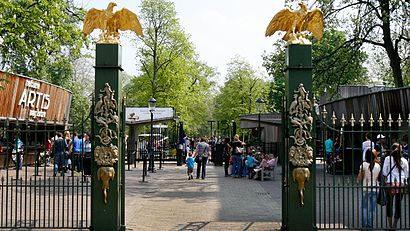
Artis Address: Plantage Middenlaan street in Amsterdam
Attractions near Artis
Tramhalte Artis,Hollandsche Schouwburg,Hollandsche Schouwburg,Stichting Derdengelden Jozefzoon Advocaten,Quentin Zoo Hotel,Studio Marc Van Oene,P. Zeilstra,Cafe Eik En Linde,Cafe Koosje,National Holocaust Museum,Pizzeria Pasta Villa,Het Bourgondisch Genootschap,Chinees Indisch Restaurant New Happy Cor,Het Zuivelhuis R.Cheu-Choi,Amigo hotel,Elegance Bloemen,Garage Artis,Sapori Del Mondo,Palorma,Happy CornerHow to get to popular attractions in Amsterdam with public transit
Tilburg University, Tilburg,Pathé, Breda,IKEA, Utrecht,Madurodam, 'S-Gravenhage,Universiteit Twente, Enschede,Station Hengelo, Hengelo,Safaripark Beekse Bergen, Hilvarenbeek,azM/Maastricht UMC+, Maastricht,Station Baarn, Baarn,IKEA, Duiven,Den Haag Centrum, 'S-Gravenhage,Knooppunt Kleinpolderplein, Rotterdam,Duinrell, Wassenaar,IKEA, Groningen,Station Zwijndrecht, Zwijndrecht,High Tech Campus, Eindhoven,SnowWorld, Landgraaf,GelreDome, Arnhem,Amstelveen, Amstelveen,Vrijthof, MaastrichtGet around Amsterdam by public transit!
Traveling around Amsterdam has never been so easy. See step by step directions as you travel to any attraction, street or major public transit station. View bus and train schedules, arrival times, service alerts and detailed routes on a map, so you know exactly how to get to anywhere in Amsterdam.
When traveling to any destination around Amsterdam use Moovit's Live Directions with Get Off Notifications to know exactly where and how far to walk, how long to wait for your line, and how many stops are left. Moovit will alert you when it's time to get off — no need to constantly re-check whether yours is the next stop.
Wondering how to use public transit in Amsterdam or how to pay for public transit in Amsterdam? Moovit public transit app can help you navigate your way with public transit easily, and at minimum cost. It includes public transit fees, ticket prices, and costs. Looking for a map of Amsterdam public transit lines? Moovit public transit app shows all public transit maps in Amsterdam with all bus, metro, train or light rail routes and stops on an interactive map.
Amsterdam has 4 transit type(s), including: bus, metro, train or light rail, operated by several transit agencies, including NS, NS International, GVB, GVB, GVB, GVB, U-OV, U-OV, Overal, HTM, R-net, RET, RET, De Lijn and Connexxion