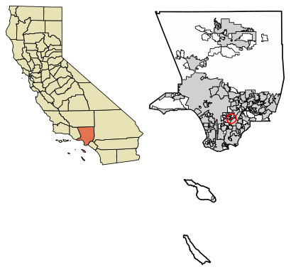
See Bell Gardens, California on the map
Directions to Bell Gardens, California with public transportation
The following transit lines have routes that pass near Bell Gardens, California
 Bus:
Bus: - Train:
How to get to Bell Gardens, California by bus?
Click on the bus route to see step by step directions with maps, line arrival times and updated time schedules.
How to get to Bell Gardens, California by train?
Click on the train route to see step by step directions with maps, line arrival times and updated time schedules.
Bus stations near Bell Gardens, California
- Garfield/Loveland,5 min walk,
- Florence Place and Perry Road,6 min walk,
- Gage Ave & Garfield Ave (EB),8 min walk,
- Florence Garfield Layover,8 min walk,
Train stations near Bell Gardens, California
- Commerce Metrolink Station,51 min walk,
- Montebello/Commerce,64 min walk,
Bus lines to Bell Gardens, California
- 300,Bell Gardens,
- 30,30 Garfield Ave,
- 110,Playa Vista,
- FIXED ROUTE,Ford Park,
- 100,Veterans Park,
- 111,Inglewood Transit Center,
What are the closest stations to Bell Gardens, California?
The closest stations to Bell Gardens, California are:
- Garfield/Loveland is 349 yards away, 5 min walk.
- Florence Place and Perry Road is 422 yards away, 6 min walk.
- Gage Ave & Garfield Ave (EB) is 615 yards away, 8 min walk.
- Florence Garfield Layover is 661 yards away, 8 min walk.
- Commerce Metrolink Station is 4314 yards away, 51 min walk.
- Montebello/Commerce is 5425 yards away, 64 min walk.
Which bus lines stop near Bell Gardens, California?
These bus lines stop near Bell Gardens, California: 30, 300.
Which train line stops near Bell Gardens, California?
METROLINK ORANGE COUNTY LINE
What’s the nearest bus stop to Bell Gardens, California?
The nearest bus stop to Bell Gardens, California is Garfield/Loveland. It’s a 5 min walk away.
What time is the first train to Bell Gardens, California?
The METROLINK RIVERSIDE LINE is the first train that goes to Bell Gardens, California. It stops nearby at 5:38 AM.
What time is the last train to Bell Gardens, California?
The METROLINK RIVERSIDE LINE is the last train that goes to Bell Gardens, California. It stops nearby at 6:17 PM.
What time is the first bus to Bell Gardens, California?
The 30 is the first bus that goes to Bell Gardens, California. It stops nearby at 5:27 AM.
What time is the last bus to Bell Gardens, California?
The 30 is the last bus that goes to Bell Gardens, California. It stops nearby at 9:15 PM.
See Bell Gardens, California on the map
Public Transportation to Bell Gardens, California
Wondering how to get to Bell Gardens, California, United States? Moovit helps you find the best way to get to Bell Gardens, California with step-by-step directions from the nearest public transit station.
Moovit provides free maps and live directions to help you navigate through your city. View schedules, routes, timetables, and find out how long does it take to get to Bell Gardens, California in real time.
Looking for the nearest stop or station to Bell Gardens, California? Check out this list of stops closest to your destination: Garfield/Loveland; Florence Place and Perry Road; Gage Ave & Garfield Ave (EB); Florence Garfield Layover; Commerce Metrolink Station; Montebello/Commerce.
Bus:Train:
Want to see if there’s another route that gets you there at an earlier time? Moovit helps you find alternative routes or times. Get directions from and directions to Bell Gardens, California easily from the Moovit App or Website.
We make riding to Bell Gardens, California easy, which is why over 1.5 million users, including users in Bell Gardens, trust Moovit as the best app for public transit. You don’t need to download an individual bus app or train app, Moovit is your all-in-one transit app that helps you find the best bus time or train time available.
For information on prices of bus and train, costs and ride fares to Bell Gardens, California, please check the Moovit app.
Use the app to navigate to popular places including to the airport, hospital, stadium, grocery store, mall, coffee shop, school, college, and university.
Bell Gardens, California Address: Los Angeles, CA street in Bell Gardens
Attractions near Bell Gardens, California
Bell Gardens,DMV,DJ Oceans,Sonia Aguilar Notary Public,Boys Burger,Emperor Insurance Center - Bell Gardens,Atlantis Insurance,6907 3/4 Granger Ave Apts,6922 Granger Ave Apts,United States Postal Service,6563 Loveland St Apts,6755 Toler Ave Apts,6941 Perry Rd Apts,6712 Granger Ave Apts,Bell Gardens Police Department (Bell Gardens Police Officers Association),6725 Perry Rd Apts,Los Angeles County Library Public,Ching-Yi Chiu,Sunny General Trading,Alvarado Legal SupportHow to get to popular attractions in Bell Gardens with public transit
Temecula Promenade Mall, Temecula,Main Street, U.S.A., Anaheim,Corona del Mar State Beach, Newport Beach,Toy Story Parking Lot, Anaheim,Paradise Pier, Anaheim,Saddleback Community College, Mission Viejo,Mickey & Friends Parking Structure, Anaheim,Star Tours - The Adventures Continue, Anaheim,The NOVO by Microsoft, Downtown, La,IKEA, Costa Mesa,City of West Hollywood, West Hollywood,Universal City / Studio City Metro Station, Studio City, La,City of Laguna Beach, Laguna Beach,Six Flags Magic Mountain, Santa Susana Mountains, La,Tito's Tacos, Culver City,City of Calabasas, Calabasas,Hollywood Hills, Hollywood Hills West, La,Whole Foods Market, Tustin,Huntington Beach, CA, Huntington Beach,Blu Jam Café, Fairfax, LaGet around Bell Gardens by public transit!
Traveling around Bell Gardens has never been so easy. See step by step directions as you travel to any attraction, street or major public transit station. View bus and train schedules, arrival times, service alerts and detailed routes on a map, so you know exactly how to get to anywhere in Bell Gardens.
When traveling to any destination around Bell Gardens use Moovit's Live Directions with Get Off Notifications to know exactly where and how far to walk, how long to wait for your line, and how many stops are left. Moovit will alert you when it's time to get off — no need to constantly re-check whether yours is the next stop.
Wondering how to use public transit in Bell Gardens or how to pay for public transit in Bell Gardens? Moovit public transit app can help you navigate your way with public transit easily, and at minimum cost. It includes public transit fees, ticket prices, and costs. Looking for a map of Bell Gardens public transit lines? Moovit public transit app shows all public transit maps in Bell Gardens with all bus or train routes and stops on an interactive map.
Bell Gardens has 2 transit type(s), including: bus or train, operated by several transit agencies, including Metro - Los Angeles, Metro - Los Angeles, Metrolink Trains, METRO, Long Beach Transit, LADOT, OCTA, Foothill Transit, Big Blue Bus, Riverside Transit Agency, LAX FlyAway, Airporter Shuttle, Playa Vista Shuttle, Amtrak and OMNITRANS