How to get to Ranger Surplus by bus?
Click on the bus route to see step by step directions with maps, line arrival times and updated time schedules.
From Millie’S, Washington
37 minFrom Washington DC VA Medical Center, Washington
75 minFrom Children's National - Main Hospital (Children's National Medical Center), Washington
70 minFrom Islamic Center of Washington, Washington
69 minFrom U Street Metro Station, Washington
66 minFrom Crumbs & Whiskers, Washington
64 minFrom Consulado Bolivia Washington, Washington
66 minFrom Georgetown Flea Market, Washington
56 minFrom Lincoln Theatre, Washington
65 minFrom Filomena Ristorante, Washington
65 min
How to get to Ranger Surplus by metro?
Click on the metro route to see step by step directions with maps, line arrival times and updated time schedules.
From Millie’S, Washington
43 minFrom Washington DC VA Medical Center, Washington
67 minFrom Children's National - Main Hospital (Children's National Medical Center), Washington
67 minFrom Islamic Center of Washington, Washington
45 minFrom U Street Metro Station, Washington
42 minFrom Crumbs & Whiskers, Washington
53 minFrom Consulado Bolivia Washington, Washington
35 minFrom Lincoln Theatre, Washington
42 minFrom Filomena Ristorante, Washington
58 min
Bus stops near Ranger Surplus in Montgomery County
Bus lines to Ranger Surplus in Montgomery County
What are the closest stations to Ranger Surplus?
The closest stations to Ranger Surplus are:
- Wisconsin Av+Highland Av is 114 yards away, 2 min walk.
- Woodmont Av & Battery La is 379 yards away, 5 min walk.
- Old Georgetown Rd & Fairmont Ave is 566 yards away, 7 min walk.
- Old Georgetown Rd & Arlington Rd is 581 yards away, 8 min walk.
Which bus line stops near Ranger Surplus?
M70 (West To Montgomery Mall)
Which metro line stops near Ranger Surplus?
RED (Shady Grove)
What’s the nearest bus station to Ranger Surplus in Montgomery County?
The nearest bus station to Ranger Surplus in Montgomery County is Wisconsin Av+Highland Av. It’s a 2 min walk away.
What time is the first bus to Ranger Surplus in Montgomery County?
The M70 is the first bus that goes to Ranger Surplus in Montgomery County. It stops nearby at 4:56 AM.
What time is the last bus to Ranger Surplus in Montgomery County?
The M70 is the last bus that goes to Ranger Surplus in Montgomery County. It stops nearby at 2:16 AM.
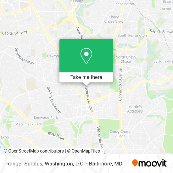
See Ranger Surplus, Montgomery County, on the map
Public Transit to Ranger Surplus in Montgomery County
Wondering how to get to Ranger Surplus in Montgomery County? Moovit helps you find the best way to get to Ranger Surplus with step-by-step directions from the nearest public transit station.
Moovit provides free maps and live directions to help you navigate through your city. View schedules, routes, timetables, and find out how long does it take to get to Ranger Surplus in real time.
Looking for the nearest stop or station to Ranger Surplus? Check out this list of stops closest to your destination: Wisconsin Av+Highland Av; Woodmont Av & Battery La; Old Georgetown Rd & Fairmont Ave; Old Georgetown Rd & Arlington Rd.
Bus: M70, 34, 70, 30, 32, 47, 29.Metro: RED.
Want to see if there’s another route that gets you there at an earlier time? Moovit helps you find alternative routes or times. Get directions from and directions to Ranger Surplus easily from the Moovit App or Website.
We make riding to Ranger Surplus easy, which is why over 1.5 million users, including users in Montgomery County, trust Moovit as the best app for public transit. You don’t need to download an individual bus app or train app, Moovit is your all-in-one transit app that helps you find the best bus time or train time available.
For information on prices of bus and metro, costs and ride fares to Ranger Surplus, please check the Moovit app.
Use the app to navigate to popular places including to the airport, hospital, stadium, grocery store, mall, coffee shop, school, college, and university.
Ranger Surplus Address: 8008 Wisconsin Ave Bethesda, MD 20814 street in Montgomery County
- Wisconsin Ave West Ave,
- Cordell Ave & MD-355,
- Lynnalan Family Dental Center,
- Paint Nail Bar,
- Fialova,
- Bethesdan Hotel, Tapestry Collection by Hilton,
- The Bethesdan Hotel,
- Pumphrey Funeral Home & Funeralnet,
- The Church of the Living God,
- Beyond Measure Custom,
- DoubleTree by Hilton Hotel Bethesda - Washington DC,
- Best for DMV,
- Blink Charging,
- Guapo's,
- Mauro Insurance Group,
- Palisades Eye Surgery Center ,
- Remix Recycling,
- Not Available,
- EC America/Govbuys,
- Trader Joe's
Places Near Ranger Surplus (Montgomery County)
- M&T Bank Stadium, Baltimore,
- Georgetown, Washington,
- Washington National Cathedral, Washington,
- Westfield Montgomery Mall, Montgomery County,
- National Mall, Washington,
- Pennsylvania Ave NW (3rd st and pennsylvania), Washington,
- Museum Of The Bible, Washington,
- Basilica of the National Shrine, Washington,
- National Zoo, Washington,
- Sibley Memorial Hospital, Washington,
- Capital One Arena, Washington,
- Rock Creek Tennis Center, Washington,
- Amazon Hq2, Arlington County,
- PG Mall, Prince George's County,
- The Anthem, Washington,
- Camden Yards, Baltimore,
- Warner Theatre, Washington,
- Marriott Marquis Washington, DC, Washington,
- Washington DC VA Medical Center, Washington,
- National Museum of African American History and Culture, Washington
How to get to popular places in Washington, D.C. - Baltimore, MD with public transit
Get around Montgomery County by public transit!
Traveling around Montgomery County has never been so easy. See step by step directions as you travel to any attraction, street or major public transit station. View bus and train schedules, arrival times, service alerts and detailed routes on a map, so you know exactly how to get to anywhere in Montgomery County.
When traveling to any destination around Montgomery County use Moovit's Live Directions with Get Off Notifications to know exactly where and how far to walk, how long to wait for your line, and how many stops are left. Moovit will alert you when it's time to get off — no need to constantly re-check whether yours is the next stop.
Wondering how to use public transit in Montgomery County or how to pay for public transit in Montgomery County? Moovit public transit app can help you navigate your way with public transit easily, and at minimum cost. It includes public transit fees, ticket prices, and costs. Looking for a map of Montgomery County public transit lines? Moovit public transit app shows all public transit maps in Montgomery County with all Bus, Train, Metro, Light Rail and Ferry routes and stops on an interactive map.
Washington, D.C. - Baltimore, MD has 5 transit type(s), including: Bus, Train, Metro, Light Rail and Ferry, operated by several transit agencies, including WMATA, Montgomery County Ride On, Fairfax Connector, TheBus, PRTC, DASH - Alexandria, Arlington Transit (ART), RTA of Central Maryland, MDOT MTA, MDOT MTA Light RailLink, MDOT MTA Commuter Bus, MDOT MTA Local Bus, FXBGO!, Virginia Railway Express (VRE) and MARC