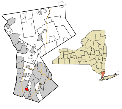
See Bronxville, Bronxville, Ny, on the map
Directions to Bronxville (Bronxville, Ny) with public transportation
The following transit lines have routes that pass near Bronxville
 Bus:
Bus: - Train:
- Subway:
How to get to Bronxville by bus?
Click on the bus route to see step by step directions with maps, line arrival times and updated time schedules.
How to get to Bronxville by train?
Click on the train route to see step by step directions with maps, line arrival times and updated time schedules.
How to get to Bronxville by subway?
Click on the subway route to see step by step directions with maps, line arrival times and updated time schedules.
Train stations near Bronxville in Bronxville, Ny
- Bronxville,6 min walk,
Bus stations near Bronxville in Bronxville, Ny
- Pondfield Rd @ Gramatan Ave,6 min walk,
- Bronxville Railroad Station West,9 min walk,
Bus lines to Bronxville in Bronxville, Ny
- 30,New Rochelle,
- 26,The Bronx-Yonkers,
- 52,Mt Vernon - The Bronx - Bronxville,
What are the closest stations to Bronxville?
The closest stations to Bronxville are:
- Bronxville is 413 yards away, 6 min walk.
- Pondfield Rd @ Gramatan Ave is 484 yards away, 6 min walk.
- Bronxville Railroad Station West is 643 yards away, 9 min walk.
Which bus lines stop near Bronxville?
These bus lines stop near Bronxville: 30, 52.
Which train line stops near Bronxville?
HARLEM
Which subway line stops near Bronxville?
2
What’s the nearest train station to Bronxville in Bronxville, Ny?
The nearest train station to Bronxville in Bronxville, Ny is Bronxville. It’s a 6 min walk away.
What’s the nearest bus stop to Bronxville in Bronxville, Ny?
The nearest bus stop to Bronxville in Bronxville, Ny is Pondfield Rd @ Gramatan Ave. It’s a 6 min walk away.
See Bronxville, Bronxville, Ny, on the map
Public Transit to Bronxville in Bronxville, Ny
Wondering how to get to Bronxville in Bronxville, Ny, United States? Moovit helps you find the best way to get to Bronxville with step-by-step directions from the nearest public transit station.
Moovit provides free maps and live directions to help you navigate through your city. View schedules, routes, timetables, and find out how long does it take to get to Bronxville in real time.
Looking for the nearest stop or station to Bronxville? Check out this list of stops closest to your destination: Bronxville; Pondfield Rd @ Gramatan Ave; Bronxville Railroad Station West.
Bus:Train:Subway:
Want to see if there’s another route that gets you there at an earlier time? Moovit helps you find alternative routes or times. Get directions from and directions to Bronxville easily from the Moovit App or Website.
We make riding to Bronxville easy, which is why over 1.5 million users, including users in Bronxville, Ny, trust Moovit as the best app for public transit. You don’t need to download an individual bus app or train app, Moovit is your all-in-one transit app that helps you find the best bus time or train time available.
For information on prices of bus, subway and train, costs and ride fares to Bronxville, please check the Moovit app.
Use the app to navigate to popular places including to the airport, hospital, stadium, grocery store, mall, coffee shop, school, college, and university.
Bronxville Address: Meadow Avenue street in Bronxville, Ny
Attractions near Bronxville
برونكسفيل,布隆克維,Бронксвил,Underhill's Crossing,1,On Consignment Inc,Super Apartments,Thomas K Landry,Athans, Robt J,Mothers Club Of St Josephs,Divine Wine Studios,Pane E Vino,Bicentennial Park,Bronxville Post Office,James W Walkup,Connolly Communications,B&M Financial Management Services,Nyc 174 Realty,Polly Kanganis MD,WFB ConstructionHow to get to popular attractions in Bronxville, Ny with public transit
Gramercy Tavern, Manhattan,The Meatball Shop,I-80 (Interstate 80), Paterson, Nj,MTA Subway - 42nd St / Bryant Park (B / D/F / M/7), Manhattan,The Dead Rabbit, Manhattan,Bubba Gump Shrimp Co., Manhattan,Time Life, Manhattan,Avenue, Manhattan,Stout, Manhattan,Mad Dog & Beans Mexican Cantina, Manhattan,Great Lawn, Manhattan,Jing Fong Restaurant 金豐大酒樓, Manhattan,Jackson Heights, NY, Queens,Veselka, Manhattan,Rattle N Hum, Manhattan,Smith Haven Mall, Lake Grove, Ny,Caesars Atlantic City Hotel and Casino, Atlantic City, Nj,Central Park SummerStage, Manhattan,The Biergarten at The Standard, Manhattan,The Grey Dog, ManhattanGet around Bronxville, Ny by public transit!
Traveling around Bronxville, Ny has never been so easy. See step by step directions as you travel to any attraction, street or major public transit station. View bus and train schedules, arrival times, service alerts and detailed routes on a map, so you know exactly how to get to anywhere in Bronxville, Ny.
When traveling to any destination around Bronxville, Ny use Moovit's Live Directions with Get Off Notifications to know exactly where and how far to walk, how long to wait for your line, and how many stops are left. Moovit will alert you when it's time to get off — no need to constantly re-check whether yours is the next stop.
Wondering how to use public transit in Bronxville, Ny or how to pay for public transit in Bronxville, Ny? Moovit public transit app can help you navigate your way with public transit easily, and at minimum cost. It includes public transit fees, ticket prices, and costs. Looking for a map of Bronxville, Ny public transit lines? Moovit public transit app shows all public transit maps in Bronxville, Ny with all bus, subway or train routes and stops on an interactive map.
Bronxville, Ny has 3 transit type(s), including: bus, subway or train, operated by several transit agencies, including MTA Subway, Metro-North Railroad, LIRR, PATH, Shore Line East, MTA Bus Company, MTA New York City Transit - Express routes, MTA Bus, NJ Transit, NYC Ferry, NICE bus, Bee-Line Bus, NJ Transit Rail, NJ Transit Rail and Norwalk Transit District