Directions to Burbank Airport South Station with public transportation
The following transit lines have routes that pass near Burbank Airport South Station
How to get to Burbank Airport South Station by bus?
Click on the bus route to see step by step directions with maps, line arrival times and updated time schedules.
Bus stations near Burbank Airport South Station
- Empire / Burbank Airport Transit Center, 1 min walk,
- Empire / Hollywood Way, 2 min walk,
- Hollywood Way / Thornton, 5 min walk,
- Hollywood Burbank Airport RITC, 5 min walk,
Train stations near Burbank Airport South Station
- Burbank Airport - North (Av Line) Metrolink Station, 41 min walk,
- Downtown Burbank, 46 min walk,
- Burbank Bob Hope Airport, 60 min walk,
Bus lines to Burbank Airport South Station
- 165, Vanowen - Topanga Canyon,
- 294, Burbank Station,
- 169, West Hills Medical Center,
- 222, Universal - Studio City Station,
- ORANGE, NoHo Station,
What are the closest stations to Burbank Airport South Station?
The closest stations to Burbank Airport South Station are:
- Empire / Burbank Airport Transit Center is 56 yards away, 1 min walk.
- Empire / Hollywood Way is 106 yards away, 2 min walk.
- Hollywood Way / Thornton is 376 yards away, 5 min walk.
- Hollywood Burbank Airport RITC is 404 yards away, 5 min walk.
- Burbank Airport - North (Av Line) Metrolink Station is 1859 yards away, 41 min walk.
- Downtown Burbank is 3863 yards away, 46 min walk.
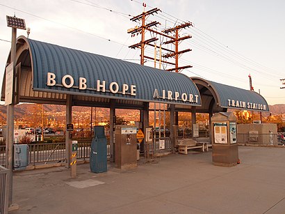
- Burbank Bob Hope Airport is 5107 yards away, 60 min walk.
Which bus lines stop near Burbank Airport South Station?
These bus lines stop near Burbank Airport South Station: 165, 222.
Which train lines stop near Burbank Airport South Station?
These train lines stop near Burbank Airport South Station: METROLINK VENTURA COUNTY LINE, PACIFIC SURFLINER.
What’s the nearest bus stop to Burbank Airport South Station?
The nearest bus stop to Burbank Airport South Station is Empire / Burbank Airport Transit Center. It’s a 1 min walk away.
What time is the first train to Burbank Airport South Station?
The METROLINK ANTELOPE VALLEY LINE is the first train that goes to Burbank Airport South Station. It stops nearby at 5:17 AM.
What time is the last train to Burbank Airport South Station?
The COAST STARLIGHT is the last train that goes to Burbank Airport South Station. It stops nearby at 8:44 PM.
What time is the first bus to Burbank Airport South Station?
The 165 is the first bus that goes to Burbank Airport South Station. It stops nearby at 4:42 AM.
What time is the last bus to Burbank Airport South Station?
The AMTRAK THRUWAY CONNECTING SERVICE is the last bus that goes to Burbank Airport South Station. It stops nearby at 1:45 AM.
How much is the train fare to Burbank Airport South Station?
The train fare to Burbank Airport South Station costs about $2.50 - $11.50.
How much is the bus fare to Burbank Airport South Station?
The bus fare to Burbank Airport South Station costs about $1.75.
How much is the subway fare to Burbank Airport South Station?
The subway fare to Burbank Airport South Station costs about $1.75.
See Burbank Airport South Station on the map
Public Transportation to Burbank Airport South Station
Wondering how to get to Burbank Airport South Station, United States? Moovit helps you find the best way to get to Burbank Airport South Station with step-by-step directions from the nearest public transit station.
Moovit provides free maps and live directions to help you navigate through your city. View schedules, routes, timetables, and find out how long does it take to get to Burbank Airport South Station in real time.
Looking for the nearest stop or station to Burbank Airport South Station? Check out this list of stops closest to your destination: Empire / Burbank Airport Transit Center; Empire / Hollywood Way; Hollywood Way / Thornton; Hollywood Burbank Airport RITC; Burbank Airport - North (Av Line) Metrolink Station; Downtown Burbank; Burbank Bob Hope Airport.
Bus: 165, 222, 294, 169.Train: METROLINK VENTURA COUNTY LINE, PACIFIC SURFLINER, ANTELOPE VALLEY LINE, VENTURA COUNTY LINE, COAST STARLIGHT.
Want to see if there’s another route that gets you there at an earlier time? Moovit helps you find alternative routes or times. Get directions from and directions to Burbank Airport South Station easily from the Moovit App or Website.
We make riding to Burbank Airport South Station easy, which is why over 1.5 million users, including users in Burbank, trust Moovit as the best app for public transit. You don’t need to download an individual bus app or train app, Moovit is your all-in-one transit app that helps you find the best bus time or train time available.
For information on prices of bus, subway and train, costs and ride fares to Burbank Airport South Station, please check the Moovit app.
Use the app to navigate to popular places including to the airport, hospital, stadium, grocery store, mall, coffee shop, school, college, and university.
Location: Burbank, Los Angeles
Attractions near Burbank Airport South Station
Metrolink Burbank-Bob Hope Airport Station,Burbank Amtrak Station,3854 W Empire Ave,Avis Car Rental,Burbank Airport,Hollywood Burbank Airport-Covered Lot G Long Term,Fry's Electronics,The Lost World: Jurassic Park Filming Location,Midway Car Rental - Burbank Airport,Lockheed Federal Credit Union,12 Roofing,Atm,Greenlots,Enterprise,Baggage Claim Terminal B,Los Angeles Marriott Burbank Airport,Parking Lot E Burbank Airport,Best Valet Parking,BUR,Hollywood Burbank Airport (BUR)How to get to popular attractions in Burbank with public transit
Interstate 405 (San Diego Freeway), Carson,Studio City, CA, Studio City, La,Monsters, Inc. Mike & Sulley to the Rescue!, Anaheim,City of Thousand Oaks, Thousand Oaks,Six Flags Magic Mountain, Santa Susana Mountains, La,East Shuttle Area, Anaheim,Paradise Pier, Anaheim,City of Brea, Brea,Costa Mesa, CA, Costa Mesa,Lax, Westchester, La,City of Alhambra, Alhambra,Disneyland Park, Anaheim,IKEA, Costa Mesa,The Little Mermaid ~ Ariel's Undersea Adventure, Anaheim,Redlands, CA, Redlands,85°C Bakery Cafe, Irvine,Galleria at Tyler, Riverside,Laguna Beach, Laguna Beach,Honda Center, Anaheim,Tomorrowland, AnaheimGet around Los Angeles by public transit!
Traveling around Los Angeles has never been so easy. See step by step directions as you travel to any attraction, street or major public transit station. View bus and train schedules, arrival times, service alerts and detailed routes on a map, so you know exactly how to get to anywhere in Los Angeles.
When traveling to any destination around Los Angeles use Moovit's Live Directions with Get Off Notifications to know exactly where and how far to walk, how long to wait for your line, and how many stops are left. Moovit will alert you when it's time to get off — no need to constantly re-check whether yours is the next stop.
Wondering how to use public transit in Los Angeles or how to pay for public transit in Los Angeles? Moovit public transit app can help you navigate your way with public transit easily, and at minimum cost. It includes public transit fees, ticket prices, and costs. Looking for a map of Los Angeles public transit lines? Moovit public transit app shows all public transit maps in Los Angeles with all Bus, Train, Subway, Light Rail, Ferry and Funicular routes and stops on an interactive map.
Los Angeles has 6 transit type(s), including: Bus, Train, Subway, Light Rail, Ferry and Funicular, operated by several transit agencies, including Metro - Los Angeles, Metrolink Trains, METRO, Long Beach Transit, LADOT, OCTA, Foothill Transit, Big Blue Bus, Riverside Transit Agency, LAX FlyAway, Airporter Shuttle, Playa Vista Shuttle, Amtrak, OMNITRANS, Pasadena Transit