Directions to Byram River (Greenwich, Ct) with public transportation
The following transit lines have routes that pass near Byram River
How to get to Byram River by bus?
Click on the bus route to see step by step directions with maps, line arrival times and updated time schedules.
How to get to Byram River by train?
Click on the train route to see step by step directions with maps, line arrival times and updated time schedules.
Bus stations near Byram River in Greenwich, Ct
- Abendroth Ave And Westchester Ave,22 min walk,
- S Main St @ Purdy Ave,27 min walk,
Bus lines to Byram River in Greenwich, Ct
- 311,311b - Port Chester Via Hamilton Ave,
- 13,Ossining Railroad Station,
- 61,Port Chester,
What are the closest stations to Byram River?
The closest stations to Byram River are:
- Abendroth Ave And Westchester Ave is 1841 yards away, 22 min walk.
- S Main St @ Purdy Ave is 2231 yards away, 27 min walk.
Which bus line stops near Byram River?
13
Which train line stops near Byram River?
NEW HAVEN
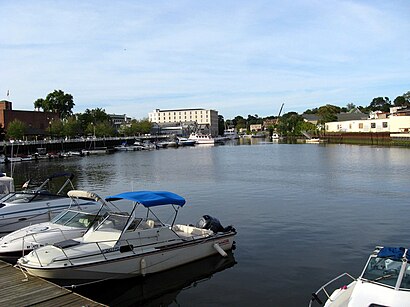
See Byram River, Greenwich, Ct, on the map
Public Transit to Byram River in Greenwich, Ct
Wondering how to get to Byram River in Greenwich, Ct, United States? Moovit helps you find the best way to get to Byram River with step-by-step directions from the nearest public transit station.
Moovit provides free maps and live directions to help you navigate through your city. View schedules, routes, timetables, and find out how long does it take to get to Byram River in real time.
Looking for the nearest stop or station to Byram River? Check out this list of stops closest to your destination: Abendroth Ave And Westchester Ave; S Main St @ Purdy Ave.
Bus:1331161Train:NEW HAVEN
Want to see if there’s another route that gets you there at an earlier time? Moovit helps you find alternative routes or times. Get directions from and directions to Byram River easily from the Moovit App or Website.
We make riding to Byram River easy, which is why over 1.5 million users, including users in Greenwich, Ct, trust Moovit as the best app for public transit. You don’t need to download an individual bus app or train app, Moovit is your all-in-one transit app that helps you find the best bus time or train time available.
For information on prices of train, bus and subway, costs and ride fares to Byram River, please check the Moovit app.
Use the app to navigate to popular places including to the airport, hospital, stadium, grocery store, mall, coffee shop, school, college, and university.
Location: Greenwich, Ct, New York - New Jersey
Attractions near Byram River
Connecticut / New York State Border,Governor John Davis Lodge Tpke,Magic Touch Fishing,Development Pompa,Pompa Development & Construction,Kristiina,Gpm International Inc,House Of Love,Varadys Boatyard LLC,Rudy's Tackle Barn,276 S Water St ,257 S Water St,Crystal Transport Bus,Rudys Tackle Barn Inc,Green Wich Kaya Canoe Co,Sprague Energy,Ellerin Stephen Resume Writer,Ellerinstephen,Great American Publishing Scty,S Water StHow to get to popular attractions in Greenwich, Ct with public transit
New Jersey, Phillipsburg, Nj,Flushing, NY, Queens,Charging Bull, Manhattan,180 Greenwich St, Manhattan,JFK Building 66, Queens,Sing Sing Correctional Facility, Ossining, Ny,The Cloisters (Met Cloisters), Manhattan,Hudson River Park, Manhattan,Elizabeth, NJ, Elizabeth, Nj,Pier 17, Manhattan,550 1st Avenue, Manhattan,City Island, Bronx,Maspeth, NY, Queens,Pier 35, Manhattan,High Line, Manhattan,1468 Madison Avenue, Manhattan,845 Barretto Street, Bronx,Paramount Hotel Times Square New York, Manhattan,168th street, Manhattan,Zhong Hua Flushing-Chinatown Shuttle Van Service, ManhattanGet around Greenwich, Ct by public transit!
Traveling around Greenwich, Ct has never been so easy. See step by step directions as you travel to any attraction, street or major public transit station. View bus and train schedules, arrival times, service alerts and detailed routes on a map, so you know exactly how to get to anywhere in Greenwich, Ct.
When traveling to any destination around Greenwich, Ct use Moovit's Live Directions with Get Off Notifications to know exactly where and how far to walk, how long to wait for your line, and how many stops are left. Moovit will alert you when it's time to get off — no need to constantly re-check whether yours is the next stop.
Wondering how to use public transit in Greenwich, Ct or how to pay for public transit in Greenwich, Ct? Moovit public transit app can help you navigate your way with public transit easily, and at minimum cost. It includes public transit fees, ticket prices, and costs. Looking for a map of Greenwich, Ct public transit lines? Moovit public transit app shows all public transit maps in Greenwich, Ct with all train, bus or subway routes and stops on an interactive map.
Greenwich, Ct has 3 transit type(s), including: train, bus or subway, operated by several transit agencies, including MTA Subway, Metro-North Railroad, LIRR, PATH, Shore Line East, MTA Bus Company, MTA New York City Transit - Express routes, MTA Bus, NJ Transit, NYC Ferry, NICE bus, Bee-Line Bus, NJ Transit Rail, NJ Transit Rail and Norwalk Transit District