Directions to Caixaforum Barcelona station with public transit
The following transit lines have routes that pass near Caixaforum Barcelona
How to get to Caixaforum Barcelona station by bus?
Click on the bus route to see step by step directions with maps, line arrival times and updated time schedules.
How to get to Caixaforum Barcelona station by train?
Click on the train route to see step by step directions with maps, line arrival times and updated time schedules.
How to get to Caixaforum Barcelona station by metro?
Click on the metro route to see step by step directions with maps, line arrival times and updated time schedules.
Bus stops near Caixaforum Barcelona
- Av Ferrer I Guàrdia - Mèxic, 2 min walk,
- Pl Espanya - Av Reina Maria Cristina, 2 min walk,
- Gran Via Corts Catalanes, 5 min walk,
- Poble Espanyol, 6 min walk,
- Pl. Espanya (Gran Via), 6 min walk,
- Plaça Espanya - Fgc, 6 min walk,
- Pl. Espanya - Creu Coberta, 6 min walk,
- Pl Espanya - Fgc, 7 min walk,
Train station near Caixaforum Barcelona
- Espanya, 7 min walk,
Bus lines to Caixaforum Barcelona station
- 13, Mercat Sant Antoni,
- 150, Pl. Espanya,
- 902, Barcelona (Per L'Hospitalet),
- CJ, Est. Sants-Ctat. Justícia,
- N1, Mercabarna-Trinitat Nova,
- N13, Barcelona-St. Boi L.,
- N15, Barcelona-St. Joan D.,
- N16, Barcelona-Castelldefels,
- N17, Barcelona-Aeroport T1,
- N18, Barcelona-Aeroport T1·T2,
- N20, Barcelona-St. Boi L.,
- H12, Gornal,
- H16, Fòrum Campus Besòs,
- 91, Manso,
- 109, Zona Franca Zal,
- 23, Pl. Espanya,
- N51, Rda. Universitat - C. Balmes,
- BCN-VNG, Barcelona - Vilanova per Aeroport,
- VP, Barcelona - Vilanova Park,
- (E2), Barcelona (Gran Via) - Tarragona,
What are the closest stations to Caixaforum Barcelona?
The closest stations to Caixaforum Barcelona are:
- Av Ferrer I Guàrdia - Mèxic is 98 meters away, 2 min walk.
- Pl Espanya - Av Reina Maria Cristina is 109 meters away, 2 min walk.
- Gran Via Corts Catalanes is 335 meters away, 5 min walk.
- Poble Espanyol is 383 meters away, 6 min walk.
- Pl. Espanya (Gran Via) is 384 meters away, 6 min walk.
- Plaça Espanya - Fgc is 388 meters away, 6 min walk.
- Pl. Espanya - Creu Coberta is 396 meters away, 6 min walk.
- Espanya is 428 meters away, 7 min walk.
- Pl Espanya - Fgc is 468 meters away, 7 min walk.
Which metro lines stop near Caixaforum Barcelona?
These metro lines stop near Caixaforum Barcelona: L1, L3, L8.
Which train lines stop near Caixaforum Barcelona?
These train lines stop near Caixaforum Barcelona: R1, R4, R50, RG1.
Which bus lines stop near Caixaforum Barcelona?
These bus lines stop near Caixaforum Barcelona: 109, 13, CJ, H12, H16, X70.
What’s the nearest train station to Caixaforum Barcelona?
The nearest train station to Caixaforum Barcelona is Espanya. It’s a 7 min walk away.
What’s the nearest bus station to Caixaforum Barcelona?
The nearest bus stations to Caixaforum Barcelona are Av Ferrer I Guàrdia - Mèxic and Pl Espanya - Av Reina Maria Cristina. The closest one is a 2 min walk away.
What time is the first metro to Caixaforum Barcelona?
The L3 is the first metro that goes to Caixaforum Barcelona. It stops nearby at 5:00 AM.
What time is the last metro to Caixaforum Barcelona?
The L3 is the last metro that goes to Caixaforum Barcelona. It stops nearby at 12:31 AM.
What time is the first train to Caixaforum Barcelona?
The S4 is the first train that goes to Caixaforum Barcelona. It stops nearby at 5:00 AM.
What time is the last train to Caixaforum Barcelona?
The R6 is the last train that goes to Caixaforum Barcelona. It stops nearby at 12:17 AM.
What time is the first bus to Caixaforum Barcelona?
The N16 is the first bus that goes to Caixaforum Barcelona. It stops nearby at 3:00 AM.
What time is the last bus to Caixaforum Barcelona?
The N30 is the last bus that goes to Caixaforum Barcelona. It stops nearby at 4:04 AM.
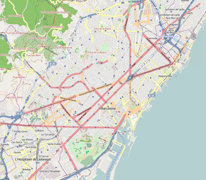
See Caixaforum Barcelona on the map
Public Transportation to Caixaforum Barcelona
Wondering how to get to Caixaforum Barcelona, Spain? Moovit helps you find the best way to get to Caixaforum Barcelona with step-by-step directions from the nearest public transit station.
Moovit provides free maps and live directions to help you navigate through your city. View schedules, routes, timetables, and find out how long does it take to get to Caixaforum Barcelona in real time.
Looking for the nearest stop or station to Caixaforum Barcelona? Check out this list of stops closest to your destination: Av Ferrer I Guàrdia - Mèxic; Pl Espanya - Av Reina Maria Cristina; Gran Via Corts Catalanes; Poble Espanyol; Pl. Espanya (Gran Via); Plaça Espanya - Fgc; Pl. Espanya - Creu Coberta; Espanya; Pl Espanya - Fgc.
Metro: L1, L3, L8.Train: R1, R4, R50, RG1, L1, L3, S3, S4, R5.Bus: 109, 13, CJ, H12, H16, X70, 902, 150, N1, N13, N15, N16, 91, 23.
Want to see if there’s another route that gets you there at an earlier time? Moovit helps you find alternative routes or times. Get directions from and directions to Caixaforum Barcelona easily from the Moovit App or Website.
We make riding to Caixaforum Barcelona easy, which is why over 1.5 million users, including users in Barcelona, trust Moovit as the best app for public transit. You don’t need to download an individual bus app or train app, Moovit is your all-in-one transit app that helps you find the best bus time or train time available.
For information on prices of metro, bus, train and Tramvia, costs and ride fares to Caixaforum Barcelona, please check the Moovit app.
Use the app to navigate to popular places including to the airport, hospital, stadium, grocery store, mall, coffee shop, school, college, and university.
Caixaforum Barcelona Address: Carrer dels Morabos street in Barcelona
Places Near Caixaforum Barcelona
How to get to popular places in Barcelona with public transit
Get around Barcelona by public transit!
Traveling around Barcelona has never been so easy. See step by step directions as you travel to any attraction, street or major public transit station. View bus and train schedules, arrival times, service alerts and detailed routes on a map, so you know exactly how to get to anywhere in Barcelona.
When traveling to any destination around Barcelona use Moovit's Live Directions with Get Off Notifications to know exactly where and how far to walk, how long to wait for your line, and how many stops are left. Moovit will alert you when it's time to get off — no need to constantly re-check whether yours is the next stop.
Wondering how to use public transit in Barcelona or how to pay for public transit in Barcelona? Moovit public transit app can help you navigate your way with public transit easily, and at minimum cost. It includes public transit fees, ticket prices, and costs. Looking for a map of Barcelona public transit lines? Moovit public transit app shows all public transit maps in Barcelona with all Bus, Train, Metro, Tramvia, Ferry, Funicular and Gondola routes and stops on an interactive map.
Barcelona has 7 transit type(s), including: Bus, Train, Metro, Tramvia, Ferry, Funicular and Gondola, operated by several transit agencies, including Rodalies de Catalunya, Trambaix, Trambesòs, TMB, Soler i Sauret, DIREXIS TUSGSAL, FGC, Transports Municipals del Girones, Moventis, Bus Garraf (Grup Plana), Sagalés, Font, Teisa, Bus Intern UAB and Sagalés Barcelona Bus