How to get to Calí's Underhouse by bus?
Click on the bus route to see step by step directions with maps, line arrival times and updated time schedules.
From Celio*, Roma
54 minFrom Hydromania Water Park, Roma
59 minFrom GRA - Exit 26 - Pontina/Colombo/EUR, Roma
96 minFrom Finance Guard Circle Villa Spada, Roma
109 minFrom Pyramid, Roma
72 minFrom Cinecittà, Roma
92 minFrom Saxa Rubra, Roma
72 minFrom Centocelle, Roma
76 minFrom Talenti, Roma
77 minFrom Santa Caterina della Rosa - ASL RM C, Roma
53 min
How to get to Calí's Underhouse by train?
Click on the train route to see step by step directions with maps, line arrival times and updated time schedules.
How to get to Calí's Underhouse by metro?
Click on the metro route to see step by step directions with maps, line arrival times and updated time schedules.
Bus stops near Calí's Underhouse in Roma
Train station near Calí's Underhouse in Roma
- Roma San Pietro, 8 min walk,VIEW
Light Rail stations near Calí's Underhouse in Roma
Bus lines to Calí's Underhouse in Roma
What are the closest stations to Calí's Underhouse?
The closest stations to Calí's Underhouse are:
- Fornaci/Aurelian Walls is 573 meters away, 8 min walk.
- Roma San Pietro is 596 meters away, 8 min walk.
- Belli is 681 meters away, 9 min walk.
- Monte Del Gallo/Brancaleone is 1013 meters away, 13 min walk.
- Garibaldi Square G. is 1158 meters away, 15 min walk.
- Trastevere/Bernard. Da Feltre is 1413 meters away, 19 min walk.
- Carini/St. Pancrazio is 1600 meters away, 21 min walk.
- Trastevere/Ministry of Education is 2724 meters away, 35 min walk.
Which bus lines stop near Calí's Underhouse?
These bus lines stop near Calí's Underhouse: 62, 64, 881.
Which train lines stop near Calí's Underhouse?
These train lines stop near Calí's Underhouse: FC3, FL3.
Which metro line stops near Calí's Underhouse?
A (Battistini)
What’s the nearest light rail station to Calí's Underhouse in Roma?
The nearest light rail station to Calí's Underhouse in Roma is Belli. It’s a 9 min walk away.
What’s the nearest train station to Calí's Underhouse in Roma?
The nearest train station to Calí's Underhouse in Roma is Roma San Pietro. It’s a 8 min walk away.
What’s the nearest bus station to Calí's Underhouse in Roma?
The nearest bus station to Calí's Underhouse in Roma is Fornaci/Aurelian Walls. It’s a 8 min walk away.
What time is the first light rail to Calí's Underhouse in Roma?
The 8 is the first light rail that goes to Calí's Underhouse in Roma. It stops nearby at 4:47 AM.
What time is the last light rail to Calí's Underhouse in Roma?
The 3L is the last light rail that goes to Calí's Underhouse in Roma. It stops nearby at 1:34 AM.
What time is the first train to Calí's Underhouse in Roma?
The FL3 is the first train that goes to Calí's Underhouse in Roma. It stops nearby at 5:41 AM.
What time is the last train to Calí's Underhouse in Roma?
The FL5 is the last train that goes to Calí's Underhouse in Roma. It stops nearby at 11:47 PM.
What time is the first bus to Calí's Underhouse in Roma?
The 64 is the first bus that goes to Calí's Underhouse in Roma. It stops nearby at 5:20 AM.
What time is the last bus to Calí's Underhouse in Roma?
The 62 is the last bus that goes to Calí's Underhouse in Roma. It stops nearby at 12:38 AM.
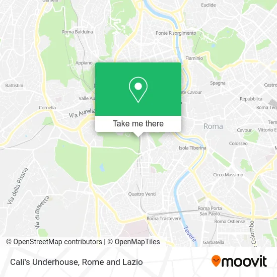
See Calí's Underhouse, Roma, on the map
Public Transit to Calí's Underhouse in Roma
Wondering how to get to Calí's Underhouse in Roma? Moovit helps you find the best way to get to Calí's Underhouse with step-by-step directions from the nearest public transit station.
Moovit provides free maps and live directions to help you navigate through your city. View schedules, routes, timetables, and find out how long does it take to get to Calí's Underhouse in real time.
Looking for the nearest stop or station to Calí's Underhouse? Check out this list of stops closest to your destination: Fornaci/Aurelian Walls; Roma San Pietro; Belli; Monte Del Gallo/Brancaleone; Garibaldi Square G.; Trastevere/Bernard. Da Feltre; Carini/St. Pancrazio; Trastevere/Ministry of Education.
Bus: 62, 64, 881, 34, 115, 870, 710, 3NAV, 8BUS.Train: FC3, FL3, R, R, R, RV.Metro: A.
Want to see if there’s another route that gets you there at an earlier time? Moovit helps you find alternative routes or times. Get directions from and directions to Calí's Underhouse easily from the Moovit App or Website.
We make riding to Calí's Underhouse easy, which is why over 1.5 million users, including users in Roma, trust Moovit as the best app for public transit. You don’t need to download an individual bus app or train app, Moovit is your all-in-one transit app that helps you find the best bus time or train time available.
For information on prices of bus, train and metro, costs and ride fares to Calí's Underhouse, please check the Moovit app.
Use the app to navigate to popular places including to the airport, hospital, stadium, grocery store, mall, coffee shop, school, college, and university.
Calí's Underhouse Address: Via di San Pancrazio, 00152 Roma street in Roma
- House of Theaters,
- New Furnaces Street 67,
- New Furnaces Street, 46 Parking,
- REG 7147 Ladispoli-Cerveteri > Rome Termini,
- Gianicolo in Music,
- Giuseppe Garibaldi Monument,
- Nocciolcono,
- Vivaroma Tours,
- Giuseppe Garibaldi Square / Janiculum Promenade,
- Monument to Garibaldi,
- Gianicolo 150,
- Gianicolo,
- Chiosco,
- Garibaldi Square Terrace,
- Gianicolo Puppet Theater,
- Velehrad Center,
- Monte Gianicolo,
- Janiculum Promenade / Belvedere February 9, 1849,
- Janiculum,
- Gianicolo
Places Near Calí's Underhouse (Roma)
- Roma Est Shopping Center, Roma,
- Sandro Pertini Hospital, Roma,
- The Wow Side, Fiumicino,
- Santa Maria Maggiore, Roma,
- Trastevere Quarter, Roma,
- Villa Borghese, Roma,
- The Sail, Roma,
- Tor Vergata, Roma,
- Olympic Stadium, Rome, Roma,
- Cristo Re Hospital, Roma,
- Auditorium Music Park, Roma,
- Paths, Roma,
- Termini Station, Roma,
- Gemelli Polyclinic, Roma,
- Casilino Polyclinic, Roma,
- IDI (Dermopatico Dell'Immacolata Institute), Roma,
- Gravity, Roma,
- Scuderie Del Quirinale, Roma,
- Tiber Island, Roma,
- Coppedè Quarter, Roma
How to get to popular places in Rome and Lazio with public transit
Get around Roma by public transit!
Traveling around Roma has never been so easy. See step by step directions as you travel to any attraction, street or major public transit station. View bus and train schedules, arrival times, service alerts and detailed routes on a map, so you know exactly how to get to anywhere in Roma.
When traveling to any destination around Roma use Moovit's Live Directions with Get Off Notifications to know exactly where and how far to walk, how long to wait for your line, and how many stops are left. Moovit will alert you when it's time to get off — no need to constantly re-check whether yours is the next stop.
Wondering how to use public transit in Roma or how to pay for public transit in Roma? Moovit public transit app can help you navigate your way with public transit easily, and at minimum cost. It includes public transit fees, ticket prices, and costs. Looking for a map of Roma public transit lines? Moovit public transit app shows all public transit maps in Roma with all Bus, Train, Metro, Light Rail, Ferry, Funicular and Gondola routes and stops on an interactive map.
Rome and Lazio has 7 transit type(s), including: Bus, Train, Metro, Light Rail, Ferry, Funicular and Gondola, operated by several transit agencies, including ATAC, Cotral, Trenitalia, Troiani Transportation Services, BIS, ATR Mobility, Tuscia, Shuttle, Seatour, Troiani Bus Lines, CSC Mobility, Terravision, ATRAL, Tambus and Sitbus