See Censier - Daubenton, Paris, on the map
Directions to Censier - Daubenton (Paris) with public transportation
The following transit lines have routes that pass near Censier - Daubenton
 Metro:
 - Bus:
How to get to Censier - Daubenton by bus?
Click on the bus route to see step by step directions with maps, line arrival times and updated time schedules.
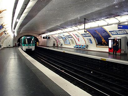
How to get to Censier - Daubenton by metro?
Click on the metro route to see step by step directions with maps, line arrival times and updated time schedules.
Bus stations near Censier - Daubenton in Paris
- Censier - Daubenton,4 min walk,
- Monge - Claude Bernard,4 min walk,
- Buffon - la Mosquée,5 min walk,
- Les Gobelins,7 min walk,
Metro stations near Censier - Daubenton in Paris
- Place Monge,6 min walk,
- Cardinal Lemoine,10 min walk,
Bus lines to Censier - Daubenton in Paris
- 24,Ecole Vétérinaire de Maisons-Alfort,
- 47,Fort du Kremlin-Bicêtre,
- N15,Villejuif - Louis Aragon,
- 27,Luxembourg,
- 67,Jussieu,
- 89,Gare de Vanves - Malakoff,
- 91,Montparnasse 2 - Gare Tgv,
- N01,Gare Montparnasse,
- N02,Barbès - Rochechouart,
What are the closest stations to Censier - Daubenton?
The closest stations to Censier - Daubenton are:
- Censier - Daubenton is 235 meters away, 4 min walk.
- Monge - Claude Bernard is 282 meters away, 4 min walk.
- Buffon - la Mosquée is 361 meters away, 5 min walk.
- Place Monge is 384 meters away, 6 min walk.
- Les Gobelins is 474 meters away, 7 min walk.
- Cardinal Lemoine is 765 meters away, 10 min walk.
Which metro line stops near Censier - Daubenton?
7
Which bus lines stop near Censier - Daubenton?
These bus lines stop near Censier - Daubenton: 47, 59, 63, 91.
What’s the nearest metro station to Censier - Daubenton in Paris?
The nearest metro station to Censier - Daubenton in Paris is Place Monge. It’s a 6 min walk away.
What’s the nearest bus stop to Censier - Daubenton in Paris?
The nearest bus stops to Censier - Daubenton in Paris are Censier - Daubenton and Monge - Claude Bernard. The closest one is a 4 min walk away.
What time is the first metro to Censier - Daubenton in Paris?
The 10 is the first metro that goes to Censier - Daubenton in Paris. It stops nearby at 5:32 AM.
What time is the last metro to Censier - Daubenton in Paris?
The 10 is the last metro that goes to Censier - Daubenton in Paris. It stops nearby at 1:13 AM.
What time is the first bus to Censier - Daubenton in Paris?
The N02 is the first bus that goes to Censier - Daubenton in Paris. It stops nearby at 3:01 AM.
What time is the last bus to Censier - Daubenton in Paris?
The N01 is the last bus that goes to Censier - Daubenton in Paris. It stops nearby at 3:18 AM.
See Censier - Daubenton, Paris, on the map
Public Transit to Censier - Daubenton in Paris
Wondering how to get to Censier - Daubenton in Paris, France? Moovit helps you find the best way to get to Censier - Daubenton with step-by-step directions from the nearest public transit station.
Moovit provides free maps and live directions to help you navigate through your city. View schedules, routes, timetables, and find out how long does it take to get to Censier - Daubenton in real time.
Looking for the nearest stop or station to Censier - Daubenton? Check out this list of stops closest to your destination: Censier - Daubenton; Monge - Claude Bernard; Buffon - la Mosquée; Place Monge; Les Gobelins; Cardinal Lemoine.
Metro:Bus:
Want to see if there’s another route that gets you there at an earlier time? Moovit helps you find alternative routes or times. Get directions from and directions to Censier - Daubenton easily from the Moovit App or Website.
We make riding to Censier - Daubenton easy, which is why over 1.5 million users, including users in Paris, trust Moovit as the best app for public transit. You don’t need to download an individual bus app or train app, Moovit is your all-in-one transit app that helps you find the best bus time or train time available.
For information on prices of metro, bus, RER and train, costs and ride fares to Censier - Daubenton, please check the Moovit app.
Use the app to navigate to popular places including to the airport, hospital, stadium, grocery store, mall, coffee shop, school, college, and university.
Censier - Daubenton Address: Rue Monge street in Paris
Attractions near Censier - Daubenton
Censier - Daubenton,Arrêt Censier Daubenton [47,N15,N22],Le Pied,Métro-Censier-Daubenton,Maxim Quartier Latin,Audionova,28 Rue Censier,Mejane,Essor Construction,Bulles En Vrac,Le Mirbel,Mavrommatis,Lisa,Narcotiques Anonymes France,4 Rue de Candolle,Sc-l'Arbre Bleu,Collège Pierre Alviset,16 Rue des Patriarches,Rue Censier,Rue de la ClefHow to get to popular attractions in Paris with public transit
Gonesse, Gonesse,Roissy Charles de Gaulle, Roissy-En-France,Le Valmy, Puteaux,Airbus Group, Elancourt,Orly Paris Airport, Paray-Vieille-Poste,McCann Paris, Clichy,Aéroville, Tremblay-En-France,Stade de France K To Z, Saint-Denis,McDonald's, Suresnes,Melun, Melun,Moulin de la Bièvre, Antony,Starbucks, Versailles,Toussus-le-Noble, Toussus-Le-Noble,Moret-sur-Loing, Moret-Sur-Loing,Edenred, Malakoff,Obiane (Orange Business Services), Palaiseau,Envies de Saison, Arcueil,IFP School, Rueil-Malmaison,Mennecy, Mennecy,Monoprix, ParisGet around Paris by public transit!
Traveling around Paris has never been so easy. See step by step directions as you travel to any attraction, street or major public transit station. View bus and train schedules, arrival times, service alerts and detailed routes on a map, so you know exactly how to get to anywhere in Paris.
When traveling to any destination around Paris use Moovit's Live Directions with Get Off Notifications to know exactly where and how far to walk, how long to wait for your line, and how many stops are left. Moovit will alert you when it's time to get off — no need to constantly re-check whether yours is the next stop.
Wondering how to use public transit in Paris or how to pay for public transit in Paris? Moovit public transit app can help you navigate your way with public transit easily, and at minimum cost. It includes public transit fees, ticket prices, and costs. Looking for a map of Paris public transit lines? Moovit public transit app shows all public transit maps in Paris with all metro, bus, RER or train routes and stops on an interactive map.
Paris has 4 transit type(s), including: metro, bus, RER or train, operated by several transit agencies, including RATP, RER, RER Bus de remplacement, Train, Train Bus de remplacement, RATP, Tramway Bus de remplacement, TER, RATP, Tramway, ADP, ADP, RATP, Noctilien and Magical Shuttle