Directions to Chao Center (Boston) with public transportation
The following transit lines have routes that pass near Chao Center
 Bus: 1, 109, 501, 66, 70.
- Train: FRAMINGHAM/WORCESTER.
- Subway: RED LINE, GREEN LINE B.
How to get to Chao Center by bus?
Click on the bus route to see step by step directions with maps, line arrival times and updated time schedules.
From Capo Restaurant & Supper Club, Boston
62 minFrom Suffolk Downs, Boston
95 minFrom Hampton Inn Boston Logan Airport, Revere
101 minFrom Old State House, Boston
46 minFrom Ramada by Wyndham Boston, Boston
101 minFrom Doubletree-Boston Bayside, Boston
69 minFrom Boston College (BC), Boston
45 minFrom Wellington Station, Medford
66 minFrom MBTA Suffolk Downs Station, Boston
99 minFrom Ramada Boston, Boston
101 min
How to get to Chao Center by train?
Click on the train route to see step by step directions with maps, line arrival times and updated time schedules.
How to get to Chao Center by subway?
Click on the subway route to see step by step directions with maps, line arrival times and updated time schedules.
From Capo Restaurant & Supper Club, Boston
49 minFrom Suffolk Downs, Boston
65 minFrom Hampton Inn Boston Logan Airport, Revere
74 minFrom Old State House, Boston
37 minFrom Ramada by Wyndham Boston, Boston
69 minFrom Doubletree-Boston Bayside, Boston
47 minFrom Boston College (BC), Boston
85 minFrom Wellington Station, Medford
45 minFrom MBTA Suffolk Downs Station, Boston
54 minFrom Ramada Boston, Boston
69 min
Bus stops near Chao Center in Boston
Bus lines to Chao Center in Boston
- 70, Central Square,VIEW
- 66, Nubian Via Allston,VIEW
- 86, Harvard,VIEW
- 1, Nubian,VIEW
- 64, Kendall/MIT,VIEW
- 71, Harvard - Watertown Square,VIEW
- 74, Harvard - Belmont Center,VIEW
- 75, Harvard - Belmont Center,VIEW
- 77, Harvard - Arlington Heights,VIEW
- 78, Harvard - Arlmont Village,VIEW
- 96, Harvard - Medford Square,VIEW
- 109, Harvard via Sullivan - Linden Square via Sullivan,VIEW
What are the closest stations to Chao Center?
The closest stations to Chao Center are:
- Western Ave Opp Genzyme is 420 yards away, 6 min walk.
- N Harvard St Opp Harvard Stadium Gate 2 is 474 yards away, 6 min walk.
- Amory Street is 559 yards away, 7 min walk.
- Mt Auburn St @ Dewolfe St is 737 yards away, 9 min walk.
- Western Ave @ Putnam Ave is 861 yards away, 11 min walk.
- Eliot St @ Bennett St is 1043 yards away, 13 min walk.
- Central is 1164 yards away, 14 min walk.
Which bus lines stop near Chao Center?
These bus lines stop near Chao Center: 1, 109, 501, 66, 70, 86.
Which train line stops near Chao Center?
FRAMINGHAM/WORCESTER (#525 | Worcester)
Which subway line stops near Chao Center?
RED LINE (Alewife)
What’s the nearest subway station to Chao Center in Boston?
The nearest subway station to Chao Center in Boston is Amory Street. It’s a 7 min walk away.
What’s the nearest bus station to Chao Center in Boston?
The nearest bus stations to Chao Center in Boston are Western Ave Opp Genzyme and N Harvard St Opp Harvard Stadium Gate 2. The closest one is a 6 min walk away.
What time is the first subway to Chao Center in Boston?
The GREEN LINE B is the first subway that goes to Chao Center in Boston. It stops nearby at 5:18 AM.
What time is the last subway to Chao Center in Boston?
The GREEN LINE B is the last subway that goes to Chao Center in Boston. It stops nearby at 2:22 AM.
What time is the first bus to Chao Center in Boston?
The 70 is the first bus that goes to Chao Center in Boston. It stops nearby at 4:28 AM.
What time is the last bus to Chao Center in Boston?
The 66 is the last bus that goes to Chao Center in Boston. It stops nearby at 2:31 AM.
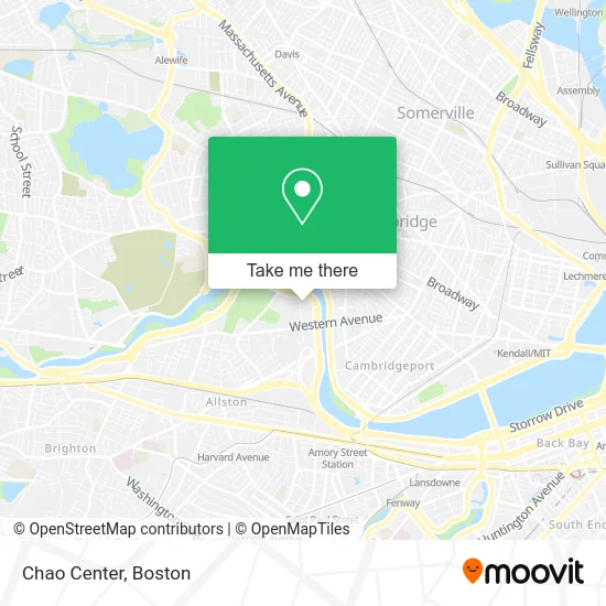
See Chao Center, Boston, on the map
Public Transit to Chao Center in Boston
Wondering how to get to Chao Center in Boston? Moovit helps you find the best way to get to Chao Center with step-by-step directions from the nearest public transit station.
Moovit provides free maps and live directions to help you navigate through your city. View schedules, routes, timetables, and find out how long does it take to get to Chao Center in real time.
Looking for the nearest stop or station to Chao Center? Check out this list of stops closest to your destination: Western Ave Opp Genzyme; N Harvard St Opp Harvard Stadium Gate 2; Amory Street; Mt Auburn St @ Dewolfe St; Western Ave @ Putnam Ave; Eliot St @ Bennett St; Central.
Bus: 1, 109, 501, 66, 70, 86, 64.Train: FRAMINGHAM/WORCESTER.Subway: RED LINE, GREEN LINE B.
Want to see if there’s another route that gets you there at an earlier time? Moovit helps you find alternative routes or times. Get directions from and directions to Chao Center easily from the Moovit App or Website.
We make riding to Chao Center easy, which is why over 1.7 million users, including users in Boston, trust Moovit as the best app for public transit. You don’t need to download an individual bus app or train app, Moovit is your all-in-one transit app that helps you find the best bus time or train time available.
For information on prices of bus, subway and train, costs and ride fares to Chao Center, please check the Moovit app.
Use the app to navigate to popular places including to the airport, hospital, stadium, grocery store, mall, coffee shop, school, college, and university.
Location: Boston
- Elitethirtynine,
- Bibliomotion,
- Charles River Park,
- Harvard Business School,
- Charles River,
- John Weeks Bridge (Weeks Memorial Bridge),
- Spangler Center,
- Harvard Business School Taxi Stand,
- John W. Weeks Bridge,
- Cotting Hall,
- Harvard Stadium,
- Dunster Grille,
- Winthrop House,
- Blodgett Pool,
- Cabbie's Cab,
- Block Denise S Psychothrpst,
- Leverett D-Hall,
- Harvard Innovation Lab (Harvard Ilab),
- Corporal Burns Playground,
- Charles River Aquatics Masters (Cambridge Masters Swim Club)
Places Near Chao Center (Boston)
- Castle Island, Boston,
- Boston Medical Center, Boston,
- Seaport District, Boston,
- Leader Bank Pavilion (Leader Bank Pavillion), Boston,
- Boston Convention & Exhibition Center, Boston,
- Massachusetts General Hospital, Boston,
- Boston Children's Hospital, Boston,
- Mgm Music Hall, Boston,
- North End, Boston,
- Prudential Center, Boston,
- Museum Of Science, Boston,
- House Of Blues, Boston,
- Quincy Market, Boston,
- Isabella Stewart Gardner Museum, Boston,
- Cheers, Boston,
- Boston Common, Boston,
- Wang Theater, Boston,
- Wilbur Theatre, Boston,
- Faneuil Hall, Boston,
- Td Garden, Boston
How to get to popular places in Boston with public transit
Get around Boston by public transit!
Traveling around Boston has never been so easy. See step by step directions as you travel to any attraction, street or major public transit station. View bus and train schedules, arrival times, service alerts and detailed routes on a map, so you know exactly how to get to anywhere in Boston.
When traveling to any destination around Boston use Moovit's Live Directions with Get Off Notifications to know exactly where and how far to walk, how long to wait for your line, and how many stops are left. Moovit will alert you when it's time to get off — no need to constantly re-check whether yours is the next stop.
Wondering how to use public transit in Boston or how to pay for public transit in Boston? Moovit public transit app can help you navigate your way with public transit easily, and at minimum cost. It includes public transit fees, ticket prices, and costs. Looking for a map of Boston public transit lines? Moovit public transit app shows all public transit maps in Boston with all Bus, Train, Subway and Ferry routes and stops on an interactive map.
Boston has 4 transit type(s), including: Bus, Train, Subway and Ferry, operated by several transit agencies, including MBTA, Southeastern Regional Transit Authority, MetroWest Regional Transit Authority, Rhode Island Public Transit Authority, WRTA, Lowell Regional Transit Authority, Merrimack Valley Transit, Montachusett Regional Transit Authority, Cape Cod Regional Transit Authority, Brockton Area Transit Authority, Martha's Vineyard Transit Authority, the WAVE - Nantucket Regional Transit Authority, GATRA, Cape Ann Transportation Authority and Massport