Directions to City National Plaza (Downtown, La) with public transportation
The following transit lines have routes that pass near City National Plaza
How to get to City National Plaza by bus?
Click on the bus route to see step by step directions with maps, line arrival times and updated time schedules.
How to get to City National Plaza by subway?
Click on the subway route to see step by step directions with maps, line arrival times and updated time schedules.
Bus stops near City National Plaza in Downtown, La
- Flower St & 5th St, 1 min walk,
- Flower St. & 5th St., 1 min walk,
- Flower / 5th, 1 min walk,
- Flower St & 5th St (Southbound), 2 min walk,
- Figueroa St and 5th St E, 2 min walk,
- STH Flower St & West 5th St, 2 min walk,
- 5th/Flower, 2 min walk,
- 5th / Flower, 2 min walk,
Subway stations near City National Plaza in Downtown, La
- Pershing Square Station, 13 min walk,
- 7th Street / Metro Center Station, 14 min walk,
Funicular station near City National Plaza in Downtown, La
- Angels Flight Top Station, 18 min walk,
Bus lines to City National Plaza in Downtown, La
- DASH A, (Westbound) Dash A / City West,
- DASH B, Southbound,
- DASH F, (Southbound) Dash F / Expo Park - USC /,
- 785, Downtown LA,
- R10, Downtown LA Express,
- 487/489, Downtown LA - 5th - Beaudry,
- CE409, Southbound,
- CE422, Eastbound,
- CE423, Westbound,
- CE431, Downtown LA/Westwood,
- CE431B, CE431B,
- CE437A, Downtown LA/Culver City,
- CE437B, Playa Vista/Downtown LA,
- CE438, El Segundo/Downtown LA,
- CE438B, El Segundo/Downtown LA,
- CE448, Rancho Palos Verdes/Financial District,
- CE534, West LA/Downtown LA,
- 490, East: Glendora via Covina,
- 493, East: Rowland Heights via Puentehillsmal,
- 495, East: Industry Park and Ride,
What are the closest stations to City National Plaza?
The closest stations to City National Plaza are:
- Flower St & 5th St is 17 yards away, 1 min walk.
- Flower St. & 5th St. is 24 yards away, 1 min walk.
- Flower / 5th is 37 yards away, 1 min walk.
- Flower St & 5th St (Southbound) is 92 yards away, 2 min walk.
- Figueroa St and 5th St E is 125 yards away, 2 min walk.
- STH Flower St & West 5th St is 127 yards away, 2 min walk.
- 5th/Flower is 154 yards away, 2 min walk.
- 5th / Flower is 163 yards away, 2 min walk.
- Pershing Square Station is 1080 yards away, 13 min walk.
- 7th Street / Metro Center Station is 1113 yards away, 14 min walk.
- Angels Flight Top Station is 1457 yards away, 18 min walk.
Which bus lines stop near City National Plaza?
These bus lines stop near City National Plaza: 14/37, 20, 487/489, METRO J LINE (SILVER) 910/950.
Which subway line stops near City National Plaza?
B LINE (Eastbound - Union Station)
Which light rail line stops near City National Plaza?
E LINE (Eastbound to East L.A.)
What’s the nearest subway station to City National Plaza in Downtown, La?
The nearest subway station to City National Plaza in Downtown, La is Pershing Square Station. It’s a 13 min walk away.
What’s the nearest bus station to City National Plaza in Downtown, La?
The nearest bus stations to City National Plaza in Downtown, La are Flower St & 5th St, Flower St. & 5th St. and Flower / 5th. The closest one is a 1 min walk away.
What’s the nearest funicular station to City National Plaza in Downtown, La?
The nearest funicular station to City National Plaza in Downtown, La is Angels Flight Top Station. It’s a 18 min walk away.
What time is the first light rail to City National Plaza in Downtown, La?
The E LINE is the first light rail that goes to City National Plaza in Downtown, La. It stops nearby at 3:55 AM.
What time is the last light rail to City National Plaza in Downtown, La?
The A LINE is the last light rail that goes to City National Plaza in Downtown, La. It stops nearby at 12:45 AM.
What time is the first subway to City National Plaza in Downtown, La?
The B LINE is the first subway that goes to City National Plaza in Downtown, La. It stops nearby at 4:14 AM.
What time is the last subway to City National Plaza in Downtown, La?
The B LINE is the last subway that goes to City National Plaza in Downtown, La. It stops nearby at 12:30 AM.
What time is the first bus to City National Plaza in Downtown, La?
The 20 is the first bus that goes to City National Plaza in Downtown, La. It stops nearby at 3:23 AM.
What time is the last bus to City National Plaza in Downtown, La?
The 20 is the last bus that goes to City National Plaza in Downtown, La. It stops nearby at 2:53 AM.
What time is the first funicular to City National Plaza in Downtown, La?
The ANGELS FLIGHT is the first funicular that goes to City National Plaza in Downtown, La. It stops nearby at 6:45 AM.
What time is the last funicular to City National Plaza in Downtown, La?
The ANGELS FLIGHT is the last funicular that goes to City National Plaza in Downtown, La. It stops nearby at 10:05 PM.
See City National Plaza, Downtown, La, on the map
Public Transit to City National Plaza in Downtown, La
Wondering how to get to City National Plaza in Downtown, La, United States? Moovit helps you find the best way to get to City National Plaza with step-by-step directions from the nearest public transit station.
Moovit provides free maps and live directions to help you navigate through your city. View schedules, routes, timetables, and find out how long does it take to get to City National Plaza in real time.
Looking for the nearest stop or station to City National Plaza? Check out this list of stops closest to your destination: Flower St & 5th St; Flower St. & 5th St.; Flower / 5th; Flower St & 5th St (Southbound); Figueroa St and 5th St E; STH Flower St & West 5th St; 5th/Flower; 5th / Flower; Pershing Square Station; 7th Street / Metro Center Station; Angels Flight Top Station.
Bus: 14/37, 20, 487/489, METRO J LINE (SILVER) 910/950, 785, DASH A, DASH B, DASH F, R10.Subway: B LINE, D LINE, A LINE, E LINE.Light Rail: E LINE.Funicular: ANGELS FLIGHT.
Want to see if there’s another route that gets you there at an earlier time? Moovit helps you find alternative routes or times. Get directions from and directions to City National Plaza easily from the Moovit App or Website.
We make riding to City National Plaza easy, which is why over 1.5 million users, including users in Downtown, La, trust Moovit as the best app for public transit. You don’t need to download an individual bus app or train app, Moovit is your all-in-one transit app that helps you find the best bus time or train time available.
For information on prices of bus, subway and light rail, costs and ride fares to City National Plaza, please check the Moovit app.
Use the app to navigate to popular places including to the airport, hospital, stadium, grocery store, mall, coffee shop, school, college, and university.
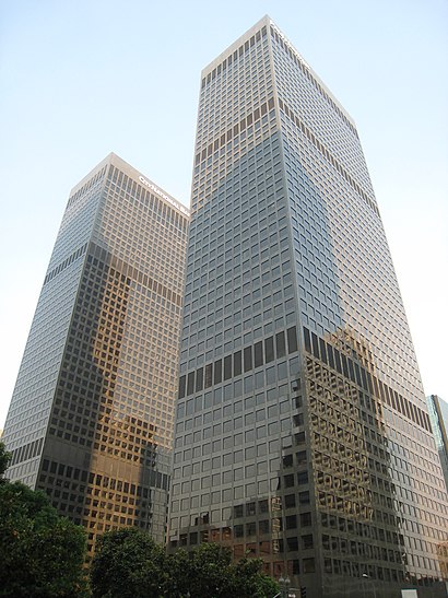
City National Plaza Address: 515 S Flower St street in Downtown, La
City National Plaza is a twin tower skyscraper complex on South Flower Street in western Downtown Los Angeles, California, United States. It was originally named ARCO Plaza upon opening in 1972.Wiki
Places Near City National Plaza (Downtown, La)
How to get to popular places in Los Angeles with public transit
Get around Downtown, La by public transit!
Traveling around Downtown, La has never been so easy. See step by step directions as you travel to any attraction, street or major public transit station. View bus and train schedules, arrival times, service alerts and detailed routes on a map, so you know exactly how to get to anywhere in Downtown, La.
When traveling to any destination around Downtown, La use Moovit's Live Directions with Get Off Notifications to know exactly where and how far to walk, how long to wait for your line, and how many stops are left. Moovit will alert you when it's time to get off — no need to constantly re-check whether yours is the next stop.
Wondering how to use public transit in Downtown, La or how to pay for public transit in Downtown, La? Moovit public transit app can help you navigate your way with public transit easily, and at minimum cost. It includes public transit fees, ticket prices, and costs. Looking for a map of Downtown, La public transit lines? Moovit public transit app shows all public transit maps in Downtown, La with all Bus, Train, Subway, Light Rail, Ferry and Funicular routes and stops on an interactive map.
Los Angeles has 6 transit type(s), including: Bus, Train, Subway, Light Rail, Ferry and Funicular, operated by several transit agencies, including METRO, OCTA, Metrolink Trains, Big Blue Bus, LAX FlyAway, PVPTA, Burbank Bus, Laguna Beach Transit, Thousand Oaks Transit, Amtrak, OMNITRANS, Foothill Transit, Culver City Bus, Glendale Beeline and Long Beach Transit