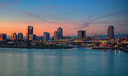
Directions to City of Long Beach with public transportation
The following transit lines have routes that pass near City of Long Beach
Directions to City of Long Beach with public transportation
The following transit lines have routes that pass near City of Long Beach
How to get to City of Long Beach by bus?
Click on the bus route to see step by step directions with maps, line arrival times and updated time schedules.
Bus lines to City of Long Beach
- PASSPORT,Passport North/To Downtown and A/Blue,
- 21,21 Cherry to Alondra,
- 22,22 Downey Ave to Artesia Blvd Only,
- 23,23 Cherry to Downtown via Paramount,
- 61,61 Atlantic to Artesia Sta,
- 121,121 Belmont Shore to PCH at Clark via,
- 71,71 - Orange to Rosecrans at Lakewood,
What are the closest stations to City of Long Beach?
The closest stations to City of Long Beach are:
- Shoreline & Village W is 59 yards away, 1 min walk.
- Ocean & Pine NE is 222 yards away, 3 min walk.
- Ocean & Pine SE is 231 yards away, 3 min walk.
- Long Beach Port is 729 yards away, 9 min walk.
- Downtown Long Beach Station is 1212 yards away, 15 min walk.
Which bus lines stop near City of Long Beach?
These bus lines stop near City of Long Beach: 121, 3.
Which light rail line stops near City of Long Beach?
METRO A LINE
What’s the nearest light rail station to City of Long Beach?
The nearest light rail station to City of Long Beach is Downtown Long Beach Station. It’s a 15 min walk away.
What’s the nearest bus stop to City of Long Beach?
The nearest bus stop to City of Long Beach is Shoreline & Village W. It’s a 1 min walk away.
What’s the nearest ferry station to City of Long Beach?
The nearest ferry station to City of Long Beach is Long Beach Port. It’s a 9 min walk away.
What time is the first light rail to City of Long Beach?
The METRO A LINE is the first light rail that goes to City of Long Beach. It stops nearby at 3:48 AM.
What time is the last light rail to City of Long Beach?
The METRO A LINE is the last light rail that goes to City of Long Beach. It stops nearby at 1:40 AM.
What time is the first bus to City of Long Beach?
The 21 is the first bus that goes to City of Long Beach. It stops nearby at 5:00 AM.
What time is the last bus to City of Long Beach?
The 23 is the last bus that goes to City of Long Beach. It stops nearby at 11:27 PM.
What time is the first ferry to City of Long Beach?
The CATALINA EXPRESS is the first ferry that goes to City of Long Beach. It stops nearby at 6:00 AM.
What time is the last ferry to City of Long Beach?
The CATALINA EXPRESS is the last ferry that goes to City of Long Beach. It stops nearby at 8:45 PM.
How much is the light rail fare to City of Long Beach?
The light rail fare to City of Long Beach costs about $1.75.
How much is the bus fare to City of Long Beach?
The bus fare to City of Long Beach costs about $0.35 - $1.00.
See City of Long Beach on the map
Public Transportation to City of Long Beach
Wondering how to get to City of Long Beach, United States? Moovit helps you find the best way to get to City of Long Beach with step-by-step directions from the nearest public transit station.
Moovit provides free maps and live directions to help you navigate through your city. View schedules, routes, timetables, and find out how long does it take to get to City of Long Beach in real time.
Looking for the nearest stop or station to City of Long Beach? Check out this list of stops closest to your destination: Shoreline & Village W; Ocean & Pine NE; Ocean & Pine SE; Long Beach Port; Downtown Long Beach Station.
Bus: 121, 3, PASSPORT, 21, 22, 23, 61, 71.Light Rail: METRO A LINE.Ferry: CATALINA EXPRESS.
Want to see if there’s another route that gets you there at an earlier time? Moovit helps you find alternative routes or times. Get directions from and directions to City of Long Beach easily from the Moovit App or Website.
We make riding to City of Long Beach easy, which is why over 1.5 million users, including users in Long Beach, trust Moovit as the best app for public transit. You don’t need to download an individual bus app or train app, Moovit is your all-in-one transit app that helps you find the best bus time or train time available.
For information on prices of bus and light rail, costs and ride fares to City of Long Beach, please check the Moovit app.
Use the app to navigate to popular places including to the airport, hospital, stadium, grocery store, mall, coffee shop, school, college, and university.
City of Long Beach Address: 486 Shoreline Village Dr Long Beach, CA 90802 street in Long Beach
Attractions near City of Long Beach
Bogdana Dees,Ultimate Escape Rooms - Long Beach,Little Girl Blue's Toys and Gifts,Full Service Real Estate Group,MSLM Guild Musique Sur la Mer,Diveworks,Original Lobster Festival,Long Beach Boat Rentals (Charter Boat Company),Seaview Cruises,United Valet Parking,Charter Boat Company,Yard House,Long Beach Shoreline Marina,Long Beach Speed Boat Tours,Shoreline Village,Harborside Pub,La Dolce Vita Spa,Alamitos Beach Parking,Sugar Daddies Sweet Shoppe,Toyota Grand Prix of Long Beach Start / Finish LineHow to get to popular attractions in Long Beach with public transit
Seven Grand, Downtown, La,Ball Cast Member Parking Lot (BCML), Anaheim,California Screamin', Anaheim,The Misfit Restaurant + Bar, Santa Monica,Anaheim GardenWalk, Anaheim,City of Laguna Beach, Laguna Beach,East Shuttle Area, Anaheim,Paradise Pier, Anaheim,Pomona, CA, Pomona,Radiator Springs Racers, Anaheim,Galleria at Tyler, Riverside,Fullerton College, Fullerton,85°C Bakery Cafe, Irvine,City of Anaheim, Anaheim,Apple South Coast Plaza, Costa Mesa,Anaheim Marriott, Anaheim,Northridge, CA, Northridge, La,Costco Wholesale, Fountain Valley,Mickey & Friends Tram, Anaheim,MainPlace Mall, Santa AnaGet around Los Angeles by public transit!
Traveling around Los Angeles has never been so easy. See step by step directions as you travel to any attraction, street or major public transit station. View bus and train schedules, arrival times, service alerts and detailed routes on a map, so you know exactly how to get to anywhere in Los Angeles.
When traveling to any destination around Los Angeles use Moovit's Live Directions with Get Off Notifications to know exactly where and how far to walk, how long to wait for your line, and how many stops are left. Moovit will alert you when it's time to get off — no need to constantly re-check whether yours is the next stop.
Wondering how to use public transit in Los Angeles or how to pay for public transit in Los Angeles? Moovit public transit app can help you navigate your way with public transit easily, and at minimum cost. It includes public transit fees, ticket prices, and costs. Looking for a map of Los Angeles public transit lines? Moovit public transit app shows all public transit maps in Los Angeles with all Bus, Train, Subway, Light Rail, Ferry and Funicular routes and stops on an interactive map.
Los Angeles has 6 transit type(s), including: Bus, Train, Subway, Light Rail, Ferry and Funicular, operated by several transit agencies, including Metro - Los Angeles, Metrolink Trains, METRO, Long Beach Transit, LADOT, OCTA, Foothill Transit, Big Blue Bus, Riverside Transit Agency, LAX FlyAway, Airporter Shuttle, Playa Vista Shuttle, Amtrak, OMNITRANS, Pasadena Transit