Directions to Coinme (Watertown Town) with public transportation
The following transit lines have routes that pass near Coinme
 Bus: 504, 52, 57, 59, 70.
- Train: FITCHBURG, FRAMINGHAM/WORCESTER.
- Subway: GREEN LINE D, GREEN LINE B.
How to get to Coinme by bus?
Click on the bus route to see step by step directions with maps, line arrival times and updated time schedules.
From Hood Park, Boston
81 minFrom Forest Hills Station MBTA, Boston
63 minFrom Fire & Ice (Fire Ice Restaurant), Boston
30 minFrom Charles/MGH T Stop, Boston
47 minFrom Cambridge Crossing, Cambridge
67 minFrom The Friendly Toast, Boston
33 minFrom Cambridge Health Alliance (CHA), Cambridge
45 minFrom O'Bryant High School, Boston
63 minFrom DoubleTree Suites by Hilton Hotel Boston - Cambridge, Boston
39 minFrom John Hancock Tower (200 Clarendon), Boston
31 min
How to get to Coinme by train?
Click on the train route to see step by step directions with maps, line arrival times and updated time schedules.
From Forest Hills Station MBTA, Boston
133 minFrom Fire & Ice (Fire Ice Restaurant), Boston
51 minFrom Charles/MGH T Stop, Boston
83 minFrom Cambridge Crossing, Cambridge
83 minFrom The Friendly Toast, Boston
48 minFrom O'Bryant High School, Boston
141 minFrom DoubleTree Suites by Hilton Hotel Boston - Cambridge, Boston
122 minFrom John Hancock Tower (200 Clarendon), Boston
49 min
Bus stops near Coinme in Watertown Town
Subway stations near Coinme in Watertown Town
What are the closest stations to Coinme?
The closest stations to Coinme are:
- Chapel St @ Watertown St is 90 yards away, 2 min walk.
- Watertown St @ Pearl St is 215 yards away, 3 min walk.
- Newton Centre is 222 yards away, 3 min walk.
- Waverley is 1843 yards away, 22 min walk.
- West Newton is 1884 yards away, 22 min walk.
- Boston College is 5056 yards away, 60 min walk.
Which bus lines stop near Coinme?
These bus lines stop near Coinme: 504, 52, 57, 59, 70, 71.
Which train lines stop near Coinme?
These train lines stop near Coinme: FITCHBURG, FRAMINGHAM/WORCESTER.
What’s the nearest subway station to Coinme in Watertown Town?
The nearest subway station to Coinme in Watertown Town is Newton Centre. It’s a 3 min walk away.
What’s the nearest train station to Coinme in Watertown Town?
The nearest train stations to Coinme in Watertown Town are Waverley and West Newton. The closest one is a 22 min walk away.
What’s the nearest bus station to Coinme in Watertown Town?
The nearest bus station to Coinme in Watertown Town is Chapel St @ Watertown St. It’s a 2 min walk away.
What time is the first subway to Coinme in Watertown Town?
The GREEN LINE D is the first subway that goes to Coinme in Watertown Town. It stops nearby at 4:54 AM.
What time is the last subway to Coinme in Watertown Town?
The GREEN LINE B is the last subway that goes to Coinme in Watertown Town. It stops nearby at 2:39 AM.
What time is the first train to Coinme in Watertown Town?
The FRAMINGHAM/WORCESTER is the first train that goes to Coinme in Watertown Town. It stops nearby at 5:22 AM.
What time is the last train to Coinme in Watertown Town?
The FRAMINGHAM/WORCESTER is the last train that goes to Coinme in Watertown Town. It stops nearby at 12:20 AM.
What time is the first bus to Coinme in Watertown Town?
The 59 is the first bus that goes to Coinme in Watertown Town. It stops nearby at 6:06 AM.
What time is the last bus to Coinme in Watertown Town?
The 59 is the last bus that goes to Coinme in Watertown Town. It stops nearby at 8:21 PM.
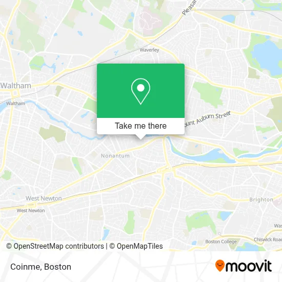
See Coinme, Watertown Town, on the map
Public Transit to Coinme in Watertown Town
Wondering how to get to Coinme in Watertown Town? Moovit helps you find the best way to get to Coinme with step-by-step directions from the nearest public transit station.
Moovit provides free maps and live directions to help you navigate through your city. View schedules, routes, timetables, and find out how long does it take to get to Coinme in real time.
Looking for the nearest stop or station to Coinme? Check out this list of stops closest to your destination: Chapel St @ Watertown St; Watertown St @ Pearl St; Newton Centre; Waverley; West Newton; Boston College.
Bus: 504, 52, 57, 59, 70, 71, 558.Train: FITCHBURG, FRAMINGHAM/WORCESTER.Subway: GREEN LINE D, GREEN LINE B.
Want to see if there’s another route that gets you there at an earlier time? Moovit helps you find alternative routes or times. Get directions from and directions to Coinme easily from the Moovit App or Website.
We make riding to Coinme easy, which is why over 1.7 million users, including users in Watertown Town, trust Moovit as the best app for public transit. You don’t need to download an individual bus app or train app, Moovit is your all-in-one transit app that helps you find the best bus time or train time available.
For information on prices of bus, train and subway, costs and ride fares to Coinme, please check the Moovit app.
Use the app to navigate to popular places including to the airport, hospital, stadium, grocery store, mall, coffee shop, school, college, and university.
Coinme Address: 171 Watertown St street in Watertown Town
- The Pappas Company,
- Modera Newton,
- Turtle Studios Newton,
- Alpha Omega Autobody of Watertown,
- Signs by Tomorrow,
- Delio,
- Coppola Studios,
- Watertown Dealtry Pool,
- Applied Image of Watertown,
- Brewbound Experience,
- Fablevision Studios,
- Mariann Burke Psychotherapy,
- The Watertown Catholic Collaborative of Sacred Heart and Saint Patrick,
- Goddard School,
- Nerd Central,
- D and V Realty,
- Amethyst Chiropractic,
- Innovative Promotional CNCPTS,
- Nzuko - Watertown,
- 63 pleasant st, watertown, ma
Places Near Coinme (Watertown Town)
- Boston Convention & Exhibition Center, Boston,
- Boston Common, Boston,
- Isabella Stewart Gardner Museum, Boston,
- Faneuil Hall, Boston,
- Seaport District, Boston,
- Castle Island, Boston,
- Cheers, Boston,
- Leader Bank Pavilion (Leader Bank Pavillion), Boston,
- Prudential Center, Boston,
- House Of Blues, Boston,
- North End, Boston,
- Wilbur Theatre, Boston,
- Mgm Music Hall, Boston,
- Wang Theater, Boston,
- Boston Medical Center, Boston,
- Museum Of Science, Boston,
- Boston Children's Hospital, Boston,
- Quincy Market, Boston,
- Massachusetts General Hospital, Boston,
- Td Garden, Boston
How to get to popular places in Boston with public transit
Get around Watertown Town by public transit!
Traveling around Watertown Town has never been so easy. See step by step directions as you travel to any attraction, street or major public transit station. View bus and train schedules, arrival times, service alerts and detailed routes on a map, so you know exactly how to get to anywhere in Watertown Town.
When traveling to any destination around Watertown Town use Moovit's Live Directions with Get Off Notifications to know exactly where and how far to walk, how long to wait for your line, and how many stops are left. Moovit will alert you when it's time to get off — no need to constantly re-check whether yours is the next stop.
Wondering how to use public transit in Watertown Town or how to pay for public transit in Watertown Town? Moovit public transit app can help you navigate your way with public transit easily, and at minimum cost. It includes public transit fees, ticket prices, and costs. Looking for a map of Watertown Town public transit lines? Moovit public transit app shows all public transit maps in Watertown Town with all Bus, Train, Subway and Ferry routes and stops on an interactive map.
Boston has 4 transit type(s), including: Bus, Train, Subway and Ferry, operated by several transit agencies, including MBTA, Southeastern Regional Transit Authority, MetroWest Regional Transit Authority, Rhode Island Public Transit Authority, WRTA, Lowell Regional Transit Authority, Merrimack Valley Transit, Montachusett Regional Transit Authority, Cape Cod Regional Transit Authority, Brockton Area Transit Authority, Martha's Vineyard Transit Authority, the WAVE - Nantucket Regional Transit Authority, GATRA, Cape Ann Transportation Authority and Massport