Directions to Community Action For Safe Alternatives (Winthrop Town) with public transportation
The following transit lines have routes that pass near Community Action For Safe Alternatives
 Bus: 119, 120, 713.
- Subway: BLUE LINE.
- Ferry: WINTHROP FERRY, WINTHROP/QUINCY FERRY.
How to get to Community Action For Safe Alternatives by bus?
Click on the bus route to see step by step directions with maps, line arrival times and updated time schedules.
From Sweet Cheeks Q, Boston
137 minFrom South Boston, Boston
100 minFrom The Cheesecake Factory, Boston
96 minFrom Verb Hotel, Boston
138 minFrom Hyatt Regency Cambridge - Overlooking Boston, Cambridge
108 minFrom Isabella Stewart Gardner Museum, Boston
119 minFrom Hyatt Regency Cambridge, Cambridge
108 minFrom Winter Hill, Somerville
117 minFrom The Garment District, Cambridge
93 minFrom MBTA Kenmore Station, Boston
111 min
How to get to Community Action For Safe Alternatives by subway?
Click on the subway route to see step by step directions with maps, line arrival times and updated time schedules.
From Sweet Cheeks Q, Boston
71 minFrom South Boston, Boston
71 minFrom MBTA Kenmore Station, Boston
62 minFrom The Cheesecake Factory, Boston
60 minFrom Verb Hotel, Boston
71 minFrom Hyatt Regency Cambridge - Overlooking Boston, Cambridge
83 minFrom Isabella Stewart Gardner Museum, Boston
70 minFrom Hyatt Regency Cambridge, Cambridge
83 minFrom Winter Hill, Somerville
76 minFrom The Garment District, Cambridge
68 min
Bus stop near Community Action For Safe Alternatives in Winthrop Town
- Walden St @ Lincoln St, 5 min walk,VIEW
Subway station near Community Action For Safe Alternatives in Winthrop Town
- Wood Island, 11 min walk,VIEW
Ferry station near Community Action For Safe Alternatives in Winthrop Town
- Winthrop Landing, 39 min walk,VIEW
Bus lines to Community Action For Safe Alternatives in Winthrop Town
- 713, Orient Heights,VIEW
What are the closest stations to Community Action For Safe Alternatives?
The closest stations to Community Action For Safe Alternatives are:
- Walden St @ Lincoln St is 371 yards away, 5 min walk.
- Wood Island is 931 yards away, 11 min walk.
- Winthrop Landing is 3320 yards away, 39 min walk.
Which bus lines stop near Community Action For Safe Alternatives?
These bus lines stop near Community Action For Safe Alternatives: 119, 120, 713.
Which subway line stops near Community Action For Safe Alternatives?
BLUE LINE (Wonderland)
What’s the nearest subway station to Community Action For Safe Alternatives in Winthrop Town?
The nearest subway station to Community Action For Safe Alternatives in Winthrop Town is Wood Island. It’s a 11 min walk away.
What’s the nearest bus station to Community Action For Safe Alternatives in Winthrop Town?
The nearest bus station to Community Action For Safe Alternatives in Winthrop Town is Walden St @ Lincoln St. It’s a 5 min walk away.
What time is the first subway to Community Action For Safe Alternatives in Winthrop Town?
The BLUE LINE is the first subway that goes to Community Action For Safe Alternatives in Winthrop Town. It stops nearby at 5:08 AM.
What time is the last subway to Community Action For Safe Alternatives in Winthrop Town?
The BLUE LINE is the last subway that goes to Community Action For Safe Alternatives in Winthrop Town. It stops nearby at 2:06 AM.
What time is the first bus to Community Action For Safe Alternatives in Winthrop Town?
The 713 is the first bus that goes to Community Action For Safe Alternatives in Winthrop Town. It stops nearby at 5:12 AM.
What time is the last bus to Community Action For Safe Alternatives in Winthrop Town?
The 713 is the last bus that goes to Community Action For Safe Alternatives in Winthrop Town. It stops nearby at 1:08 AM.
What time is the first ferry to Community Action For Safe Alternatives in Winthrop Town?
The WINTHROP FERRY is the first ferry that goes to Community Action For Safe Alternatives in Winthrop Town. It stops nearby at 6:40 AM.
What time is the last ferry to Community Action For Safe Alternatives in Winthrop Town?
The WINTHROP FERRY is the last ferry that goes to Community Action For Safe Alternatives in Winthrop Town. It stops nearby at 9:00 PM.
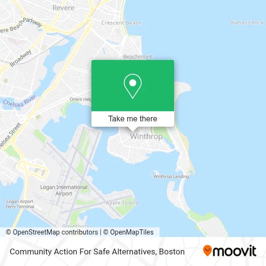
See Community Action For Safe Alternatives, Winthrop Town, on the map
Public Transit to Community Action For Safe Alternatives in Winthrop Town
Wondering how to get to Community Action For Safe Alternatives in Winthrop Town? Moovit helps you find the best way to get to Community Action For Safe Alternatives with step-by-step directions from the nearest public transit station.
Moovit provides free maps and live directions to help you navigate through your city. View schedules, routes, timetables, and find out how long does it take to get to Community Action For Safe Alternatives in real time.
Looking for the nearest stop or station to Community Action For Safe Alternatives? Check out this list of stops closest to your destination: Walden St @ Lincoln St; Wood Island; Winthrop Landing.
Bus: 119, 120, 713.Subway: BLUE LINE.Ferry: WINTHROP FERRY, WINTHROP/QUINCY FERRY.
Want to see if there’s another route that gets you there at an earlier time? Moovit helps you find alternative routes or times. Get directions from and directions to Community Action For Safe Alternatives easily from the Moovit App or Website.
We make riding to Community Action For Safe Alternatives easy, which is why over 1.7 million users, including users in Winthrop Town, trust Moovit as the best app for public transit. You don’t need to download an individual bus app or train app, Moovit is your all-in-one transit app that helps you find the best bus time or train time available.
For information on prices of subway and bus, costs and ride fares to Community Action For Safe Alternatives, please check the Moovit app.
Use the app to navigate to popular places including to the airport, hospital, stadium, grocery store, mall, coffee shop, school, college, and university.
Community Action For Safe Alternatives Address: 45 Pauline St street in Winthrop Town
- Vuolo's,
- Winthrop MA USA,
- Winthrop,
- Winthrop Marketplace (Winthrop Market Place),
- Belle Isle Lobster & Seafood,
- Elite Embroidery & Screen Printing Company,
- Belle Isle Section Winthrop Cemetery,
- Winthrop Beach,
- Beach,
- Winthrop Beach,
- Mbta Orient Heights Yard,
- Orient Heights Main Parking,
- Print Boston,
- Redgate Capital Partners,
- Halford Beach,
- Orient Heights, Massachusetts,
- Cruise Planners,
- Winthrop Arms Restaurant,
- Logan Glass Company,
- Abiha Enterprises
Places Near Community Action For Safe Alternatives (Winthrop Town)
- North End, Boston,
- Quincy Market, Boston,
- Wilbur Theatre, Boston,
- Massachusetts General Hospital, Boston,
- Boston Convention & Exhibition Center, Boston,
- Wang Theater, Boston,
- Isabella Stewart Gardner Museum, Boston,
- Td Garden, Boston,
- Boston Medical Center, Boston,
- House Of Blues, Boston,
- Leader Bank Pavilion (Leader Bank Pavillion), Boston,
- Seaport District, Boston,
- Cheers, Boston,
- Boston Common, Boston,
- Faneuil Hall, Boston,
- Museum Of Science, Boston,
- Castle Island, Boston,
- Prudential Center, Boston,
- Boston Children's Hospital, Boston,
- Mgm Music Hall, Boston
How to get to popular places in Boston with public transit
Get around Winthrop Town by public transit!
Traveling around Winthrop Town has never been so easy. See step by step directions as you travel to any attraction, street or major public transit station. View bus and train schedules, arrival times, service alerts and detailed routes on a map, so you know exactly how to get to anywhere in Winthrop Town.
When traveling to any destination around Winthrop Town use Moovit's Live Directions with Get Off Notifications to know exactly where and how far to walk, how long to wait for your line, and how many stops are left. Moovit will alert you when it's time to get off — no need to constantly re-check whether yours is the next stop.
Wondering how to use public transit in Winthrop Town or how to pay for public transit in Winthrop Town? Moovit public transit app can help you navigate your way with public transit easily, and at minimum cost. It includes public transit fees, ticket prices, and costs. Looking for a map of Winthrop Town public transit lines? Moovit public transit app shows all public transit maps in Winthrop Town with all Bus, Train, Subway and Ferry routes and stops on an interactive map.
Boston has 4 transit type(s), including: Bus, Train, Subway and Ferry, operated by several transit agencies, including MBTA, Southeastern Regional Transit Authority, MetroWest Regional Transit Authority, Rhode Island Public Transit Authority, WRTA, Lowell Regional Transit Authority, Merrimack Valley Transit, Montachusett Regional Transit Authority, Cape Cod Regional Transit Authority, Brockton Area Transit Authority, Martha's Vineyard Transit Authority, the WAVE - Nantucket Regional Transit Authority, GATRA, Cape Ann Transportation Authority and Massport