How to get to Cop Copine by bus?
Click on the bus route to see step by step directions with maps, line arrival times and updated time schedules.
How to get to Cop Copine by train?
Click on the train route to see step by step directions with maps, line arrival times and updated time schedules.
Light Rail stations near Cop Copine in Nancy
- Gare - Pierre Semard, 2 min walk,VIEW
Bus stops near Cop Copine in Nancy
Train station near Cop Copine in Nancy
- Nancy, 3 min walk,VIEW
Bus lines to Cop Copine in Nancy
- COROL, Laxou Plateau de Haye- Laxou Plateau de Haye,VIEW
- T2, Laxou Sapinière - Laneuveville Centre,VIEW
- T3, Villers Campus Sciences - Seichamps Haie Cerlin,VIEW
- T4, Laxou Champ-le-boeuf - Houdemont Porte Sud,VIEW
- 11, Saulxures Jardins Fleuris - Heillecourt La Rotonde - Tomblaine,VIEW
- 15, Nancy Gare République - Seichamps Ecoquartier,VIEW
- 16, Malzéville - Malzéville Pixerécourt - Villers Clairlieu,VIEW
- 41, Citadine 1 - Citadine Nancy,VIEW
- 43, Ligne Pleine Lune,VIEW
- 21, Gare-République,VIEW
- 33, Gabriel Fauré,VIEW
- T5, Meurthe - Canal,VIEW
- 12, Heillecourt,VIEW
- 13, Dommartemont,VIEW
- 65, Division De Fer,VIEW
- 62, Pixerécourt,VIEW
What are the closest stations to Cop Copine?
The closest stations to Cop Copine are:
- Gare - Pierre Semard is 110 meters away, 2 min walk.
- Nancy Gare / Gare - Poirel is 158 meters away, 3 min walk.
- Nancy is 223 meters away, 3 min walk.
- Saint-Sébastien is 277 meters away, 4 min walk.
- Point Central / Pl. Stanislas Dom Calmet is 408 meters away, 6 min walk.
- Division De Fer is 482 meters away, 7 min walk.
- Place Carnot is 563 meters away, 8 min walk.
Which bus lines stop near Cop Copine?
These bus lines stop near Cop Copine: 13, 15, COROL, T5.
Which train lines stop near Cop Copine?
These train lines stop near Cop Copine: C40, C41, C44.
What’s the nearest light rail station to Cop Copine in Nancy?
The nearest light rail station to Cop Copine in Nancy is Gare - Pierre Semard. It’s a 2 min walk away.
What’s the nearest train station to Cop Copine in Nancy?
The nearest train station to Cop Copine in Nancy is Nancy. It’s a 3 min walk away.
What’s the nearest bus station to Cop Copine in Nancy?
The nearest bus station to Cop Copine in Nancy is Nancy Gare / Gare - Poirel. It’s a 3 min walk away.
What time is the first light rail to Cop Copine in Nancy?
The T1 is the first light rail that goes to Cop Copine in Nancy. It stops nearby at 4:14 AM.
What time is the last light rail to Cop Copine in Nancy?
The T1 is the last light rail that goes to Cop Copine in Nancy. It stops nearby at 12:41 AM.
What time is the first train to Cop Copine in Nancy?
The 805A is the first train that goes to Cop Copine in Nancy. It stops nearby at 6:12 AM.
What time is the last train to Cop Copine in Nancy?
The 805B is the last train that goes to Cop Copine in Nancy. It stops nearby at 9:05 PM.
What time is the first bus to Cop Copine in Nancy?
The T2 is the first bus that goes to Cop Copine in Nancy. It stops nearby at 4:45 AM.
What time is the last bus to Cop Copine in Nancy?
The T2 is the last bus that goes to Cop Copine in Nancy. It stops nearby at 12:38 AM.
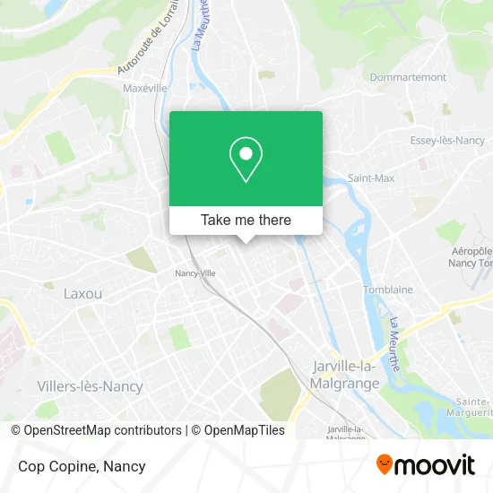
See Cop Copine, Nancy, on the map
Public Transit to Cop Copine in Nancy
Wondering how to get to Cop Copine in Nancy? Moovit helps you find the best way to get to Cop Copine with step-by-step directions from the nearest public transit station.
Moovit provides free maps and live directions to help you navigate through your city. View schedules, routes, timetables, and find out how long does it take to get to Cop Copine in real time.
Looking for the nearest stop or station to Cop Copine? Check out this list of stops closest to your destination: Gare - Pierre Semard; Nancy Gare / Gare - Poirel; Nancy; Saint-Sébastien; Point Central / Pl. Stanislas Dom Calmet; Division De Fer; Place Carnot.
Bus: 13, 15, COROL, T5, T2, T3, T4, 11, 21, 33, 12, 65, 62.Train: C40, C41, C44, 071A, 805A, 805B.
Want to see if there’s another route that gets you there at an earlier time? Moovit helps you find alternative routes or times. Get directions from and directions to Cop Copine easily from the Moovit App or Website.
We make riding to Cop Copine easy, which is why over 1.5 million users, including users in Nancy, trust Moovit as the best app for public transit. You don’t need to download an individual bus app or train app, Moovit is your all-in-one transit app that helps you find the best bus time or train time available.
For information on prices of bus and train, costs and ride fares to Cop Copine, please check the Moovit app.
Use the app to navigate to popular places including to the airport, hospital, stadium, grocery store, mall, coffee shop, school, college, and university.
Cop Copine Address: Rue des Dominicains street in Nancy
- 6 Rue Général Chevert,
- Ugg Australia,
- Parking Place Stanislas,
- Baccarat,
- Station Cathédrale [T1],
- Mamie Branchée,
- Hôtel de Ville de Nancy,
- Cathédrale,
- Parking Dom Calmet,
- Rue Préfet Claude Erignac,
- Station Point Central [T1],
- Arrêt de bus Dom Calmet,
- Préfecture De Meurthe-Et-Moselle,
- Cathédrale Notre-Dame-de-l'Annonciation,
- Les Estudines Saint Dizier,
- Burger King,
- Statue Stanislas Leszczyński,
- Rue Stanislas,
- Rue du Pont Mouja,
- 1 Rue Saint-Dizier
Places Near Cop Copine (Nancy)
- Hopital de Brabois CHU, VandUvre-Lès-Nancy,
- Nancy Thermal, Nancy,
- Essey-Lès-Nancy, Essey-Lès-Nancy,
- Polyclinique De Gentilly, Nancy,
- Villa Majorelle, Nancy,
- Zénith De Nancy, Maxéville,
- Maxéville, Maxéville,
- Tomblaine, Tomblaine,
- Dépose-Minute, Nancy,
- Hôpital Central, Nancy,
- Haut Du Lièvre, Nancy,
- Clinique Pasteur, Essey-Lès-Nancy,
- centre d'imagerie jacques callot, Maxéville,
- Rue Colette, Nancy,
- Clinique Majorelle, Nancy,
- Cora, Houdemont,
- Piscine Nancy Thermal, Nancy,
- Villers-Lès-Nancy, Villers-Lès-Nancy,
- E.Leclerc, VandUvre-Lès-Nancy,
- Kinepolis Nancy, Nancy
How to get to popular places in Nancy with public transit
Get around Nancy by public transit!
Traveling around Nancy has never been so easy. See step by step directions as you travel to any attraction, street or major public transit station. View bus and train schedules, arrival times, service alerts and detailed routes on a map, so you know exactly how to get to anywhere in Nancy.
When traveling to any destination around Nancy use Moovit's Live Directions with Get Off Notifications to know exactly where and how far to walk, how long to wait for your line, and how many stops are left. Moovit will alert you when it's time to get off — no need to constantly re-check whether yours is the next stop.
Wondering how to use public transit in Nancy or how to pay for public transit in Nancy? Moovit public transit app can help you navigate your way with public transit easily, and at minimum cost. It includes public transit fees, ticket prices, and costs. Looking for a map of Nancy public transit lines? Moovit public transit app shows all public transit maps in Nancy with all Bus, Train and Light Rail routes and stops on an interactive map.
Nancy has 3 transit type(s), including: Bus, Train and Light Rail, operated by several transit agencies, including Réseau STAN, SNCF VOYAGEURS and OCEdefault