Directions to Crkva Sv. Blaža station (Zagreb) with public transit
The following transit lines have routes that pass near Crkva Sv. Blaža
How to get to Crkva Sv. Blaža station by bus?
Click on the bus route to see step by step directions with maps, line arrival times and updated time schedules.
How to get to Crkva Sv. Blaža station by train?
Click on the train route to see step by step directions with maps, line arrival times and updated time schedules.
Light Rail stations near Crkva Sv. Blaža in Zagreb
- Britanski trg, 5 min walk,
- Talovčeva, 6 min walk,
Bus stops near Crkva Sv. Blaža in Zagreb
- Petračićeva, 7 min walk,
- Vinogradska 3, 8 min walk,
- Hercegovačka 21, 9 min walk,
- Pantovčak 56, 14 min walk,
- Britanski trg, 15 min walk,
- Zapadni Kolodvor, 18 min walk,
Bus lines to Crkva Sv. Blaža station in Zagreb
- 118, Voltino,
- 139, Reljk-Jelenovac-Relj,
- 141, Relj.-Vinogradi-Relj,
- 148, Reljkovićeva,
- 101, Britan. trg,
- 105A, Britanski Trg,
- 138, Britan. trg,
- 102, Mihaljevac,
- 105, Kaptol,
- 103, Britan. trg,
- 146, Reljkovićeva,
What are the closest stations to Crkva Sv. Blaža?
The closest stations to Crkva Sv. Blaža are:
- Britanski trg is 343 meters away, 5 min walk.
- Talovčeva is 418 meters away, 6 min walk.
- Petračićeva is 480 meters away, 7 min walk.
- Vinogradska 3 is 619 meters away, 8 min walk.
- Hercegovačka 21 is 688 meters away, 9 min walk.
- Pantovčak 56 is 1066 meters away, 14 min walk.
- Zapadni Kolodvor is 1364 meters away, 18 min walk.
Which bus lines stop near Crkva Sv. Blaža?
These bus lines stop near Crkva Sv. Blaža: 102, 105, 118, 146.
Which train lines stop near Crkva Sv. Blaža?
These train lines stop near Crkva Sv. Blaža: 3004, 8025, 8027.
Which light rail lines stop near Crkva Sv. Blaža?
These light rail lines stop near Crkva Sv. Blaža: 1, 11, 14.
What’s the nearest light rail station to Crkva Sv. Blaža in Zagreb?
The nearest light rail station to Crkva Sv. Blaža in Zagreb is Britanski trg. It’s a 5 min walk away.
What’s the nearest bus station to Crkva Sv. Blaža in Zagreb?
The nearest bus station to Crkva Sv. Blaža in Zagreb is Petračićeva. It’s a 7 min walk away.
See Crkva Sv. Blaža, Zagreb, on the map
Public Transit to Crkva Sv. Blaža in Zagreb
Wondering how to get to Crkva Sv. Blaža in Zagreb, Croatia? Moovit helps you find the best way to get to Crkva Sv. Blaža with step-by-step directions from the nearest public transit station.
Moovit provides free maps and live directions to help you navigate through your city. View schedules, routes, timetables, and find out how long does it take to get to Crkva Sv. Blaža in real time.
Looking for the nearest stop or station to Crkva Sv. Blaža? Check out this list of stops closest to your destination: Britanski trg; Talovčeva; Petračićeva; Vinogradska 3; Hercegovačka 21; Pantovčak 56; Zapadni Kolodvor.
Bus: 102, 105, 118, 146, 139, 141, 148, 101, 105A, 138.Train: 3004, 8025, 8027.Light Rail: 1, 11, 14.
Want to see if there’s another route that gets you there at an earlier time? Moovit helps you find alternative routes or times. Get directions from and directions to Crkva Sv. Blaža easily from the Moovit App or Website.
We make riding to Crkva Sv. Blaža easy, which is why over 1.5 million users, including users in Zagreb, trust Moovit as the best app for public transit. You don’t need to download an individual bus app or train app, Moovit is your all-in-one transit app that helps you find the best bus time or train time available.
For information on prices of bus, train, light rail and gondola, costs and ride fares to Crkva Sv. Blaža, please check the Moovit app.
Use the app to navigate to popular places including to the airport, hospital, stadium, grocery store, mall, coffee shop, school, college, and university.
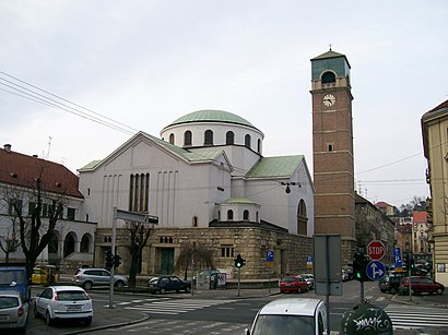
Crkva Sv. Blaža Address: Primorska (Prilaz Gjure Deželića 64) street in Zagreb
Places Near Crkva Sv. Blaža (Zagreb)
Get around Zagreb by public transit!
Traveling around Zagreb has never been so easy. See step by step directions as you travel to any attraction, street or major public transit station. View bus and train schedules, arrival times, service alerts and detailed routes on a map, so you know exactly how to get to anywhere in Zagreb.
When traveling to any destination around Zagreb use Moovit's Live Directions with Get Off Notifications to know exactly where and how far to walk, how long to wait for your line, and how many stops are left. Moovit will alert you when it's time to get off — no need to constantly re-check whether yours is the next stop.
Wondering how to use public transit in Zagreb or how to pay for public transit in Zagreb? Moovit public transit app can help you navigate your way with public transit easily, and at minimum cost. It includes public transit fees, ticket prices, and costs. Looking for a map of Zagreb public transit lines? Moovit public transit app shows all public transit maps in Zagreb with all Bus, Train, Light Rail, Funicular and Gondola routes and stops on an interactive map.
Zagreb has 5 transit type(s), including: Bus, Train, Light Rail, Funicular and Gondola, operated by several transit agencies, including Croatian Railways, Zagrebački Električni Tramvaj, Auto Promet Sisak, Samoborček and HŽ Putnicki prijevoz