How to get to Cvs by bus?
Click on the bus route to see step by step directions with maps, line arrival times and updated time schedules.
From MBTA-Aquarium, Boston
38 minFrom Grill 23 & Bar, Boston
64 minFrom Harvard Museum Of Natural History, Cambridge
68 minFrom Citrus & Salt, Boston
64 minFrom Old North Church, Boston
39 minFrom Fort Independence, Boston
80 minFrom Royale, Boston
55 minFrom Shubert Theatre, Boston
49 minFrom Castle Island, Boston
77 min
How to get to Cvs by subway?
Click on the subway route to see step by step directions with maps, line arrival times and updated time schedules.
Bus stops near Cvs in Revere
Subway station near Cvs in Revere
- Beachmont, 34 min walk,VIEW
Bus lines to Cvs in Revere
What are the closest stations to Cvs?
The closest stations to Cvs are:
- Washington Ave @ Brookdale St is 30 yards away, 1 min walk.
- Charger St @ Squire Rd is 117 yards away, 2 min walk.
- Squire Rd Opp Super Stop + Shop is 300 yards away, 4 min walk.
- Beachmont is 2879 yards away, 34 min walk.
Which bus lines stop near Cvs?
These bus lines stop near Cvs: 119, 426, 429.
Which subway line stops near Cvs?
BLUE LINE (Wonderland)
What’s the nearest bus station to Cvs in Revere?
The nearest bus station to Cvs in Revere is Washington Ave @ Brookdale St. It’s a 1 min walk away.
What time is the first subway to Cvs in Revere?
The BLUE LINE is the first subway that goes to Cvs in Revere. It stops nearby at 5:12 AM.
What time is the last subway to Cvs in Revere?
The BLUE LINE is the last subway that goes to Cvs in Revere. It stops nearby at 2:10 AM.
What time is the first bus to Cvs in Revere?
The 119 is the first bus that goes to Cvs in Revere. It stops nearby at 5:00 AM.
What time is the last bus to Cvs in Revere?
The 426 is the last bus that goes to Cvs in Revere. It stops nearby at 1:21 AM.
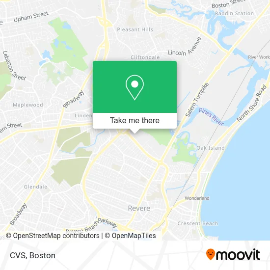
See Cvs, Revere, on the map
Public Transit to Cvs in Revere
Wondering how to get to Cvs in Revere? Moovit helps you find the best way to get to Cvs with step-by-step directions from the nearest public transit station.
Moovit provides free maps and live directions to help you navigate through your city. View schedules, routes, timetables, and find out how long does it take to get to Cvs in real time.
Looking for the nearest stop or station to Cvs? Check out this list of stops closest to your destination: Washington Ave @ Brookdale St; Charger St @ Squire Rd; Squire Rd Opp Super Stop + Shop; Beachmont.
Bus: 119, 426, 429, 411, 428.Subway: BLUE LINE.
Want to see if there’s another route that gets you there at an earlier time? Moovit helps you find alternative routes or times. Get directions from and directions to Cvs easily from the Moovit App or Website.
We make riding to Cvs easy, which is why over 1.7 million users, including users in Revere, trust Moovit as the best app for public transit. You don’t need to download an individual bus app or train app, Moovit is your all-in-one transit app that helps you find the best bus time or train time available.
For information on prices of bus and subway, costs and ride fares to Cvs, please check the Moovit app.
Use the app to navigate to popular places including to the airport, hospital, stadium, grocery store, mall, coffee shop, school, college, and university.
Cvs Address: 339 Squire Rd street in Revere
- Petco Revere,
- Northgate Shopping Plaza (Nortgate Shopping Center),
- Bus Stop at Northgate,
- Chase,
- Four Points by Sheraton Boston Logan Airport,
- MoneyGram,
- Dunkin',
- Market Basket (Market Basket #74 Revere),
- Price Rite Pharmacy,
- Route 60/Rt. 1 N/S Rotary,
- Market Basket,
- Copeland Circle / Cutler Circle,
- Coinstar,
- KeyMe,
- Coinstar - Bitcoin ATM,
- MBTA Bus Route 426/426W,
- Advanced Technology Patient Center,
- Revere Beach,
- 15 Locksmith Near Me,
- Super Threading
Places Near Cvs (Revere)
- Quincy Market, Boston,
- Prudential Center, Boston,
- Cheers, Boston,
- Isabella Stewart Gardner Museum, Boston,
- Boston Medical Center, Boston,
- Castle Island, Boston,
- House Of Blues, Boston,
- Wilbur Theatre, Boston,
- Td Garden, Boston,
- Mgm Music Hall, Boston,
- Faneuil Hall, Boston,
- Museum Of Science, Boston,
- Massachusetts General Hospital, Boston,
- Boston Common, Boston,
- Leader Bank Pavilion (Leader Bank Pavillion), Boston,
- North End, Boston,
- Boston Convention & Exhibition Center, Boston,
- Wang Theater, Boston,
- Boston Children's Hospital, Boston,
- Seaport District, Boston
How to get to popular places in Boston with public transit
Get around Revere by public transit!
Traveling around Revere has never been so easy. See step by step directions as you travel to any attraction, street or major public transit station. View bus and train schedules, arrival times, service alerts and detailed routes on a map, so you know exactly how to get to anywhere in Revere.
When traveling to any destination around Revere use Moovit's Live Directions with Get Off Notifications to know exactly where and how far to walk, how long to wait for your line, and how many stops are left. Moovit will alert you when it's time to get off — no need to constantly re-check whether yours is the next stop.
Wondering how to use public transit in Revere or how to pay for public transit in Revere? Moovit public transit app can help you navigate your way with public transit easily, and at minimum cost. It includes public transit fees, ticket prices, and costs. Looking for a map of Revere public transit lines? Moovit public transit app shows all public transit maps in Revere with all Bus, Train, Subway and Ferry routes and stops on an interactive map.
Boston has 4 transit type(s), including: Bus, Train, Subway and Ferry, operated by several transit agencies, including MBTA, Southeastern Regional Transit Authority, MetroWest Regional Transit Authority, Rhode Island Public Transit Authority, WRTA, Lowell Regional Transit Authority, Merrimack Valley Transit, Montachusett Regional Transit Authority, Cape Cod Regional Transit Authority, Brockton Area Transit Authority, Martha's Vineyard Transit Authority, the WAVE - Nantucket Regional Transit Authority, GATRA, Cape Ann Transportation Authority and Massport