Directions to D L Auto Pecas (Colombo) with public transportation
The following transit lines have routes that pass near D L Auto Pecas
How to get to D L Auto Pecas by bus?
Click on the bus route to see step by step directions with maps, line arrival times and updated time schedules.
From Hospital e Maternidade Santa Madalena Sofia, Bairro Alto
61 minFrom Estação Tubo Praça da Bandeira - Inter 2 (Horário ), São Francisco
53 minFrom Rua Padre Germano Mayer 840, Alto Da Rua XV
54 minFrom Rua Doutor Faivre 141, Centro
46 minFrom Hospital das nações, Jardim Social
54 minFrom Hospital Nossa Senhora Do Pilar, Bom Retiro
55 minFrom Hospital Menino Deus, Alto Da Rua XV
57 minFrom Rua Lodovico Geronazzo, Boa Vista
38 minFrom Rua Tapajós, Mercês
55 minFrom Parque Tingui, São João
93 min
Bus stops near D L Auto Pecas in Colombo
Bus lines to D L Auto Pecas in Colombo
- S14 ANA ROSA, Ana Rosa → Terminal Roça Grande,VIEW
- S15 SANTA TEREZA, Terminal Roça Grande → Santa Tereza,VIEW
- S19 SEDE / ROÇA GRANDE, Terminal Roça Grande → Terminal Sede Colombo,VIEW
- S59 SANTA FÉ / ROÇA GRANDE, Terminal Roça Grande ↺ Santa Fé (Circular),VIEW
- B72 COLOMBO / GUADALUPE (VIA T. ROÇA GRANDE), Terminal Sede Colombo → Terminal Guadalupe (via Terminal Santa Cândida),VIEW
- S12 PARQUE EMBU, Terminal Roça Grande → Parque Embu,VIEW
- S01 ROÇA GRANDE / GUADALUPE (VIA SANTA CÂNDIDA), Terminal Roça Grande → Terminal Guadalupe,VIEW
- S02 ROÇA GRANDE / ESTAÇÃO ATUBA, Terminal Roça Grande → Estação Atuba,VIEW
- S11 ROÇA GRANDE / GUARAITUBA, Terminal Roça Grande → Terminal Guaraituba,VIEW
- S16 GUARACI, Terminal Sede Colombo → Terminal Roça Grande,VIEW
- B29 ROÇA GRANDE / APDEC (VIA MARACANÃ), Terminal Maracanã → Terminal Roça Grande,VIEW
- S31 ROÇA GRANDE / SANTA CÂNDIDA, Terminal Roça Grande → Terminal Santa Cândida,VIEW
- I90 CACHOEIRA / MARACANÃ, Terminal Cachoeira → Terminal Maracanã,VIEW
What are the closest stations to D L Auto Pecas?
The closest stations to D L Auto Pecas are:
- Rodovia da Uva (PR 417), 2400 is 291 meters away, 5 min walk.
- Rodovia da Uva (PR 417), 2386 is 314 meters away, 5 min walk.
- Terminal Metropolitano Roça Grande is 562 meters away, 8 min walk.
Which bus lines stop near D L Auto Pecas?
These bus lines stop near D L Auto Pecas: B72 COLOMBO / GUADALUPE (VIA T. ROÇA GRANDE), S31 ROÇA GRANDE / SANTA CÂNDIDA.
What’s the nearest bus station to D L Auto Pecas in Colombo?
The nearest bus stations to D L Auto Pecas in Colombo are Rodovia da Uva (PR 417), 2400 and Rodovia da Uva (PR 417), 2386. The closest one is a 5 min walk away.
What time is the first bus to D L Auto Pecas in Colombo?
The S59 SANTA FÉ / ROÇA GRANDE is the first bus that goes to D L Auto Pecas in Colombo. It stops nearby at 4:50 AM.
What time is the last bus to D L Auto Pecas in Colombo?
The B72 COLOMBO / GUADALUPE (VIA T. ROÇA GRANDE) is the last bus that goes to D L Auto Pecas in Colombo. It stops nearby at 1:06 AM.
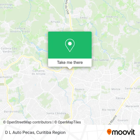
See D L Auto Pecas, Colombo, on the map
Public Transit to D L Auto Pecas in Colombo
Wondering how to get to D L Auto Pecas in Colombo? Moovit helps you find the best way to get to D L Auto Pecas with step-by-step directions from the nearest public transit station.
Moovit provides free maps and live directions to help you navigate through your city. View schedules, routes, timetables, and find out how long does it take to get to D L Auto Pecas in real time.
Looking for the nearest stop or station to D L Auto Pecas? Check out this list of stops closest to your destination: Rodovia da Uva (PR 417); Rodovia da Uva (PR 417); Terminal Metropolitano Roça Grande.
Bus: B72 COLOMBO / GUADALUPE (VIA T. ROÇA GRANDE), S31 ROÇA GRANDE / SANTA CÂNDIDA, S14 ANA ROSA, S15 SANTA TEREZA, S19 SEDE / ROÇA GRANDE, S59 SANTA FÉ / ROÇA GRANDE, S12 PARQUE EMBU, S01 ROÇA GRANDE / GUADALUPE (VIA SANTA CÂNDIDA), S02 ROÇA GRANDE / ESTAÇÃO ATUBA, S11 ROÇA GRANDE / GUARAITUBA, S16 GUARACI, B29 ROÇA GRANDE / APDEC (VIA MARACANÃ).
Want to see if there’s another route that gets you there at an earlier time? Moovit helps you find alternative routes or times. Get directions from and directions to D L Auto Pecas easily from the Moovit App or Website.
We make riding to D L Auto Pecas easy, which is why over 1.5 million users, including users in Colombo, trust Moovit as the best app for public transit. You don’t need to download an individual bus app or train app, Moovit is your all-in-one transit app that helps you find the best bus time or train time available.
For information on prices of bus, costs and ride fares to D L Auto Pecas, please check the Moovit app.
Use the app to navigate to popular places including to the airport, hospital, stadium, grocery store, mall, coffee shop, school, college, and university.
D L Auto Pecas Address: Rodovia Contorno Norte, 219 Roça Grande Colombo-PR 83402-335 street in Colombo
- Rodovia do Contorno Norte de Curitiba 1954,
- Roça Grande,
- Aliança Metais,
- Dimedeiros,
- R Dias Isopor,
- Atn Administração de Bens,
- Rua Rosália Kubis Weigert 315,
- Fr Armazem Geral e Logística,
- Naciofuel Produtos Para Combustíveis,
- Naciopetro Distribuidora de Petróleo,
- Farmácias Nissei Loja Central Adm Nissei,
- L Alberti,
- Hotel & Restaurante Colombo,
- Patrino Importadora e Exportadora,
- Bom Jesus Loterias,
- Exclusive Impressão Digital,
- Ph Cientifica Aparelhos Cientificos Ltda,
- Centro de Saúde César Augusto,
- Lava Car Cherubin,
- Triar Componentes Para Ar Condicionado
Places Near D L Auto Pecas (Colombo)
- Hospital Nossa Senhora Das Graças, Mercês,
- Parque Barigui, Mercês,
- Hospital Erasto Gaertner, Jardim Das Américas,
- Hospital Universitário Evangélico de Curitiba, Bigorrilho,
- Hospital Do Senhor - Madre Virgínia, São José Dos Pinhais,
- Rua General Mário Tourinho, Campina Do Siqueira,
- Park Shopping Barigüi, Mossunguê,
- Pontifícia Universidade Católica do Paraná (PUCPR), Prado Velho,
- Jockey Plaza Shopping Center, Tarumã,
- Rua Martim Afonso 558, Mercês,
- Hospital Madalena Sofia, Bairro Alto,
- Hospital de Clínicas (HC - UFPR), Centro,
- Hospital Angelina Caron, Campina Grande Do Sul,
- Hospital do Rocio, Campo,
- Hospital Da Cruz Vermelha, Batel,
- Shopping Estação, Rebouças,
- Hhhhh, Fazendinha,
- Jardim Botânico de Curitiba PR, Centro,
- Shopping Palladium, Portão,
- Arena Da Baixada - Curitiba
How to get to popular places in Curitiba Region with public transit
Get around Colombo by public transit!
Traveling around Colombo has never been so easy. See step by step directions as you travel to any attraction, street or major public transit station. View bus and train schedules, arrival times, service alerts and detailed routes on a map, so you know exactly how to get to anywhere in Colombo.
When traveling to any destination around Colombo use Moovit's Live Directions with Get Off Notifications to know exactly where and how far to walk, how long to wait for your line, and how many stops are left. Moovit will alert you when it's time to get off — no need to constantly re-check whether yours is the next stop.
Wondering how to use public transit in Colombo or how to pay for public transit in Colombo? Moovit public transit app can help you navigate your way with public transit easily, and at minimum cost. It includes public transit fees, ticket prices, and costs. Looking for a map of Colombo public transit lines? Moovit public transit app shows all public transit maps in Colombo with all Bus and Cable Car routes and stops on an interactive map.
Curitiba Region has 2 transit type(s), including: Bus and Cable Car, operated by several transit agencies, including Sistema Integrado de Mobilidade (URBS), Sistema Integrado de Mobilidade (AMEP), URBS (Cartões bancários e Dinheiro), URBS (Cartões bancários / Cartão URBS), AMEP (Cartões bancários / Cartão MetroCard), AMEP (Cartões bancários / Cartão MetroCard / Dinheiro), Viação Colombo (Dinheiro), TRIAR (Cartão TRIAR / Dinheiro), Empresa Curitiba Cerro Azul (Dinheiro), Expresso Nossa Senhora da Penha (Dinheiro), Empresa Campo Alto Tijucas (Dinheiro), Auto Viação São José (Cartão VEM / Dinheiro), BRT S/A (Cartão VEM / Dinheiro), TransPiedade (Cartão Cidadão / Dinheiro) and Oceânica Sul (Cartão Transporte / Dinheiro)