Directions to Encantado with public transportation
The following transit lines have routes that pass near Encantado
 Bus: 353, 383, 607, 692, 979.
- Metro: L2.
- Train: RAMAL DEODORO, RAMAL JAPERI, RAMAL SANTA CRUZ, RAMAL BELFORD ROXO.
How to get to Encantado by bus?
Click on the bus route to see step by step directions with maps, line arrival times and updated time schedules.
From Hospital Universitário Pedro Ernesto
35 minFrom Rua Maxwell
37 minFrom Santo Cristo
58 minFrom Parque Shopping Sulacap
42 minFrom Avenida Paris
40 minFrom Rua Aristides Lobo
53 minFrom Hospital Badim
39 minFrom Avenida Paulo de Frontin
56 minFrom Rua Dom Marcos Barbosa
51 minFrom Estrada do Bananal
30 min
How to get to Encantado by train?
Click on the train route to see step by step directions with maps, line arrival times and updated time schedules.
How to get to Encantado by metro?
Click on the metro route to see step by step directions with maps, line arrival times and updated time schedules.
Bus stops near Encantado
Train stations near Encantado
Bus lines to Encantado
- 239, Passeio,VIEW
- 353, Gardênia Azul,VIEW
- SN 353, Gardênia Azul ,VIEW
- 363, Vila Valqueire (Área De Lazer),VIEW
- SN 363, Candelária,VIEW
- SR 363, Candelária,VIEW
- 383, Praça Da República,VIEW
- SN 383, Praça da República,VIEW
- SV 391, Padre Miguel,VIEW
- 607, Rio Comprido,VIEW
- 636, Taquara (Merck),VIEW
- SN 636, Saens Peña,VIEW
- 649, Parque Piedade,VIEW
- 653, Deodoro (Área De Lazer),VIEW
- 685, Méier,VIEW
- SN 685, Méier,VIEW
- SVA 685, Irajá,VIEW
- SVB 685, Méier,VIEW
- 652, Cascadura (Via Lins / Via Água Santa),VIEW
- 254, Madureira - Candelária (Brs 4 - Via Méier / Uerj),VIEW
What are the closest stations to Encantado?
The closest stations to Encantado are:
- Rua Clarimundo De Melo, 13 is 315 meters away, 5 min walk.
- Rua Paraná, 84 is 479 meters away, 7 min walk.
- Rua Goiás, 183 is 603 meters away, 8 min walk.
- Rua Dois De Fevereiro, 228 is 715 meters away, 10 min walk.
- Olímpica De Engenho De Dentro is 1141 meters away, 15 min walk.
- Pilares is 2805 meters away, 36 min walk.
Which bus lines stop near Encantado?
These bus lines stop near Encantado: 353, 383, 607, 692, 979, SV 391.
Which metro line stops near Encantado?
L2 (Pavuna)
Which train lines stop near Encantado?
These train lines stop near Encantado: RAMAL DEODORO, RAMAL JAPERI, RAMAL SANTA CRUZ.
What’s the nearest train station to Encantado?
The nearest train station to Encantado is Olímpica De Engenho De Dentro. It’s a 15 min walk away.
What’s the nearest bus station to Encantado?
The nearest bus station to Encantado is Rua Clarimundo De Melo, 13. It’s a 5 min walk away.
What time is the first train to Encantado?
The RAMAL DEODORO is the first train that goes to Encantado. It stops nearby at 4:23 AM.
What time is the last train to Encantado?
The RAMAL SANTA CRUZ is the last train that goes to Encantado. It stops nearby at 11:43 PM.
What time is the first bus to Encantado?
The SN 636 is the first bus that goes to Encantado. It stops nearby at 3:00 AM.
What time is the last bus to Encantado?
The SN 639 is the last bus that goes to Encantado. It stops nearby at 3:20 AM.
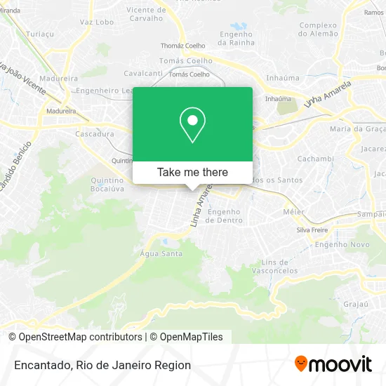
See Encantado on the map
Public Transportation to Encantado
Wondering how to get to Encantado? Moovit helps you find the best way to get to Encantado with step-by-step directions from the nearest public transit station.
Moovit provides free maps and live directions to help you navigate through your city. View schedules, routes, timetables, and find out how long does it take to get to Encantado in real time.
Looking for the nearest stop or station to Encantado? Check out this list of stops closest to your destination: Rua Clarimundo De Melo; Rua Paraná; Rua Goiás; Rua Dois De Fevereiro; Olímpica De Engenho De Dentro; Pilares.
Bus: 353, 383, 607, 692, 979, SV 391, 239, SN 353, 363, SN 363, 652, 254, 277, 543, 638, 639, 238, SN 238, 691, 693.Metro: L2.Train: RAMAL DEODORO, RAMAL JAPERI, RAMAL SANTA CRUZ, RAMAL BELFORD ROXO.
Want to see if there’s another route that gets you there at an earlier time? Moovit helps you find alternative routes or times. Get directions from and directions to Encantado easily from the Moovit App or Website.
We make riding to Encantado easy, which is why over 1.5 million users, including users in Encantado, trust Moovit as the best app for public transit. You don’t need to download an individual bus app or train app, Moovit is your all-in-one transit app that helps you find the best bus time or train time available.
For information on prices of bus, train and metro, costs and ride fares to Encantado, please check the Moovit app.
Use the app to navigate to popular places including to the airport, hospital, stadium, grocery store, mall, coffee shop, school, college, and university.
Encantado Address: Rua Pernambuco street in Encantado
- Centro Espírita Deus Luz e Verdade,
- Colégio e Faculdade São Judas Tadeu,
- Rua Francisco Fragoso / Rua Cruz e Souza,
- Shopping Das Carnes (Cruz E Souza),
- Rua Pernambuco / Rua Cruz e Souza,
- Rua Cruz e Souza 69,
- Colégio São Judas Tadeu,
- Escola Municipal Tobias Barreto,
- Feira da rua Cruz e Souza / Pernambuco,
- Escola Técnica Estadual República,
- Rua Clarimundo de Melo 50,
- Rua Pompílio de Albuquerque 125,
- Frango Assado do André,
- Rua Clarimundo de Melo Próximo ao 128,
- Rua Cruz e Souza, 296,
- Sede Moto Clube Imortais Mc RJ,
- Rua Clarimundo de Melo / Praça Sargento Eudóxio Passos,
- Igreja Da Graca,
- Linha Amarela,
- Irmãos Horovitz
Places Near Encantado
- Feira Livre da Gloria, Glória,
- Rua Ulysses Guimarães 16, Cidade Nova,
- Hospital Federal Do Andaraí, Andaraí,
- Avenida Rio Branco, Centro,
- Praia do Arpoador, Ipanema,
- Avenida Venezuela 134, Saúde,
- Hospital Pedro Ernesto, Vila Isabel,
- Hospital Municipal Ronaldo Gazolla, Acari,
- Rodoviária Novo Rio (Rodoviária do Rio de Janeiro), Santo Cristo,
- Shopping RioSul, Botafogo,
- Niterói, Niterói,
- Norte Shopping, Cachambi,
- Museu Do Amanhã, Centro,
- Rua Licínio Cardoso, São Francisco Xavier,
- Hospital Federal Cardoso Fontes, Jacarepaguá,
- Feirão De Malhas, Duque De Caxias,
- Shopping Rio Sul, Botafogo,
- Shopping Nova América, Del Castilho,
- Rio De Janeiro,
- Shopping Downtown, Barra Da Tijuca
How to get to popular places in Rio de Janeiro Region with public transit
Get around Encantado by public transit!
Traveling around Encantado has never been so easy. See step by step directions as you travel to any attraction, street or major public transit station. View bus and train schedules, arrival times, service alerts and detailed routes on a map, so you know exactly how to get to anywhere in Encantado.
When traveling to any destination around Encantado use Moovit's Live Directions with Get Off Notifications to know exactly where and how far to walk, how long to wait for your line, and how many stops are left. Moovit will alert you when it's time to get off — no need to constantly re-check whether yours is the next stop.
Wondering how to use public transit in Encantado or how to pay for public transit in Encantado? Moovit public transit app can help you navigate your way with public transit easily, and at minimum cost. It includes public transit fees, ticket prices, and costs. Looking for a map of Encantado public transit lines? Moovit public transit app shows all public transit maps in Encantado with all Bus, Train, Metro, Light Rail, Ferry, Cable Car, Gondola and Funicular routes and stops on an interactive map.
Rio de Janeiro Region has 8 transit type(s), including: Bus, Train, Metro, Light Rail, Ferry, Cable Car, Gondola and Funicular, operated by several transit agencies, including TrensRJ, Metrô Rio, VLT Carioca, Barcas Rio, BRT MOBI-Rio, Auto Viação Alpha, Auto Viação Tijuca, Gire Transportes, Transurb, Viação Nossa Senhora das Graças, Consórcio INTERSUL, Braso Lisboa (Municipal), Caprichosa Auto Ônibus, Auto Viação Três Amigos and Rodoviária Âncora Matias
Public transit lines with stations closest to Encantado
Train lines with stations closest to Encantado
Bus lines with stations closest to Encantado
Rua Goiás, 183
- 254Madureira - Candelária (Brs 4 - Via Méier / Uerj)
- 277Rocha Miranda - Candelária (Brs 4 - Via Madureira / São Cristóvão)
- 543Nova Iguaçu - Méier (Via Engenho de Dentro)
- 638Marechal Hermes - Saens Peña (Brs 6 - Via Madureira / Méier / Vila Isabel)
- 639Jardim América - Saens Peña (Brs 6 - Via Rocha Miranda / Madureira / Méier)