How to get to Esseda by bus?
Click on the bus route to see step by step directions with maps, line arrival times and updated time schedules.
From Ciudad Financiera Banco Santander, Boadilla Del Monte
47 minFrom Piscina Puerta de Hierro, Madrid
49 minFrom Universidad Camilo José Cela (UCJC), Villanueva De La Cañada
33 minFrom Kinepolis Madrid Ciudad de la Imagen, Pozuelo De Alarcón
51 minFrom Parque Deportivo Puerta de Hierro, Madrid
55 minFrom Rtve Prado Del Rey, Área Metropolitana De Madrid Y Corredor Del Henares
44 minFrom Hipercor, Pozuelo De Alarcón
23 minFrom El Corte Inglés, Pozuelo De Alarcón
23 minFrom Club de Campo Villa de Madrid, Madrid
59 minFrom Universidad Alfonso X El Sabio (UAX), Villanueva De La Cañada
45 min
How to get to Esseda by train?
Click on the train route to see step by step directions with maps, line arrival times and updated time schedules.
Bus stops near Esseda in Área Metropolitana De Madrid Y Corredor Del Henares
Train station near Esseda in Área Metropolitana De Madrid Y Corredor Del Henares
- Las Rozas, 36 min walk,VIEW
Bus lines to Esseda in Área Metropolitana De Madrid Y Corredor Del Henares
- 561, Intercambiador De Aluche,VIEW
- 567, Av. Villaviciosa - Urb. El Castillo,VIEW
- 626, Acanto - Jacinto,VIEW
- 655, Intercambiador De Moncloa (Islas 2 Y 3),VIEW
- 561A, Av. Noroeste - Siete Picos,VIEW
- 2, Circular (Hospital - Estación FF.CC.),VIEW
- 685, J. Rodrigo - Hospital Puerta De Hierro,VIEW
- 1, Circular (Hospital - Estación FF.CC.),VIEW
- 651, Av. España - El Zoco,VIEW
- 652, Químicos - C. C. Gran Plaza 2,VIEW
- 626A, C.º Real - Río Miño,VIEW
- 650B, C.º Cerro De Los Gamos - Est. El Barrial,VIEW
- N906, Princesa - Moncloa,VIEW
- 654, Av. Satélites - Pegaso,VIEW
- 650A, C.º Cerro De Los Gamos - Est. El Barrial,VIEW
- N901, Princesa - Moncloa,VIEW
What are the closest stations to Esseda?
The closest stations to Esseda are:
- Av. España - Cervantes is 48 meters away, 1 min walk.
- Av. España - Doctor Calero is 313 meters away, 5 min walk.
- Av. España - Colombia is 315 meters away, 5 min walk.
- Doctor Calero - Nicaragua is 330 meters away, 5 min walk.
- Doctor Calero - Fundadores is 346 meters away, 5 min walk.
- Las Rozas is 2776 meters away, 36 min walk.
Which bus lines stop near Esseda?
These bus lines stop near Esseda: 561, 567, 626A, 651, 652.
Which train line stops near Esseda?
C10 (Villalba De Guadarrama)
What’s the nearest bus station to Esseda in Área Metropolitana De Madrid Y Corredor Del Henares?
The nearest bus station to Esseda in Área Metropolitana De Madrid Y Corredor Del Henares is Av. España - Cervantes. It’s a 1 min walk away.
What time is the first train to Esseda in Área Metropolitana De Madrid Y Corredor Del Henares?
The C10 is the first train that goes to Esseda in Área Metropolitana De Madrid Y Corredor Del Henares. It stops nearby at 5:51 AM.
What time is the last train to Esseda in Área Metropolitana De Madrid Y Corredor Del Henares?
The C7 is the last train that goes to Esseda in Área Metropolitana De Madrid Y Corredor Del Henares. It stops nearby at 11:48 PM.
What time is the first bus to Esseda in Área Metropolitana De Madrid Y Corredor Del Henares?
The N906 is the first bus that goes to Esseda in Área Metropolitana De Madrid Y Corredor Del Henares. It stops nearby at 3:59 AM.
What time is the last bus to Esseda in Área Metropolitana De Madrid Y Corredor Del Henares?
The N901 is the last bus that goes to Esseda in Área Metropolitana De Madrid Y Corredor Del Henares. It stops nearby at 2:51 AM.
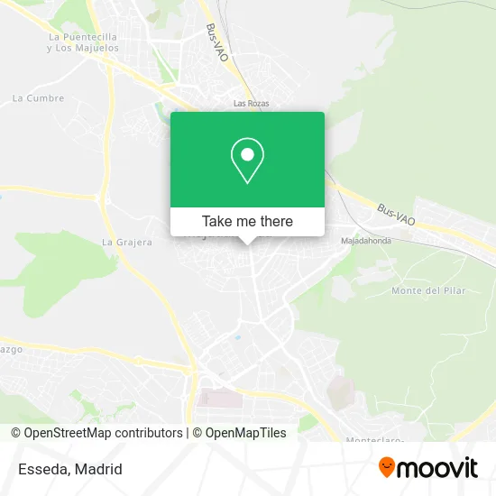
See Esseda, Área Metropolitana De Madrid Y Corredor Del Henares, on the map
Public Transit to Esseda in Área Metropolitana De Madrid Y Corredor Del Henares
Wondering how to get to Esseda in Área Metropolitana De Madrid Y Corredor Del Henares? Moovit helps you find the best way to get to Esseda with step-by-step directions from the nearest public transit station.
Moovit provides free maps and live directions to help you navigate through your city. View schedules, routes, timetables, and find out how long does it take to get to Esseda in real time.
Looking for the nearest stop or station to Esseda? Check out this list of stops closest to your destination: Av. España - Cervantes; Av. España - Doctor Calero; Av. España - Colombia; Doctor Calero - Nicaragua; Doctor Calero - Fundadores; Las Rozas.
Bus: 561, 567, 626A, 651, 652, 626, 655, 561A, 1, 2, 685, 650B, N906, 654, 650A, N901.Train: C10, C7, REG.
Want to see if there’s another route that gets you there at an earlier time? Moovit helps you find alternative routes or times. Get directions from and directions to Esseda easily from the Moovit App or Website.
We make riding to Esseda easy, which is why over 1.5 million users, including users in Área Metropolitana De Madrid Y Corredor Del Henares, trust Moovit as the best app for public transit. You don’t need to download an individual bus app or train app, Moovit is your all-in-one transit app that helps you find the best bus time or train time available.
For information on prices of bus, light rail and train, costs and ride fares to Esseda, please check the Moovit app.
Use the app to navigate to popular places including to the airport, hospital, stadium, grocery store, mall, coffee shop, school, college, and university.
Esseda Address: Avenida de España street in Área Metropolitana De Madrid Y Corredor Del Henares
- Berta & Wallace,
- Avenida de España & Calle de Cervantes,
- Sevillano Ingelmo Pilar,
- Gastón Y Daniela,
- Avenida de España 24-26,
- Parada E.M.T #6236,
- Castello Arroces,
- Pilar Mendez Lopez,
- Calle Benavente, 8,
- Calle Las Norias 8,
- Auditorio Alfredo Kraus,
- Garcia Ojos Negros Maria Del Sagrario,
- Mencia Gutierrez Marta,
- Menal Gonzalez Fernando,
- Centro Hispano Peruano,
- Plaza De Francisco Pizarro,
- Calle San Isidro & Avenida de España,
- Centro Comercial Equinoccio,
- Calle Rigoletto,
- Plaza De La Calle Escudero
Places Near Esseda (Área Metropolitana De Madrid Y Corredor Del Henares)
- Plaza Mayor, Madrid,
- Nassica, Área Metropolitana De Madrid Y Corredor Del Henares,
- Calle de López de Hoyos 169, Madrid,
- Centro Comercial Islazul, Área Metropolitana De Madrid Y Corredor Del Henares,
- Mercadillo de Majadahonda, Majadahonda,
- Wizink Center, Madrid,
- Rastro De Madrid, Área Metropolitana De Madrid Y Corredor Del Henares,
- Hospital Universitario La Paz, Madrid,
- Centro Comercial La Vaguada, Área Metropolitana De Madrid Y Corredor Del Henares,
- Centro Comercial La Gavia, Área Metropolitana De Madrid Y Corredor Del Henares,
- Palacio De Vistalegre, Área Metropolitana De Madrid Y Corredor Del Henares,
- Centro Comercial Oasiz Madrid, Área Metropolitana De Madrid Y Corredor Del Henares,
- Tres Aguas, Alcorcón,
- Plenilunio, Área Metropolitana De Madrid Y Corredor Del Henares,
- Hospital Clínico Universitario San Carlos, Madrid,
- Hospital Universitario Ramón y Cajal, Madrid,
- Sala La Riviera, Madrid,
- Estadio Wanda Metropolitano, Área Metropolitana De Madrid Y Corredor Del Henares,
- Estacion de Chamartin, Madrid,
- Mendez Alvaro, Madrid
How to get to popular places in Madrid with public transit
Get around Área Metropolitana De Madrid Y Corredor Del Henares by public transit!
Traveling around Área Metropolitana De Madrid Y Corredor Del Henares has never been so easy. See step by step directions as you travel to any attraction, street or major public transit station. View bus and train schedules, arrival times, service alerts and detailed routes on a map, so you know exactly how to get to anywhere in Área Metropolitana De Madrid Y Corredor Del Henares.
When traveling to any destination around Área Metropolitana De Madrid Y Corredor Del Henares use Moovit's Live Directions with Get Off Notifications to know exactly where and how far to walk, how long to wait for your line, and how many stops are left. Moovit will alert you when it's time to get off — no need to constantly re-check whether yours is the next stop.
Wondering how to use public transit in Área Metropolitana De Madrid Y Corredor Del Henares or how to pay for public transit in Área Metropolitana De Madrid Y Corredor Del Henares? Moovit public transit app can help you navigate your way with public transit easily, and at minimum cost. It includes public transit fees, ticket prices, and costs. Looking for a map of Área Metropolitana De Madrid Y Corredor Del Henares public transit lines? Moovit public transit app shows all public transit maps in Área Metropolitana De Madrid Y Corredor Del Henares with all Bus, Train, Metro and Light Rail routes and stops on an interactive map.
Madrid has 4 transit type(s), including: Bus, Train, Metro and Light Rail, operated by several transit agencies, including Metro de Madrid, Metro Ligero, Tranvía de Parla, Renfe Cercanías - Servicios de Autobús especiales, Renfe Cercanias, Renfe Cercanías, EMT, Interurbanos, Urbanos de Alcalá de Henares, Urbanos de Alcobendas, Urbanos de Alcorcón, Urbanos de Algete, Urbanos de Aranjuez, Urbanos de Arganda del Rey and Urbanos de Arroyomolinos