Directions to Exercise Physiology Lab (Boston) with public transportation
The following transit lines have routes that pass near Exercise Physiology Lab
 Bus: 39, 47, 85, CT3, 8.
- Train: PROVIDENCE/STOUGHTON.
- Subway: GREEN LINE E, GREEN LINE D.
How to get to Exercise Physiology Lab by bus?
Click on the bus route to see step by step directions with maps, line arrival times and updated time schedules.
From Charlestown, Boston
56 minFrom Sheraton-Needham Hotel (Sheraton Boston Needham Hotel), Needham
88 minFrom Georgetown, Massachusetts, Boston
67 minFrom World Trade Center MBTA Station - Silver Line, Boston
60 minFrom SharkNinja Operating LLC, Needham
92 minFrom Sarma, Somerville
57 minFrom Milton Academy, Milton
97 minFrom Wollaston Beach, Quincy
110 minFrom Davis Sq, Somerville
61 min
How to get to Exercise Physiology Lab by train?
Click on the train route to see step by step directions with maps, line arrival times and updated time schedules.
How to get to Exercise Physiology Lab by subway?
Click on the subway route to see step by step directions with maps, line arrival times and updated time schedules.
Bus stops near Exercise Physiology Lab in Boston
Subway stations near Exercise Physiology Lab in Boston
Bus lines to Exercise Physiology Lab in Boston
- 8, Kenmore via South Bay Center - Harbor Point via South Bay Center,VIEW
- 19, Kenmore - Fields Corner,VIEW
- 47, Broadway - Central Square,VIEW
- 85, Ruggles - Assembly,VIEW
- 9, Kenmore Via Boston Latin,VIEW
- CT3, Avenue Louis Pasteur (Limited Stops),VIEW
- 22, Ashmont,VIEW
- 28, Mattapan,VIEW
- 35, Dedham Mall,VIEW
- 39, Wolcott Square Via Forest Hills,VIEW
- 57, Watertown Yard,VIEW
- 60, Kenmore - Chestnut Hill Mall,VIEW
- 65, Kenmore - Brighton Center,VIEW
- GREEN LINE D SHUTTLE, Reservoir - Fenway,VIEW
- GREEN LINE D SHUTTLE, Riverside - Fenway,VIEW
- GREEN LINE D SHUTTLE, Newton Highlands - Kenmore,VIEW
- GREEN LINE D SHUTTLE, Newton Highlands - Fenway,VIEW
- GREEN LINE D SHUTTLE, Reservoir - Kenmore,VIEW
- GREEN LINE D SHUTTLE, Brookline Hills - Kenmore,VIEW
- GREEN LINE D SHUTTLE, Newton Highlands - Kenmore via Saint Mary's Street,VIEW
What are the closest stations to Exercise Physiology Lab?
The closest stations to Exercise Physiology Lab are:
- Longwood Ave @ Blackfan St is 98 yards away, 2 min walk.
- Longwood Ave @ Binney St is 102 yards away, 2 min walk.
- Ave Louis Pasteur @ Longwood Ave is 217 yards away, 3 min walk.
- Brookline Ave @ Longwood Ave is 269 yards away, 4 min walk.
- Longwood Medical Area is 482 yards away, 6 min walk.
- 677 Huntington Ave is 621 yards away, 8 min walk.
- Chapel St, Colchester St is 834 yards away, 10 min walk.
- Tremont St @ Huntington Ave is 909 yards away, 11 min walk.
Which bus lines stop near Exercise Physiology Lab?
These bus lines stop near Exercise Physiology Lab: 39, 47, 85, CT3.
Which train line stops near Exercise Physiology Lab?
PROVIDENCE/STOUGHTON (#824 | South Station)
Which subway line stops near Exercise Physiology Lab?
GREEN LINE E (Heath Street)
What’s the nearest subway station to Exercise Physiology Lab in Boston?
The nearest subway station to Exercise Physiology Lab in Boston is Longwood Medical Area. It’s a 6 min walk away.
What’s the nearest bus station to Exercise Physiology Lab in Boston?
The nearest bus stations to Exercise Physiology Lab in Boston are Longwood Ave @ Blackfan St and Longwood Ave @ Binney St. The closest one is a 2 min walk away.
What time is the first subway to Exercise Physiology Lab in Boston?
The GREEN LINE D is the first subway that goes to Exercise Physiology Lab in Boston. It stops nearby at 4:55 AM.
What time is the last subway to Exercise Physiology Lab in Boston?
The GREEN LINE D is the last subway that goes to Exercise Physiology Lab in Boston. It stops nearby at 2:22 AM.
What time is the first bus to Exercise Physiology Lab in Boston?
The 39 is the first bus that goes to Exercise Physiology Lab in Boston. It stops nearby at 4:50 AM.
What time is the last bus to Exercise Physiology Lab in Boston?
The 66 is the last bus that goes to Exercise Physiology Lab in Boston. It stops nearby at 2:09 AM.
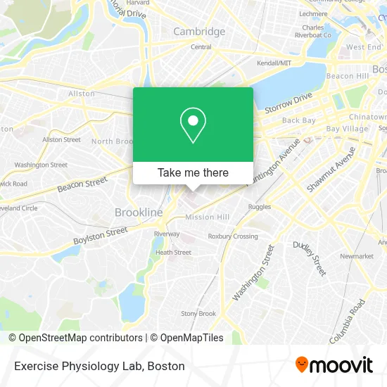
See Exercise Physiology Lab, Boston, on the map
Public Transit to Exercise Physiology Lab in Boston
Wondering how to get to Exercise Physiology Lab in Boston? Moovit helps you find the best way to get to Exercise Physiology Lab with step-by-step directions from the nearest public transit station.
Moovit provides free maps and live directions to help you navigate through your city. View schedules, routes, timetables, and find out how long does it take to get to Exercise Physiology Lab in real time.
Looking for the nearest stop or station to Exercise Physiology Lab? Check out this list of stops closest to your destination: Longwood Ave @ Blackfan St; Longwood Ave @ Binney St; Ave Louis Pasteur @ Longwood Ave; Brookline Ave @ Longwood Ave; Longwood Medical Area; 677 Huntington Ave; Chapel St; Tremont St @ Huntington Ave.
Bus: 39, 47, 85, CT3, 8, 19, 9, 22, 28, 35, 57, 60, 65, GREEN LINE D SHUTTLE, GREEN LINE D SHUTTLE, GREEN LINE D SHUTTLE.Train: PROVIDENCE/STOUGHTON.Subway: GREEN LINE E, GREEN LINE D.
Want to see if there’s another route that gets you there at an earlier time? Moovit helps you find alternative routes or times. Get directions from and directions to Exercise Physiology Lab easily from the Moovit App or Website.
We make riding to Exercise Physiology Lab easy, which is why over 1.7 million users, including users in Boston, trust Moovit as the best app for public transit. You don’t need to download an individual bus app or train app, Moovit is your all-in-one transit app that helps you find the best bus time or train time available.
For information on prices of bus, subway and train, costs and ride fares to Exercise Physiology Lab, please check the Moovit app.
Use the app to navigate to popular places including to the airport, hospital, stadium, grocery store, mall, coffee shop, school, college, and university.
Exercise Physiology Lab Address: 300 Longwood Avenue, Boston Children's Hospital street in Boston
- Infantile Spasm Program,
- Pediatric Psychiatry Consultation Service,
- Neonatal And Congenital Anomaly Neurosurgery Program,
- Emergency Pediatric Dental Care,
- Boston Orthotics And Prosthetics,
- Boston Children's Hospital,
- Sampson Lab For Kidney Genomics,
- Children's Hospital Boston ER,
- Cvs / Pharmacy Children's Hospital,
- Luis Alvernaz, MD,
- Avram Z. Traum, MD,
- Demers, Shaela M,
- Meredith van der Velden, MD,
- Konstantinos Papadakis MD,
- BJ's Playground,
- Pediatric Kidney Transplant Program,
- Asha Nair MD,
- Kenneth H Pollard Funeral Home,
- Schlehuber, Alyssa,
- Camuso
Places Near Exercise Physiology Lab (Boston)
- Quincy Market, Boston,
- Museum Of Science, Boston,
- Cheers, Boston,
- North End, Boston,
- Castle Island, Boston,
- Seaport District, Boston,
- Wilbur Theatre, Boston,
- Td Garden, Boston,
- Mgm Music Hall, Boston,
- Isabella Stewart Gardner Museum, Boston,
- Boston Children's Hospital, Boston,
- Boston Medical Center, Boston,
- Wang Theater, Boston,
- House Of Blues, Boston,
- Prudential Center, Boston,
- Faneuil Hall, Boston,
- Leader Bank Pavilion (Leader Bank Pavillion), Boston,
- Boston Common, Boston,
- Massachusetts General Hospital, Boston,
- Boston Convention & Exhibition Center, Boston
How to get to popular places in Boston with public transit
Get around Boston by public transit!
Traveling around Boston has never been so easy. See step by step directions as you travel to any attraction, street or major public transit station. View bus and train schedules, arrival times, service alerts and detailed routes on a map, so you know exactly how to get to anywhere in Boston.
When traveling to any destination around Boston use Moovit's Live Directions with Get Off Notifications to know exactly where and how far to walk, how long to wait for your line, and how many stops are left. Moovit will alert you when it's time to get off — no need to constantly re-check whether yours is the next stop.
Wondering how to use public transit in Boston or how to pay for public transit in Boston? Moovit public transit app can help you navigate your way with public transit easily, and at minimum cost. It includes public transit fees, ticket prices, and costs. Looking for a map of Boston public transit lines? Moovit public transit app shows all public transit maps in Boston with all Bus, Train, Subway and Ferry routes and stops on an interactive map.
Boston has 4 transit type(s), including: Bus, Train, Subway and Ferry, operated by several transit agencies, including MBTA, Southeastern Regional Transit Authority, MetroWest Regional Transit Authority, Rhode Island Public Transit Authority, WRTA, Lowell Regional Transit Authority, Merrimack Valley Transit, Montachusett Regional Transit Authority, Cape Cod Regional Transit Authority, Brockton Area Transit Authority, Martha's Vineyard Transit Authority, the WAVE - Nantucket Regional Transit Authority, GATRA, Cape Ann Transportation Authority and Massport