Directions to Extra Space Storage (Boston) with public transportation
The following transit lines have routes that pass near Extra Space Storage
 Bus: 32, 33, FRANKLIN LINE SHUTTLE, FRANKLIN LINE SHUTTLE.
- Train: FRANKLIN/FOXBORO, PROVIDENCE/STOUGHTON, FAIRMOUNT.
How to get to Extra Space Storage by bus?
Click on the bus route to see step by step directions with maps, line arrival times and updated time schedules.
From Boston Scientific, Quincy
115 minFrom Moderna, Norwood
74 minFrom Hilton Garden Inn, Brookline
52 minFrom Best Western Adams Inn Quincy - Boston, Quincy
92 minFrom The Monument, Boston
40 minFrom 1 Brookline Place, Brookline
54 minFrom Brookline High School (Brookline Town High School), Brookline
69 minFrom Jamaica Plain VA Medical Center (VA Hospital), Boston
48 minFrom Hilton Garden Inn Boston Brookline, Brookline
53 minFrom Arnold Arboretum, Boston
37 min
How to get to Extra Space Storage by train?
Click on the train route to see step by step directions with maps, line arrival times and updated time schedules.
Bus stops near Extra Space Storage in Boston
Train stations near Extra Space Storage in Boston
Bus lines to Extra Space Storage in Boston
What are the closest stations to Extra Space Storage?
The closest stations to Extra Space Storage are:
- Readville is 328 yards away, 5 min walk.
- Hyde Park is 421 yards away, 6 min walk.
- Hyde Park Ave @ Milton St is 468 yards away, 6 min walk.
- Neponset Valley Pkwy @ Westinghouse Plaza is 474 yards away, 6 min walk.
Which bus lines stop near Extra Space Storage?
These bus lines stop near Extra Space Storage: 32, 33.
Which train lines stop near Extra Space Storage?
These train lines stop near Extra Space Storage: FRANKLIN/FOXBORO, PROVIDENCE/STOUGHTON.
What’s the nearest train station to Extra Space Storage in Boston?
The nearest train station to Extra Space Storage in Boston is Hyde Park. It’s a 6 min walk away.
What’s the nearest bus station to Extra Space Storage in Boston?
The nearest bus station to Extra Space Storage in Boston is Readville. It’s a 5 min walk away.
What time is the first train to Extra Space Storage in Boston?
The PROVIDENCE/STOUGHTON is the first train that goes to Extra Space Storage in Boston. It stops nearby at 5:05 AM.
What time is the last train to Extra Space Storage in Boston?
The PROVIDENCE/STOUGHTON is the last train that goes to Extra Space Storage in Boston. It stops nearby at 12:22 AM.
What time is the first bus to Extra Space Storage in Boston?
The 32 is the first bus that goes to Extra Space Storage in Boston. It stops nearby at 4:48 AM.
What time is the last bus to Extra Space Storage in Boston?
The 32 is the last bus that goes to Extra Space Storage in Boston. It stops nearby at 1:27 AM.
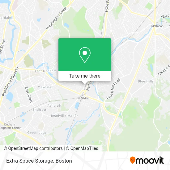
See Extra Space Storage, Boston, on the map
Public Transit to Extra Space Storage in Boston
Wondering how to get to Extra Space Storage in Boston? Moovit helps you find the best way to get to Extra Space Storage with step-by-step directions from the nearest public transit station.
Moovit provides free maps and live directions to help you navigate through your city. View schedules, routes, timetables, and find out how long does it take to get to Extra Space Storage in real time.
Looking for the nearest stop or station to Extra Space Storage? Check out this list of stops closest to your destination: Readville; Hyde Park; Hyde Park Ave @ Milton St; Neponset Valley Pkwy @ Westinghouse Plaza.
Bus: 32, 33, FRANKLIN LINE SHUTTLE, FRANKLIN LINE SHUTTLE.Train: FRANKLIN/FOXBORO, PROVIDENCE/STOUGHTON, FAIRMOUNT.
Want to see if there’s another route that gets you there at an earlier time? Moovit helps you find alternative routes or times. Get directions from and directions to Extra Space Storage easily from the Moovit App or Website.
We make riding to Extra Space Storage easy, which is why over 1.7 million users, including users in Boston, trust Moovit as the best app for public transit. You don’t need to download an individual bus app or train app, Moovit is your all-in-one transit app that helps you find the best bus time or train time available.
For information on prices of bus, train and subway, costs and ride fares to Extra Space Storage, please check the Moovit app.
Use the app to navigate to popular places including to the airport, hospital, stadium, grocery store, mall, coffee shop, school, college, and university.
Extra Space Storage Address: 140 Neponset Valley Pkwy street in Boston
- Alert Ambulance,
- JKBM Enterprises,
- Quality Auto Body,
- U-Haul,
- Global van Lines,
- Su'Dae Spa,
- FTTX Services,
- Parkway Towing,
- Insight Realty Group,
- G Greene,
- Readville Commuter Rail Yard,
- J. Kelly Landscape,
- Readville MBTA Station,
- Fraternity Locksmith,
- Alpha O Barry,
- Academy Of the Pacific Rim Charter Public School,
- Readville - Lot A,
- Readville,
- Shell Recharge,
- DUNKIN'
Places Near Extra Space Storage (Boston)
- Td Garden, Boston,
- Isabella Stewart Gardner Museum, Boston,
- Mgm Music Hall, Boston,
- Boston Common, Boston,
- Wang Theater, Boston,
- House Of Blues, Boston,
- Boston Medical Center, Boston,
- Massachusetts General Hospital, Boston,
- North End, Boston,
- Quincy Market, Boston,
- Castle Island, Boston,
- Seaport District, Boston,
- Museum Of Science, Boston,
- Faneuil Hall, Boston,
- Boston Children's Hospital, Boston,
- Cheers, Boston,
- Wilbur Theatre, Boston,
- Boston Convention & Exhibition Center, Boston,
- Prudential Center, Boston,
- Leader Bank Pavilion (Leader Bank Pavillion), Boston
How to get to popular places in Boston with public transit
Get around Boston by public transit!
Traveling around Boston has never been so easy. See step by step directions as you travel to any attraction, street or major public transit station. View bus and train schedules, arrival times, service alerts and detailed routes on a map, so you know exactly how to get to anywhere in Boston.
When traveling to any destination around Boston use Moovit's Live Directions with Get Off Notifications to know exactly where and how far to walk, how long to wait for your line, and how many stops are left. Moovit will alert you when it's time to get off — no need to constantly re-check whether yours is the next stop.
Wondering how to use public transit in Boston or how to pay for public transit in Boston? Moovit public transit app can help you navigate your way with public transit easily, and at minimum cost. It includes public transit fees, ticket prices, and costs. Looking for a map of Boston public transit lines? Moovit public transit app shows all public transit maps in Boston with all Bus, Train, Subway and Ferry routes and stops on an interactive map.
Boston has 4 transit type(s), including: Bus, Train, Subway and Ferry, operated by several transit agencies, including MBTA, Southeastern Regional Transit Authority, MetroWest Regional Transit Authority, Rhode Island Public Transit Authority, WRTA, Lowell Regional Transit Authority, Merrimack Valley Transit, Montachusett Regional Transit Authority, Cape Cod Regional Transit Authority, Brockton Area Transit Authority, Martha's Vineyard Transit Authority, the WAVE - Nantucket Regional Transit Authority, GATRA, Cape Ann Transportation Authority and Massport