Directions to Fashion Point (Boston) with public transportation
The following transit lines have routes that pass near Fashion Point
 Bus: 501, 66, 57, 64.
- Train: FRAMINGHAM/WORCESTER.
- Subway: GREEN LINE B.
How to get to Fashion Point by bus?
Click on the bus route to see step by step directions with maps, line arrival times and updated time schedules.
From City Hall To Go, Boston
36 minFrom Boston Marriott Newton, Newton
73 minFrom Courtyard by Marriott Boston Logan Airport, Boston
64 minFrom General Consulate of Colombia, Boston
14 minFrom Intercontinental Boston Hotel Boston, Boston
31 minFrom Fort Independence, Boston
70 minFrom Hyatt Place Medford, Medford
61 minFrom I-95 / Route 128 & Route 16 Interchange (Exit 21), Newton
77 minFrom Castle Island, Boston
67 minFrom East Boston, Boston
50 min
How to get to Fashion Point by train?
Click on the train route to see step by step directions with maps, line arrival times and updated time schedules.
How to get to Fashion Point by subway?
Click on the subway route to see step by step directions with maps, line arrival times and updated time schedules.
From City Hall To Go, Boston
64 minFrom Boston Marriott Newton, Newton
76 minFrom Courtyard by Marriott Boston Logan Airport, Boston
68 minFrom General Consulate of Colombia, Boston
36 minFrom Intercontinental Boston Hotel Boston, Boston
50 minFrom East Boston, Boston
59 minFrom Hyatt Place Medford, Medford
91 minFrom I-95 / Route 128 & Route 16 Interchange (Exit 21), Newton
63 min
Bus stops near Fashion Point in Boston
Subway station near Fashion Point in Boston
- Packards Corner, 9 min walk,VIEW
Bus lines to Fashion Point in Boston
What are the closest stations to Fashion Point?
The closest stations to Fashion Point are:
- Cambridge St @ N Beacon St is 44 yards away, 1 min walk.
- N Beacon St @ Cambridge St is 60 yards away, 1 min walk.
- Packards Corner is 711 yards away, 9 min walk.
Which bus lines stop near Fashion Point?
These bus lines stop near Fashion Point: 501, 66.
Which train line stops near Fashion Point?
FRAMINGHAM/WORCESTER (#526 | South Station)
Which subway line stops near Fashion Point?
GREEN LINE B (Boston College)
What’s the nearest subway station to Fashion Point in Boston?
The nearest subway station to Fashion Point in Boston is Packards Corner. It’s a 9 min walk away.
What’s the nearest bus station to Fashion Point in Boston?
The nearest bus stations to Fashion Point in Boston are Cambridge St @ N Beacon St and N Beacon St @ Cambridge St. The closest one is a 1 min walk away.
What time is the first subway to Fashion Point in Boston?
The GREEN LINE B is the first subway that goes to Fashion Point in Boston. It stops nearby at 5:12 AM.
What time is the last subway to Fashion Point in Boston?
The GREEN LINE B is the last subway that goes to Fashion Point in Boston. It stops nearby at 2:28 AM.
What time is the first bus to Fashion Point in Boston?
The 57 is the first bus that goes to Fashion Point in Boston. It stops nearby at 4:39 AM.
What time is the last bus to Fashion Point in Boston?
The 66 is the last bus that goes to Fashion Point in Boston. It stops nearby at 2:25 AM.
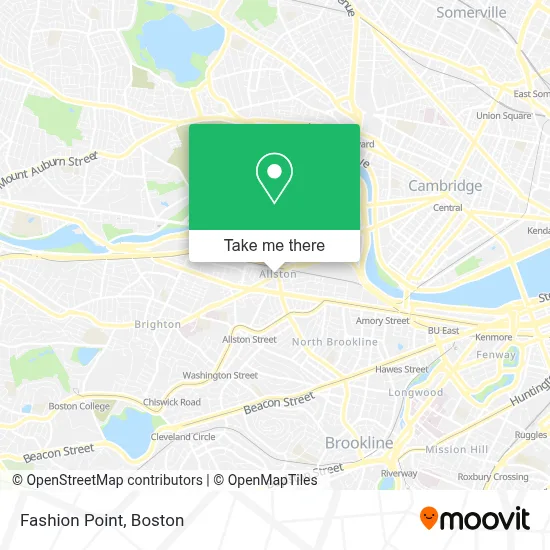
See Fashion Point, Boston, on the map
Public Transit to Fashion Point in Boston
Wondering how to get to Fashion Point in Boston? Moovit helps you find the best way to get to Fashion Point with step-by-step directions from the nearest public transit station.
Moovit provides free maps and live directions to help you navigate through your city. View schedules, routes, timetables, and find out how long does it take to get to Fashion Point in real time.
Looking for the nearest stop or station to Fashion Point? Check out this list of stops closest to your destination: Cambridge St @ N Beacon St; N Beacon St @ Cambridge St; Packards Corner.
Bus: 501, 66, 57, 64.Train: FRAMINGHAM/WORCESTER.Subway: GREEN LINE B.
Want to see if there’s another route that gets you there at an earlier time? Moovit helps you find alternative routes or times. Get directions from and directions to Fashion Point easily from the Moovit App or Website.
We make riding to Fashion Point easy, which is why over 1.7 million users, including users in Boston, trust Moovit as the best app for public transit. You don’t need to download an individual bus app or train app, Moovit is your all-in-one transit app that helps you find the best bus time or train time available.
For information on prices of bus, subway and train, costs and ride fares to Fashion Point, please check the Moovit app.
Use the app to navigate to popular places including to the airport, hospital, stadium, grocery store, mall, coffee shop, school, college, and university.
Fashion Point Address: 391 Cambridge St street in Boston
- Stingray Creations,
- Stingray Body Art,
- O'Brien's Pub (O'Briens Pub),
- O'Brien's Pub, 3 Harvard Avenue,
- MG Hair Artistic Salon,
- Brazilian Immigrant Center (Brazilian Worker Center / Centro do Trabalhador Brasileiro),
- Lucky Mobile Car Detailing,
- Rochas Cleaning,
- Boston Christmas Trees,
- Lulu's Allston,
- Regina Pizzeria,
- ZipCar,
- Vachina Town,
- Make Out Point,
- Allston,
- La Favorita Market,
- Farrington Inn,
- Vacco Roger P Lawyer,
- Alexander Mystica M Lawyer,
- Allston
Places Near Fashion Point (Boston)
- North End, Boston,
- Td Garden, Boston,
- House Of Blues, Boston,
- Castle Island, Boston,
- Museum Of Science, Boston,
- Prudential Center, Boston,
- Wang Theater, Boston,
- Quincy Market, Boston,
- Faneuil Hall, Boston,
- Isabella Stewart Gardner Museum, Boston,
- Mgm Music Hall, Boston,
- Boston Common, Boston,
- Boston Medical Center, Boston,
- Cheers, Boston,
- Wilbur Theatre, Boston,
- Leader Bank Pavilion (Leader Bank Pavillion), Boston,
- Massachusetts General Hospital, Boston,
- Boston Convention & Exhibition Center, Boston,
- Seaport District, Boston,
- Boston Children's Hospital, Boston
How to get to popular places in Boston with public transit
Get around Boston by public transit!
Traveling around Boston has never been so easy. See step by step directions as you travel to any attraction, street or major public transit station. View bus and train schedules, arrival times, service alerts and detailed routes on a map, so you know exactly how to get to anywhere in Boston.
When traveling to any destination around Boston use Moovit's Live Directions with Get Off Notifications to know exactly where and how far to walk, how long to wait for your line, and how many stops are left. Moovit will alert you when it's time to get off — no need to constantly re-check whether yours is the next stop.
Wondering how to use public transit in Boston or how to pay for public transit in Boston? Moovit public transit app can help you navigate your way with public transit easily, and at minimum cost. It includes public transit fees, ticket prices, and costs. Looking for a map of Boston public transit lines? Moovit public transit app shows all public transit maps in Boston with all Bus, Train, Subway and Ferry routes and stops on an interactive map.
Boston has 4 transit type(s), including: Bus, Train, Subway and Ferry, operated by several transit agencies, including MBTA, Southeastern Regional Transit Authority, MetroWest Regional Transit Authority, Rhode Island Public Transit Authority, WRTA, Lowell Regional Transit Authority, Merrimack Valley Transit, Montachusett Regional Transit Authority, Cape Cod Regional Transit Authority, Brockton Area Transit Authority, Martha's Vineyard Transit Authority, the WAVE - Nantucket Regional Transit Authority, GATRA, Cape Ann Transportation Authority and Massport