Directions to Fast Weight Loss 365 (Boston) with public transportation
The following transit lines have routes that pass near Fast Weight Loss 365
 Bus: 28, 41, 42, 44, 66.
- Train: NEEDHAM, PROVIDENCE/STOUGHTON, FRANKLIN/FOXBORO, ORANGE LINE.
- Subway: ORANGE LINE, GREEN LINE E.
How to get to Fast Weight Loss 365 by bus?
Click on the bus route to see step by step directions with maps, line arrival times and updated time schedules.
From Medford Square, Medford
59 minFrom Hyatt Place Medford, Medford
58 minFrom Santarpio's Pizza, Boston
66 minFrom Bunker Hill, Boston
71 minFrom MBTA Suffolk Downs Station, Boston
88 minFrom Curry College, Milton
61 minFrom Massachusetts, Boston
52 minFrom Massachusetts Water Resource Authority (MWRA), Chelsea
69 minFrom Winthrop, Winthrop Town
130 minFrom Silver Line Stop Terminal B, Boston
52 min
How to get to Fast Weight Loss 365 by train?
Click on the train route to see step by step directions with maps, line arrival times and updated time schedules.
How to get to Fast Weight Loss 365 by subway?
Click on the subway route to see step by step directions with maps, line arrival times and updated time schedules.
From Silver Line Stop Terminal B, Boston
61 minFrom Medford Square, Medford
73 minFrom Hyatt Place Medford, Medford
75 minFrom Santarpio's Pizza, Boston
40 minFrom Bunker Hill, Boston
47 minFrom MBTA Suffolk Downs Station, Boston
40 minFrom Massachusetts, Boston
74 minFrom Massachusetts Water Resource Authority (MWRA), Chelsea
61 min
Bus stops near Fast Weight Loss 365 in Boston
Subway station near Fast Weight Loss 365 in Boston
- Longwood Medical Area, 7 min walk,VIEW
Train station near Fast Weight Loss 365 in Boston
- Ruggles, 25 min walk,VIEW
Bus lines to Fast Weight Loss 365 in Boston
- 10, Townsend & Humboldt,VIEW
- 14, Heath St,VIEW
- 19, Gallivan Blvd,VIEW
- 23, Franklin Park,VIEW
- 28, Nubian,VIEW
- 44, Ruggles,VIEW
- 1, Nubian - Harvard,VIEW
- 8, Kenmore via South Bay Center - Harbor Point via South Bay Center,VIEW
- 15, Ruggles - Fields Corner,VIEW
- 41, JFK/UMass - Centre St & Eliot St,VIEW
- 42, Nubian - Forest Hills,VIEW
- 45, Ruggles - Franklin Park,VIEW
- 47, Broadway - Central Square,VIEW
- 66, Nubian via Allston - Harvard via Allston,VIEW
- 171, - Logan Airport via Andrew,VIEW
- SL4, South Station - Nubian,VIEW
- SL5, Downtown - Nubian,VIEW
What are the closest stations to Fast Weight Loss 365?
The closest stations to Fast Weight Loss 365 are:
- Warren St @ Kearsarge Ave is 166 yards away, 3 min walk.
- Nubian is 261 yards away, 4 min walk.
- Longwood Medical Area is 544 yards away, 7 min walk.
- Ruggles is 2129 yards away, 25 min walk.
Which bus lines stop near Fast Weight Loss 365?
These bus lines stop near Fast Weight Loss 365: 28, 41, 42, 44, 66, BB, SL4, SL5.
Which train lines stop near Fast Weight Loss 365?
These train lines stop near Fast Weight Loss 365: NEEDHAM, PROVIDENCE/STOUGHTON.
Which subway line stops near Fast Weight Loss 365?
ORANGE LINE (Forest Hills)
What’s the nearest subway station to Fast Weight Loss 365 in Boston?
The nearest subway station to Fast Weight Loss 365 in Boston is Longwood Medical Area. It’s a 7 min walk away.
What’s the nearest train station to Fast Weight Loss 365 in Boston?
The nearest train station to Fast Weight Loss 365 in Boston is Ruggles. It’s a 25 min walk away.
What’s the nearest bus station to Fast Weight Loss 365 in Boston?
The nearest bus station to Fast Weight Loss 365 in Boston is Warren St @ Kearsarge Ave. It’s a 3 min walk away.
What time is the first subway to Fast Weight Loss 365 in Boston?
The ORANGE LINE is the first subway that goes to Fast Weight Loss 365 in Boston. It stops nearby at 5:20 AM.
What time is the last subway to Fast Weight Loss 365 in Boston?
The GREEN LINE E is the last subway that goes to Fast Weight Loss 365 in Boston. It stops nearby at 2:04 AM.
What time is the first train to Fast Weight Loss 365 in Boston?
The PROVIDENCE/STOUGHTON is the first train that goes to Fast Weight Loss 365 in Boston. It stops nearby at 4:28 AM.
What time is the last train to Fast Weight Loss 365 in Boston?
The PROVIDENCE/STOUGHTON is the last train that goes to Fast Weight Loss 365 in Boston. It stops nearby at 12:34 AM.
What time is the first bus to Fast Weight Loss 365 in Boston?
The 28 is the first bus that goes to Fast Weight Loss 365 in Boston. It stops nearby at 3:19 AM.
What time is the last bus to Fast Weight Loss 365 in Boston?
The 1 is the last bus that goes to Fast Weight Loss 365 in Boston. It stops nearby at 2:44 AM.
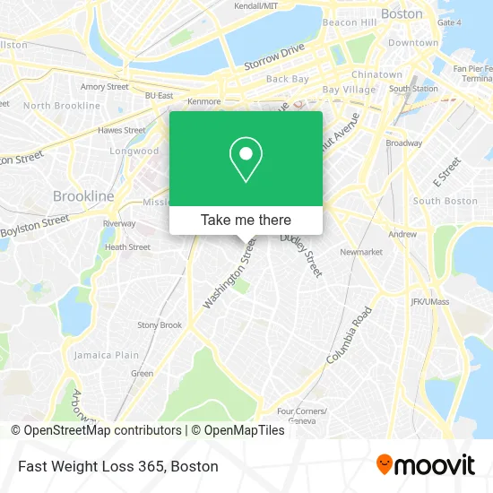
See Fast Weight Loss 365, Boston, on the map
Public Transit to Fast Weight Loss 365 in Boston
Wondering how to get to Fast Weight Loss 365 in Boston? Moovit helps you find the best way to get to Fast Weight Loss 365 with step-by-step directions from the nearest public transit station.
Moovit provides free maps and live directions to help you navigate through your city. View schedules, routes, timetables, and find out how long does it take to get to Fast Weight Loss 365 in real time.
Looking for the nearest stop or station to Fast Weight Loss 365? Check out this list of stops closest to your destination: Warren St @ Kearsarge Ave; Nubian; Longwood Medical Area; Ruggles.
Bus: 28, 41, 42, 44, 66, BB, SL4, SL5, 10, 14, 19, 23, 1, 8, 15.Train: NEEDHAM, PROVIDENCE/STOUGHTON, FRANKLIN/FOXBORO, ORANGE LINE.Subway: ORANGE LINE, GREEN LINE E.
Want to see if there’s another route that gets you there at an earlier time? Moovit helps you find alternative routes or times. Get directions from and directions to Fast Weight Loss 365 easily from the Moovit App or Website.
We make riding to Fast Weight Loss 365 easy, which is why over 1.7 million users, including users in Boston, trust Moovit as the best app for public transit. You don’t need to download an individual bus app or train app, Moovit is your all-in-one transit app that helps you find the best bus time or train time available.
For information on prices of bus, subway and train, costs and ride fares to Fast Weight Loss 365, please check the Moovit app.
Use the app to navigate to popular places including to the airport, hospital, stadium, grocery store, mall, coffee shop, school, college, and university.
Fast Weight Loss 365 Address: 2565 Washington St street in Boston
- District 7 Tavern,
- Roxbury Roots Montessori Inc.,
- Nuestra Comunidad Development Corporation,
- Live Longer Get Fit,
- Nubian Square,
- Bartlett Station Condominium Trust,
- Feeltbaskets,
- 1 Juniper ter Parking,
- Brush & Floss,
- Dillaway School,
- Boston Town 25 Locks Change,
- Omega Locksmith,
- Acedone,
- Premiere Customized Services,
- Nubian Station,
- Yawkey Boys & Girls Club of Roxbury,
- BMC Roxbury Division,
- Nubian Square,
- Safohaircom,
- Safo Hair
Places Near Fast Weight Loss 365 (Boston)
- Boston Convention & Exhibition Center, Boston,
- Castle Island, Boston,
- Museum Of Science, Boston,
- Wilbur Theatre, Boston,
- Seaport District, Boston,
- Quincy Market, Boston,
- House Of Blues, Boston,
- Cheers, Boston,
- Prudential Center, Boston,
- Massachusetts General Hospital, Boston,
- Isabella Stewart Gardner Museum, Boston,
- Boston Common, Boston,
- Boston Children's Hospital, Boston,
- North End, Boston,
- Td Garden, Boston,
- Wang Theater, Boston,
- Faneuil Hall, Boston,
- Mgm Music Hall, Boston,
- Boston Medical Center, Boston,
- Leader Bank Pavilion (Leader Bank Pavillion), Boston
How to get to popular places in Boston with public transit
Get around Boston by public transit!
Traveling around Boston has never been so easy. See step by step directions as you travel to any attraction, street or major public transit station. View bus and train schedules, arrival times, service alerts and detailed routes on a map, so you know exactly how to get to anywhere in Boston.
When traveling to any destination around Boston use Moovit's Live Directions with Get Off Notifications to know exactly where and how far to walk, how long to wait for your line, and how many stops are left. Moovit will alert you when it's time to get off — no need to constantly re-check whether yours is the next stop.
Wondering how to use public transit in Boston or how to pay for public transit in Boston? Moovit public transit app can help you navigate your way with public transit easily, and at minimum cost. It includes public transit fees, ticket prices, and costs. Looking for a map of Boston public transit lines? Moovit public transit app shows all public transit maps in Boston with all Bus, Train, Subway and Ferry routes and stops on an interactive map.
Boston has 4 transit type(s), including: Bus, Train, Subway and Ferry, operated by several transit agencies, including MBTA, Southeastern Regional Transit Authority, MetroWest Regional Transit Authority, Rhode Island Public Transit Authority, WRTA, Lowell Regional Transit Authority, Merrimack Valley Transit, Montachusett Regional Transit Authority, Cape Cod Regional Transit Authority, Brockton Area Transit Authority, Martha's Vineyard Transit Authority, the WAVE - Nantucket Regional Transit Authority, GATRA, Cape Ann Transportation Authority and Massport