Directions to Federal Protective Services (Boston) with public transportation
The following transit lines have routes that pass near Federal Protective Services
 Bus: 111, 354, 43, 92, EZRIDE.
- Train: FAIRMOUNT, FITCHBURG, FRAMINGHAM/WORCESTER, HAVERHILL.
- Subway: GREEN LINE C, GREEN LINE E, ORANGE LINE, RED LINE, BLUE LINE.
How to get to Federal Protective Services by bus?
Click on the bus route to see step by step directions with maps, line arrival times and updated time schedules.
From Brattle St / Harvard Sq, Cambridge
52 minFrom FOUR POINTS BY SHERATON Boston Newton, Newton
44 minFrom Hotel Hilton Boston/Woburn, Boston
51 minFrom Lower Mills, Boston
92 minFrom Staybridge Suites Boston-Quincy, Quincy
117 minFrom Coolidge Corner Theatre, Brookline
62 minFrom Wollaston Beach, Quincy
135 minFrom Melrose, MA, Melrose
78 minFrom Chevalier Theatre (Chevalier Theater Show Line), Medford
32 minFrom Arlington, MA, Arlington
67 min
How to get to Federal Protective Services by train?
Click on the train route to see step by step directions with maps, line arrival times and updated time schedules.
How to get to Federal Protective Services by subway?
Click on the subway route to see step by step directions with maps, line arrival times and updated time schedules.
From Brattle St / Harvard Sq, Cambridge
24 minFrom Hotel Hilton Boston/Woburn, Boston
30 minFrom Lower Mills, Boston
47 minFrom Staybridge Suites Boston-Quincy, Quincy
35 minFrom Coolidge Corner Theatre, Brookline
35 minFrom Wollaston Beach, Quincy
50 minFrom Chevalier Theatre (Chevalier Theater Show Line), Medford
50 min
Bus stops near Federal Protective Services in Boston
Subway stations near Federal Protective Services in Boston
Bus lines to Federal Protective Services in Boston
- ORANGE LINE SHUTTLE, Sullivan (Shuttle),VIEW
- 111, Haymarket,VIEW
- BLUE LINE SHUTTLE, Orient Heights (Local Shuttle),VIEW
- BLUE LINE SHUTTLE, Orient Heights (Express Shuttle),VIEW
- BLUE LINE SHUTTLE, Haymarket (Express Shuttle),VIEW
- BLUE LINE SHUTTLE, Airport (Local Shuttle),VIEW
- 116, Maverick,VIEW
- 354, Burlington (Express) Via Woburn,VIEW
- BLUE LINE SHUTTLE, Government Center (Express Shuttle),VIEW
- BLUE LINE SHUTTLE, Government Center Via Maverick (Shuttle),VIEW
- BLUE LINE SHUTTLE, Airport Via Maverick (Shuttle),VIEW
- BLUE LINE SHUTTLE, Wonderland (Shuttle),VIEW
- RED LINE SHUTTLE, Jfk/Umass (Shuttle),VIEW
- 92, Sullivan,VIEW
- 93, Sullivan Via Navy Yard,VIEW
- 426, Haymarket Via Cliftondale,VIEW
- 428, Oaklandvale Via Cliftondale (Express),VIEW
- 450, Salem Depot,VIEW
- 89/93, Haymarket Via Sullivan,VIEW
- BLUE LINE SHUTTLE, Airport (Shuttle),VIEW
What are the closest stations to Federal Protective Services?
The closest stations to Federal Protective Services are:
- State is 171 yards away, 3 min walk.
- Surface Rd @ Hanover St is 194 yards away, 3 min walk.
- State St @ Washington Mall - State St Sta is 205 yards away, 3 min walk.
- Congress St Opp North St is 258 yards away, 4 min walk.
- Congress St @ Haymarket Sta is 320 yards away, 4 min walk.
- Government Center is 423 yards away, 6 min walk.
- Cambridge St @ Government Ctr Sta is 448 yards away, 6 min walk.
- State Street is 493 yards away, 6 min walk.
- Causeway St (East) is 651 yards away, 8 min walk.
Which bus lines stop near Federal Protective Services?
These bus lines stop near Federal Protective Services: 111, 354, 43, 92, EZRIDE, SL5.
Which train lines stop near Federal Protective Services?
These train lines stop near Federal Protective Services: FAIRMOUNT, FITCHBURG, FRAMINGHAM/WORCESTER, HAVERHILL.
Which subway lines stop near Federal Protective Services?
These subway lines stop near Federal Protective Services: GREEN LINE C, GREEN LINE E, ORANGE LINE, RED LINE.
What’s the nearest subway station to Federal Protective Services in Boston?
The nearest subway stations to Federal Protective Services in Boston are Government Center and State Street. The closest one is a 6 min walk away.
What’s the nearest bus station to Federal Protective Services in Boston?
The nearest bus stations to Federal Protective Services in Boston are State, Surface Rd @ Hanover St and State St @ Washington Mall - State St Sta. The closest one is a 3 min walk away.
What time is the first subway to Federal Protective Services in Boston?
The GREEN LINE E is the first subway that goes to Federal Protective Services in Boston. It stops nearby at 5:01 AM.
What time is the last subway to Federal Protective Services in Boston?
The GREEN LINE E is the last subway that goes to Federal Protective Services in Boston. It stops nearby at 2:24 AM.
What time is the first bus to Federal Protective Services in Boston?
The 111 is the first bus that goes to Federal Protective Services in Boston. It stops nearby at 4:53 AM.
What time is the last bus to Federal Protective Services in Boston?
The 111 is the last bus that goes to Federal Protective Services in Boston. It stops nearby at 2:20 AM.
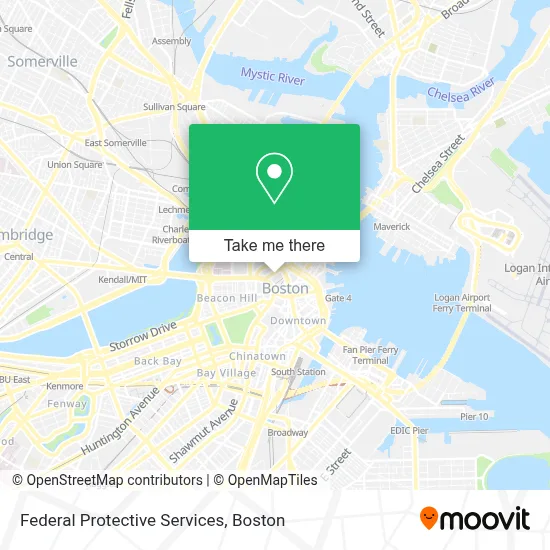
See Federal Protective Services, Boston, on the map
Public Transit to Federal Protective Services in Boston
Wondering how to get to Federal Protective Services in Boston? Moovit helps you find the best way to get to Federal Protective Services with step-by-step directions from the nearest public transit station.
Moovit provides free maps and live directions to help you navigate through your city. View schedules, routes, timetables, and find out how long does it take to get to Federal Protective Services in real time.
Looking for the nearest stop or station to Federal Protective Services? Check out this list of stops closest to your destination: State; Surface Rd @ Hanover St; State St @ Washington Mall - State St Sta; Congress St Opp North St; Congress St @ Haymarket Sta; Government Center; Cambridge St @ Government Ctr Sta; State Street; Causeway St (East).
Bus: 111, 354, 43, 92, EZRIDE, SL5, ORANGE LINE SHUTTLE, BLUE LINE SHUTTLE, BLUE LINE SHUTTLE, BLUE LINE SHUTTLE, BLUE LINE SHUTTLE, 116, BLUE LINE SHUTTLE, BLUE LINE SHUTTLE, BLUE LINE SHUTTLE.Train: FAIRMOUNT, FITCHBURG, FRAMINGHAM/WORCESTER, HAVERHILL.Subway: GREEN LINE C, GREEN LINE E, ORANGE LINE, RED LINE, BLUE LINE, GREEN LINE B, GREEN LINE D, HAVERHILL LINE SHUTTLE, HAVERHILL LINE SHUTTLE, LOWELL LINE SHUTTLE, LOWELL LINE SHUTTLE, NEWBURYPORT/ROCKPORT LINE SHUTTLE.
Want to see if there’s another route that gets you there at an earlier time? Moovit helps you find alternative routes or times. Get directions from and directions to Federal Protective Services easily from the Moovit App or Website.
We make riding to Federal Protective Services easy, which is why over 1.7 million users, including users in Boston, trust Moovit as the best app for public transit. You don’t need to download an individual bus app or train app, Moovit is your all-in-one transit app that helps you find the best bus time or train time available.
For information on prices of subway, bus and train, costs and ride fares to Federal Protective Services, please check the Moovit app.
Use the app to navigate to popular places including to the airport, hospital, stadium, grocery store, mall, coffee shop, school, college, and university.
Federal Protective Services Address: 25 New Sudbury St street in Boston
- U.S. Immigration Court,
- JFK Federal Building,
- Parcel 7 Parking Garage,
- Sudbury,
- Tobin Bridge,
- MA Health Connector,
- Boston Sports Club,
- State Street at Washington Mall MBTA Bus Stop,
- Boston City Hall Plaza,
- Boston Public Market Kitchen,
- Government Center/Faneuil Hall,
- Mbta Bus Route 326,
- Massachusetts State Employees Credit Union (MSECU),
- Navy Federal Credit Union,
- Enterprise Rent-A-Car,
- Puma,
- City Hall Plaza,
- Boston City Hall (Boston Office of Fair Housing & Equity),
- City of Boston Economic Development (City of Boston Administrative Offices Main Number),
- Registry of Motor Vehicles Haymarket (Boston)
Places Near Federal Protective Services (Boston)
- Boston Medical Center, Boston,
- Prudential Center, Boston,
- House Of Blues, Boston,
- Quincy Market, Boston,
- Boston Common, Boston,
- Museum Of Science, Boston,
- Isabella Stewart Gardner Museum, Boston,
- Seaport District, Boston,
- Leader Bank Pavilion (Leader Bank Pavillion), Boston,
- Castle Island, Boston,
- North End, Boston,
- Boston Children's Hospital, Boston,
- Boston Convention & Exhibition Center, Boston,
- Massachusetts General Hospital, Boston,
- Wilbur Theatre, Boston,
- Faneuil Hall, Boston,
- Cheers, Boston,
- Mgm Music Hall, Boston,
- Wang Theater, Boston,
- Td Garden, Boston
How to get to popular places in Boston with public transit
Get around Boston by public transit!
Traveling around Boston has never been so easy. See step by step directions as you travel to any attraction, street or major public transit station. View bus and train schedules, arrival times, service alerts and detailed routes on a map, so you know exactly how to get to anywhere in Boston.
When traveling to any destination around Boston use Moovit's Live Directions with Get Off Notifications to know exactly where and how far to walk, how long to wait for your line, and how many stops are left. Moovit will alert you when it's time to get off — no need to constantly re-check whether yours is the next stop.
Wondering how to use public transit in Boston or how to pay for public transit in Boston? Moovit public transit app can help you navigate your way with public transit easily, and at minimum cost. It includes public transit fees, ticket prices, and costs. Looking for a map of Boston public transit lines? Moovit public transit app shows all public transit maps in Boston with all Bus, Train, Subway and Ferry routes and stops on an interactive map.
Boston has 4 transit type(s), including: Bus, Train, Subway and Ferry, operated by several transit agencies, including MBTA, Southeastern Regional Transit Authority, MetroWest Regional Transit Authority, Rhode Island Public Transit Authority, WRTA, Lowell Regional Transit Authority, Merrimack Valley Transit, Montachusett Regional Transit Authority, Cape Cod Regional Transit Authority, Brockton Area Transit Authority, Martha's Vineyard Transit Authority, the WAVE - Nantucket Regional Transit Authority, GATRA, Cape Ann Transportation Authority and Massport