Directions to Fenway Dining Hall (Boston) with public transportation
The following transit lines have routes that pass near Fenway Dining Hall
 Bus: 47, 60, 8, 85, BB.
- Train: PROVIDENCE/STOUGHTON, FRAMINGHAM/WORCESTER.
- Subway: GREEN LINE D, GREEN LINE C.
How to get to Fenway Dining Hall by bus?
Click on the bus route to see step by step directions with maps, line arrival times and updated time schedules.
From Alumni Stadium, Newton
48 minFrom MBTA Suffolk Downs Station, Boston
85 minFrom Beth Israel Deaconess Hospital-Milton, Milton
96 minFrom Suffolk Downs, Boston
82 minFrom Sheraton-Needham Hotel (Sheraton Boston Needham Hotel), Needham
84 minFrom Hyatt Place Boston Seaport District, Boston
66 minFrom Flynn Cruiseport Boston, Boston
67 minFrom DoubleTree by Hilton Boston Logan Airport Chelsea, Chelsea
71 minFrom Belle Isle Lobster & Seafood, Winthrop Town
112 minFrom Boston Logan International Airport (Bos), Boston
43 min
How to get to Fenway Dining Hall by train?
Click on the train route to see step by step directions with maps, line arrival times and updated time schedules.
How to get to Fenway Dining Hall by subway?
Click on the subway route to see step by step directions with maps, line arrival times and updated time schedules.
From Boston Logan International Airport (Bos), Boston
60 minFrom Alumni Stadium, Newton
41 minFrom MBTA Suffolk Downs Station, Boston
44 minFrom Beth Israel Deaconess Hospital-Milton, Milton
89 minFrom Suffolk Downs, Boston
57 minFrom Belle Isle Lobster & Seafood, Winthrop Town
59 minFrom Hyatt Place Boston Seaport District, Boston
58 min
Bus stops near Fenway Dining Hall in Boston
Train station near Fenway Dining Hall in Boston
- Lansdowne, 4 min walk,VIEW
Subway stations near Fenway Dining Hall in Boston
Bus lines to Fenway Dining Hall in Boston
- 47, Broadway - Central Square,VIEW
- 85, Ruggles - Assembly,VIEW
- GREEN LINE D SHUTTLE, Riverside - Kenmore (Shuttle),VIEW
- GREEN LINE D SHUTTLE, Reservoir - Fenway,VIEW
- GREEN LINE D SHUTTLE, Reservoir - Kenmore,VIEW
- GREEN LINE D SHUTTLE, Riverside - Kenmore via Saint Mary's Street,VIEW
- GREEN LINE D SHUTTLE, Newton Highlands - Kenmore,VIEW
- GREEN LINE D SHUTTLE, Riverside - Fenway,VIEW
- GREEN LINE D SHUTTLE, Newton Highlands - Fenway,VIEW
- GREEN LINE D SHUTTLE, Brookline Hills - Kenmore,VIEW
- GREEN LINE D SHUTTLE, Newton Highlands - Kenmore via Saint Mary's Street,VIEW
- GREEN LINE D SHUTTLE, Brookline Hills - Back Bay (Shuttle),VIEW
- GREEN LINE D SHUTTLE, Riverside - Kenmore,VIEW
- GREEN LINE C SHUTTLE, Cleveland Circle - Saint Mary's Street,VIEW
- GREEN LINE C SHUTTLE, Saint Mary's Street - Back Bay,VIEW
- GREEN LINE C SHUTTLE, Saint Mary's Street - Kenmore,VIEW
- 8, Kenmore via South Bay Center - Harbor Point via South Bay Center,VIEW
- 19, Kenmore - Fields Corner,VIEW
- 60, Kenmore - Chestnut Hill Mall,VIEW
- 65, Kenmore - Brighton Center,VIEW
What are the closest stations to Fenway Dining Hall?
The closest stations to Fenway Dining Hall are:
- Park Dr @ Fenway Station SB is 260 yards away, 4 min walk.
- Lansdowne is 271 yards away, 4 min walk.
- Saint Mary's Street - Beacon St @ Saint Mary's St is 344 yards away, 5 min walk.
- Brookline Ave @ Pilgrim Rd / Fenway Campus is 385 yards away, 5 min walk.
- Brookline Ave @ the Fenway is 435 yards away, 6 min walk.
- Brookline Ave Opp Short St is 482 yards away, 6 min walk.
- Park Dr @ Fenway Station NB is 589 yards away, 8 min walk.
- Fenway is 646 yards away, 8 min walk.
- Hawes Street is 1091 yards away, 13 min walk.
Which bus lines stop near Fenway Dining Hall?
These bus lines stop near Fenway Dining Hall: 47, 60, 8, 85, BB.
Which train line stops near Fenway Dining Hall?
PROVIDENCE/STOUGHTON (#825 | Providence)
Which subway line stops near Fenway Dining Hall?
GREEN LINE D (Riverside)
What’s the nearest subway station to Fenway Dining Hall in Boston?
The nearest subway station to Fenway Dining Hall in Boston is Fenway. It’s a 8 min walk away.
What’s the nearest train station to Fenway Dining Hall in Boston?
The nearest train station to Fenway Dining Hall in Boston is Lansdowne. It’s a 4 min walk away.
What’s the nearest bus station to Fenway Dining Hall in Boston?
The nearest bus station to Fenway Dining Hall in Boston is Park Dr @ Fenway Station SB. It’s a 4 min walk away.
What time is the first subway to Fenway Dining Hall in Boston?
The GREEN LINE D is the first subway that goes to Fenway Dining Hall in Boston. It stops nearby at 4:55 AM.
What time is the last subway to Fenway Dining Hall in Boston?
The GREEN LINE D is the last subway that goes to Fenway Dining Hall in Boston. It stops nearby at 2:22 AM.
What time is the first train to Fenway Dining Hall in Boston?
The FRAMINGHAM/WORCESTER is the first train that goes to Fenway Dining Hall in Boston. It stops nearby at 4:55 AM.
What time is the last train to Fenway Dining Hall in Boston?
The FRAMINGHAM/WORCESTER is the last train that goes to Fenway Dining Hall in Boston. It stops nearby at 12:06 AM.
What time is the first bus to Fenway Dining Hall in Boston?
The 60 is the first bus that goes to Fenway Dining Hall in Boston. It stops nearby at 5:22 AM.
What time is the last bus to Fenway Dining Hall in Boston?
The 47 is the last bus that goes to Fenway Dining Hall in Boston. It stops nearby at 1:10 AM.
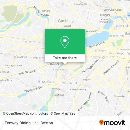
See Fenway Dining Hall, Boston, on the map
Public Transit to Fenway Dining Hall in Boston
Wondering how to get to Fenway Dining Hall in Boston? Moovit helps you find the best way to get to Fenway Dining Hall with step-by-step directions from the nearest public transit station.
Moovit provides free maps and live directions to help you navigate through your city. View schedules, routes, timetables, and find out how long does it take to get to Fenway Dining Hall in real time.
Looking for the nearest stop or station to Fenway Dining Hall? Check out this list of stops closest to your destination: Park Dr @ Fenway Station SB; Lansdowne; Saint Mary's Street - Beacon St @ Saint Mary's St; Brookline Ave @ Pilgrim Rd / Fenway Campus; Brookline Ave @ the Fenway; Brookline Ave Opp Short St; Park Dr @ Fenway Station NB; Fenway; Hawes Street.
Bus: 47, 60, 8, 85, BB, GREEN LINE D SHUTTLE, GREEN LINE D SHUTTLE, GREEN LINE D SHUTTLE, GREEN LINE C SHUTTLE, GREEN LINE C SHUTTLE, GREEN LINE C SHUTTLE, 19, 65.Train: PROVIDENCE/STOUGHTON, FRAMINGHAM/WORCESTER.Subway: GREEN LINE D, GREEN LINE C.
Want to see if there’s another route that gets you there at an earlier time? Moovit helps you find alternative routes or times. Get directions from and directions to Fenway Dining Hall easily from the Moovit App or Website.
We make riding to Fenway Dining Hall easy, which is why over 1.7 million users, including users in Boston, trust Moovit as the best app for public transit. You don’t need to download an individual bus app or train app, Moovit is your all-in-one transit app that helps you find the best bus time or train time available.
For information on prices of bus, subway and train, costs and ride fares to Fenway Dining Hall, please check the Moovit app.
Use the app to navigate to popular places including to the airport, hospital, stadium, grocery store, mall, coffee shop, school, college, and university.
Fenway Dining Hall Address: 150 Riverway street in Boston
- Riverway House,
- Wheelock College,
- Wheelock Family Theatre,
- Oncampus Boston- 온캠퍼스 보스턴,
- Emmanuel college auditorium,
- Simmons College,
- Boston University Summer Term,
- Boston University Fenway Campus,
- MBTA-Fenway (Park Dr @ Fenway Station),
- Muddy River Jogging Path,
- Pulse,
- Whoop,
- Harvard,
- 401 Park,
- Trillium Fenway,
- Saltie Girl,
- BED BATH & BEYOND - Fenway Park,
- Emmanuel College MA USA,
- Management Team Allen Associates Properties, Inc.,
- The Green
Places Near Fenway Dining Hall (Boston)
- Td Garden, Boston,
- Wang Theater, Boston,
- Museum Of Science, Boston,
- North End, Boston,
- Isabella Stewart Gardner Museum, Boston,
- Faneuil Hall, Boston,
- Boston Medical Center, Boston,
- Wilbur Theatre, Boston,
- Prudential Center, Boston,
- Cheers, Boston,
- Boston Common, Boston,
- Mgm Music Hall, Boston,
- House Of Blues, Boston,
- Massachusetts General Hospital, Boston,
- Quincy Market, Boston,
- Boston Children's Hospital, Boston,
- Boston Convention & Exhibition Center, Boston,
- Seaport District, Boston,
- Leader Bank Pavilion (Leader Bank Pavillion), Boston,
- Castle Island, Boston
How to get to popular places in Boston with public transit
Get around Boston by public transit!
Traveling around Boston has never been so easy. See step by step directions as you travel to any attraction, street or major public transit station. View bus and train schedules, arrival times, service alerts and detailed routes on a map, so you know exactly how to get to anywhere in Boston.
When traveling to any destination around Boston use Moovit's Live Directions with Get Off Notifications to know exactly where and how far to walk, how long to wait for your line, and how many stops are left. Moovit will alert you when it's time to get off — no need to constantly re-check whether yours is the next stop.
Wondering how to use public transit in Boston or how to pay for public transit in Boston? Moovit public transit app can help you navigate your way with public transit easily, and at minimum cost. It includes public transit fees, ticket prices, and costs. Looking for a map of Boston public transit lines? Moovit public transit app shows all public transit maps in Boston with all Bus, Train, Subway and Ferry routes and stops on an interactive map.
Boston has 4 transit type(s), including: Bus, Train, Subway and Ferry, operated by several transit agencies, including MBTA, Southeastern Regional Transit Authority, MetroWest Regional Transit Authority, Rhode Island Public Transit Authority, WRTA, Lowell Regional Transit Authority, Merrimack Valley Transit, Montachusett Regional Transit Authority, Cape Cod Regional Transit Authority, Brockton Area Transit Authority, Martha's Vineyard Transit Authority, the WAVE - Nantucket Regional Transit Authority, GATRA, Cape Ann Transportation Authority and Massport