Directions to Finger Licking Foods (Boston) with public transportation
The following transit lines have routes that pass near Finger Licking Foods
 Bus: 14, 22, 39, 66, 41.
- Train: FRAMINGHAM/WORCESTER.
- Subway: ORANGE LINE, GREEN LINE E.
How to get to Finger Licking Foods by bus?
Click on the bus route to see step by step directions with maps, line arrival times and updated time schedules.
From Inman Square, Cambridge
69 minFrom Reelhouse, Boston
93 minFrom Beth Israel Deaconess Hospital-Milton, Milton
71 minFrom Dedham District Court, Dedham
52 minFrom Courtyard by Marriott Boston Logan Airport, Boston
75 minFrom Spaulding Rehabilitation Center, Boston
50 minFrom Mount Auburn, Cambridge
66 minFrom Everett, MA, Everett
91 minFrom Granite Links Golf Club at Quarry Hills, Quincy
91 minFrom Constitution Beach, Boston
94 min
How to get to Finger Licking Foods by train?
Click on the train route to see step by step directions with maps, line arrival times and updated time schedules.
How to get to Finger Licking Foods by subway?
Click on the subway route to see step by step directions with maps, line arrival times and updated time schedules.
Bus stops near Finger Licking Foods in Boston
Subway stations near Finger Licking Foods in Boston
What are the closest stations to Finger Licking Foods?
The closest stations to Finger Licking Foods are:
- Centre St @ Estrella St is 60 yards away, 1 min walk.
- Heath St Opp Hayden St is 284 yards away, 4 min walk.
- Heath Street is 1059 yards away, 13 min walk.
- Stony Brook is 1144 yards away, 14 min walk.
Which bus lines stop near Finger Licking Foods?
These bus lines stop near Finger Licking Foods: 14, 22, 39, 66.
Which train line stops near Finger Licking Foods?
FRAMINGHAM/WORCESTER (#518 | South Station)
Which subway line stops near Finger Licking Foods?
ORANGE LINE (Forest Hills)
What’s the nearest subway station to Finger Licking Foods in Boston?
The nearest subway station to Finger Licking Foods in Boston is Heath Street. It’s a 13 min walk away.
What’s the nearest bus station to Finger Licking Foods in Boston?
The nearest bus station to Finger Licking Foods in Boston is Centre St @ Estrella St. It’s a 1 min walk away.
What time is the first subway to Finger Licking Foods in Boston?
The ORANGE LINE is the first subway that goes to Finger Licking Foods in Boston. It stops nearby at 5:18 AM.
What time is the last subway to Finger Licking Foods in Boston?
The GREEN LINE E is the last subway that goes to Finger Licking Foods in Boston. It stops nearby at 2:00 AM.
What time is the first bus to Finger Licking Foods in Boston?
The 41 is the first bus that goes to Finger Licking Foods in Boston. It stops nearby at 5:20 AM.
What time is the last bus to Finger Licking Foods in Boston?
The 41 is the last bus that goes to Finger Licking Foods in Boston. It stops nearby at 9:29 PM.
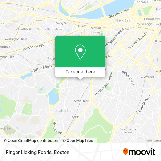
See Finger Licking Foods, Boston, on the map
Public Transit to Finger Licking Foods in Boston
Wondering how to get to Finger Licking Foods in Boston? Moovit helps you find the best way to get to Finger Licking Foods with step-by-step directions from the nearest public transit station.
Moovit provides free maps and live directions to help you navigate through your city. View schedules, routes, timetables, and find out how long does it take to get to Finger Licking Foods in real time.
Looking for the nearest stop or station to Finger Licking Foods? Check out this list of stops closest to your destination: Centre St @ Estrella St; Heath St Opp Hayden St; Heath Street; Stony Brook.
Bus: 14, 22, 39, 66, 41.Train: FRAMINGHAM/WORCESTER.Subway: ORANGE LINE, GREEN LINE E.
Want to see if there’s another route that gets you there at an earlier time? Moovit helps you find alternative routes or times. Get directions from and directions to Finger Licking Foods easily from the Moovit App or Website.
We make riding to Finger Licking Foods easy, which is why over 1.7 million users, including users in Boston, trust Moovit as the best app for public transit. You don’t need to download an individual bus app or train app, Moovit is your all-in-one transit app that helps you find the best bus time or train time available.
For information on prices of bus, subway and train, costs and ride fares to Finger Licking Foods, please check the Moovit app.
Use the app to navigate to popular places including to the airport, hospital, stadium, grocery store, mall, coffee shop, school, college, and university.
Finger Licking Foods Address: 25 Gay Head St street in Boston
- Jp Convenience Store,
- Keating Total Fitness,
- Walden Garden,
- Other Apartments for Rent,
- Justice 4 Housing,
- Horan Way Building 57,
- Heath St Building 170,
- JP Corner Store,
- Coinstar - Bitcoin ATM,
- Happy Birthday Flowers,
- Plain Fast Locksmith,
- Baez High Style Hair Salon,
- Direct SAT TV,
- DUNKIN',
- Tori Japan,
- Codman Square Market,
- Bulfinch Hotel,
- Foxwoods Resort And Casino,
- Centre St,
- Red Sun Press Today
Places Near Finger Licking Foods (Boston)
- Wang Theater, Boston,
- Boston Children's Hospital, Boston,
- Seaport District, Boston,
- Faneuil Hall, Boston,
- Cheers, Boston,
- Massachusetts General Hospital, Boston,
- Td Garden, Boston,
- Boston Common, Boston,
- Museum Of Science, Boston,
- Isabella Stewart Gardner Museum, Boston,
- North End, Boston,
- Mgm Music Hall, Boston,
- Wilbur Theatre, Boston,
- House Of Blues, Boston,
- Boston Convention & Exhibition Center, Boston,
- Boston Medical Center, Boston,
- Castle Island, Boston,
- Quincy Market, Boston,
- Prudential Center, Boston,
- Leader Bank Pavilion (Leader Bank Pavillion), Boston
How to get to popular places in Boston with public transit
Get around Boston by public transit!
Traveling around Boston has never been so easy. See step by step directions as you travel to any attraction, street or major public transit station. View bus and train schedules, arrival times, service alerts and detailed routes on a map, so you know exactly how to get to anywhere in Boston.
When traveling to any destination around Boston use Moovit's Live Directions with Get Off Notifications to know exactly where and how far to walk, how long to wait for your line, and how many stops are left. Moovit will alert you when it's time to get off — no need to constantly re-check whether yours is the next stop.
Wondering how to use public transit in Boston or how to pay for public transit in Boston? Moovit public transit app can help you navigate your way with public transit easily, and at minimum cost. It includes public transit fees, ticket prices, and costs. Looking for a map of Boston public transit lines? Moovit public transit app shows all public transit maps in Boston with all Bus, Train, Subway and Ferry routes and stops on an interactive map.
Boston has 4 transit type(s), including: Bus, Train, Subway and Ferry, operated by several transit agencies, including MBTA, Southeastern Regional Transit Authority, MetroWest Regional Transit Authority, Rhode Island Public Transit Authority, WRTA, Lowell Regional Transit Authority, Merrimack Valley Transit, Montachusett Regional Transit Authority, Cape Cod Regional Transit Authority, Brockton Area Transit Authority, Martha's Vineyard Transit Authority, the WAVE - Nantucket Regional Transit Authority, GATRA, Cape Ann Transportation Authority and Massport