Directions to Firecode Design (Boston) with public transportation
The following transit lines have routes that pass near Firecode Design
 Bus: 32, 33, 39, 50, 24.
- Train: FAIRMOUNT, PROVIDENCE/STOUGHTON, FAIRMOUNT LINE SHUTTLE, FRANKLIN/FOXBORO.
- Subway: MATTAPAN LINE.
How to get to Firecode Design by bus?
Click on the bus route to see step by step directions with maps, line arrival times and updated time schedules.
From Museum Of Fine Arts MBTA Station, Boston
47 minFrom 240 Mount Vernon Street, Boston
62 minFrom AC Hotel by Marriott Boston Cleveland Circle, Boston
60 minFrom MBTA-Museum of Fine Arts, Boston
47 minFrom Qea, Quincy
82 minFrom Alumni Stadium, Boston
83 minFrom Beth Israel Deaconess Medical Center, West Campus - Farr Building, Boston
52 minFrom Reggie Lewis Athletic Center, Boston
53 minFrom South Bay Center, Boston
52 min
How to get to Firecode Design by train?
Click on the train route to see step by step directions with maps, line arrival times and updated time schedules.
From Museum Of Fine Arts MBTA Station, Boston
51 minFrom 240 Mount Vernon Street, Boston
61 minFrom MBTA-Museum of Fine Arts, Boston
51 minFrom Beth Israel Deaconess Medical Center, West Campus - Farr Building, Boston
68 minFrom Reggie Lewis Athletic Center, Boston
52 minFrom South Bay Center, Boston
40 min
How to get to Firecode Design by subway?
Click on the subway route to see step by step directions with maps, line arrival times and updated time schedules.
From Museum Of Fine Arts MBTA Station, Boston
102 minFrom 240 Mount Vernon Street, Boston
81 minFrom AC Hotel by Marriott Boston Cleveland Circle, Boston
125 minFrom MBTA-Museum of Fine Arts, Boston
102 minFrom Qea, Quincy
94 minFrom Alumni Stadium, Boston
139 minFrom Beth Israel Deaconess Medical Center, West Campus - Farr Building, Boston
115 minFrom Reggie Lewis Athletic Center, Boston
102 minFrom South Bay Center, Boston
89 min
Bus stops near Firecode Design in Boston
Train station near Firecode Design in Boston
- Fairmount, 22 min walk,VIEW
Bus lines to Firecode Design in Boston
What are the closest stations to Firecode Design?
The closest stations to Firecode Design are:
- Hyde Park Ave @ Glenwood Ave is 170 yards away, 3 min walk.
- Hyde Park Ave @ Oak St is 233 yards away, 3 min walk.
- River St @ Reservation Rd is 381 yards away, 5 min walk.
- Truman Hwy @ Tyler St is 767 yards away, 9 min walk.
- Fairmount is 1873 yards away, 22 min walk.
Which bus lines stop near Firecode Design?
These bus lines stop near Firecode Design: 32, 33.
Which train lines stop near Firecode Design?
These train lines stop near Firecode Design: FAIRMOUNT, PROVIDENCE/STOUGHTON.
Which subway line stops near Firecode Design?
MATTAPAN LINE (Mattapan)
What’s the nearest train station to Firecode Design in Boston?
The nearest train station to Firecode Design in Boston is Fairmount. It’s a 22 min walk away.
What’s the nearest bus station to Firecode Design in Boston?
The nearest bus stations to Firecode Design in Boston are Hyde Park Ave @ Glenwood Ave and Hyde Park Ave @ Oak St. The closest one is a 3 min walk away.
What time is the first train to Firecode Design in Boston?
The FAIRMOUNT is the first train that goes to Firecode Design in Boston. It stops nearby at 4:33 AM.
What time is the last train to Firecode Design in Boston?
The PROVIDENCE/STOUGHTON is the last train that goes to Firecode Design in Boston. It stops nearby at 12:22 AM.
What time is the first bus to Firecode Design in Boston?
The 39 is the first bus that goes to Firecode Design in Boston. It stops nearby at 4:25 AM.
What time is the last bus to Firecode Design in Boston?
The 32 is the last bus that goes to Firecode Design in Boston. It stops nearby at 1:29 AM.
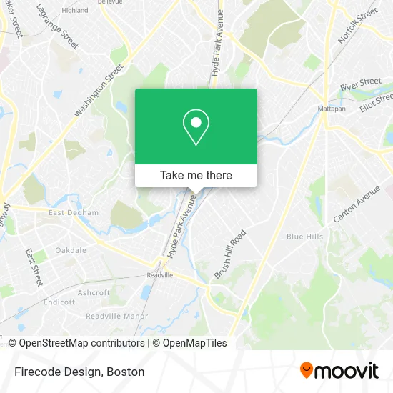
See Firecode Design, Boston, on the map
Public Transit to Firecode Design in Boston
Wondering how to get to Firecode Design in Boston? Moovit helps you find the best way to get to Firecode Design with step-by-step directions from the nearest public transit station.
Moovit provides free maps and live directions to help you navigate through your city. View schedules, routes, timetables, and find out how long does it take to get to Firecode Design in real time.
Looking for the nearest stop or station to Firecode Design? Check out this list of stops closest to your destination: Hyde Park Ave @ Glenwood Ave; Hyde Park Ave @ Oak St; River St @ Reservation Rd; Truman Hwy @ Tyler St; Fairmount.
Bus: 32, 33, 39, 50, 24.Train: FAIRMOUNT, PROVIDENCE/STOUGHTON, FAIRMOUNT LINE SHUTTLE, FRANKLIN/FOXBORO.Subway: MATTAPAN LINE.
Want to see if there’s another route that gets you there at an earlier time? Moovit helps you find alternative routes or times. Get directions from and directions to Firecode Design easily from the Moovit App or Website.
We make riding to Firecode Design easy, which is why over 1.7 million users, including users in Boston, trust Moovit as the best app for public transit. You don’t need to download an individual bus app or train app, Moovit is your all-in-one transit app that helps you find the best bus time or train time available.
For information on prices of bus, subway and train, costs and ride fares to Firecode Design, please check the Moovit app.
Use the app to navigate to popular places including to the airport, hospital, stadium, grocery store, mall, coffee shop, school, college, and university.
Firecode Design Address: 10 A St street in Boston
- Akiki,
- Boston Housing Authority,
- Hyde Park Emergency Plumbing,
- Mario Musto,
- Rapida,
- Leroy's Kitchen,
- Capital Masonry and Construction,
- Coinstar - Bitcoin ATM,
- bp,
- James Sheehan Landscaping,
- Able Care Health,
- D'Angelo,
- Joseph E. Amatucci Square,
- DJ Jay Lee,
- Pipe Maintenance Plumbing,
- Dollar Tree,
- Garage Door Springsn Repair Garage Door,
- FedEx,
- Top Ornamental Iron,
- How We Cookin
Places Near Firecode Design (Boston)
- Prudential Center, Boston,
- Wilbur Theatre, Boston,
- Mgm Music Hall, Boston,
- North End, Boston,
- Td Garden, Boston,
- Boston Children's Hospital, Boston,
- Seaport District, Boston,
- Cheers, Boston,
- Castle Island, Boston,
- Boston Convention & Exhibition Center, Boston,
- Massachusetts General Hospital, Boston,
- House Of Blues, Boston,
- Isabella Stewart Gardner Museum, Boston,
- Boston Common, Boston,
- Wang Theater, Boston,
- Boston Medical Center, Boston,
- Leader Bank Pavilion (Leader Bank Pavillion), Boston,
- Faneuil Hall, Boston,
- Museum Of Science, Boston,
- Quincy Market, Boston
How to get to popular places in Boston with public transit
Get around Boston by public transit!
Traveling around Boston has never been so easy. See step by step directions as you travel to any attraction, street or major public transit station. View bus and train schedules, arrival times, service alerts and detailed routes on a map, so you know exactly how to get to anywhere in Boston.
When traveling to any destination around Boston use Moovit's Live Directions with Get Off Notifications to know exactly where and how far to walk, how long to wait for your line, and how many stops are left. Moovit will alert you when it's time to get off — no need to constantly re-check whether yours is the next stop.
Wondering how to use public transit in Boston or how to pay for public transit in Boston? Moovit public transit app can help you navigate your way with public transit easily, and at minimum cost. It includes public transit fees, ticket prices, and costs. Looking for a map of Boston public transit lines? Moovit public transit app shows all public transit maps in Boston with all Bus, Train, Subway and Ferry routes and stops on an interactive map.
Boston has 4 transit type(s), including: Bus, Train, Subway and Ferry, operated by several transit agencies, including MBTA, Southeastern Regional Transit Authority, MetroWest Regional Transit Authority, Rhode Island Public Transit Authority, WRTA, Lowell Regional Transit Authority, Merrimack Valley Transit, Montachusett Regional Transit Authority, Cape Cod Regional Transit Authority, Brockton Area Transit Authority, Martha's Vineyard Transit Authority, the WAVE - Nantucket Regional Transit Authority, GATRA, Cape Ann Transportation Authority and Massport