Directions to Fish Design And Architecture Llc (Boston) with public transportation
The following transit lines have routes that pass near Fish Design And Architecture Llc
 Bus: 35, 36, 37, 51, 38.
- Train: NEEDHAM, FRANKLIN/FOXBORO, ORANGE LINE, PROVIDENCE/STOUGHTON.
How to get to Fish Design And Architecture Llc by bus?
Click on the bus route to see step by step directions with maps, line arrival times and updated time schedules.
From UMass Boston Campus Center, Boston
78 minFrom Newbury Boston, Boston
55 minFrom Eastern Standard Kitchen & Drinks, Boston
59 minFrom Contessa, Boston
55 minFrom Boston Park Plaza, Boston
54 minFrom Maggiano's Little Italy, Boston
56 minFrom Harvard Stadium, Boston
60 minFrom Fenway Park-Gate C Entrance, Boston
59 minFrom Spaulding Rehabilitation Center, Boston
45 minFrom Emerson College, Boston
58 min
How to get to Fish Design And Architecture Llc by train?
Click on the train route to see step by step directions with maps, line arrival times and updated time schedules.
From UMass Boston Campus Center, Boston
72 minFrom Newbury Boston, Boston
32 minFrom Eastern Standard Kitchen & Drinks, Boston
51 minFrom Contessa, Boston
32 minFrom Boston Park Plaza, Boston
28 minFrom Maggiano's Little Italy, Boston
29 minFrom Harvard Stadium, Boston
80 minFrom Fenway Park-Gate C Entrance, Boston
55 minFrom Spaulding Rehabilitation Center, Boston
65 minFrom Emerson College, Boston
34 min
Bus stops near Fish Design And Architecture Llc in Boston
Train stations near Fish Design And Architecture Llc in Boston
Bus lines to Fish Design And Architecture Llc in Boston
What are the closest stations to Fish Design And Architecture Llc?
The closest stations to Fish Design And Architecture Llc are:
- Centre St @ Corey St is 55 yards away, 1 min walk.
- Anawan Ave @ W Roxbury Pkwy is 107 yards away, 2 min walk.
- Highland is 176 yards away, 3 min walk.
- Bellevue is 1374 yards away, 17 min walk.
- Forest Hills is 3776 yards away, 44 min walk.
Which bus lines stop near Fish Design And Architecture Llc?
These bus lines stop near Fish Design And Architecture Llc: 35, 36, 37, 51.
Which train line stops near Fish Design And Architecture Llc?
NEEDHAM (#625 | Needham Heights)
What’s the nearest train station to Fish Design And Architecture Llc in Boston?
The nearest train station to Fish Design And Architecture Llc in Boston is Bellevue. It’s a 17 min walk away.
What’s the nearest bus station to Fish Design And Architecture Llc in Boston?
The nearest bus station to Fish Design And Architecture Llc in Boston is Centre St @ Corey St. It’s a 1 min walk away.
What time is the first subway to Fish Design And Architecture Llc in Boston?
The ORANGE LINE is the first subway that goes to Fish Design And Architecture Llc in Boston. It stops nearby at 5:15 AM.
What time is the last subway to Fish Design And Architecture Llc in Boston?
The ORANGE LINE is the last subway that goes to Fish Design And Architecture Llc in Boston. It stops nearby at 1:58 AM.
What time is the first train to Fish Design And Architecture Llc in Boston?
The NEEDHAM is the first train that goes to Fish Design And Architecture Llc in Boston. It stops nearby at 7:22 AM.
What time is the last train to Fish Design And Architecture Llc in Boston?
The PROVIDENCE/STOUGHTON is the last train that goes to Fish Design And Architecture Llc in Boston. It stops nearby at 12:08 AM.
What time is the first bus to Fish Design And Architecture Llc in Boston?
The 36 is the first bus that goes to Fish Design And Architecture Llc in Boston. It stops nearby at 4:39 AM.
What time is the last bus to Fish Design And Architecture Llc in Boston?
The 36 is the last bus that goes to Fish Design And Architecture Llc in Boston. It stops nearby at 1:34 AM.
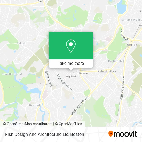
See Fish Design And Architecture Llc, Boston, on the map
Public Transit to Fish Design And Architecture Llc in Boston
Wondering how to get to Fish Design And Architecture Llc in Boston? Moovit helps you find the best way to get to Fish Design And Architecture Llc with step-by-step directions from the nearest public transit station.
Moovit provides free maps and live directions to help you navigate through your city. View schedules, routes, timetables, and find out how long does it take to get to Fish Design And Architecture Llc in real time.
Looking for the nearest stop or station to Fish Design And Architecture Llc? Check out this list of stops closest to your destination: Centre St @ Corey St; Anawan Ave @ W Roxbury Pkwy; Highland; Bellevue; Forest Hills.
Bus: 35, 36, 37, 51, 38, NEEDHAM LINE SHUTTLE, NEEDHAM LINE SHUTTLE.Train: NEEDHAM, FRANKLIN/FOXBORO, ORANGE LINE, PROVIDENCE/STOUGHTON.
Want to see if there’s another route that gets you there at an earlier time? Moovit helps you find alternative routes or times. Get directions from and directions to Fish Design And Architecture Llc easily from the Moovit App or Website.
We make riding to Fish Design And Architecture Llc easy, which is why over 1.7 million users, including users in Boston, trust Moovit as the best app for public transit. You don’t need to download an individual bus app or train app, Moovit is your all-in-one transit app that helps you find the best bus time or train time available.
For information on prices of bus, train and subway, costs and ride fares to Fish Design And Architecture Llc, please check the Moovit app.
Use the app to navigate to popular places including to the airport, hospital, stadium, grocery store, mall, coffee shop, school, college, and university.
Fish Design And Architecture Llc Address: 1842 Centre St street in Boston
- Boston Ale House,
- Roche Bros.,
- Claude's Jewelry,
- Banh Mi Oi (Banh Mi Ngon),
- Hercules Stump Grinding,
- Parkway Community Ymca,
- West Roxbury,
- City Lock Co.,
- English High School,
- Boston Concrete Pros,
- MLB Construction,
- New England Sign and Design,
- Bellevue Hill, Massachusetts,
- Charlie's MRKT,
- Ross & Toner PC,
- MBTA Bellevue Commuter Rail,
- Boston Public Schools,
- Joyce Kilmer Upper School,
- Bel Ave Pizza,
- H&R Block
Places Near Fish Design And Architecture Llc (Boston)
- Wang Theater, Boston,
- Isabella Stewart Gardner Museum, Boston,
- Td Garden, Boston,
- Faneuil Hall, Boston,
- Seaport District, Boston,
- Boston Medical Center, Boston,
- North End, Boston,
- Wilbur Theatre, Boston,
- Mgm Music Hall, Boston,
- Castle Island, Boston,
- Quincy Market, Boston,
- Boston Children's Hospital, Boston,
- House Of Blues, Boston,
- Prudential Center, Boston,
- Boston Common, Boston,
- Boston Convention & Exhibition Center, Boston,
- Leader Bank Pavilion (Leader Bank Pavillion), Boston,
- Massachusetts General Hospital, Boston,
- Cheers, Boston,
- Museum Of Science, Boston
How to get to popular places in Boston with public transit
Get around Boston by public transit!
Traveling around Boston has never been so easy. See step by step directions as you travel to any attraction, street or major public transit station. View bus and train schedules, arrival times, service alerts and detailed routes on a map, so you know exactly how to get to anywhere in Boston.
When traveling to any destination around Boston use Moovit's Live Directions with Get Off Notifications to know exactly where and how far to walk, how long to wait for your line, and how many stops are left. Moovit will alert you when it's time to get off — no need to constantly re-check whether yours is the next stop.
Wondering how to use public transit in Boston or how to pay for public transit in Boston? Moovit public transit app can help you navigate your way with public transit easily, and at minimum cost. It includes public transit fees, ticket prices, and costs. Looking for a map of Boston public transit lines? Moovit public transit app shows all public transit maps in Boston with all Bus, Train, Subway and Ferry routes and stops on an interactive map.
Boston has 4 transit type(s), including: Bus, Train, Subway and Ferry, operated by several transit agencies, including MBTA, Southeastern Regional Transit Authority, MetroWest Regional Transit Authority, Rhode Island Public Transit Authority, WRTA, Lowell Regional Transit Authority, Merrimack Valley Transit, Montachusett Regional Transit Authority, Cape Cod Regional Transit Authority, Brockton Area Transit Authority, Martha's Vineyard Transit Authority, the WAVE - Nantucket Regional Transit Authority, GATRA, Cape Ann Transportation Authority and Massport