Directions to Fit Fx (Arlington) with public transportation
The following transit lines have routes that pass near Fit Fx
 Bus: 77, 350, 87.
- Train: LOWELL, FITCHBURG.
- Subway: RED LINE, GREEN LINE B, GREEN LINE C, GREEN LINE E.
How to get to Fit Fx by bus?
Click on the bus route to see step by step directions with maps, line arrival times and updated time schedules.
From Track 7 (MBTA Back Bay Station), Boston
56 minFrom new hampshire!, Boston
61 minFrom The Barking Crab, Boston
77 minFrom Allston, Boston
49 minFrom Sowa, Boston
65 minFrom Assembly Square Mall Shopping Center, Somerville
48 minFrom Boston Tea Party - Ships And Museum, Boston
78 minFrom Hotel Hilton Boston/Woburn, Boston
82 minFrom MSPCA Angell Animal Medical Center, Boston
80 minFrom Fire & Ice (Fire Ice Restaurant), Boston
55 min
How to get to Fit Fx by train?
Click on the train route to see step by step directions with maps, line arrival times and updated time schedules.
How to get to Fit Fx by subway?
Click on the subway route to see step by step directions with maps, line arrival times and updated time schedules.
From Track 7 (MBTA Back Bay Station), Boston
57 minFrom new hampshire!, Boston
73 minFrom The Barking Crab, Boston
61 minFrom Allston, Boston
89 minFrom Sowa, Boston
62 minFrom Assembly Square Mall Shopping Center, Somerville
72 minFrom Boston Tea Party - Ships And Museum, Boston
56 minFrom Hotel Hilton Boston/Woburn, Boston
74 minFrom MSPCA Angell Animal Medical Center, Boston
83 minFrom Fire & Ice (Fire Ice Restaurant), Boston
58 min
Bus stops near Fit Fx in Arlington
Subway stations near Fit Fx in Arlington
What are the closest stations to Fit Fx?
The closest stations to Fit Fx are:
- Massachusetts Ave @ Harlow St is 128 yards away, 2 min walk.
- Broadway @ Tufts St is 557 yards away, 7 min walk.
- West Medford is 3062 yards away, 37 min walk.
- Belmont is 3162 yards away, 37 min walk.
- Alewife is 3165 yards away, 37 min walk.
- Medford/Tufts Station is 4982 yards away, 59 min walk.
Which bus line stops near Fit Fx?
77 (Arlington Heights)
Which train line stops near Fit Fx?
LOWELL (#327 | Lowell)
Which subway line stops near Fit Fx?
RED LINE (Alewife)
What’s the nearest bus station to Fit Fx in Arlington?
The nearest bus station to Fit Fx in Arlington is Massachusetts Ave @ Harlow St. It’s a 2 min walk away.
What time is the first subway to Fit Fx in Arlington?
The GREEN LINE E is the first subway that goes to Fit Fx in Arlington. It stops nearby at 4:57 AM.
What time is the last subway to Fit Fx in Arlington?
The GREEN LINE E is the last subway that goes to Fit Fx in Arlington. It stops nearby at 2:41 AM.
What time is the first train to Fit Fx in Arlington?
The LOWELL is the first train that goes to Fit Fx in Arlington. It stops nearby at 5:31 AM.
What time is the last train to Fit Fx in Arlington?
The LOWELL is the last train that goes to Fit Fx in Arlington. It stops nearby at 12:20 AM.
What time is the first bus to Fit Fx in Arlington?
The 77 is the first bus that goes to Fit Fx in Arlington. It stops nearby at 4:55 AM.
What time is the last bus to Fit Fx in Arlington?
The 87 is the last bus that goes to Fit Fx in Arlington. It stops nearby at 1:42 AM.
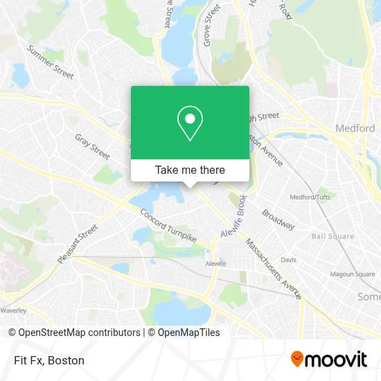
See Fit Fx, Arlington, on the map
Public Transit to Fit Fx in Arlington
Wondering how to get to Fit Fx in Arlington? Moovit helps you find the best way to get to Fit Fx with step-by-step directions from the nearest public transit station.
Moovit provides free maps and live directions to help you navigate through your city. View schedules, routes, timetables, and find out how long does it take to get to Fit Fx in real time.
Looking for the nearest stop or station to Fit Fx? Check out this list of stops closest to your destination: Massachusetts Ave @ Harlow St; Broadway @ Tufts St; West Medford; Belmont; Alewife; Medford/Tufts Station.
Bus: 77, 350, 87.Train: LOWELL, FITCHBURG.Subway: RED LINE, GREEN LINE B, GREEN LINE C, GREEN LINE E.
Want to see if there’s another route that gets you there at an earlier time? Moovit helps you find alternative routes or times. Get directions from and directions to Fit Fx easily from the Moovit App or Website.
We make riding to Fit Fx easy, which is why over 1.7 million users, including users in Arlington, trust Moovit as the best app for public transit. You don’t need to download an individual bus app or train app, Moovit is your all-in-one transit app that helps you find the best bus time or train time available.
For information on prices of bus, subway and train, costs and ride fares to Fit Fx, please check the Moovit app.
Use the app to navigate to popular places including to the airport, hospital, stadium, grocery store, mall, coffee shop, school, college, and university.
Fit Fx Address: 1 Belknap St street in Arlington
- Adrianne Jorge,
- Lynette Ingram Cassel,
- Major Wellness Massage,
- Sandy Dixon Psychologist,
- Joyce Bloom, M.Ed., Lmhc at the Healing Center,
- His Voice Aloud,
- Healing Connections,
- Tantric Intimacy,
- Greater Boston Speech And Language Services,
- Rimkus,
- Larp Adventure Program,
- East Arlington,
- USPS,
- Red Sweater Software,
- Meraki Garden Services,
- Revivo Massage,
- Brightview Arlington Addiction Treatment Center,
- Matt Conlin Painting Company,
- Renew Beauty And Wellness,
- Friends of the Fox Thrift
Places Near Fit Fx (Arlington)
- Boston Convention & Exhibition Center, Boston,
- Leader Bank Pavilion (Leader Bank Pavillion), Boston,
- Prudential Center, Boston,
- House Of Blues, Boston,
- Mgm Music Hall, Boston,
- Boston Children's Hospital, Boston,
- Boston Medical Center, Boston,
- Wang Theater, Boston,
- Faneuil Hall, Boston,
- Massachusetts General Hospital, Boston,
- Td Garden, Boston,
- Boston Common, Boston,
- Cheers, Boston,
- Museum Of Science, Boston,
- Quincy Market, Boston,
- North End, Boston,
- Isabella Stewart Gardner Museum, Boston,
- Wilbur Theatre, Boston,
- Castle Island, Boston,
- Seaport District, Boston
How to get to popular places in Boston with public transit
Get around Arlington by public transit!
Traveling around Arlington has never been so easy. See step by step directions as you travel to any attraction, street or major public transit station. View bus and train schedules, arrival times, service alerts and detailed routes on a map, so you know exactly how to get to anywhere in Arlington.
When traveling to any destination around Arlington use Moovit's Live Directions with Get Off Notifications to know exactly where and how far to walk, how long to wait for your line, and how many stops are left. Moovit will alert you when it's time to get off — no need to constantly re-check whether yours is the next stop.
Wondering how to use public transit in Arlington or how to pay for public transit in Arlington? Moovit public transit app can help you navigate your way with public transit easily, and at minimum cost. It includes public transit fees, ticket prices, and costs. Looking for a map of Arlington public transit lines? Moovit public transit app shows all public transit maps in Arlington with all Bus, Train, Subway and Ferry routes and stops on an interactive map.
Boston has 4 transit type(s), including: Bus, Train, Subway and Ferry, operated by several transit agencies, including MBTA, Southeastern Regional Transit Authority, MetroWest Regional Transit Authority, Rhode Island Public Transit Authority, WRTA, Lowell Regional Transit Authority, Merrimack Valley Transit, Montachusett Regional Transit Authority, Cape Cod Regional Transit Authority, Brockton Area Transit Authority, Martha's Vineyard Transit Authority, the WAVE - Nantucket Regional Transit Authority, GATRA, Cape Ann Transportation Authority and Massport