Directions to Forcella (Boston) with public transportation
The following transit lines have routes that pass near Forcella
 Bus: 111, 501, 92, 93, SL4.
- Train: FAIRMOUNT, FITCHBURG, FRAMINGHAM/WORCESTER, HAVERHILL, NEEDHAM.
- Subway: GREEN LINE C, GREEN LINE D, GREEN LINE E, ORANGE LINE, BLUE LINE.
- Ferry: EAST BOSTON FERRY.
How to get to Forcella by bus?
Click on the bus route to see step by step directions with maps, line arrival times and updated time schedules.
From Jamaica Plain, Boston
74 minFrom Melrose, MA, Melrose
78 minFrom Harvard Square T Station - Red Line, Cambridge
55 minFrom 98 Binney St, Boston
78 minFrom Harvard Museum Of Natural History, Cambridge
54 minFrom Lower Mills, Boston
97 minFrom Alumni Stadium, Newton
81 minFrom Wollaston Beach, Quincy
125 minFrom Courtyard by Marriott Brookline, Brookline
76 minFrom Watertown, MA, Watertown Town
62 min
How to get to Forcella by train?
Click on the train route to see step by step directions with maps, line arrival times and updated time schedules.
How to get to Forcella by subway?
Click on the subway route to see step by step directions with maps, line arrival times and updated time schedules.
From Jamaica Plain, Boston
33 minFrom Harvard Square T Station - Red Line, Cambridge
25 minFrom 98 Binney St, Boston
41 minFrom Harvard Museum Of Natural History, Cambridge
38 minFrom Lower Mills, Boston
49 minFrom Alumni Stadium, Newton
64 minFrom Wollaston Beach, Quincy
53 minFrom Courtyard by Marriott Brookline, Brookline
42 min
Bus stops near Forcella in Boston
- North Station, 2 min walk,VIEW
- N Washington St @ Cooper St, 3 min walk,VIEW
- Aquarium - Surface Rd @ State St, 4 min walk,VIEW
- Commercial St @ Battery St, 4 min walk,VIEW
- Haymarket - Congress St @ Hanover St, 5 min walk,VIEW
- Haymarket - Congress St Opp Hanover St, 5 min walk,VIEW
- Congress St @ Haymarket Sta, 5 min walk,VIEW
- Surface Rd @ Hanover St, 6 min walk,VIEW
- Haymarket - Congress St @ New Sudbury St, 8 min walk,VIEW
Ferry stations near Forcella in Boston
Bus lines to Forcella in Boston
- ORANGE LINE SHUTTLE, State (Shuttle),VIEW
- 92, Sullivan,VIEW
- 93, Sullivan Via Navy Yard,VIEW
- 111, Haymarket,VIEW
- BLUE LINE SHUTTLE, Government Center (Shuttle),VIEW
- 4, North Station Via South Station,VIEW
- RED LINE SHUTTLE, Kendall/MIT (Shuttle),VIEW
- GREEN LINE SHUTTLE, North Station - Government Center,VIEW
- GREEN LINE SHUTTLE, Union Square - Government Center,VIEW
- 15, Haymarket Via Fields Corner & Nubian,VIEW
- 39, Haymarket Via Forest Hills,VIEW
- 57, Haymarket Via Kenmore,VIEW
- 116, Haymarket Via Maverick,VIEW
- 426, Haymarket Via Cliftondale,VIEW
- 428, Oaklandvale Via Cliftondale (Express),VIEW
- 450, Salem Depot,VIEW
- BLUE LINE SHUTTLE, Haymarket (Express Shuttle),VIEW
- BLUE LINE SHUTTLE, Airport (Local Shuttle),VIEW
- BLUE LINE SHUTTLE, Airport (Shuttle),VIEW
- RED LINE SHUTTLE, Harvard (Shuttle),VIEW
What are the closest stations to Forcella?
The closest stations to Forcella are:
- North Station is 139 yards away, 2 min walk.
- Long Wharf (North) - Gate 5b is 140 yards away, 2 min walk.
- Long Wharf (North) - Gate 5a is 161 yards away, 3 min walk.
- N Washington St @ Cooper St is 196 yards away, 3 min walk.
- Aquarium - Surface Rd @ State St is 281 yards away, 4 min walk.
- Aquarium is 304 yards away, 4 min walk.
- Commercial St @ Battery St is 323 yards away, 4 min walk.
- Haymarket - Congress St @ Hanover St is 341 yards away, 5 min walk.
- Haymarket - Congress St Opp Hanover St is 344 yards away, 5 min walk.
- Congress St @ Haymarket Sta is 371 yards away, 5 min walk.
- Haymarket is 396 yards away, 5 min walk.
- Long Wharf North is 439 yards away, 6 min walk.
- Surface Rd @ Hanover St is 482 yards away, 6 min walk.
- Haymarket - Congress St @ New Sudbury St is 588 yards away, 8 min walk.
Which bus lines stop near Forcella?
These bus lines stop near Forcella: 111, 501, 92, 93, SL4, SL5.
Which train lines stop near Forcella?
These train lines stop near Forcella: FAIRMOUNT, FITCHBURG, FRAMINGHAM/WORCESTER, HAVERHILL, NEEDHAM.
Which subway lines stop near Forcella?
These subway lines stop near Forcella: GREEN LINE C, GREEN LINE D, GREEN LINE E, ORANGE LINE.
What’s the nearest subway station to Forcella in Boston?
The nearest subway station to Forcella in Boston is Aquarium. It’s a 4 min walk away.
What’s the nearest bus station to Forcella in Boston?
The nearest bus station to Forcella in Boston is North Station. It’s a 2 min walk away.
What’s the nearest ferry station to Forcella in Boston?
The nearest ferry station to Forcella in Boston is Long Wharf (North) - Gate 5b. It’s a 2 min walk away.
What time is the first subway to Forcella in Boston?
The GREEN LINE E is the first subway that goes to Forcella in Boston. It stops nearby at 5:03 AM.
What time is the last subway to Forcella in Boston?
The GREEN LINE E is the last subway that goes to Forcella in Boston. It stops nearby at 2:22 AM.
What time is the first bus to Forcella in Boston?
The 111 is the first bus that goes to Forcella in Boston. It stops nearby at 4:53 AM.
What time is the last bus to Forcella in Boston?
The 111 is the last bus that goes to Forcella in Boston. It stops nearby at 2:20 AM.
What time is the first ferry to Forcella in Boston?
The HINGHAM/HULL FERRY is the first ferry that goes to Forcella in Boston. It stops nearby at 6:25 AM.
What time is the last ferry to Forcella in Boston?
The HINGHAM/HULL FERRY is the last ferry that goes to Forcella in Boston. It stops nearby at 9:55 PM.
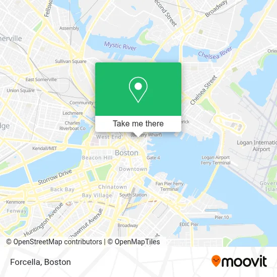
See Forcella, Boston, on the map
Public Transit to Forcella in Boston
Wondering how to get to Forcella in Boston? Moovit helps you find the best way to get to Forcella with step-by-step directions from the nearest public transit station.
Moovit provides free maps and live directions to help you navigate through your city. View schedules, routes, timetables, and find out how long does it take to get to Forcella in real time.
Looking for the nearest stop or station to Forcella? Check out this list of stops closest to your destination: North Station; Long Wharf (North) - Gate 5b; Long Wharf (North) - Gate 5a; N Washington St @ Cooper St; Aquarium - Surface Rd @ State St; Aquarium; Commercial St @ Battery St; Haymarket - Congress St @ Hanover St; Haymarket - Congress St Opp Hanover St; Congress St @ Haymarket Sta; Haymarket; Long Wharf North; Surface Rd @ Hanover St; Haymarket - Congress St @ New Sudbury St.
Bus: 111, 501, 92, 93, SL4, SL5, ORANGE LINE SHUTTLE, BLUE LINE SHUTTLE.Train: FAIRMOUNT, FITCHBURG, FRAMINGHAM/WORCESTER, HAVERHILL, NEEDHAM.Subway: GREEN LINE C, GREEN LINE D, GREEN LINE E, ORANGE LINE, BLUE LINE, GREEN LINE B.Ferry: EAST BOSTON FERRY.
Want to see if there’s another route that gets you there at an earlier time? Moovit helps you find alternative routes or times. Get directions from and directions to Forcella easily from the Moovit App or Website.
We make riding to Forcella easy, which is why over 1.7 million users, including users in Boston, trust Moovit as the best app for public transit. You don’t need to download an individual bus app or train app, Moovit is your all-in-one transit app that helps you find the best bus time or train time available.
For information on prices of subway, bus and train, costs and ride fares to Forcella, please check the Moovit app.
Use the app to navigate to popular places including to the airport, hospital, stadium, grocery store, mall, coffee shop, school, college, and university.
Forcella Address: 33 North Sq street in Boston
- Mariners House,
- Carmelina's,
- Google Maps,
- Trattoria Il Panino,
- Paul Revere House,
- Little Italy,
- Joseph J. Giovannani Square,
- Mike's Pastry,
- North St & Sun Court St,
- Caffe Paradiso (Cafe Paradiso),
- Modern Pastry Shop,
- Bricco,
- North Bennet Street School,
- North Street Grille,
- North End Rehabilitation And Healthcare Center,
- Bricco Suites,
- St. Leonard's Church,
- Saint Leonard of Port Maurice ,
- North End Rehab & Nursing Center,
- Post-Offer Physical Therapy
Places Near Forcella (Boston)
- Boston Convention & Exhibition Center, Boston,
- Castle Island, Boston,
- Museum Of Science, Boston,
- Wilbur Theatre, Boston,
- Seaport District, Boston,
- Quincy Market, Boston,
- House Of Blues, Boston,
- Cheers, Boston,
- Prudential Center, Boston,
- Massachusetts General Hospital, Boston,
- Isabella Stewart Gardner Museum, Boston,
- Boston Common, Boston,
- Boston Children's Hospital, Boston,
- North End, Boston,
- Td Garden, Boston,
- Wang Theater, Boston,
- Faneuil Hall, Boston,
- Mgm Music Hall, Boston,
- Boston Medical Center, Boston,
- Leader Bank Pavilion (Leader Bank Pavillion), Boston
How to get to popular places in Boston with public transit
Get around Boston by public transit!
Traveling around Boston has never been so easy. See step by step directions as you travel to any attraction, street or major public transit station. View bus and train schedules, arrival times, service alerts and detailed routes on a map, so you know exactly how to get to anywhere in Boston.
When traveling to any destination around Boston use Moovit's Live Directions with Get Off Notifications to know exactly where and how far to walk, how long to wait for your line, and how many stops are left. Moovit will alert you when it's time to get off — no need to constantly re-check whether yours is the next stop.
Wondering how to use public transit in Boston or how to pay for public transit in Boston? Moovit public transit app can help you navigate your way with public transit easily, and at minimum cost. It includes public transit fees, ticket prices, and costs. Looking for a map of Boston public transit lines? Moovit public transit app shows all public transit maps in Boston with all Bus, Train, Subway and Ferry routes and stops on an interactive map.
Boston has 4 transit type(s), including: Bus, Train, Subway and Ferry, operated by several transit agencies, including MBTA, Southeastern Regional Transit Authority, MetroWest Regional Transit Authority, Rhode Island Public Transit Authority, WRTA, Lowell Regional Transit Authority, Merrimack Valley Transit, Montachusett Regional Transit Authority, Cape Cod Regional Transit Authority, Brockton Area Transit Authority, Martha's Vineyard Transit Authority, the WAVE - Nantucket Regional Transit Authority, GATRA, Cape Ann Transportation Authority and Massport