Directions to Forge Homes (Boston) with public transportation
The following transit lines have routes that pass near Forge Homes
 Bus: 101, 109, 85, 89, 90.
- Subway: ORANGE LINE, GREEN LINE B, GREEN LINE C, GREEN LINE E, GREEN LINE D.
How to get to Forge Homes by bus?
Click on the bus route to see step by step directions with maps, line arrival times and updated time schedules.
From Spaulding Rehab, Boston
86 minFrom Lemuel Shattuck Hospital, Boston
77 minFrom Chestnut Hill, Boston
75 minFrom Stone Zoo, Stoneham
68 minFrom Codman Square, Boston
89 minFrom Revere, MA, Revere
45 minFrom Dorchester District Court, Boston
84 minFrom Ramada Boston, Boston
90 minFrom Ramada by Wyndham Boston, Boston
90 min
How to get to Forge Homes by subway?
Click on the subway route to see step by step directions with maps, line arrival times and updated time schedules.
Bus stops near Forge Homes in Boston
Subway stations near Forge Homes in Boston
Bus lines to Forge Homes in Boston
- 85, Ruggles,VIEW
- 89, Sullivan,VIEW
- 90, Assembly,VIEW
- 95, Arlington Center,VIEW
- 101, Malden,VIEW
- 89/93, Haymarket Via Sullivan,VIEW
- 91, Central Square,VIEW
- 92, Sullivan,VIEW
- 93, Sullivan Via Navy Yard,VIEW
- 105, Sullivan,VIEW
- 109, Linden Square Via Sullivan,VIEW
- GREEN LINE SHUTTLE, Sullivan Square (Shuttle),VIEW
- ORANGE LINE SHUTTLE, State (Shuttle),VIEW
- ORANGE LINE SHUTTLE, North Station (Local Shuttle),VIEW
- ORANGE LINE SHUTTLE, Wellington (Local Shuttle),VIEW
- LOWER MYSTIC LINK, Market Basket/Chelsea Station,VIEW
What are the closest stations to Forge Homes?
The closest stations to Forge Homes are:
- Broadway @ Mt Vernon St is 149 yards away, 2 min walk.
- Sullivan Square is 280 yards away, 4 min walk.
- Sullivan Square Station is 372 yards away, 5 min walk.
- East Somerville Station is 901 yards away, 11 min walk.
- Community Collge is 1270 yards away, 16 min walk.
- Lechmere is 1834 yards away, 22 min walk.
Which bus lines stop near Forge Homes?
These bus lines stop near Forge Homes: 101, 109, 85.
Which subway line stops near Forge Homes?
ORANGE LINE (Oak Grove)
What’s the nearest subway station to Forge Homes in Boston?
The nearest subway station to Forge Homes in Boston is East Somerville Station. It’s a 11 min walk away.
What’s the nearest bus station to Forge Homes in Boston?
The nearest bus station to Forge Homes in Boston is Broadway @ Mt Vernon St. It’s a 2 min walk away.
What time is the first subway to Forge Homes in Boston?
The GREEN LINE E is the first subway that goes to Forge Homes in Boston. It stops nearby at 4:49 AM.
What time is the last subway to Forge Homes in Boston?
The GREEN LINE E is the last subway that goes to Forge Homes in Boston. It stops nearby at 2:34 AM.
What time is the first bus to Forge Homes in Boston?
The 89/93 is the first bus that goes to Forge Homes in Boston. It stops nearby at 4:43 AM.
What time is the last bus to Forge Homes in Boston?
The 89 is the last bus that goes to Forge Homes in Boston. It stops nearby at 1:52 AM.
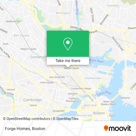
See Forge Homes, Boston, on the map
Public Transit to Forge Homes in Boston
Wondering how to get to Forge Homes in Boston? Moovit helps you find the best way to get to Forge Homes with step-by-step directions from the nearest public transit station.
Moovit provides free maps and live directions to help you navigate through your city. View schedules, routes, timetables, and find out how long does it take to get to Forge Homes in real time.
Looking for the nearest stop or station to Forge Homes? Check out this list of stops closest to your destination: Broadway @ Mt Vernon St; Sullivan Square; Sullivan Square Station; East Somerville Station; Community Collge; Lechmere.
Bus: 101, 109, 85, 89, 90, 95, 91, 92, 93, 105, LOWER MYSTIC LINK.Subway: ORANGE LINE, GREEN LINE B, GREEN LINE C, GREEN LINE E, GREEN LINE D.
Want to see if there’s another route that gets you there at an earlier time? Moovit helps you find alternative routes or times. Get directions from and directions to Forge Homes easily from the Moovit App or Website.
We make riding to Forge Homes easy, which is why over 1.7 million users, including users in Boston, trust Moovit as the best app for public transit. You don’t need to download an individual bus app or train app, Moovit is your all-in-one transit app that helps you find the best bus time or train time available.
For information on prices of bus, subway and ferry, costs and ride fares to Forge Homes, please check the Moovit app.
Use the app to navigate to popular places including to the airport, hospital, stadium, grocery store, mall, coffee shop, school, college, and university.
Forge Homes Address: 27 Parker St street in Boston
- Standard Parking,
- Crimson Charlestown,
- Perkins St / Mt Pleasant St,
- Bombay Brunch,
- Perkins St / Mt Vernon St,
- NXFX Web Design,
- Bunker Hill Bridge,
- MBTA Sullivan Square Station,
- Sullivan Station - Upper Busway,
- MBTA Commuter Rail, Rockport Line,
- Schrafft's Center Shuttle,
- Somerville No Touch Car Wash,
- Holiday Inn Boston Bunker Hill an IHG Hotel Somerville,
- 15 Mt Pleasant St Parking,
- Netblazr,
- Igreja Batista Lagoinha - Boston,
- American Restaurant in Somerville Ma,
- Threading Services Center,
- Bonita Hair Salon,
- Sky Vault Investment
Places Near Forge Homes (Boston)
- North End, Boston,
- Mgm Music Hall, Boston,
- Isabella Stewart Gardner Museum, Boston,
- Boston Common, Boston,
- Boston Medical Center, Boston,
- Boston Convention & Exhibition Center, Boston,
- Faneuil Hall, Boston,
- Wang Theater, Boston,
- Castle Island, Boston,
- Prudential Center, Boston,
- Massachusetts General Hospital, Boston,
- House Of Blues, Boston,
- Museum Of Science, Boston,
- Leader Bank Pavilion (Leader Bank Pavillion), Boston,
- Quincy Market, Boston,
- Wilbur Theatre, Boston,
- Cheers, Boston,
- Seaport District, Boston,
- Boston Children's Hospital, Boston,
- Td Garden, Boston
How to get to popular places in Boston with public transit
Get around Boston by public transit!
Traveling around Boston has never been so easy. See step by step directions as you travel to any attraction, street or major public transit station. View bus and train schedules, arrival times, service alerts and detailed routes on a map, so you know exactly how to get to anywhere in Boston.
When traveling to any destination around Boston use Moovit's Live Directions with Get Off Notifications to know exactly where and how far to walk, how long to wait for your line, and how many stops are left. Moovit will alert you when it's time to get off — no need to constantly re-check whether yours is the next stop.
Wondering how to use public transit in Boston or how to pay for public transit in Boston? Moovit public transit app can help you navigate your way with public transit easily, and at minimum cost. It includes public transit fees, ticket prices, and costs. Looking for a map of Boston public transit lines? Moovit public transit app shows all public transit maps in Boston with all Bus, Train, Subway and Ferry routes and stops on an interactive map.
Boston has 4 transit type(s), including: Bus, Train, Subway and Ferry, operated by several transit agencies, including MBTA, Southeastern Regional Transit Authority, MetroWest Regional Transit Authority, Rhode Island Public Transit Authority, WRTA, Lowell Regional Transit Authority, Merrimack Valley Transit, Montachusett Regional Transit Authority, Cape Cod Regional Transit Authority, Brockton Area Transit Authority, Martha's Vineyard Transit Authority, the WAVE - Nantucket Regional Transit Authority, GATRA, Cape Ann Transportation Authority and Massport