Directions to Forsyth Institute (Boston) with public transportation
The following transit lines have routes that pass near Forsyth Institute
 Bus: 57, 501, 64.
- Train: FRAMINGHAM/WORCESTER.
- Subway: GREEN LINE B.
How to get to Forsyth Institute by bus?
Click on the bus route to see step by step directions with maps, line arrival times and updated time schedules.
From Prudential Center South Garden, Boston
26 minFrom South Boston Waterfront, Boston
57 minFrom The Capital Grille, Boston
30 minFrom Seaport Boston Hotel, Boston
58 minFrom 200 Seaport Blvd, Boston
55 minFrom Chevalier Theatre (Chevalier Theater Show Line), Medford
75 minFrom Christian Science Plaza, Boston
33 minFrom 240 Mount Vernon Street, Boston
85 minFrom Copley House, Boston
29 minFrom Downeast Cider House, Boston
80 min
How to get to Forsyth Institute by train?
Click on the train route to see step by step directions with maps, line arrival times and updated time schedules.
From Prudential Center South Garden, Boston
57 minFrom South Boston Waterfront, Boston
70 minFrom The Capital Grille, Boston
63 minFrom Seaport Boston Hotel, Boston
72 minFrom 200 Seaport Blvd, Boston
72 minFrom Christian Science Plaza, Boston
64 minFrom 240 Mount Vernon Street, Boston
81 minFrom Copley House, Boston
57 min
How to get to Forsyth Institute by subway?
Click on the subway route to see step by step directions with maps, line arrival times and updated time schedules.
From Prudential Center South Garden, Boston
65 minFrom South Boston Waterfront, Boston
89 minFrom The Capital Grille, Boston
59 minFrom Seaport Boston Hotel, Boston
90 minFrom 200 Seaport Blvd, Boston
90 minFrom Chevalier Theatre (Chevalier Theater Show Line), Medford
114 minFrom Christian Science Plaza, Boston
63 minFrom 240 Mount Vernon Street, Boston
85 minFrom Copley House, Boston
66 min
Bus stops near Forsyth Institute in Boston
Subway station near Forsyth Institute in Boston
- Sutherland Road, 16 min walk,VIEW
Bus lines to Forsyth Institute in Boston
What are the closest stations to Forsyth Institute?
The closest stations to Forsyth Institute are:
- Tremont St @ Washington St is 168 yards away, 3 min walk.
- Faneuil St @ Bigelow St is 220 yards away, 3 min walk.
- Sutherland Road is 1275 yards away, 16 min walk.
Which bus line stops near Forsyth Institute?
57 (Kenmore)
Which train line stops near Forsyth Institute?
FRAMINGHAM/WORCESTER (#521 | Worcester)
Which subway line stops near Forsyth Institute?
GREEN LINE B (Boston College)
What’s the nearest subway station to Forsyth Institute in Boston?
The nearest subway station to Forsyth Institute in Boston is Sutherland Road. It’s a 16 min walk away.
What’s the nearest bus station to Forsyth Institute in Boston?
The nearest bus stations to Forsyth Institute in Boston are Tremont St @ Washington St and Faneuil St @ Bigelow St. The closest one is a 3 min walk away.
What time is the first subway to Forsyth Institute in Boston?
The GREEN LINE B is the first subway that goes to Forsyth Institute in Boston. It stops nearby at 5:01 AM.
What time is the last subway to Forsyth Institute in Boston?
The GREEN LINE B is the last subway that goes to Forsyth Institute in Boston. It stops nearby at 2:39 AM.
What time is the first bus to Forsyth Institute in Boston?
The 57 is the first bus that goes to Forsyth Institute in Boston. It stops nearby at 4:34 AM.
What time is the last bus to Forsyth Institute in Boston?
The 57 is the last bus that goes to Forsyth Institute in Boston. It stops nearby at 2:30 AM.
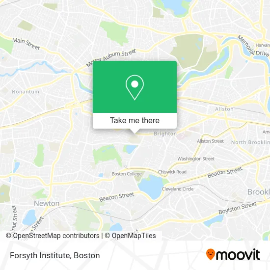
See Forsyth Institute, Boston, on the map
Public Transit to Forsyth Institute in Boston
Wondering how to get to Forsyth Institute in Boston? Moovit helps you find the best way to get to Forsyth Institute with step-by-step directions from the nearest public transit station.
Moovit provides free maps and live directions to help you navigate through your city. View schedules, routes, timetables, and find out how long does it take to get to Forsyth Institute in real time.
Looking for the nearest stop or station to Forsyth Institute? Check out this list of stops closest to your destination: Tremont St @ Washington St; Faneuil St @ Bigelow St; Sutherland Road.
Bus: 57, 501, 64.Train: FRAMINGHAM/WORCESTER.Subway: GREEN LINE B.
Want to see if there’s another route that gets you there at an earlier time? Moovit helps you find alternative routes or times. Get directions from and directions to Forsyth Institute easily from the Moovit App or Website.
We make riding to Forsyth Institute easy, which is why over 1.7 million users, including users in Boston, trust Moovit as the best app for public transit. You don’t need to download an individual bus app or train app, Moovit is your all-in-one transit app that helps you find the best bus time or train time available.
For information on prices of bus, subway and train, costs and ride fares to Forsyth Institute, please check the Moovit app.
Use the app to navigate to popular places including to the airport, hospital, stadium, grocery store, mall, coffee shop, school, college, and university.
Forsyth Institute Address: 245 1st St street in Boston
- MBTA Bus Route 57,
- Ef Boston,
- Washington St,
- EF laundry,
- EF Reception,
- Hult International Business,
- Walgreens,
- MBTA Bus Stop | Washington St (at Brock St),
- EvGateway,
- Park Center Plaza,
- MBTA Bus Stop | Oak Square,
- GNC,
- The Magical Forest,
- The Seminary of Our Lady of Providence,
- Master of Arts Ministry PRGRM for Lty,
- Blunt Kush-Weed Delivery,
- Beijing Taste,
- Rockland Trust,
- Flying Prince House Cleaning,
- Akhundlu
Places Near Forsyth Institute (Boston)
- Td Garden, Boston,
- Prudential Center, Boston,
- Boston Medical Center, Boston,
- Quincy Market, Boston,
- Boston Convention & Exhibition Center, Boston,
- Castle Island, Boston,
- Boston Children's Hospital, Boston,
- Faneuil Hall, Boston,
- Seaport District, Boston,
- Leader Bank Pavilion (Leader Bank Pavillion), Boston,
- North End, Boston,
- Mgm Music Hall, Boston,
- Cheers, Boston,
- Wang Theater, Boston,
- Isabella Stewart Gardner Museum, Boston,
- Boston Common, Boston,
- Wilbur Theatre, Boston,
- Massachusetts General Hospital, Boston,
- House Of Blues, Boston,
- Museum Of Science, Boston
How to get to popular places in Boston with public transit
Get around Boston by public transit!
Traveling around Boston has never been so easy. See step by step directions as you travel to any attraction, street or major public transit station. View bus and train schedules, arrival times, service alerts and detailed routes on a map, so you know exactly how to get to anywhere in Boston.
When traveling to any destination around Boston use Moovit's Live Directions with Get Off Notifications to know exactly where and how far to walk, how long to wait for your line, and how many stops are left. Moovit will alert you when it's time to get off — no need to constantly re-check whether yours is the next stop.
Wondering how to use public transit in Boston or how to pay for public transit in Boston? Moovit public transit app can help you navigate your way with public transit easily, and at minimum cost. It includes public transit fees, ticket prices, and costs. Looking for a map of Boston public transit lines? Moovit public transit app shows all public transit maps in Boston with all Bus, Train, Subway and Ferry routes and stops on an interactive map.
Boston has 4 transit type(s), including: Bus, Train, Subway and Ferry, operated by several transit agencies, including MBTA, Southeastern Regional Transit Authority, MetroWest Regional Transit Authority, Rhode Island Public Transit Authority, WRTA, Lowell Regional Transit Authority, Merrimack Valley Transit, Montachusett Regional Transit Authority, Cape Cod Regional Transit Authority, Brockton Area Transit Authority, Martha's Vineyard Transit Authority, the WAVE - Nantucket Regional Transit Authority, GATRA, Cape Ann Transportation Authority and Massport