See Franklin Canyon Park, Los Angeles, on the map
Directions to Franklin Canyon Park (Los Angeles) with public transportation
The following transit lines have routes that pass near Franklin Canyon Park
 Bus:
Bus:
How to get to Franklin Canyon Park by bus?
Click on the bus route to see step by step directions with maps, line arrival times and updated time schedules.
Bus stations near Franklin Canyon Park in Los Angeles
- Sunset / Alpine,39 min walk,
Bus lines to Franklin Canyon Park in Los Angeles
- 2,Expo Park / USC Station,
What are the closest stations to Franklin Canyon Park?
The closest stations to Franklin Canyon Park are:
- Sunset / Alpine is 3272 yards away, 39 min walk.
Which bus line stops near Franklin Canyon Park?
2/302
See Franklin Canyon Park, Los Angeles, on the map
Public Transit to Franklin Canyon Park in Los Angeles
Wondering how to get to Franklin Canyon Park in Los Angeles, United States? Moovit helps you find the best way to get to Franklin Canyon Park with step-by-step directions from the nearest public transit station.
Moovit provides free maps and live directions to help you navigate through your city. View schedules, routes, timetables, and find out how long does it take to get to Franklin Canyon Park in real time.
Looking for the nearest stop or station to Franklin Canyon Park? Check out this list of stops closest to your destination: Sunset / Alpine.
Bus:
Want to see if there’s another route that gets you there at an earlier time? Moovit helps you find alternative routes or times. Get directions from and directions to Franklin Canyon Park easily from the Moovit App or Website.
We make riding to Franklin Canyon Park easy, which is why over 1.5 million users, including users in Los Angeles, trust Moovit as the best app for public transit. You don’t need to download an individual bus app or train app, Moovit is your all-in-one transit app that helps you find the best bus time or train time available.
For information on prices of bus, costs and ride fares to Franklin Canyon Park, please check the Moovit app.
Use the app to navigate to popular places including to the airport, hospital, stadium, grocery store, mall, coffee shop, school, college, and university.
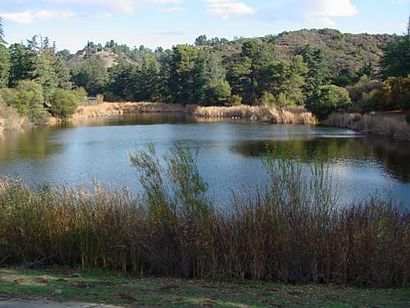
Franklin Canyon Park Address: Franklin Canyon Dr street in Los Angeles
Attractions near Franklin Canyon Park
Never Never Land,Hastain Trail,Stan Place,Norman B Levy, MD,San Cir,50 Beverly Park Way,The Robert Thorne Company,Magers' Balcony,The Vineyard Beverly Hills,8500 Beverly Grove Drive,Heather and Sons Photography,Beverly Grove Dr,Cabrillo Dr,The Top Of Beverly Hills,Anthony Pl,Beverly Estate Drive,Coldwater Canyon Dr,Soodi & Roy,8500 Beverlycrest Drive,Santa Monica OceanviewHow to get to popular attractions in Los Angeles with public transit
Sawtelle / Little Japantown, Sawtelle, La,Fry's Electronics, Anaheim,City of West Hollywood, West Hollywood,Torrance, CA, Torrance,Galleria at Tyler, Riverside,Katella Cast Member Parking Lot (K-Lot), Anaheim,Hyatt Regency Orange County, Garden Grove,Paradise Pier, Anaheim,85°C Bakery Cafe, Irvine,Temecula Promenade Mall, Temecula,Indiana Jones Adventure, Anaheim,In-N-Out Burger, Palms, La,Diamond Bar, CA, Diamond Bar,Toy Story Parking Lot, Anaheim,Diamond Jamboree Shopping Center, Irvine,Apple South Coast Plaza, Costa Mesa,Pomona, CA, Pomona,The NOVO by Microsoft, Downtown, La,The Little Mermaid ~ Ariel's Undersea Adventure, Anaheim,The Water Garden, Santa MonicaGet around Los Angeles by public transit!
Traveling around Los Angeles has never been so easy. See step by step directions as you travel to any attraction, street or major public transit station. View bus and train schedules, arrival times, service alerts and detailed routes on a map, so you know exactly how to get to anywhere in Los Angeles.
When traveling to any destination around Los Angeles use Moovit's Live Directions with Get Off Notifications to know exactly where and how far to walk, how long to wait for your line, and how many stops are left. Moovit will alert you when it's time to get off — no need to constantly re-check whether yours is the next stop.
Wondering how to use public transit in Los Angeles or how to pay for public transit in Los Angeles? Moovit public transit app can help you navigate your way with public transit easily, and at minimum cost. It includes public transit fees, ticket prices, and costs. Looking for a map of Los Angeles public transit lines? Moovit public transit app shows all public transit maps in Los Angeles with all bus routes and stops on an interactive map.
Los Angeles has 1 transit type(s), including: bus, operated by several transit agencies, including Metro - Los Angeles, Metro - Los Angeles, Metrolink Trains, METRO, Long Beach Transit, LADOT, OCTA, Foothill Transit, Big Blue Bus, Riverside Transit Agency, LAX FlyAway, Airporter Shuttle, Playa Vista Shuttle, Amtrak and OMNITRANS