Directions to Franklin Park Shattuck Side (Boston) with public transportation
The following transit lines have routes that pass near Franklin Park Shattuck Side
 Bus: 16, 21, 31, 42, 32.
- Train: NEEDHAM, FAIRMOUNT, FRANKLIN/FOXBORO, PROVIDENCE/STOUGHTON.
- Subway: ORANGE LINE.
How to get to Franklin Park Shattuck Side by bus?
Click on the bus route to see step by step directions with maps, line arrival times and updated time schedules.
From Rental Car Center - Logan Airport, Boston
83 minFrom crown Colony Shuttle, Quincy
72 minFrom Downeast Cider House, Boston
112 minFrom Citizenm Boston North Station, Boston
67 minFrom One Financial Center, Boston
54 minFrom Legal Sea Foods, Boston
68 minFrom East Boston, Boston
84 minFrom One International Place, Boston
68 minFrom Theatre District, Boston
48 minFrom Boston Logan International Airport (Bos), Boston
55 min
How to get to Franklin Park Shattuck Side by train?
Click on the train route to see step by step directions with maps, line arrival times and updated time schedules.
How to get to Franklin Park Shattuck Side by subway?
Click on the subway route to see step by step directions with maps, line arrival times and updated time schedules.
From Rental Car Center - Logan Airport, Boston
45 minFrom crown Colony Shuttle, Quincy
78 minFrom Citizenm Boston North Station, Boston
42 minFrom One Financial Center, Boston
41 minFrom Legal Sea Foods, Boston
41 minFrom East Boston, Boston
44 minFrom One International Place, Boston
42 minFrom Boston Logan International Airport (Bos), Boston
68 minFrom Theatre District, Boston
36 min
Bus stops near Franklin Park Shattuck Side in Boston
Subway station near Franklin Park Shattuck Side in Boston
- Stony Brook, 7 min walk,VIEW
Train stations near Franklin Park Shattuck Side in Boston
Bus lines to Franklin Park Shattuck Side in Boston
What are the closest stations to Franklin Park Shattuck Side?
The closest stations to Franklin Park Shattuck Side are:
- Circuit Dr @ Shattuck Hospital is 178 yards away, 3 min walk.
- Morton St @ Shattuck Hospital is 243 yards away, 3 min walk.
- Circuit Dr Opp Shattuck Hospital is 252 yards away, 4 min walk.
- Stony Brook is 525 yards away, 7 min walk.
- Washington St @ Williams St is 1208 yards away, 15 min walk.
- Talbot Avenue is 1409 yards away, 17 min walk.
- Four Corners/Geneva is 1888 yards away, 23 min walk.
- Forest Hills is 2067 yards away, 25 min walk.
Which bus lines stop near Franklin Park Shattuck Side?
These bus lines stop near Franklin Park Shattuck Side: 16, 21, 31, 42.
Which train line stops near Franklin Park Shattuck Side?
NEEDHAM (#625 | Needham Heights)
Which subway line stops near Franklin Park Shattuck Side?
ORANGE LINE (Forest Hills)
What’s the nearest subway station to Franklin Park Shattuck Side in Boston?
The nearest subway station to Franklin Park Shattuck Side in Boston is Stony Brook. It’s a 7 min walk away.
What’s the nearest train station to Franklin Park Shattuck Side in Boston?
The nearest train station to Franklin Park Shattuck Side in Boston is Talbot Avenue. It’s a 17 min walk away.
What’s the nearest bus station to Franklin Park Shattuck Side in Boston?
The nearest bus stations to Franklin Park Shattuck Side in Boston are Circuit Dr @ Shattuck Hospital and Morton St @ Shattuck Hospital. The closest one is a 3 min walk away.
What time is the first subway to Franklin Park Shattuck Side in Boston?
The ORANGE LINE is the first subway that goes to Franklin Park Shattuck Side in Boston. It stops nearby at 5:15 AM.
What time is the last subway to Franklin Park Shattuck Side in Boston?
The ORANGE LINE is the last subway that goes to Franklin Park Shattuck Side in Boston. It stops nearby at 1:58 AM.
What time is the first train to Franklin Park Shattuck Side in Boston?
The FAIRMOUNT is the first train that goes to Franklin Park Shattuck Side in Boston. It stops nearby at 4:41 AM.
What time is the last train to Franklin Park Shattuck Side in Boston?
The PROVIDENCE/STOUGHTON is the last train that goes to Franklin Park Shattuck Side in Boston. It stops nearby at 12:08 AM.
What time is the first bus to Franklin Park Shattuck Side in Boston?
The 31 is the first bus that goes to Franklin Park Shattuck Side in Boston. It stops nearby at 4:30 AM.
What time is the last bus to Franklin Park Shattuck Side in Boston?
The 16 is the last bus that goes to Franklin Park Shattuck Side in Boston. It stops nearby at 1:39 AM.
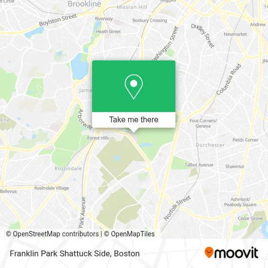
See Franklin Park Shattuck Side, Boston, on the map
Public Transit to Franklin Park Shattuck Side in Boston
Wondering how to get to Franklin Park Shattuck Side in Boston? Moovit helps you find the best way to get to Franklin Park Shattuck Side with step-by-step directions from the nearest public transit station.
Moovit provides free maps and live directions to help you navigate through your city. View schedules, routes, timetables, and find out how long does it take to get to Franklin Park Shattuck Side in real time.
Looking for the nearest stop or station to Franklin Park Shattuck Side? Check out this list of stops closest to your destination: Circuit Dr @ Shattuck Hospital; Morton St @ Shattuck Hospital; Circuit Dr Opp Shattuck Hospital; Stony Brook; Washington St @ Williams St; Talbot Avenue; Four Corners/Geneva; Forest Hills.
Bus: 16, 21, 31, 42, 32, 34, 36.Train: NEEDHAM, FAIRMOUNT, FRANKLIN/FOXBORO, PROVIDENCE/STOUGHTON.Subway: ORANGE LINE.
Want to see if there’s another route that gets you there at an earlier time? Moovit helps you find alternative routes or times. Get directions from and directions to Franklin Park Shattuck Side easily from the Moovit App or Website.
We make riding to Franklin Park Shattuck Side easy, which is why over 1.7 million users, including users in Boston, trust Moovit as the best app for public transit. You don’t need to download an individual bus app or train app, Moovit is your all-in-one transit app that helps you find the best bus time or train time available.
For information on prices of bus, subway and train, costs and ride fares to Franklin Park Shattuck Side, please check the Moovit app.
Use the app to navigate to popular places including to the airport, hospital, stadium, grocery store, mall, coffee shop, school, college, and university.
Franklin Park Shattuck Side Address: Franklin Park Shattuck Side street in Boston
- Lemuel Shattuck Hospital Correctional Unit,
- Franklin Field,
- Pine Street Inn,
- Lemuel Shattuck Hospital,
- Franklin Park - The 99 Steps and Ellicott Arch,
- Franklin Park Villa Co-Op Apartments,
- Bicon Dental Implants,
- Sound Energy,
- Death And the Sculptor,
- Match Middle School (Match Charter Public School),
- Crematory,
- Forest Hills Cemetery,
- Blonde on the Run Catering,
- Jrf Corporation,
- MBTA Arborway Bus Garage,
- City on A Hill Church,
- West Roxbury District Court,
- West Roxbury-Boston Municipal Court ,
- West Roxbury Division - Boston Municipal Court,
- West Roxbury Courthouse
Places Near Franklin Park Shattuck Side (Boston)
- Quincy Market, Boston,
- Boston Convention & Exhibition Center, Boston,
- Wilbur Theatre, Boston,
- Cheers, Boston,
- Leader Bank Pavilion (Leader Bank Pavillion), Boston,
- Boston Children's Hospital, Boston,
- Museum Of Science, Boston,
- Boston Common, Boston,
- North End, Boston,
- Prudential Center, Boston,
- Td Garden, Boston,
- Boston Medical Center, Boston,
- Isabella Stewart Gardner Museum, Boston,
- Castle Island, Boston,
- House Of Blues, Boston,
- Faneuil Hall, Boston,
- Seaport District, Boston,
- Wang Theater, Boston,
- Mgm Music Hall, Boston,
- Massachusetts General Hospital, Boston
How to get to popular places in Boston with public transit
Get around Boston by public transit!
Traveling around Boston has never been so easy. See step by step directions as you travel to any attraction, street or major public transit station. View bus and train schedules, arrival times, service alerts and detailed routes on a map, so you know exactly how to get to anywhere in Boston.
When traveling to any destination around Boston use Moovit's Live Directions with Get Off Notifications to know exactly where and how far to walk, how long to wait for your line, and how many stops are left. Moovit will alert you when it's time to get off — no need to constantly re-check whether yours is the next stop.
Wondering how to use public transit in Boston or how to pay for public transit in Boston? Moovit public transit app can help you navigate your way with public transit easily, and at minimum cost. It includes public transit fees, ticket prices, and costs. Looking for a map of Boston public transit lines? Moovit public transit app shows all public transit maps in Boston with all Bus, Train, Subway and Ferry routes and stops on an interactive map.
Boston has 4 transit type(s), including: Bus, Train, Subway and Ferry, operated by several transit agencies, including MBTA, Southeastern Regional Transit Authority, MetroWest Regional Transit Authority, Rhode Island Public Transit Authority, WRTA, Lowell Regional Transit Authority, Merrimack Valley Transit, Montachusett Regional Transit Authority, Cape Cod Regional Transit Authority, Brockton Area Transit Authority, Martha's Vineyard Transit Authority, the WAVE - Nantucket Regional Transit Authority, GATRA, Cape Ann Transportation Authority and Massport