Directions to Fuel 77 (Lynn) with public transportation
The following transit lines have routes that pass near Fuel 77
 Bus: 426, 436, 441, 442, 455.
- Train: NEWBURYPORT/ROCKPORT.
- Ferry: LYNN FERRY.
How to get to Fuel 77 by bus?
Click on the bus route to see step by step directions with maps, line arrival times and updated time schedules.
How to get to Fuel 77 by train?
Click on the train route to see step by step directions with maps, line arrival times and updated time schedules.
Bus stops near Fuel 77 in Lynn
Ferry station near Fuel 77 in Lynn
- Blossom Street Pier, 19 min walk,VIEW
Train station near Fuel 77 in Lynn
- Swampscott, 25 min walk,VIEW
Bus lines to Fuel 77 in Lynn
- 441, Wonderland Via Paradise Rd & Central Square,VIEW
- 442, West Lynn Garage Via Central Square & Humphrey St,VIEW
- 441/442, Ocean St Via Central Square,VIEW
- 436, Central Square via Malls & Lynnfield St - Liberty Tree via North Shore Mall & Lynnfield St,VIEW
- 455, Wonderland via Central Square - Salem Depot via Central Square,VIEW
- 456, Central Square - Salem Depot,VIEW
- 429, Kings Lynn,VIEW
- 439, Nahant,VIEW
- 426, Haymarket Via Cliftondale,VIEW
- 435, Central Square Via Malls,VIEW
- NEWBURYPORT LINE SHUTTLE, Oak Grove (Local Shuttle),VIEW
- NEWBURYPORT/ROCKPORT LINE SHUTTLE, Swampscott (Shuttle),VIEW
- NEWBURYPORT/ROCKPORT LINE SHUTTLE, Beverly (Shuttle),VIEW
What are the closest stations to Fuel 77?
The closest stations to Fuel 77 are:
- Broad St @ Silsbee St is 95 yards away, 2 min walk.
- Union St @ Pinkham St is 178 yards away, 3 min walk.
- Oxford St @ Market St is 253 yards away, 3 min walk.
- Nahant St @ W Baltimore St is 272 yards away, 4 min walk.
- Market St @ Commuter Rail is 344 yards away, 5 min walk.
- Market Street @ Lynn Commuter Rail is 396 yards away, 5 min walk.
- Blossom Street Pier is 1569 yards away, 19 min walk.
- Swampscott is 2098 yards away, 25 min walk.
Which bus lines stop near Fuel 77?
These bus lines stop near Fuel 77: 426, 436, 441, 442, 455.
Which train line stops near Fuel 77?
NEWBURYPORT/ROCKPORT (#125 | Newburyport)
What’s the nearest train station to Fuel 77 in Lynn?
The nearest train station to Fuel 77 in Lynn is Swampscott. It’s a 25 min walk away.
What’s the nearest bus station to Fuel 77 in Lynn?
The nearest bus station to Fuel 77 in Lynn is Broad St @ Silsbee St. It’s a 2 min walk away.
What’s the nearest ferry station to Fuel 77 in Lynn?
The nearest ferry station to Fuel 77 in Lynn is Blossom Street Pier. It’s a 19 min walk away.
What time is the first train to Fuel 77 in Lynn?
The NEWBURYPORT/ROCKPORT is the first train that goes to Fuel 77 in Lynn. It stops nearby at 5:27 AM.
What time is the last train to Fuel 77 in Lynn?
The NEWBURYPORT/ROCKPORT is the last train that goes to Fuel 77 in Lynn. It stops nearby at 12:20 AM.
What time is the first bus to Fuel 77 in Lynn?
The 455 is the first bus that goes to Fuel 77 in Lynn. It stops nearby at 4:45 AM.
What time is the last bus to Fuel 77 in Lynn?
The 426 is the last bus that goes to Fuel 77 in Lynn. It stops nearby at 1:46 AM.
What time is the first ferry to Fuel 77 in Lynn?
The LYNN FERRY is the first ferry that goes to Fuel 77 in Lynn. It stops nearby at 6:00 AM.
What time is the last ferry to Fuel 77 in Lynn?
The LYNN FERRY is the last ferry that goes to Fuel 77 in Lynn. It stops nearby at 7:55 PM.
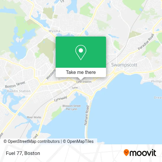
See Fuel 77, Lynn, on the map
Public Transit to Fuel 77 in Lynn
Wondering how to get to Fuel 77 in Lynn? Moovit helps you find the best way to get to Fuel 77 with step-by-step directions from the nearest public transit station.
Moovit provides free maps and live directions to help you navigate through your city. View schedules, routes, timetables, and find out how long does it take to get to Fuel 77 in real time.
Looking for the nearest stop or station to Fuel 77? Check out this list of stops closest to your destination: Broad St @ Silsbee St; Union St @ Pinkham St; Oxford St @ Market St; Nahant St @ W Baltimore St; Market St @ Commuter Rail; Market Street @ Lynn Commuter Rail; Blossom Street Pier; Swampscott.
Bus: 426, 436, 441, 442, 455, 441/442, 456, 429, 439.Train: NEWBURYPORT/ROCKPORT.Ferry: LYNN FERRY.
Want to see if there’s another route that gets you there at an earlier time? Moovit helps you find alternative routes or times. Get directions from and directions to Fuel 77 easily from the Moovit App or Website.
We make riding to Fuel 77 easy, which is why over 1.7 million users, including users in Lynn, trust Moovit as the best app for public transit. You don’t need to download an individual bus app or train app, Moovit is your all-in-one transit app that helps you find the best bus time or train time available.
For information on prices of bus, train and subway, costs and ride fares to Fuel 77, please check the Moovit app.
Use the app to navigate to popular places including to the airport, hospital, stadium, grocery store, mall, coffee shop, school, college, and university.
Fuel 77 Address: 301 Mount Vernon St street in Lynn
- 24 Mount Vernon Apartments,
- Beyond Walls,
- National Fire Escape Association,
- Mt Vernon Shops - Central Sq Business Depot,
- Cubatodo,
- Brazilian Top Team Lynn,
- Cvs Beauty,
- East Coast Karate,
- Sin City Superette,
- Lysoa,
- Osmin Construction And Carpentry Inc,
- North Shore Music Center,
- Sokharith Mey MD,
- Lynn Primary Care Center,
- Lynn Concrete Contractor,
- The Studios at Lynn Museum & Arts Center (Lynnarts),
- Psychiatric Associates,
- Precision Insurance,
- Family Day Care,
- USPS Collection Box - Blue Box
Places Near Fuel 77 (Lynn)
- Boston Medical Center, Boston,
- North End, Boston,
- Seaport District, Boston,
- House Of Blues, Boston,
- Cheers, Boston,
- Castle Island, Boston,
- Wang Theater, Boston,
- Isabella Stewart Gardner Museum, Boston,
- Quincy Market, Boston,
- Wilbur Theatre, Boston,
- Massachusetts General Hospital, Boston,
- Td Garden, Boston,
- Boston Children's Hospital, Boston,
- Leader Bank Pavilion (Leader Bank Pavillion), Boston,
- Faneuil Hall, Boston,
- Museum Of Science, Boston,
- Boston Convention & Exhibition Center, Boston,
- Boston Common, Boston,
- Prudential Center, Boston,
- Mgm Music Hall, Boston
How to get to popular places in Boston with public transit
Get around Lynn by public transit!
Traveling around Lynn has never been so easy. See step by step directions as you travel to any attraction, street or major public transit station. View bus and train schedules, arrival times, service alerts and detailed routes on a map, so you know exactly how to get to anywhere in Lynn.
When traveling to any destination around Lynn use Moovit's Live Directions with Get Off Notifications to know exactly where and how far to walk, how long to wait for your line, and how many stops are left. Moovit will alert you when it's time to get off — no need to constantly re-check whether yours is the next stop.
Wondering how to use public transit in Lynn or how to pay for public transit in Lynn? Moovit public transit app can help you navigate your way with public transit easily, and at minimum cost. It includes public transit fees, ticket prices, and costs. Looking for a map of Lynn public transit lines? Moovit public transit app shows all public transit maps in Lynn with all Bus, Train, Subway and Ferry routes and stops on an interactive map.
Boston has 4 transit type(s), including: Bus, Train, Subway and Ferry, operated by several transit agencies, including MBTA, Southeastern Regional Transit Authority, MetroWest Regional Transit Authority, Rhode Island Public Transit Authority, WRTA, Lowell Regional Transit Authority, Merrimack Valley Transit, Montachusett Regional Transit Authority, Cape Cod Regional Transit Authority, Brockton Area Transit Authority, Martha's Vineyard Transit Authority, the WAVE - Nantucket Regional Transit Authority, GATRA, Cape Ann Transportation Authority and Massport