Directions to Functional Music Training (Cambridge) with public transportation
The following transit lines have routes that pass near Functional Music Training
 Bus: 1, 47, 70, 91, RED LINE SHUTTLE.
- Train: FRAMINGHAM/WORCESTER, HAVERHILL, NEEDHAM.
- Subway: RED LINE, GREEN LINE B.
How to get to Functional Music Training by bus?
Click on the bus route to see step by step directions with maps, line arrival times and updated time schedules.
From Ramada Boston, Boston
83 minFrom Arnold Arboretum, Boston
66 minFrom Market Basket, Revere
99 minFrom Four Points by Sheraton Boston Logan Airport, Revere
100 minFrom Bentley University, Waltham
79 minFrom Courtyard South Boston (COURTYARD by Marriott), Boston
52 minFrom Boda Borg, Malden
77 minFrom West Roxbury, Boston
74 minFrom Lower Mills, Boston
86 minFrom Hyatt Regency-Boston Harbor (Hyatt Harborside At Boston's Logan International Airport Hotel Boston), Boston
61 min
How to get to Functional Music Training by train?
Click on the train route to see step by step directions with maps, line arrival times and updated time schedules.
How to get to Functional Music Training by subway?
Click on the subway route to see step by step directions with maps, line arrival times and updated time schedules.
From Ramada Boston, Boston
54 minFrom Arnold Arboretum, Boston
47 minFrom Hyatt Regency-Boston Harbor (Hyatt Harborside At Boston's Logan International Airport Hotel Boston), Boston
55 minFrom Courtyard South Boston (COURTYARD by Marriott), Boston
30 minFrom Boda Borg, Malden
40 minFrom Lower Mills, Boston
50 min
Subway stations near Functional Music Training in Cambridge
Bus stops near Functional Music Training in Cambridge
Bus lines to Functional Music Training in Cambridge
- 47, Broadway,VIEW
- 70, Central Square,VIEW
- 1, Harvard,VIEW
- RED LINE SHUTTLE, Kendall/MIT (Loop Shuttle),VIEW
- RED LINE SHUTTLE, Harvard (Shuttle),VIEW
- RED LINE SHUTTLE, Jfk/Umass (Shuttle),VIEW
- RED LINE SHUTTLE, Park Street (Shuttle),VIEW
- RED LINE SHUTTLE, Alewife (Shuttle),VIEW
- RED LINE SHUTTLE, Alewife (Local Shuttle),VIEW
- EZRIDE, Outbound North Station To Erie St Via Lechmere And Kendall,VIEW
- EZRIDE, Inbound To North Station From Erie St,VIEW
- EZRIDE, Outbound To Erie St From North Station,VIEW
- EZRIDE, Inbound To North Station Via Kendall And Lechmere,VIEW
What are the closest stations to Functional Music Training?
The closest stations to Functional Music Training are:
- Kendall/MIT is 33 yards away, 1 min walk.
- Green St @ Pearl St is 120 yards away, 2 min walk.
- Massachusetts Ave @ Sidney St is 362 yards away, 5 min walk.
- Massachusetts Ave @ Prospect St is 385 yards away, 5 min walk.
- Central - Massachusetts Ave Opp Pearl St is 422 yards away, 5 min walk.
- Pacific St./Albany St. is 439 yards away, 6 min walk.
- Pacific St. is 538 yards away, 7 min walk.
- Blandford Street is 607 yards away, 8 min walk.
Which bus lines stop near Functional Music Training?
These bus lines stop near Functional Music Training: 1, 47, 70, 91.
Which train lines stop near Functional Music Training?
These train lines stop near Functional Music Training: FRAMINGHAM/WORCESTER, HAVERHILL, NEEDHAM.
Which subway line stops near Functional Music Training?
RED LINE (Alewife)
What’s the nearest subway station to Functional Music Training in Cambridge?
The nearest subway station to Functional Music Training in Cambridge is Kendall/MIT. It’s a 1 min walk away.
What’s the nearest bus station to Functional Music Training in Cambridge?
The nearest bus station to Functional Music Training in Cambridge is Green St @ Pearl St. It’s a 2 min walk away.
What time is the first subway to Functional Music Training in Cambridge?
The RED LINE is the first subway that goes to Functional Music Training in Cambridge. It stops nearby at 5:25 AM.
What time is the last subway to Functional Music Training in Cambridge?
The GREEN LINE B is the last subway that goes to Functional Music Training in Cambridge. It stops nearby at 2:15 AM.
What time is the first bus to Functional Music Training in Cambridge?
The 70 is the first bus that goes to Functional Music Training in Cambridge. It stops nearby at 4:25 AM.
What time is the last bus to Functional Music Training in Cambridge?
The 1 is the last bus that goes to Functional Music Training in Cambridge. It stops nearby at 2:30 AM.
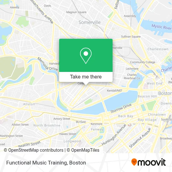
See Functional Music Training, Cambridge, on the map
Public Transit to Functional Music Training in Cambridge
Wondering how to get to Functional Music Training in Cambridge? Moovit helps you find the best way to get to Functional Music Training with step-by-step directions from the nearest public transit station.
Moovit provides free maps and live directions to help you navigate through your city. View schedules, routes, timetables, and find out how long does it take to get to Functional Music Training in real time.
Looking for the nearest stop or station to Functional Music Training? Check out this list of stops closest to your destination: Kendall/MIT; Green St @ Pearl St; Massachusetts Ave @ Sidney St; Massachusetts Ave @ Prospect St; Central - Massachusetts Ave Opp Pearl St; Pacific St./Albany St.; Pacific St.; Blandford Street.
Bus: 1, 47, 70, 91, RED LINE SHUTTLE, RED LINE SHUTTLE, RED LINE SHUTTLE, RED LINE SHUTTLE, RED LINE SHUTTLE, RED LINE SHUTTLE, RED LINE SHUTTLE, RED LINE SHUTTLE.Train: FRAMINGHAM/WORCESTER, HAVERHILL, NEEDHAM.Subway: RED LINE, GREEN LINE B.
Want to see if there’s another route that gets you there at an earlier time? Moovit helps you find alternative routes or times. Get directions from and directions to Functional Music Training easily from the Moovit App or Website.
We make riding to Functional Music Training easy, which is why over 1.7 million users, including users in Cambridge, trust Moovit as the best app for public transit. You don’t need to download an individual bus app or train app, Moovit is your all-in-one transit app that helps you find the best bus time or train time available.
For information on prices of bus, subway and train, costs and ride fares to Functional Music Training, please check the Moovit app.
Use the app to navigate to popular places including to the airport, hospital, stadium, grocery store, mall, coffee shop, school, college, and university.
Functional Music Training Address: 129 Franklin St street in Cambridge
- Central Square Theater (Underground Railway Theater),
- Central Square Theater,
- Sonia,
- Veggie Galaxy,
- The Middle East Downstairs,
- The Middle East Restaurant,
- Loft 23 - Residences at University Park,
- Embondeiro Capoeira Boston (Flamenco Boston),
- The Goodwill Store,
- University Park at MIT,
- Wing Chun Kung Fu Academy,
- Le Meridien Boston Cambridge,
- Goodwill,
- The Phoenix Landing,
- Little Donkey,
- Le Meridien Cambridge-Mit,
- University Park Commons,
- Blue Owl Rooftop Bar,
- Shalimar India Food & Spices (Shalimar of India),
- Wrca 1330 am Radio (Wrca-Wlyn Radio Station)
Places Near Functional Music Training (Cambridge)
- Boston Common, Boston,
- Faneuil Hall, Boston,
- Castle Island, Boston,
- Wilbur Theatre, Boston,
- Td Garden, Boston,
- Cheers, Boston,
- Boston Children's Hospital, Boston,
- Museum Of Science, Boston,
- Boston Convention & Exhibition Center, Boston,
- Prudential Center, Boston,
- Wang Theater, Boston,
- Isabella Stewart Gardner Museum, Boston,
- Seaport District, Boston,
- Mgm Music Hall, Boston,
- Massachusetts General Hospital, Boston,
- House Of Blues, Boston,
- North End, Boston,
- Leader Bank Pavilion (Leader Bank Pavillion), Boston,
- Boston Medical Center, Boston,
- Quincy Market, Boston
How to get to popular places in Boston with public transit
Get around Cambridge by public transit!
Traveling around Cambridge has never been so easy. See step by step directions as you travel to any attraction, street or major public transit station. View bus and train schedules, arrival times, service alerts and detailed routes on a map, so you know exactly how to get to anywhere in Cambridge.
When traveling to any destination around Cambridge use Moovit's Live Directions with Get Off Notifications to know exactly where and how far to walk, how long to wait for your line, and how many stops are left. Moovit will alert you when it's time to get off — no need to constantly re-check whether yours is the next stop.
Wondering how to use public transit in Cambridge or how to pay for public transit in Cambridge? Moovit public transit app can help you navigate your way with public transit easily, and at minimum cost. It includes public transit fees, ticket prices, and costs. Looking for a map of Cambridge public transit lines? Moovit public transit app shows all public transit maps in Cambridge with all Bus, Train, Subway and Ferry routes and stops on an interactive map.
Boston has 4 transit type(s), including: Bus, Train, Subway and Ferry, operated by several transit agencies, including MBTA, Southeastern Regional Transit Authority, MetroWest Regional Transit Authority, Rhode Island Public Transit Authority, WRTA, Lowell Regional Transit Authority, Merrimack Valley Transit, Montachusett Regional Transit Authority, Cape Cod Regional Transit Authority, Brockton Area Transit Authority, Martha's Vineyard Transit Authority, the WAVE - Nantucket Regional Transit Authority, GATRA, Cape Ann Transportation Authority and Massport