Directions to GUS & Ruby (Boston) with public transportation
The following transit lines have routes that pass near GUS & Ruby
 Bus: 111, 19, 43, 64, SL4.
- Train: FRAMINGHAM/WORCESTER.
- Subway: RED LINE, GREEN LINE B, GREEN LINE C, GREEN LINE D, GREEN LINE E.
How to get to GUS & Ruby by bus?
Click on the bus route to see step by step directions with maps, line arrival times and updated time schedules.
From Newton, MA, Newton
54 minFrom Staybridge Suites Boston-Quincy, Quincy
108 minFrom Marina Bay, Quincy
152 minFrom Revere Beach, Revere
73 minFrom Spaulding Rehabilitation Center, Boston
56 minFrom Heartbreak Hill, Newton
53 minFrom Wollaston Beach, Quincy
129 minFrom Massachusetts, Boston
54 minFrom Sonia, Boston
57 minFrom Ramada by Wyndham Boston, Boston
82 min
How to get to GUS & Ruby by train?
Click on the train route to see step by step directions with maps, line arrival times and updated time schedules.
How to get to GUS & Ruby by subway?
Click on the subway route to see step by step directions with maps, line arrival times and updated time schedules.
From Newton, MA, Newton
61 minFrom Staybridge Suites Boston-Quincy, Quincy
31 minFrom Revere Beach, Revere
55 minFrom Spaulding Rehabilitation Center, Boston
66 minFrom Heartbreak Hill, Newton
62 minFrom Wollaston Beach, Quincy
49 minFrom Massachusetts, Boston
63 minFrom Sonia, Boston
62 minFrom Ramada by Wyndham Boston, Boston
49 min
Bus stops near GUS & Ruby in Boston
- Arlington, 2 min walk,VIEW
- Charles St @ Beacon St, 8 min walk,VIEW
- Tremont St @ Boylston Station, 11 min walk,VIEW
- North Station - Lomasney Way @ Causeway St, 11 min walk,VIEW
- Park Street - Tremont St @ Winter St, 11 min walk,VIEW
- Tremont St Opp Temple Pl, 12 min walk,VIEW
- Charles/Mgh - 325 Cambridge St, 12 min walk,VIEW
- Park Street - Tremont St Opp Hamilton Pl, 12 min walk,VIEW
- Government Center - Cambridge St @ Sudbury St, 14 min walk,VIEW
- Science Park/West End - Martha Rd @ Amy Ct, 14 min walk,VIEW
Subway stations near GUS & Ruby in Boston
Bus lines to GUS & Ruby in Boston
- GREEN LINE E SHUTTLE, Heath Street - Park Street,VIEW
- GREEN LINE SHUTTLE, Boston University East - Park Street,VIEW
- 43, Park St & Tremont St,VIEW
- 15, Mattapan Via Nubian & Fields Corner,VIEW
- 39, Forest Hills,VIEW
- 57, Watertown Via Kenmore,VIEW
- SL5, Downtown,VIEW
- GREEN LINE SHUTTLE, Government Center (Shuttle),VIEW
- GREEN LINE SHUTTLE, Government Center Via Union Square (Shuttle),VIEW
- RED LINE SHUTTLE, Park Street (Shuttle),VIEW
- RED LINE SHUTTLE, Kendall/MIT (Shuttle),VIEW
- RED LINE SHUTTLE, Broadway (Shuttle),VIEW
- RED LINE SHUTTLE, Harvard (Shuttle),VIEW
- RED LINE SHUTTLE, Jfk/Umass (Shuttle),VIEW
- RED LINE SHUTTLE, Alewife - Park Street,VIEW
- RED LINE SHUTTLE, Harvard - JFK/UMass via Congress Street,VIEW
- RED LINE SHUTTLE, Harvard - Broadway,VIEW
- RED LINE SHUTTLE, Kendall/MIT - JFK/UMass,VIEW
- RED LINE SHUTTLE, Harvard - JFK/UMass via State Street,VIEW
- RED LINE SHUTTLE, JFK/UMass - Kendall/MIT (Shuttle),VIEW
What are the closest stations to GUS & Ruby?
The closest stations to GUS & Ruby are:
- Arlington is 89 yards away, 2 min walk.
- Charles St @ Beacon St is 644 yards away, 8 min walk.
- Boylston is 650 yards away, 8 min walk.
- Tremont St @ Boylston Station is 874 yards away, 11 min walk.
- Park Street is 883 yards away, 11 min walk.
- North Station - Lomasney Way @ Causeway St is 885 yards away, 11 min walk.
- Park Street - Tremont St @ Winter St is 899 yards away, 11 min walk.
- Tremont St Opp Temple Pl is 935 yards away, 12 min walk.
- Charles/Mgh - 325 Cambridge St is 948 yards away, 12 min walk.
- Bowdoin is 973 yards away, 12 min walk.
- Park Street - Tremont St Opp Hamilton Pl is 976 yards away, 12 min walk.
- Government Center - Cambridge St @ Sudbury St is 1103 yards away, 14 min walk.
- Science Park/West End - Martha Rd @ Amy Ct is 1164 yards away, 14 min walk.
Which bus lines stop near GUS & Ruby?
These bus lines stop near GUS & Ruby: 111, 19, 43, 64, SL4.
Which train line stops near GUS & Ruby?
FRAMINGHAM/WORCESTER (#518 | South Station)
Which subway line stops near GUS & Ruby?
RED LINE (Alewife)
What’s the nearest subway station to GUS & Ruby in Boston?
The nearest subway station to GUS & Ruby in Boston is Boylston. It’s a 8 min walk away.
What’s the nearest bus station to GUS & Ruby in Boston?
The nearest bus station to GUS & Ruby in Boston is Arlington. It’s a 2 min walk away.
What time is the first subway to GUS & Ruby in Boston?
The GREEN LINE E is the first subway that goes to GUS & Ruby in Boston. It stops nearby at 5:07 AM.
What time is the last subway to GUS & Ruby in Boston?
The GREEN LINE E is the last subway that goes to GUS & Ruby in Boston. It stops nearby at 2:18 AM.
What time is the first bus to GUS & Ruby in Boston?
The 57 is the first bus that goes to GUS & Ruby in Boston. It stops nearby at 5:07 AM.
What time is the last bus to GUS & Ruby in Boston?
The SL5 is the last bus that goes to GUS & Ruby in Boston. It stops nearby at 1:08 AM.
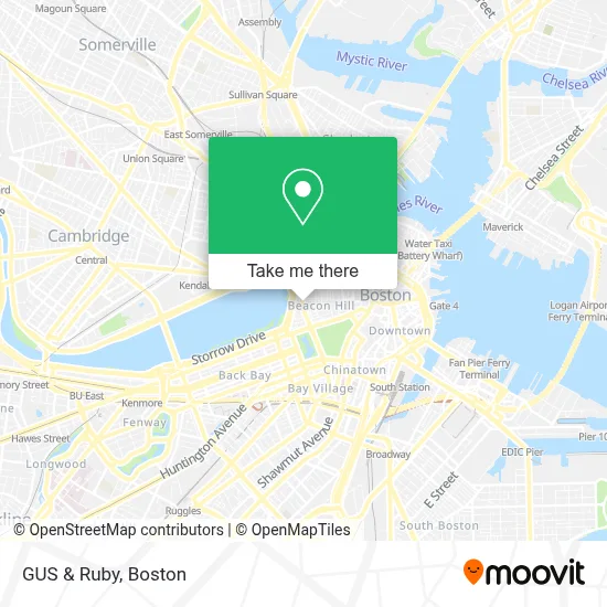
See GUS & Ruby, Boston, on the map
Public Transit to GUS & Ruby in Boston
Wondering how to get to GUS & Ruby in Boston? Moovit helps you find the best way to get to GUS & Ruby with step-by-step directions from the nearest public transit station.
Moovit provides free maps and live directions to help you navigate through your city. View schedules, routes, timetables, and find out how long does it take to get to GUS & Ruby in real time.
Looking for the nearest stop or station to GUS & Ruby? Check out this list of stops closest to your destination: Arlington; Charles St @ Beacon St; Boylston; Tremont St @ Boylston Station; Park Street; North Station - Lomasney Way @ Causeway St; Park Street - Tremont St @ Winter St; Tremont St Opp Temple Pl; Charles/Mgh - 325 Cambridge St; Bowdoin; Park Street - Tremont St Opp Hamilton Pl; Government Center - Cambridge St @ Sudbury St; Science Park/West End - Martha Rd @ Amy Ct.
Bus: 111, 19, 43, 64, SL4, GREEN LINE E SHUTTLE, GREEN LINE SHUTTLE, 15, 39, 57, SL5.Train: FRAMINGHAM/WORCESTER.Subway: RED LINE, GREEN LINE B, GREEN LINE C, GREEN LINE D, GREEN LINE E, BLUE LINE.
Want to see if there’s another route that gets you there at an earlier time? Moovit helps you find alternative routes or times. Get directions from and directions to GUS & Ruby easily from the Moovit App or Website.
We make riding to GUS & Ruby easy, which is why over 1.7 million users, including users in Boston, trust Moovit as the best app for public transit. You don’t need to download an individual bus app or train app, Moovit is your all-in-one transit app that helps you find the best bus time or train time available.
For information on prices of bus, subway and train, costs and ride fares to GUS & Ruby, please check the Moovit app.
Use the app to navigate to popular places including to the airport, hospital, stadium, grocery store, mall, coffee shop, school, college, and university.
GUS & Ruby Address: 99 Charles St street in Boston
- Churchill & White,
- Beacon Hill,
- Mount Vernon Sq & Public Alley 301,
- Tatte Bakery & Cafe,
- Charles Street Garage (Charles St Parking Garage),
- 2hotnsexy Boston Escorts,
- Advent School (Church of the Advent),
- Church Of the Advent,
- Beacon Hill, Massachusetts,
- Beacon Hill Appliance Experts,
- Running the Charles River,
- Acorn Street,
- The Whitney Hotel,
- Whitney Hotel Boston,
- Benefit Cosmetics Boutique & Browbar,
- Interior Design by Leclair Lifestyle,
- Charles/Mgh Station,
- Charles/MGH T Stop,
- Charles Circle,
- Mass Ear Eye Infirmary
Places Near GUS & Ruby (Boston)
- Boston Convention & Exhibition Center, Boston,
- Boston Common, Boston,
- Isabella Stewart Gardner Museum, Boston,
- Faneuil Hall, Boston,
- Seaport District, Boston,
- Castle Island, Boston,
- Cheers, Boston,
- Leader Bank Pavilion (Leader Bank Pavillion), Boston,
- Prudential Center, Boston,
- House Of Blues, Boston,
- North End, Boston,
- Wilbur Theatre, Boston,
- Mgm Music Hall, Boston,
- Wang Theater, Boston,
- Boston Medical Center, Boston,
- Museum Of Science, Boston,
- Boston Children's Hospital, Boston,
- Quincy Market, Boston,
- Massachusetts General Hospital, Boston,
- Td Garden, Boston
How to get to popular places in Boston with public transit
Get around Boston by public transit!
Traveling around Boston has never been so easy. See step by step directions as you travel to any attraction, street or major public transit station. View bus and train schedules, arrival times, service alerts and detailed routes on a map, so you know exactly how to get to anywhere in Boston.
When traveling to any destination around Boston use Moovit's Live Directions with Get Off Notifications to know exactly where and how far to walk, how long to wait for your line, and how many stops are left. Moovit will alert you when it's time to get off — no need to constantly re-check whether yours is the next stop.
Wondering how to use public transit in Boston or how to pay for public transit in Boston? Moovit public transit app can help you navigate your way with public transit easily, and at minimum cost. It includes public transit fees, ticket prices, and costs. Looking for a map of Boston public transit lines? Moovit public transit app shows all public transit maps in Boston with all Bus, Train, Subway and Ferry routes and stops on an interactive map.
Boston has 4 transit type(s), including: Bus, Train, Subway and Ferry, operated by several transit agencies, including MBTA, Southeastern Regional Transit Authority, MetroWest Regional Transit Authority, Rhode Island Public Transit Authority, WRTA, Lowell Regional Transit Authority, Merrimack Valley Transit, Montachusett Regional Transit Authority, Cape Cod Regional Transit Authority, Brockton Area Transit Authority, Martha's Vineyard Transit Authority, the WAVE - Nantucket Regional Transit Authority, GATRA, Cape Ann Transportation Authority and Massport