Directions to Gaby's Cakes (Boston) with public transportation
The following transit lines have routes that pass near Gaby's Cakes
 Bus: 1, 10, 8, CT3, 47.
- Train: FAIRMOUNT, NEEDHAM, FRANKLIN/FOXBORO, PROVIDENCE/STOUGHTON.
- Subway: RED LINE, ORANGE LINE.
How to get to Gaby's Cakes by bus?
Click on the bus route to see step by step directions with maps, line arrival times and updated time schedules.
From Courtyard by Marriott Boston Logan Airport, Boston
57 minFrom AC Hotel Boston Cambridge, Cambridge
84 minFrom Sommerville Theatre, Somerville
63 minFrom Vertex Pharmaceuticals, Inc., Boston
53 minFrom Spaulding Hospital, Cambridge
47 minFrom Hyatt Place Medford, Medford
56 minFrom VA Hospital, Boston
64 minFrom Quincy Center Station, Quincy
105 minFrom Quincy, MA, Quincy
92 minFrom Massport Security Badge Office, Boston
49 min
How to get to Gaby's Cakes by train?
Click on the train route to see step by step directions with maps, line arrival times and updated time schedules.
How to get to Gaby's Cakes by subway?
Click on the subway route to see step by step directions with maps, line arrival times and updated time schedules.
From Courtyard by Marriott Boston Logan Airport, Boston
59 minFrom AC Hotel Boston Cambridge, Cambridge
58 minFrom Sommerville Theatre, Somerville
41 minFrom Massport Security Badge Office, Boston
47 minFrom Vertex Pharmaceuticals, Inc., Boston
80 minFrom Spaulding Hospital, Cambridge
52 minFrom Hyatt Place Medford, Medford
82 minFrom Quincy Center Station, Quincy
33 minFrom Quincy, MA, Quincy
39 min
Bus stops near Gaby's Cakes in Boston
Subway stations near Gaby's Cakes in Boston
Bus lines to Gaby's Cakes in Boston
- 8, Harbor Point Via South Bay Center,VIEW
- 10, Arlington Via South Bay Center,VIEW
- 47, Broadway,VIEW
- CT3, Avenue Louis Pasteur (Limited Stops),VIEW
- 1, Nubian,VIEW
- 171, Logan Airport Via Andrew,VIEW
- ALBANY/E NEWTON STREET, Student Residence (815 Albany St),VIEW
- 9, City Point,VIEW
- FAIRMOUNT LINE SHUTTLE, South Station (Shuttle),VIEW
What are the closest stations to Gaby's Cakes?
The closest stations to Gaby's Cakes are:
- Albany St Opp Boston Medical is 97 yards away, 2 min walk.
- Massachusetts Ave @ Albany St is 192 yards away, 3 min walk.
- Albany Street/Massachusetts Avenue is 241 yards away, 4 min walk.
- Student Residence (815 Albany St) is 420 yards away, 5 min walk.
- Massachusetts Ave @ Island St is 465 yards away, 6 min walk.
- Massachusetts Ave. is 579 yards away, 7 min walk.
- Newmarket Sq @ Massachusetts Ave1024 is 640 yards away, 8 min walk.
- Ruggles is 1095 yards away, 13 min walk.
- Andrew is 1693 yards away, 20 min walk.
- Uphams Corner is 1799 yards away, 22 min walk.
Which bus lines stop near Gaby's Cakes?
These bus lines stop near Gaby's Cakes: 1, 10, 8, CT3.
Which train lines stop near Gaby's Cakes?
These train lines stop near Gaby's Cakes: FAIRMOUNT, NEEDHAM.
Which subway line stops near Gaby's Cakes?
RED LINE (Ashmont/Braintree)
What’s the nearest subway station to Gaby's Cakes in Boston?
The nearest subway station to Gaby's Cakes in Boston is Massachusetts Ave.. It’s a 7 min walk away.
What’s the nearest train station to Gaby's Cakes in Boston?
The nearest train station to Gaby's Cakes in Boston is Ruggles. It’s a 13 min walk away.
What’s the nearest bus station to Gaby's Cakes in Boston?
The nearest bus station to Gaby's Cakes in Boston is Albany St Opp Boston Medical. It’s a 2 min walk away.
What time is the first subway to Gaby's Cakes in Boston?
The ORANGE LINE is the first subway that goes to Gaby's Cakes in Boston. It stops nearby at 5:23 AM.
What time is the last subway to Gaby's Cakes in Boston?
The RED LINE is the last subway that goes to Gaby's Cakes in Boston. It stops nearby at 1:53 AM.
What time is the first train to Gaby's Cakes in Boston?
The PROVIDENCE/STOUGHTON is the first train that goes to Gaby's Cakes in Boston. It stops nearby at 4:28 AM.
What time is the last train to Gaby's Cakes in Boston?
The PROVIDENCE/STOUGHTON is the last train that goes to Gaby's Cakes in Boston. It stops nearby at 12:34 AM.
What time is the first bus to Gaby's Cakes in Boston?
The 171 is the first bus that goes to Gaby's Cakes in Boston. It stops nearby at 3:55 AM.
What time is the last bus to Gaby's Cakes in Boston?
The 1 is the last bus that goes to Gaby's Cakes in Boston. It stops nearby at 2:40 AM.
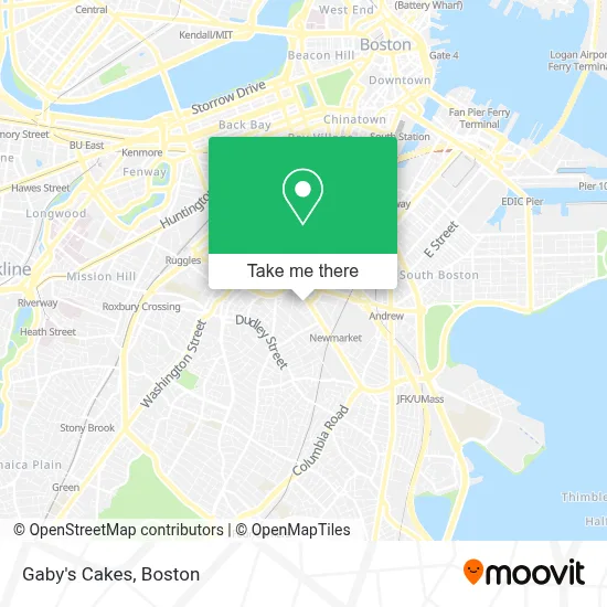
See Gaby's Cakes, Boston, on the map
Public Transit to Gaby's Cakes in Boston
Wondering how to get to Gaby's Cakes in Boston? Moovit helps you find the best way to get to Gaby's Cakes with step-by-step directions from the nearest public transit station.
Moovit provides free maps and live directions to help you navigate through your city. View schedules, routes, timetables, and find out how long does it take to get to Gaby's Cakes in real time.
Looking for the nearest stop or station to Gaby's Cakes? Check out this list of stops closest to your destination: Albany St Opp Boston Medical; Massachusetts Ave @ Albany St; Albany Street/Massachusetts Avenue; Student Residence (815 Albany St); Massachusetts Ave @ Island St; Massachusetts Ave.; Newmarket Sq @ Massachusetts Ave1024; Ruggles; Andrew; Uphams Corner.
Bus: 1, 10, 8, CT3, 47.Train: FAIRMOUNT, NEEDHAM, FRANKLIN/FOXBORO, PROVIDENCE/STOUGHTON.Subway: RED LINE, ORANGE LINE.
Want to see if there’s another route that gets you there at an earlier time? Moovit helps you find alternative routes or times. Get directions from and directions to Gaby's Cakes easily from the Moovit App or Website.
We make riding to Gaby's Cakes easy, which is why over 1.7 million users, including users in Boston, trust Moovit as the best app for public transit. You don’t need to download an individual bus app or train app, Moovit is your all-in-one transit app that helps you find the best bus time or train time available.
For information on prices of bus, subway and train, costs and ride fares to Gaby's Cakes, please check the Moovit app.
Use the app to navigate to popular places including to the airport, hospital, stadium, grocery store, mall, coffee shop, school, college, and university.
Gaby's Cakes Address: Transcontinental Dr street in Boston
- Commercial Air Conditioning,
- Boston Salads & Prepared Foods,
- Boston Event Photographer,
- Cavalier Coach Corporation,
- Bennett Locksmith,
- The Record Co.,
- Mcdonald's,
- Herc Rentals,
- Hertz,
- Best Western Plus Boston Hotel,
- U-Haul Moving & Storage at Mass Ave Boston,
- CUBESMART,
- Apj Equipment,
- Dearborn Stem Academy,
- Xfinity,
- Paul Revere Transportation,
- Massachusetts Consumer,
- Yes,
- La Alianza Hispana,
- MBTA Mobility Center
Places Near Gaby's Cakes (Boston)
- Wilbur Theatre, Boston,
- Boston Convention & Exhibition Center, Boston,
- Castle Island, Boston,
- Cheers, Boston,
- Boston Common, Boston,
- Isabella Stewart Gardner Museum, Boston,
- Museum Of Science, Boston,
- Td Garden, Boston,
- House Of Blues, Boston,
- Boston Medical Center, Boston,
- North End, Boston,
- Quincy Market, Boston,
- Faneuil Hall, Boston,
- Prudential Center, Boston,
- Mgm Music Hall, Boston,
- Seaport District, Boston,
- Boston Children's Hospital, Boston,
- Wang Theater, Boston,
- Massachusetts General Hospital, Boston,
- Leader Bank Pavilion (Leader Bank Pavillion), Boston
How to get to popular places in Boston with public transit
Get around Boston by public transit!
Traveling around Boston has never been so easy. See step by step directions as you travel to any attraction, street or major public transit station. View bus and train schedules, arrival times, service alerts and detailed routes on a map, so you know exactly how to get to anywhere in Boston.
When traveling to any destination around Boston use Moovit's Live Directions with Get Off Notifications to know exactly where and how far to walk, how long to wait for your line, and how many stops are left. Moovit will alert you when it's time to get off — no need to constantly re-check whether yours is the next stop.
Wondering how to use public transit in Boston or how to pay for public transit in Boston? Moovit public transit app can help you navigate your way with public transit easily, and at minimum cost. It includes public transit fees, ticket prices, and costs. Looking for a map of Boston public transit lines? Moovit public transit app shows all public transit maps in Boston with all Bus, Train, Subway and Ferry routes and stops on an interactive map.
Boston has 4 transit type(s), including: Bus, Train, Subway and Ferry, operated by several transit agencies, including MBTA, Southeastern Regional Transit Authority, MetroWest Regional Transit Authority, Rhode Island Public Transit Authority, WRTA, Lowell Regional Transit Authority, Merrimack Valley Transit, Montachusett Regional Transit Authority, Cape Cod Regional Transit Authority, Brockton Area Transit Authority, Martha's Vineyard Transit Authority, the WAVE - Nantucket Regional Transit Authority, GATRA, Cape Ann Transportation Authority and Massport