Directions to Genomes2people (Boston) with public transportation
The following transit lines have routes that pass near Genomes2people
 Bus: 19, 39, 47, 8, 85.
- Subway: GREEN LINE E, ORANGE LINE, GREEN LINE D.
How to get to Genomes2people by bus?
Click on the bus route to see step by step directions with maps, line arrival times and updated time schedules.
From Qea, Quincy
93 minFrom Tufts University, Medford
79 minFrom MBTA Suffolk Downs Station, Boston
79 minFrom USS Constitution (USS Constitution Museum), Boston
73 minFrom Boda Borg, Malden
92 minFrom Milton, MA, Milton
93 minFrom Mass Eye And Ear, Boston
60 minFrom Sarma, Somerville
60 minFrom Malden, MA, Malden
88 minFrom Belle Isle Lobster & Seafood, Winthrop Town
103 min
How to get to Genomes2people by subway?
Click on the subway route to see step by step directions with maps, line arrival times and updated time schedules.
From Belle Isle Lobster & Seafood, Winthrop Town
66 minFrom Qea, Quincy
63 minFrom Tufts University, Medford
58 minFrom MBTA Suffolk Downs Station, Boston
49 minFrom USS Constitution (USS Constitution Museum), Boston
58 minFrom Boda Borg, Malden
46 minFrom Milton, MA, Milton
98 minFrom Mass Eye And Ear, Boston
44 minFrom Sarma, Somerville
55 minFrom Malden, MA, Malden
50 min
Bus stops near Genomes2people in Boston
Subway stations near Genomes2people in Boston
Bus lines to Genomes2people in Boston
- 8, Kenmore via South Bay Center - Harbor Point via South Bay Center,VIEW
- 19, Kenmore - Fields Corner,VIEW
- 47, Broadway - Central Square,VIEW
- 85, Ruggles - Assembly,VIEW
- 9, Kenmore Via Boston Latin,VIEW
- CT3, Avenue Louis Pasteur (Limited Stops),VIEW
- 22, Ashmont,VIEW
- 28, Mattapan,VIEW
- 35, Dedham Mall,VIEW
- 39, Wolcott Square Via Forest Hills,VIEW
- 57, Watertown Yard,VIEW
- 55, West Fenway,VIEW
- 60, Kenmore - Chestnut Hill Mall,VIEW
- 65, Kenmore - Brighton Center,VIEW
- GREEN LINE D SHUTTLE, Reservoir - Fenway,VIEW
- GREEN LINE D SHUTTLE, Riverside - Fenway,VIEW
- GREEN LINE D SHUTTLE, Newton Highlands - Kenmore,VIEW
- GREEN LINE D SHUTTLE, Newton Highlands - Fenway,VIEW
- GREEN LINE D SHUTTLE, Reservoir - Kenmore,VIEW
- GREEN LINE D SHUTTLE, Brookline Hills - Kenmore,VIEW
What are the closest stations to Genomes2people?
The closest stations to Genomes2people are:
- Longwood Ave @ Blackfan St is 38 yards away, 1 min walk.
- Longwood Ave @ Binney St is 114 yards away, 2 min walk.
- Ave Louis Pasteur @ Longwood Ave is 209 yards away, 3 min walk.
- Kilmarnock St @ Queensberry St is 235 yards away, 3 min walk.
- Brookline Ave @ Longwood Ave is 300 yards away, 4 min walk.
- Brigham Circle is 511 yards away, 7 min walk.
- Huntington Ave @ Longwood Ave is 557 yards away, 7 min walk.
- Chapel St, Colchester St is 843 yards away, 11 min walk.
Which bus lines stop near Genomes2people?
These bus lines stop near Genomes2people: 19, 39, 47, 8, 85, CT3.
Which subway lines stop near Genomes2people?
These subway lines stop near Genomes2people: GREEN LINE E, ORANGE LINE.
What’s the nearest subway station to Genomes2people in Boston?
The nearest subway station to Genomes2people in Boston is Brigham Circle. It’s a 7 min walk away.
What’s the nearest bus station to Genomes2people in Boston?
The nearest bus station to Genomes2people in Boston is Longwood Ave @ Blackfan St. It’s a 1 min walk away.
What time is the first subway to Genomes2people in Boston?
The GREEN LINE D is the first subway that goes to Genomes2people in Boston. It stops nearby at 4:55 AM.
What time is the last subway to Genomes2people in Boston?
The GREEN LINE D is the last subway that goes to Genomes2people in Boston. It stops nearby at 2:22 AM.
What time is the first bus to Genomes2people in Boston?
The 39 is the first bus that goes to Genomes2people in Boston. It stops nearby at 4:50 AM.
What time is the last bus to Genomes2people in Boston?
The 39 is the last bus that goes to Genomes2people in Boston. It stops nearby at 1:19 AM.
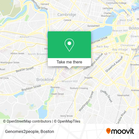
See Genomes2people, Boston, on the map
Public Transit to Genomes2people in Boston
Wondering how to get to Genomes2people in Boston? Moovit helps you find the best way to get to Genomes2people with step-by-step directions from the nearest public transit station.
Moovit provides free maps and live directions to help you navigate through your city. View schedules, routes, timetables, and find out how long does it take to get to Genomes2people in real time.
Looking for the nearest stop or station to Genomes2people? Check out this list of stops closest to your destination: Longwood Ave @ Blackfan St; Longwood Ave @ Binney St; Ave Louis Pasteur @ Longwood Ave; Kilmarnock St @ Queensberry St; Brookline Ave @ Longwood Ave; Brigham Circle; Huntington Ave @ Longwood Ave; Chapel St.
Bus: 19, 39, 47, 8, 85, CT3, 9, 22, 28, 35, 57, 55.Subway: GREEN LINE E, ORANGE LINE, GREEN LINE D.
Want to see if there’s another route that gets you there at an earlier time? Moovit helps you find alternative routes or times. Get directions from and directions to Genomes2people easily from the Moovit App or Website.
We make riding to Genomes2people easy, which is why over 1.7 million users, including users in Boston, trust Moovit as the best app for public transit. You don’t need to download an individual bus app or train app, Moovit is your all-in-one transit app that helps you find the best bus time or train time available.
For information on prices of bus and subway, costs and ride fares to Genomes2people, please check the Moovit app.
Use the app to navigate to popular places including to the airport, hospital, stadium, grocery store, mall, coffee shop, school, college, and university.
Genomes2people Address: 41 Avenue Louis Pasteur street in Boston
- Park Science Center, Simmons College,
- Boston Latin School,
- Merck & Co.,
- Joseph B Martin Conference Center,
- BWH,
- Merck,
- Merck Research Laboratories,
- BLS Link,
- Simmons College Academic Campus,
- Boston Latin School Side Parking Lot,
- Simmons University,
- Emmanuel College,
- Simmons College,
- Beth Israel Hospital,
- Dr. Sotonye Imadojemu M.D., M.B.E.,
- Brigham Dermatology Associates (Mitchell Howard Rubenstein MD - Dermatology),
- 221 Longwood,
- STARBUCKS,
- Boston Children's Hospital - Patient Family Garage,
- Brigham & Women's Longwood
Places Near Genomes2people (Boston)
- Castle Island, Boston,
- Boston Convention & Exhibition Center, Boston,
- Seaport District, Boston,
- Prudential Center, Boston,
- Wilbur Theatre, Boston,
- Museum Of Science, Boston,
- Mgm Music Hall, Boston,
- Wang Theater, Boston,
- Faneuil Hall, Boston,
- Td Garden, Boston,
- Quincy Market, Boston,
- Massachusetts General Hospital, Boston,
- Boston Medical Center, Boston,
- North End, Boston,
- Leader Bank Pavilion (Leader Bank Pavillion), Boston,
- Cheers, Boston,
- Boston Children's Hospital, Boston,
- House Of Blues, Boston,
- Boston Common, Boston,
- Isabella Stewart Gardner Museum, Boston
How to get to popular places in Boston with public transit
Get around Boston by public transit!
Traveling around Boston has never been so easy. See step by step directions as you travel to any attraction, street or major public transit station. View bus and train schedules, arrival times, service alerts and detailed routes on a map, so you know exactly how to get to anywhere in Boston.
When traveling to any destination around Boston use Moovit's Live Directions with Get Off Notifications to know exactly where and how far to walk, how long to wait for your line, and how many stops are left. Moovit will alert you when it's time to get off — no need to constantly re-check whether yours is the next stop.
Wondering how to use public transit in Boston or how to pay for public transit in Boston? Moovit public transit app can help you navigate your way with public transit easily, and at minimum cost. It includes public transit fees, ticket prices, and costs. Looking for a map of Boston public transit lines? Moovit public transit app shows all public transit maps in Boston with all Bus, Train, Subway and Ferry routes and stops on an interactive map.
Boston has 4 transit type(s), including: Bus, Train, Subway and Ferry, operated by several transit agencies, including MBTA, Southeastern Regional Transit Authority, MetroWest Regional Transit Authority, Rhode Island Public Transit Authority, WRTA, Lowell Regional Transit Authority, Merrimack Valley Transit, Montachusett Regional Transit Authority, Cape Cod Regional Transit Authority, Brockton Area Transit Authority, Martha's Vineyard Transit Authority, the WAVE - Nantucket Regional Transit Authority, GATRA, Cape Ann Transportation Authority and Massport