How to get to Geodatis Geometres by bus?
Click on the bus route to see step by step directions with maps, line arrival times and updated time schedules.
How to get to Geodatis Geometres by train?
Click on the train route to see step by step directions with maps, line arrival times and updated time schedules.
Bus stops near Geodatis Geometres in Nancy
Light Rail stations near Geodatis Geometres in Nancy
- Gare - Pierre Semard, 21 min walk,VIEW
Train stations near Geodatis Geometres in Nancy
- Nancy, 35 min walk,VIEW
Bus lines to Geodatis Geometres in Nancy
- COROL, Plateau De Haye,VIEW
- T2, Laxou Sapinière,VIEW
- T3, Haie Cerlin,VIEW
- T4, Houd. Porte Sud,VIEW
- 11, La Rotonde,VIEW
- 16, Malzéville,VIEW
- 43, Pleine Lune,VIEW
- 15, Nancy Gare République - Seichamps Ecoquartier,VIEW
- 41, Citadine 1 - Citadine Nancy,VIEW
- 14EXP, Nancy Gare République - Ludres,VIEW
- 20, Nancy Gare République - Art -Sur-Meurthe,VIEW
- 21, Nancy Gare République - Fléville - Ludres Marvingt,VIEW
- 33, Nancy Gare République - Jarville Gabriel Fauré,VIEW
- 61, Nancy Gare - Art-sur-Meurthe - Bosserville,VIEW
- 62, Nancy Gare - Malzéville Pixerécourt,VIEW
- T5, Meurthe - Canal,VIEW
- 12, Heillecourt,VIEW
- 13, Dommartemont,VIEW
What are the closest stations to Geodatis Geometres?
The closest stations to Geodatis Geometres are:
- Gare - Simone Veil is 213 meters away, 3 min walk.
- Gare - Saint-Léon is 328 meters away, 5 min walk.
- Nancy Gare / Gare - Poirel is 384 meters away, 6 min walk.
- Nancy Gare is 592 meters away, 9 min walk.
- Place Carnot is 599 meters away, 9 min walk.
- Gare - Pierre Semard is 1605 meters away, 21 min walk.
- Nancy is 2672 meters away, 35 min walk.
Which bus lines stop near Geodatis Geometres?
These bus lines stop near Geodatis Geometres: 11, T4.
Which train lines stop near Geodatis Geometres?
These train lines stop near Geodatis Geometres: C44, C50+.
What’s the nearest light rail station to Geodatis Geometres in Nancy?
The nearest light rail station to Geodatis Geometres in Nancy is Gare - Pierre Semard. It’s a 21 min walk away.
What’s the nearest bus station to Geodatis Geometres in Nancy?
The nearest bus station to Geodatis Geometres in Nancy is Gare - Simone Veil. It’s a 3 min walk away.
What time is the first light rail to Geodatis Geometres in Nancy?
The T1 is the first light rail that goes to Geodatis Geometres in Nancy. It stops nearby at 5:00 AM.
What time is the last light rail to Geodatis Geometres in Nancy?
The T1 is the last light rail that goes to Geodatis Geometres in Nancy. It stops nearby at 12:35 AM.
What time is the first train to Geodatis Geometres in Nancy?
The C50+ is the first train that goes to Geodatis Geometres in Nancy. It stops nearby at 6:50 AM.
What time is the last train to Geodatis Geometres in Nancy?
The C40 is the last train that goes to Geodatis Geometres in Nancy. It stops nearby at 1:16 AM.
What time is the first bus to Geodatis Geometres in Nancy?
The 43 is the first bus that goes to Geodatis Geometres in Nancy. It stops nearby at 3:00 AM.
What time is the last bus to Geodatis Geometres in Nancy?
The T5 is the last bus that goes to Geodatis Geometres in Nancy. It stops nearby at 12:38 AM.
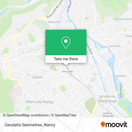
See Geodatis Geometres, Nancy, on the map
Public Transit to Geodatis Geometres in Nancy
Wondering how to get to Geodatis Geometres in Nancy? Moovit helps you find the best way to get to Geodatis Geometres with step-by-step directions from the nearest public transit station.
Moovit provides free maps and live directions to help you navigate through your city. View schedules, routes, timetables, and find out how long does it take to get to Geodatis Geometres in real time.
Looking for the nearest stop or station to Geodatis Geometres? Check out this list of stops closest to your destination: Gare - Simone Veil; Gare - Saint-Léon; Nancy Gare / Gare - Poirel; Nancy Gare; Place Carnot; Gare - Pierre Semard; Nancy.
Bus: 11, T4, COROL, T2, T3, 43.Train: C44, C50+, INCONNU, C40, C41, C42, C43, 071A, 805A, 805B.
Want to see if there’s another route that gets you there at an earlier time? Moovit helps you find alternative routes or times. Get directions from and directions to Geodatis Geometres easily from the Moovit App or Website.
We make riding to Geodatis Geometres easy, which is why over 1.5 million users, including users in Nancy, trust Moovit as the best app for public transit. You don’t need to download an individual bus app or train app, Moovit is your all-in-one transit app that helps you find the best bus time or train time available.
For information on prices of train and bus, costs and ride fares to Geodatis Geometres, please check the Moovit app.
Use the app to navigate to popular places including to the airport, hospital, stadium, grocery store, mall, coffee shop, school, college, and university.
Geodatis Geometres Address: 5 Rue Isabey 54000 Nancy street in Nancy
- Pierson Lemonnier Odile,
- quai claude le lorrain,
- Un Temps Pour Soi,
- Église Saint-Sébastien,
- Les Belges à Nancy,
- Bornert Jerome,
- Chacha Productions,
- Marot Publicite,
- Souchard Deléglise Johanne,
- Rtl,
- Kremer Michel,
- Sarl le Medea,
- Adecco,
- Leader Pai 54,
- Kalck Jacques et Kirsch Nicole,
- Vast Rh,
- Adring,
- Arrêt De Bus Patton,
- Gephifranc,
- Hôtel Mercure
Places Near Geodatis Geometres (Nancy)
- Maxéville, Maxéville,
- Zénith De Nancy, Maxéville,
- E.Leclerc, VandUvre-Lès-Nancy,
- Rue Colette, Nancy,
- Nancy Thermal, Nancy,
- Clinique Pasteur, Essey-Lès-Nancy,
- Villa Majorelle, Nancy,
- centre d'imagerie jacques callot, Maxéville,
- Cora, Houdemont,
- Haut Du Lièvre, Nancy,
- Dépose-Minute, Nancy,
- Polyclinique De Gentilly, Nancy,
- Piscine Nancy Thermal, Nancy,
- Hopital de Brabois CHU, VandUvre-Lès-Nancy,
- Hôpital Central, Nancy,
- Villers-Lès-Nancy, Villers-Lès-Nancy,
- Kinepolis Nancy, Nancy,
- Essey-Lès-Nancy, Essey-Lès-Nancy,
- Tomblaine, Tomblaine,
- Clinique Majorelle, Nancy
How to get to popular places in Nancy with public transit
Get around Nancy by public transit!
Traveling around Nancy has never been so easy. See step by step directions as you travel to any attraction, street or major public transit station. View bus and train schedules, arrival times, service alerts and detailed routes on a map, so you know exactly how to get to anywhere in Nancy.
When traveling to any destination around Nancy use Moovit's Live Directions with Get Off Notifications to know exactly where and how far to walk, how long to wait for your line, and how many stops are left. Moovit will alert you when it's time to get off — no need to constantly re-check whether yours is the next stop.
Wondering how to use public transit in Nancy or how to pay for public transit in Nancy? Moovit public transit app can help you navigate your way with public transit easily, and at minimum cost. It includes public transit fees, ticket prices, and costs. Looking for a map of Nancy public transit lines? Moovit public transit app shows all public transit maps in Nancy with all Bus, Train and Light Rail routes and stops on an interactive map.
Nancy has 3 transit type(s), including: Bus, Train and Light Rail, operated by several transit agencies, including Réseau STAN, SNCF VOYAGEURS and OCEdefault