Directions to Gilmore Murphy Realty (Boston) with public transportation
The following transit lines have routes that pass near Gilmore Murphy Realty
 Bus: 35, 36, 37, 38, 51.
- Train: FRANKLIN/FOXBORO, NEEDHAM, ORANGE LINE, PROVIDENCE/STOUGHTON.
- Subway: ORANGE LINE.
How to get to Gilmore Murphy Realty by bus?
Click on the bus route to see step by step directions with maps, line arrival times and updated time schedules.
From The 'Quin House, Boston
50 minFrom Mass Eye & Ear, Boston
29 minFrom Tufts Medical Center MBTA Station - Orange & Silver Line, Boston
57 minFrom Harvard University, Cambridge
67 minFrom Tufts Dental, Boston
57 minFrom Legacy Place, Dedham
48 minFrom Lasell College, Newton
104 minFrom Public Garden (Boston Public Garden), Boston
55 minFrom Saks Fifth Avenue, Boston
53 minFrom Citizens Bank Opera House, Boston
56 min
How to get to Gilmore Murphy Realty by train?
Click on the train route to see step by step directions with maps, line arrival times and updated time schedules.
From The 'Quin House, Boston
34 minFrom Mass Eye & Ear, Boston
42 minFrom Tufts Medical Center MBTA Station - Orange & Silver Line, Boston
37 minFrom Tufts Dental, Boston
37 minFrom Legacy Place, Dedham
71 minFrom Lasell College, Newton
77 minFrom Public Garden (Boston Public Garden), Boston
38 minFrom Saks Fifth Avenue, Boston
32 minFrom Citizens Bank Opera House, Boston
69 min
How to get to Gilmore Murphy Realty by subway?
Click on the subway route to see step by step directions with maps, line arrival times and updated time schedules.
From The 'Quin House, Boston
74 minFrom Mass Eye & Ear, Boston
73 minFrom Tufts Medical Center MBTA Station - Orange & Silver Line, Boston
68 minFrom Harvard University, Cambridge
83 minFrom Tufts Dental, Boston
68 minFrom Public Garden (Boston Public Garden), Boston
76 minFrom Saks Fifth Avenue, Boston
73 minFrom Citizens Bank Opera House, Boston
103 min
Bus stops near Gilmore Murphy Realty in Boston
Train stations near Gilmore Murphy Realty in Boston
Bus lines to Gilmore Murphy Realty in Boston
What are the closest stations to Gilmore Murphy Realty?
The closest stations to Gilmore Murphy Realty are:
- Belgrade Ave @ Centre St is 233 yards away, 3 min walk.
- Bellevue is 420 yards away, 6 min walk.
- Roslindale Village is 2850 yards away, 34 min walk.
- Forest Hills is 4769 yards away, 57 min walk.
Which bus lines stop near Gilmore Murphy Realty?
These bus lines stop near Gilmore Murphy Realty: 35, 36, 37, 38, 51.
Which train lines stop near Gilmore Murphy Realty?
These train lines stop near Gilmore Murphy Realty: FRANKLIN/FOXBORO, NEEDHAM.
Which subway line stops near Gilmore Murphy Realty?
ORANGE LINE (Forest Hills)
What’s the nearest bus station to Gilmore Murphy Realty in Boston?
The nearest bus station to Gilmore Murphy Realty in Boston is Belgrade Ave @ Centre St. It’s a 3 min walk away.
What time is the first subway to Gilmore Murphy Realty in Boston?
The ORANGE LINE is the first subway that goes to Gilmore Murphy Realty in Boston. It stops nearby at 5:15 AM.
What time is the last subway to Gilmore Murphy Realty in Boston?
The ORANGE LINE is the last subway that goes to Gilmore Murphy Realty in Boston. It stops nearby at 1:58 AM.
What time is the first train to Gilmore Murphy Realty in Boston?
The NEEDHAM is the first train that goes to Gilmore Murphy Realty in Boston. It stops nearby at 7:22 AM.
What time is the last train to Gilmore Murphy Realty in Boston?
The PROVIDENCE/STOUGHTON is the last train that goes to Gilmore Murphy Realty in Boston. It stops nearby at 12:08 AM.
What time is the first bus to Gilmore Murphy Realty in Boston?
The 36 is the first bus that goes to Gilmore Murphy Realty in Boston. It stops nearby at 4:39 AM.
What time is the last bus to Gilmore Murphy Realty in Boston?
The 36 is the last bus that goes to Gilmore Murphy Realty in Boston. It stops nearby at 1:35 AM.
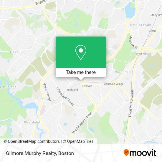
See Gilmore Murphy Realty, Boston, on the map
Public Transit to Gilmore Murphy Realty in Boston
Wondering how to get to Gilmore Murphy Realty in Boston? Moovit helps you find the best way to get to Gilmore Murphy Realty with step-by-step directions from the nearest public transit station.
Moovit provides free maps and live directions to help you navigate through your city. View schedules, routes, timetables, and find out how long does it take to get to Gilmore Murphy Realty in real time.
Looking for the nearest stop or station to Gilmore Murphy Realty? Check out this list of stops closest to your destination: Belgrade Ave @ Centre St; Bellevue; Roslindale Village; Forest Hills.
Bus: 35, 36, 37, 38, 51, NEEDHAM LINE SHUTTLE, NEEDHAM LINE SHUTTLE.Train: FRANKLIN/FOXBORO, NEEDHAM, ORANGE LINE, PROVIDENCE/STOUGHTON.Subway: ORANGE LINE.
Want to see if there’s another route that gets you there at an earlier time? Moovit helps you find alternative routes or times. Get directions from and directions to Gilmore Murphy Realty easily from the Moovit App or Website.
We make riding to Gilmore Murphy Realty easy, which is why over 1.7 million users, including users in Boston, trust Moovit as the best app for public transit. You don’t need to download an individual bus app or train app, Moovit is your all-in-one transit app that helps you find the best bus time or train time available.
For information on prices of bus, subway and train, costs and ride fares to Gilmore Murphy Realty, please check the Moovit app.
Use the app to navigate to popular places including to the airport, hospital, stadium, grocery store, mall, coffee shop, school, college, and university.
Gilmore Murphy Realty Address: 1721 Centre St street in Boston
- Banh Mi Oi (Banh Mi Ngon),
- Claude's Jewelry,
- Roche Bros.,
- MBTA Bellevue Commuter Rail,
- Ross & Toner PC,
- Bel Ave Pizza,
- Helm Residential Boston,
- H&R Block,
- G. Ortiz Photography,
- Cameral Music Management,
- Boston Ale House,
- Nicastro Law, L.L.C.,
- Joyce Kilmer Upper School,
- Boston Public Schools,
- MLB Construction,
- Paul John Kilgarriff Attorney;Enrolled AG,
- Hercules Stump Grinding,
- Parkway Community Ymca,
- Ruff Translating,
- Athleta
Places Near Gilmore Murphy Realty (Boston)
- Massachusetts General Hospital, Boston,
- Boston Convention & Exhibition Center, Boston,
- Cheers, Boston,
- North End, Boston,
- Mgm Music Hall, Boston,
- Seaport District, Boston,
- Museum Of Science, Boston,
- Isabella Stewart Gardner Museum, Boston,
- Td Garden, Boston,
- Boston Children's Hospital, Boston,
- Castle Island, Boston,
- Prudential Center, Boston,
- Boston Common, Boston,
- Leader Bank Pavilion (Leader Bank Pavillion), Boston,
- Wang Theater, Boston,
- Faneuil Hall, Boston,
- Boston Medical Center, Boston,
- Quincy Market, Boston,
- House Of Blues, Boston,
- Wilbur Theatre, Boston
How to get to popular places in Boston with public transit
Get around Boston by public transit!
Traveling around Boston has never been so easy. See step by step directions as you travel to any attraction, street or major public transit station. View bus and train schedules, arrival times, service alerts and detailed routes on a map, so you know exactly how to get to anywhere in Boston.
When traveling to any destination around Boston use Moovit's Live Directions with Get Off Notifications to know exactly where and how far to walk, how long to wait for your line, and how many stops are left. Moovit will alert you when it's time to get off — no need to constantly re-check whether yours is the next stop.
Wondering how to use public transit in Boston or how to pay for public transit in Boston? Moovit public transit app can help you navigate your way with public transit easily, and at minimum cost. It includes public transit fees, ticket prices, and costs. Looking for a map of Boston public transit lines? Moovit public transit app shows all public transit maps in Boston with all Bus, Train, Subway and Ferry routes and stops on an interactive map.
Boston has 4 transit type(s), including: Bus, Train, Subway and Ferry, operated by several transit agencies, including MBTA, Southeastern Regional Transit Authority, MetroWest Regional Transit Authority, Rhode Island Public Transit Authority, WRTA, Lowell Regional Transit Authority, Merrimack Valley Transit, Montachusett Regional Transit Authority, Cape Cod Regional Transit Authority, Brockton Area Transit Authority, Martha's Vineyard Transit Authority, the WAVE - Nantucket Regional Transit Authority, GATRA, Cape Ann Transportation Authority and Massport