Directions to Gomez Painting (Boston) with public transportation
The following transit lines have routes that pass near Gomez Painting
 Bus: 501, 66, 64, 70, 86.
- Train: FITCHBURG, FRAMINGHAM/WORCESTER.
- Subway: GREEN LINE B.
How to get to Gomez Painting by bus?
Click on the bus route to see step by step directions with maps, line arrival times and updated time schedules.
From Boston University Henry M. Goldman School of Dental Medicine, Boston
33 minFrom Malden Catholic High School, Malden
77 minFrom Constitution Beach, Boston
82 minFrom Newton-Wellesley Hospital, Newton
73 minFrom Hilton Garden Inn Boston Logan Airport, Boston
69 minFrom Royale Boston, Boston
21 minFrom World Trade Center, Boston
43 minFrom Pine Street Inn, Boston
27 minFrom Melrose Wakefield Hospital, Malden
101 minFrom Santarpio's Pizza, Boston
47 min
How to get to Gomez Painting by train?
Click on the train route to see step by step directions with maps, line arrival times and updated time schedules.
How to get to Gomez Painting by subway?
Click on the subway route to see step by step directions with maps, line arrival times and updated time schedules.
From Boston University Henry M. Goldman School of Dental Medicine, Boston
70 minFrom Constitution Beach, Boston
72 minFrom Newton-Wellesley Hospital, Newton
64 minFrom Hilton Garden Inn Boston Logan Airport, Boston
74 minFrom Royale Boston, Boston
47 minFrom World Trade Center, Boston
77 minFrom Pine Street Inn, Boston
59 minFrom Santarpio's Pizza, Boston
65 minFrom Melrose Wakefield Hospital, Malden
76 min
Subway station near Gomez Painting in Boston
- Packards Corner, 2 min walk,VIEW
Bus stops near Gomez Painting in Boston
Bus lines to Gomez Painting in Boston
What are the closest stations to Gomez Painting?
The closest stations to Gomez Painting are:
- Packards Corner is 115 yards away, 2 min walk.
- N Harvard St @ Hooker St is 142 yards away, 2 min walk.
- Cambridge St @ N Harvard St is 271 yards away, 4 min walk.
- Western Ave @ N Harvard St is 734 yards away, 9 min walk.
- N Harvard St @ Western Ave is 751 yards away, 10 min walk.
Which bus lines stop near Gomez Painting?
These bus lines stop near Gomez Painting: 501, 66.
Which train lines stop near Gomez Painting?
These train lines stop near Gomez Painting: FITCHBURG, FRAMINGHAM/WORCESTER.
Which subway line stops near Gomez Painting?
GREEN LINE B (Boston College)
What’s the nearest subway station to Gomez Painting in Boston?
The nearest subway station to Gomez Painting in Boston is Packards Corner. It’s a 2 min walk away.
What’s the nearest bus station to Gomez Painting in Boston?
The nearest bus station to Gomez Painting in Boston is N Harvard St @ Hooker St. It’s a 2 min walk away.
What time is the first subway to Gomez Painting in Boston?
The GREEN LINE B is the first subway that goes to Gomez Painting in Boston. It stops nearby at 5:13 AM.
What time is the last subway to Gomez Painting in Boston?
The GREEN LINE B is the last subway that goes to Gomez Painting in Boston. It stops nearby at 2:27 AM.
What time is the first bus to Gomez Painting in Boston?
The 70 is the first bus that goes to Gomez Painting in Boston. It stops nearby at 4:31 AM.
What time is the last bus to Gomez Painting in Boston?
The 66 is the last bus that goes to Gomez Painting in Boston. It stops nearby at 2:29 AM.
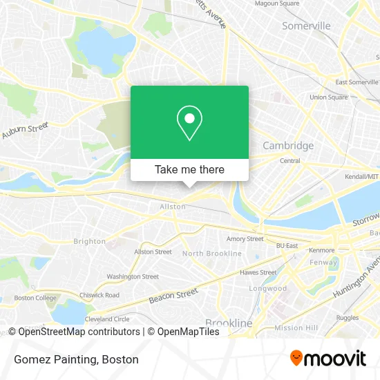
See Gomez Painting, Boston, on the map
Public Transit to Gomez Painting in Boston
Wondering how to get to Gomez Painting in Boston? Moovit helps you find the best way to get to Gomez Painting with step-by-step directions from the nearest public transit station.
Moovit provides free maps and live directions to help you navigate through your city. View schedules, routes, timetables, and find out how long does it take to get to Gomez Painting in real time.
Looking for the nearest stop or station to Gomez Painting? Check out this list of stops closest to your destination: Packards Corner; N Harvard St @ Hooker St; Cambridge St @ N Harvard St; Western Ave @ N Harvard St; N Harvard St @ Western Ave.
Bus: 501, 66, 64, 70, 86.Train: FITCHBURG, FRAMINGHAM/WORCESTER.Subway: GREEN LINE B.
Want to see if there’s another route that gets you there at an earlier time? Moovit helps you find alternative routes or times. Get directions from and directions to Gomez Painting easily from the Moovit App or Website.
We make riding to Gomez Painting easy, which is why over 1.7 million users, including users in Boston, trust Moovit as the best app for public transit. You don’t need to download an individual bus app or train app, Moovit is your all-in-one transit app that helps you find the best bus time or train time available.
For information on prices of bus, subway and train, costs and ride fares to Gomez Painting, please check the Moovit app.
Use the app to navigate to popular places including to the airport, hospital, stadium, grocery store, mall, coffee shop, school, college, and university.
Gomez Painting Address: 44 Hooker St street in Boston
- Empire Records,
- Boston Liquors,
- Cambridge Crossing,
- Vachina Town,
- Office of University Publisher,
- Air Express Div Rea Express,
- Smuggler's Notch,
- Regina Pizzeria,
- Rochas Cleaning,
- Lucky Mobile Car Detailing,
- Boston Christmas Trees,
- Brazilian Immigrant Center (Brazilian Worker Center / Centro do Trabalhador Brasileiro),
- Farrington Inn,
- MG Hair Artistic Salon,
- O'Brien's Pub, 3 Harvard Avenue,
- Harvard Ed Portal,
- Vertex Pharmaceuticals, Inc.,
- O'Brien's Pub (O'Briens Pub),
- Stingray Creations,
- Stingray Body Art
Places Near Gomez Painting (Boston)
- Isabella Stewart Gardner Museum, Boston,
- Wang Theater, Boston,
- House Of Blues, Boston,
- Cheers, Boston,
- Faneuil Hall, Boston,
- Leader Bank Pavilion (Leader Bank Pavillion), Boston,
- Td Garden, Boston,
- Castle Island, Boston,
- Massachusetts General Hospital, Boston,
- Mgm Music Hall, Boston,
- Prudential Center, Boston,
- North End, Boston,
- Museum Of Science, Boston,
- Seaport District, Boston,
- Boston Children's Hospital, Boston,
- Quincy Market, Boston,
- Boston Common, Boston,
- Boston Medical Center, Boston,
- Boston Convention & Exhibition Center, Boston,
- Wilbur Theatre, Boston
How to get to popular places in Boston with public transit
Get around Boston by public transit!
Traveling around Boston has never been so easy. See step by step directions as you travel to any attraction, street or major public transit station. View bus and train schedules, arrival times, service alerts and detailed routes on a map, so you know exactly how to get to anywhere in Boston.
When traveling to any destination around Boston use Moovit's Live Directions with Get Off Notifications to know exactly where and how far to walk, how long to wait for your line, and how many stops are left. Moovit will alert you when it's time to get off — no need to constantly re-check whether yours is the next stop.
Wondering how to use public transit in Boston or how to pay for public transit in Boston? Moovit public transit app can help you navigate your way with public transit easily, and at minimum cost. It includes public transit fees, ticket prices, and costs. Looking for a map of Boston public transit lines? Moovit public transit app shows all public transit maps in Boston with all Bus, Train, Subway and Ferry routes and stops on an interactive map.
Boston has 4 transit type(s), including: Bus, Train, Subway and Ferry, operated by several transit agencies, including MBTA, Southeastern Regional Transit Authority, MetroWest Regional Transit Authority, Rhode Island Public Transit Authority, WRTA, Lowell Regional Transit Authority, Merrimack Valley Transit, Montachusett Regional Transit Authority, Cape Cod Regional Transit Authority, Brockton Area Transit Authority, Martha's Vineyard Transit Authority, the WAVE - Nantucket Regional Transit Authority, GATRA, Cape Ann Transportation Authority and Massport