Directions to Goodpath (Cambridge) with public transportation
The following transit lines have routes that pass near Goodpath
 Bus: 19, 69, 80, 85, 88.
- Train: FAIRMOUNT, FRAMINGHAM/WORCESTER, HAVERHILL.
- Subway: GREEN LINE D, GREEN LINE E, ORANGE LINE, RED LINE, GREEN LINE B.
How to get to Goodpath by bus?
Click on the bus route to see step by step directions with maps, line arrival times and updated time schedules.
From Staybridge Suites Boston-Quincy, Quincy
133 minFrom Boston College, Boston
78 minFrom Lower Mills, Boston
105 minFrom Newton, MA, Newton
80 minFrom Marina Bay, Quincy
162 minFrom Stone Zoo, Stoneham
86 minFrom Revere Beach, Revere
77 minFrom Brighton District Court, Boston
59 minFrom Hyatt Place Medford, Medford
55 minFrom Boda Borg, Malden
66 min
How to get to Goodpath by train?
Click on the train route to see step by step directions with maps, line arrival times and updated time schedules.
How to get to Goodpath by subway?
Click on the subway route to see step by step directions with maps, line arrival times and updated time schedules.
Bus stops near Goodpath in Cambridge
- Cambridge St @ Sciarappa St, 3 min walk,VIEW
- Museum Way, 4 min walk,VIEW
- Kendall/MIT - Main St @ Hayward St, 4 min walk,VIEW
- Main St @ Kendall Station - Red Line, 5 min walk,VIEW
- Lechmere - Monsignor O'Brien Hwy Opp Gore St, 5 min walk,VIEW
- Lechmere - Water St @ Lechmere Busway, 5 min walk,VIEW
- Kendall/MIT - Main St Opp Dock St, 6 min walk,VIEW
- Binney St., 6 min walk,VIEW
- Lechmere, 7 min walk,VIEW
Subway stations near Goodpath in Cambridge
Bus lines to Goodpath in Cambridge
- 69, Harvard,VIEW
- EZRIDE, Inbound To North Station From Erie St,VIEW
- EZRIDE, Outbound North Station To Erie St Via Lechmere And Kendall,VIEW
- EZRIDE, Outbound To Erie St From North Station,VIEW
- EZRIDE, Inbound To North Station Via Kendall And Lechmere,VIEW
- RED LINE SHUTTLE, Harvard - JFK/UMass via Congress Street,VIEW
- RED LINE SHUTTLE, Harvard - Kendall/MIT (Loop),VIEW
- RED LINE SHUTTLE, Alewife - Park Street,VIEW
- RED LINE SHUTTLE, Harvard - Broadway,VIEW
- RED LINE SHUTTLE, Kendall/MIT - JFK/UMass,VIEW
- RED LINE SHUTTLE, Harvard - JFK/UMass via State Street,VIEW
- RED LINE SHUTTLE, Harvard - South Station,VIEW
- RED LINE SHUTTLE, Harvard - Park Street,VIEW
- 64, Kendall/MIT - Oak Square,VIEW
- 68, Kendall/MIT - Harvard,VIEW
- GREEN LINE SHUTTLE, Union Square (Shuttle),VIEW
- RED LINE SHUTTLE, Kendall/MIT - Broadway via Pearl Street,VIEW
- RED LINE SHUTTLE, Alewife - Kendall/MIT via Porter (Express),VIEW
- RED LINE SHUTTLE, Alewife - Kendall/MIT,VIEW
- RED LINE SHUTTLE, Kendall/MIT - Broadway via Downtown Crossing,VIEW
What are the closest stations to Goodpath?
The closest stations to Goodpath are:
- Cambridge St @ Sciarappa St is 209 yards away, 3 min walk.
- Museum Way is 290 yards away, 4 min walk.
- Kendall/MIT - Main St @ Hayward St is 319 yards away, 4 min walk.
- Main St @ Kendall Station - Red Line is 348 yards away, 5 min walk.
- Lechmere - Monsignor O'Brien Hwy Opp Gore St is 351 yards away, 5 min walk.
- Lechmere - Water St @ Lechmere Busway is 383 yards away, 5 min walk.
- Kendall/MIT - Main St Opp Dock St is 455 yards away, 6 min walk.
- Binney St. is 460 yards away, 6 min walk.
- Lechmere is 512 yards away, 7 min walk.
- Kendall/MIT is 1167 yards away, 14 min walk.
- Community Collge is 1981 yards away, 24 min walk.
Which bus lines stop near Goodpath?
These bus lines stop near Goodpath: 19, 69, 80, 85, 88, EZRIDE.
Which train lines stop near Goodpath?
These train lines stop near Goodpath: FAIRMOUNT, FRAMINGHAM/WORCESTER, HAVERHILL.
Which subway lines stop near Goodpath?
These subway lines stop near Goodpath: GREEN LINE D, GREEN LINE E, ORANGE LINE, RED LINE.
What’s the nearest subway station to Goodpath in Cambridge?
The nearest subway station to Goodpath in Cambridge is Kendall/MIT. It’s a 14 min walk away.
What’s the nearest bus station to Goodpath in Cambridge?
The nearest bus station to Goodpath in Cambridge is Cambridge St @ Sciarappa St. It’s a 3 min walk away.
What time is the first subway to Goodpath in Cambridge?
The GREEN LINE E is the first subway that goes to Goodpath in Cambridge. It stops nearby at 4:55 AM.
What time is the last subway to Goodpath in Cambridge?
The GREEN LINE E is the last subway that goes to Goodpath in Cambridge. It stops nearby at 2:30 AM.
What time is the first bus to Goodpath in Cambridge?
The 80 is the first bus that goes to Goodpath in Cambridge. It stops nearby at 5:24 AM.
What time is the last bus to Goodpath in Cambridge?
The 69 is the last bus that goes to Goodpath in Cambridge. It stops nearby at 1:22 AM.
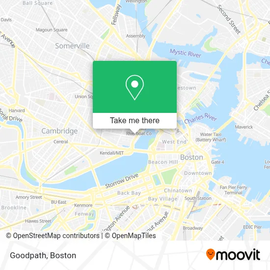
See Goodpath, Cambridge, on the map
Public Transit to Goodpath in Cambridge
Wondering how to get to Goodpath in Cambridge? Moovit helps you find the best way to get to Goodpath with step-by-step directions from the nearest public transit station.
Moovit provides free maps and live directions to help you navigate through your city. View schedules, routes, timetables, and find out how long does it take to get to Goodpath in real time.
Looking for the nearest stop or station to Goodpath? Check out this list of stops closest to your destination: Cambridge St @ Sciarappa St; Museum Way; Kendall/MIT - Main St @ Hayward St; Main St @ Kendall Station - Red Line; Lechmere - Monsignor O'Brien Hwy Opp Gore St; Lechmere - Water St @ Lechmere Busway; Kendall/MIT - Main St Opp Dock St; Binney St.; Lechmere; Kendall/MIT; Community Collge.
Bus: 19, 69, 80, 85, 88, EZRIDE, RED LINE SHUTTLE, RED LINE SHUTTLE, RED LINE SHUTTLE, RED LINE SHUTTLE, RED LINE SHUTTLE.Train: FAIRMOUNT, FRAMINGHAM/WORCESTER, HAVERHILL.Subway: GREEN LINE D, GREEN LINE E, ORANGE LINE, RED LINE, GREEN LINE B, GREEN LINE C.
Want to see if there’s another route that gets you there at an earlier time? Moovit helps you find alternative routes or times. Get directions from and directions to Goodpath easily from the Moovit App or Website.
We make riding to Goodpath easy, which is why over 1.7 million users, including users in Cambridge, trust Moovit as the best app for public transit. You don’t need to download an individual bus app or train app, Moovit is your all-in-one transit app that helps you find the best bus time or train time available.
For information on prices of bus, subway and train, costs and ride fares to Goodpath, please check the Moovit app.
Use the app to navigate to popular places including to the airport, hospital, stadium, grocery store, mall, coffee shop, school, college, and university.
Goodpath Address: 10 Rogers St street in Cambridge
- Toscanini's Ice Cream,
- Toscanini's,
- The Helmond Afghani Restaurant,
- ezride shuttle,
- Belmont Capital (Waypoint Capital Services),
- Foundation Medicine, Inc.,
- Cambridgeside Galleria Shuttle Stop,
- Galleria Mall,
- Apple Store (Apple CambridgeSide),
- Cheesecake Factory,
- Cambridgeside Galleria (Cambridge Galleria Mall),
- Superdry,
- X-Force Command Center IBM Security,
- Hotel Marlowe (Kimpton Marlowe Hotel),
- Spirit Halloween,
- Genzyme Shuttle Bus To Framingham,
- Snowy Joey's Ice Cream Truck,
- SEPHORA,
- Royal Sonesta Hotel (Sonesta International Hotels Corporation Sonesta Hotel),
- Royal Sonesta Boston Cambridge
Places Near Goodpath (Cambridge)
- Seaport District, Boston,
- Boston Medical Center, Boston,
- Boston Children's Hospital, Boston,
- Quincy Market, Boston,
- Mgm Music Hall, Boston,
- Cheers, Boston,
- House Of Blues, Boston,
- Leader Bank Pavilion (Leader Bank Pavillion), Boston,
- Massachusetts General Hospital, Boston,
- Castle Island, Boston,
- Museum Of Science, Boston,
- Boston Common, Boston,
- Faneuil Hall, Boston,
- North End, Boston,
- Isabella Stewart Gardner Museum, Boston,
- Boston Convention & Exhibition Center, Boston,
- Wang Theater, Boston,
- Prudential Center, Boston,
- Td Garden, Boston,
- Wilbur Theatre, Boston
How to get to popular places in Boston with public transit
Get around Cambridge by public transit!
Traveling around Cambridge has never been so easy. See step by step directions as you travel to any attraction, street or major public transit station. View bus and train schedules, arrival times, service alerts and detailed routes on a map, so you know exactly how to get to anywhere in Cambridge.
When traveling to any destination around Cambridge use Moovit's Live Directions with Get Off Notifications to know exactly where and how far to walk, how long to wait for your line, and how many stops are left. Moovit will alert you when it's time to get off — no need to constantly re-check whether yours is the next stop.
Wondering how to use public transit in Cambridge or how to pay for public transit in Cambridge? Moovit public transit app can help you navigate your way with public transit easily, and at minimum cost. It includes public transit fees, ticket prices, and costs. Looking for a map of Cambridge public transit lines? Moovit public transit app shows all public transit maps in Cambridge with all Bus, Train, Subway and Ferry routes and stops on an interactive map.
Boston has 4 transit type(s), including: Bus, Train, Subway and Ferry, operated by several transit agencies, including MBTA, Southeastern Regional Transit Authority, MetroWest Regional Transit Authority, Rhode Island Public Transit Authority, WRTA, Lowell Regional Transit Authority, Merrimack Valley Transit, Montachusett Regional Transit Authority, Cape Cod Regional Transit Authority, Brockton Area Transit Authority, Martha's Vineyard Transit Authority, the WAVE - Nantucket Regional Transit Authority, GATRA, Cape Ann Transportation Authority and Massport