See Grand Central Terminal, Manhattan, on the map
Directions to Grand Central Terminal (Manhattan) with public transportation
The following transit lines have routes that pass near Grand Central Terminal
 Bus:
Bus: - Train:
- Subway:
How to get to Grand Central Terminal by bus?
Click on the bus route to see step by step directions with maps, line arrival times and updated time schedules.
How to get to Grand Central Terminal by train?
Click on the train route to see step by step directions with maps, line arrival times and updated time schedules.
How to get to Grand Central Terminal by subway?
Click on the subway route to see step by step directions with maps, line arrival times and updated time schedules.
Bus stations near Grand Central Terminal in Manhattan
- Madison Av/E 42 St,3 min walk,
- 5 Av/W 44 St,3 min walk,
- E 42 St/Madison Av,4 min walk,
- Madison Av /E 42 St,4 min walk,
- Madison Av/E 46 St,4 min walk,
- E 42 St/Park Av,4 min walk,
- Madison Av/E 41 St,4 min walk,
- 5 Av / W 45 St,4 min walk,
Train stations near Grand Central Terminal in Manhattan
- Grand Central,3 min walk,
Subway stations near Grand Central Terminal in Manhattan
- Grand Central-42 St,5 min walk,
- 47-50 Sts-Rockefeller Ctr,11 min walk,
Bus lines to Grand Central Terminal in Manhattan
- M1,Harlem - East Village,
- M2,Washington Heights - East Village,
- M3,Fort George - East Village,
- M4,The Cloisters - 32 St,
- SIM23,Annadale - Midtown Manhattan Express,
- SIM24,Prince's Bay - Midtown Manhattan Express,
- Q32,Jackson Heights - Penn Station,
- M5,31 St 6 Av,
- M42,East Side U N-1 Av Crosstown,
- X27,Bay Ridge - Manhattan Express,
- X28,Sea Gate / Bensonhurst - Manhattan Express,
- X37,Bay Ridge - Midtown Manhattan Express,
- X38,Sea Gate / Bensonhurst - Midtown Manhattan Express,
- BXM3,Yonkers Getty Sq Via Sedgwick Av Via Broadway,
- BXM4,Woodlawn 242 St Via Concourse Via Katonah Av,
- BXM11,Wakefield 241 St Via Bronx Zoo Via White Plains Rd,
- X68,Midtown 57 St Via 42 St Via Madison,
- SIM22,Eltingville Via Ar Kill Rd Via Richmond,
- SIM26,Tottenville Via Blmingdale Rd Via Amboy,
- SIM6,Eltingville - Midtown Manhattan Express,
What are the closest stations to Grand Central Terminal?
The closest stations to Grand Central Terminal are:
- Madison Av/E 42 St is 162 yards away, 3 min walk.
- Grand Central is 214 yards away, 3 min walk.
- 5 Av/W 44 St is 238 yards away, 3 min walk.
- E 42 St/Madison Av is 249 yards away, 4 min walk.
- Madison Av /E 42 St is 272 yards away, 4 min walk.
- Madison Av/E 46 St is 301 yards away, 4 min walk.
- E 42 St/Park Av is 302 yards away, 4 min walk.
- Madison Av/E 41 St is 304 yards away, 4 min walk.
- 5 Av / W 45 St is 305 yards away, 4 min walk.
- Grand Central-42 St is 364 yards away, 5 min walk.
- 47-50 Sts-Rockefeller Ctr is 931 yards away, 11 min walk.
Which bus lines stop near Grand Central Terminal?
These bus lines stop near Grand Central Terminal: BM2, BXM1, M42, Q32, QM32, QM42, X37, X63.
Which train lines stop near Grand Central Terminal?
These train lines stop near Grand Central Terminal: HUDSON, MONTAUK, NJCL, PATH, PORT JEFFERSON, PORT WASHINGTON.
Which subway lines stop near Grand Central Terminal?
These subway lines stop near Grand Central Terminal: 5, 7, 7X, F, M, S.
What’s the nearest subway station to Grand Central Terminal in Manhattan?
The nearest subway station to Grand Central Terminal in Manhattan is Grand Central-42 St. It’s a 5 min walk away.
What’s the nearest train station to Grand Central Terminal in Manhattan?
The nearest train station to Grand Central Terminal in Manhattan is Grand Central. It’s a 3 min walk away.
What’s the nearest bus stop to Grand Central Terminal in Manhattan?
The nearest bus stops to Grand Central Terminal in Manhattan are Madison Av/E 42 St and 5 Av/W 44 St. The closest one is a 3 min walk away.
What time is the first subway to Grand Central Terminal in Manhattan?
The D is the first subway that goes to Grand Central Terminal in Manhattan. It stops nearby at 3:00 AM.
What time is the last subway to Grand Central Terminal in Manhattan?
The D is the last subway that goes to Grand Central Terminal in Manhattan. It stops nearby at 3:52 AM.
What time is the first train to Grand Central Terminal in Manhattan?
The NEW HAVEN is the first train that goes to Grand Central Terminal in Manhattan. It stops nearby at 5:28 AM.
What time is the last train to Grand Central Terminal in Manhattan?
The NEW HAVEN is the last train that goes to Grand Central Terminal in Manhattan. It stops nearby at 2:05 AM.
What time is the first bus to Grand Central Terminal in Manhattan?
The M2 is the first bus that goes to Grand Central Terminal in Manhattan. It stops nearby at 3:26 AM.
What time is the last bus to Grand Central Terminal in Manhattan?
The M42 is the last bus that goes to Grand Central Terminal in Manhattan. It stops nearby at 2:59 AM.
How much is the subway fare to Grand Central Terminal?
The subway fare to Grand Central Terminal costs about $2.75.
How much is the train fare to Grand Central Terminal?
The train fare to Grand Central Terminal costs about $3.25 - $23.50.
See Grand Central Terminal, Manhattan, on the map
Public Transit to Grand Central Terminal in Manhattan
Wondering how to get to Grand Central Terminal in Manhattan, United States? Moovit helps you find the best way to get to Grand Central Terminal with step-by-step directions from the nearest public transit station.
Moovit provides free maps and live directions to help you navigate through your city. View schedules, routes, timetables, and find out how long does it take to get to Grand Central Terminal in real time.
Looking for the nearest stop or station to Grand Central Terminal? Check out this list of stops closest to your destination: Madison Av/E 42 St; Grand Central; 5 Av/W 44 St; E 42 St/Madison Av; Madison Av /E 42 St; Madison Av/E 46 St; E 42 St/Park Av; Madison Av/E 41 St; 5 Av / W 45 St; Grand Central-42 St; 47-50 Sts-Rockefeller Ctr.
Bus:Train:Subway:
Want to see if there’s another route that gets you there at an earlier time? Moovit helps you find alternative routes or times. Get directions from and directions to Grand Central Terminal easily from the Moovit App or Website.
We make riding to Grand Central Terminal easy, which is why over 1.5 million users, including users in Manhattan, trust Moovit as the best app for public transit. You don’t need to download an individual bus app or train app, Moovit is your all-in-one transit app that helps you find the best bus time or train time available.
For information on prices of subway, bus and train, costs and ride fares to Grand Central Terminal, please check the Moovit app.
Use the app to navigate to popular places including to the airport, hospital, stadium, grocery store, mall, coffee shop, school, college, and university.
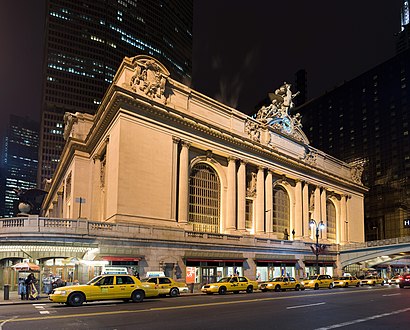
Grand Central Terminal Address: East 44th Street street in Manhattan
Attractions near Grand Central Terminal
Shirt Store,E 44th St (vanderbilt av / E 44th St),Yale Club of New York City,Yale Club Gym,Bergmano's,335 Madison Avenue,Metro North 3:33 Train to New Haven,MTA Headquarters,5:52 Train to Poughkeepsie,Grand Central Tech,E 43rd St and Vanderbilt Ave,Israel Cancer Research Fund,14,Abn Amro Bank,Grand Central 43rd Street / Vanderbilt Avenue Entrance,Track 111,E 44th St (44th street and Madison Ave),E 44th and Madison Ave,44th St & Madis,44th Mad AveHow to get to popular attractions in Manhattan with public transit
LIRR - Huntington Station, Huntington Station, Ny,MTA Subway - Coney Island / Stillwell Ave (D / F/N / Q),SoHo, Manhattan,Hair of the Dog, Manhattan,Gramercy Tavern, Manhattan,24 Hour Fitness, Manhattan,Time Life, Manhattan,Fette Sau,Freehold Raceway Mall, Freehold Township,The Grey Dog, Manhattan,Jersey Shore University Medical Center, Neptune, Nj,LIRR - Babylon Station, Babylon, Ny,J.G. Melon, Manhattan,Avenue, Manhattan,Gregory's Coffee, Manhattan,High Line, Manhattan,Nan Xiang Xiao Long Bao, Queens,Long Island, NY, Huntington Station, Ny,The Biergarten at The Standard, Manhattan,I-80 (Interstate 80), Paterson, NjGet around Manhattan by public transit!
Traveling around Manhattan has never been so easy. See step by step directions as you travel to any attraction, street or major public transit station. View bus and train schedules, arrival times, service alerts and detailed routes on a map, so you know exactly how to get to anywhere in Manhattan.
When traveling to any destination around Manhattan use Moovit's Live Directions with Get Off Notifications to know exactly where and how far to walk, how long to wait for your line, and how many stops are left. Moovit will alert you when it's time to get off — no need to constantly re-check whether yours is the next stop.
Wondering how to use public transit in Manhattan or how to pay for public transit in Manhattan? Moovit public transit app can help you navigate your way with public transit easily, and at minimum cost. It includes public transit fees, ticket prices, and costs. Looking for a map of Manhattan public transit lines? Moovit public transit app shows all public transit maps in Manhattan with all subway, bus or train routes and stops on an interactive map.
Manhattan has 3 transit type(s), including: subway, bus or train, operated by several transit agencies, including MTA Subway, Metro-North Railroad, LIRR, PATH, Shore Line East, MTA Bus Company, MTA New York City Transit - Express routes, MTA Bus, NJ Transit, NYC Ferry, NICE bus, Bee-Line Bus, NJ Transit Rail, NJ Transit Rail and Norwalk Transit District