How to get to Green Valley Analytics by bus?
Click on the bus route to see step by step directions with maps, line arrival times and updated time schedules.
From Gardner, MA, Gardner
248 minFrom Registry Of Motor Vehicles (Rmv) Branch Office, Worcester
108 minFrom Palladium, Worcester
109 minFrom Worcester, MA, Worcester
104 minFrom Saint Vincent Hospital at Worcester Medical Center, Worcester
105 minFrom Polar Park, Worcester
105 minFrom South High Community School, Worcester
203 minFrom Dcu Center, Worcester
106 minFrom Foxwoods, Worcester
135 min
How to get to Green Valley Analytics by train?
Click on the train route to see step by step directions with maps, line arrival times and updated time schedules.
Bus stops near Green Valley Analytics in Boston
Train station near Green Valley Analytics in Boston
- Holyoke Amtrak, 12 min walk,VIEW
Bus lines to Green Valley Analytics in Boston
What are the closest stations to Green Valley Analytics?
The closest stations to Green Valley Analytics are:
- Cabot / Bridge is 131 yards away, 2 min walk.
- Main / Cabot is 478 yards away, 6 min walk.
- Holyoke Amtrak is 969 yards away, 12 min walk.
Which bus lines stop near Green Valley Analytics?
These bus lines stop near Green Valley Analytics: P21, P21E.
Which train line stops near Green Valley Analytics?
VERMONTER (St Albans)
What’s the nearest train station to Green Valley Analytics in Boston?
The nearest train station to Green Valley Analytics in Boston is Holyoke Amtrak. It’s a 12 min walk away.
What’s the nearest bus station to Green Valley Analytics in Boston?
The nearest bus station to Green Valley Analytics in Boston is Cabot / Bridge. It’s a 2 min walk away.
What time is the first train to Green Valley Analytics in Boston?
The VALLEY FLYER is the first train that goes to Green Valley Analytics in Boston. It stops nearby at 6:45 AM.
What time is the last train to Green Valley Analytics in Boston?
The VALLEY FLYER is the last train that goes to Green Valley Analytics in Boston. It stops nearby at 9:51 PM.
What time is the first bus to Green Valley Analytics in Boston?
The P21 is the first bus that goes to Green Valley Analytics in Boston. It stops nearby at 5:16 AM.
What time is the last bus to Green Valley Analytics in Boston?
The P21 is the last bus that goes to Green Valley Analytics in Boston. It stops nearby at 9:05 PM.
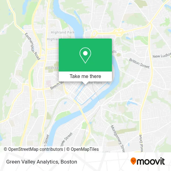
See Green Valley Analytics, Boston, on the map
Public Transit to Green Valley Analytics in Boston
Wondering how to get to Green Valley Analytics in Boston? Moovit helps you find the best way to get to Green Valley Analytics with step-by-step directions from the nearest public transit station.
Moovit provides free maps and live directions to help you navigate through your city. View schedules, routes, timetables, and find out how long does it take to get to Green Valley Analytics in real time.
Looking for the nearest stop or station to Green Valley Analytics? Check out this list of stops closest to your destination: Cabot / Bridge; Main / Cabot; Holyoke Amtrak.
Bus: P21, P21E, R22, R29, T24.Train: VERMONTER, VALLEY FLYER.
Want to see if there’s another route that gets you there at an earlier time? Moovit helps you find alternative routes or times. Get directions from and directions to Green Valley Analytics easily from the Moovit App or Website.
We make riding to Green Valley Analytics easy, which is why over 1.7 million users, including users in Boston, trust Moovit as the best app for public transit. You don’t need to download an individual bus app or train app, Moovit is your all-in-one transit app that helps you find the best bus time or train time available.
For information on prices of bus and train, costs and ride fares to Green Valley Analytics, please check the Moovit app.
Use the app to navigate to popular places including to the airport, hospital, stadium, grocery store, mall, coffee shop, school, college, and university.
Green Valley Analytics Address: 306 Race St street in Boston
- Mercy Women's Health Services, Providence Prenatal Center,
- De Todo un Poco Restaurant & Bake Shop,
- Phoenix Dance Academy,
- Main St Mini Market,
- Totsy Mfg,
- Ekko Bar & Lounge,
- Iglesia Pentecostal Poder Transformador,
- Cathedral Hill,
- Apostolic Christian Church,
- J.D. Antique Auto Repair and Sales,
- Poder Y Uncion,
- B & C Repair,
- City Paper,
- Papercity Photography & Studio Rentals,
- Ebenezer Assembly Of God Church,
- Nice Gift,
- Way Finders,
- Neighbor 2 Neighbor Ma,
- Vanguard Movement,
- Holyoke 1, 2, 4
Places Near Green Valley Analytics (Boston)
- Td Garden, Boston,
- Wang Theater, Boston,
- Museum Of Science, Boston,
- North End, Boston,
- Isabella Stewart Gardner Museum, Boston,
- Faneuil Hall, Boston,
- Boston Medical Center, Boston,
- Wilbur Theatre, Boston,
- Prudential Center, Boston,
- Cheers, Boston,
- Boston Common, Boston,
- Mgm Music Hall, Boston,
- House Of Blues, Boston,
- Massachusetts General Hospital, Boston,
- Quincy Market, Boston,
- Boston Children's Hospital, Boston,
- Boston Convention & Exhibition Center, Boston,
- Seaport District, Boston,
- Leader Bank Pavilion (Leader Bank Pavillion), Boston,
- Castle Island, Boston
How to get to popular places in Boston with public transit
Get around Boston by public transit!
Traveling around Boston has never been so easy. See step by step directions as you travel to any attraction, street or major public transit station. View bus and train schedules, arrival times, service alerts and detailed routes on a map, so you know exactly how to get to anywhere in Boston.
When traveling to any destination around Boston use Moovit's Live Directions with Get Off Notifications to know exactly where and how far to walk, how long to wait for your line, and how many stops are left. Moovit will alert you when it's time to get off — no need to constantly re-check whether yours is the next stop.
Wondering how to use public transit in Boston or how to pay for public transit in Boston? Moovit public transit app can help you navigate your way with public transit easily, and at minimum cost. It includes public transit fees, ticket prices, and costs. Looking for a map of Boston public transit lines? Moovit public transit app shows all public transit maps in Boston with all Bus, Train, Subway and Ferry routes and stops on an interactive map.
Boston has 4 transit type(s), including: Bus, Train, Subway and Ferry, operated by several transit agencies, including MBTA, Southeastern Regional Transit Authority, MetroWest Regional Transit Authority, Rhode Island Public Transit Authority, WRTA, Lowell Regional Transit Authority, Merrimack Valley Transit, Montachusett Regional Transit Authority, Cape Cod Regional Transit Authority, Brockton Area Transit Authority, Martha's Vineyard Transit Authority, the WAVE - Nantucket Regional Transit Authority, GATRA, Cape Ann Transportation Authority and Massport