How to get to Griffin Express Inc by bus?
Click on the bus route to see step by step directions with maps, line arrival times and updated time schedules.
From Gardner, MA, Gardner
264 minFrom Registry Of Motor Vehicles (Rmv) Branch Office, Worcester
126 minFrom Worcester, MA, Worcester
122 minFrom South High Community School, Worcester
219 minFrom Dcu Center, Worcester
124 minFrom Saint Vincent Hospital at Worcester Medical Center, Worcester
124 minFrom Foxwoods, Worcester
151 minFrom Palladium, Worcester
127 minFrom Polar Park, Worcester
124 min
How to get to Griffin Express Inc by train?
Click on the train route to see step by step directions with maps, line arrival times and updated time schedules.
Bus stops near Griffin Express Inc in Boston
Train station near Griffin Express Inc in Boston
- Holyoke Amtrak, 56 min walk,VIEW
Bus lines to Griffin Express Inc in Boston
What are the closest stations to Griffin Express Inc?
The closest stations to Griffin Express Inc are:
- Main / Dwight is 185 yards away, 3 min walk.
- Main / Appleton (2) is 199 yards away, 3 min walk.
- Cabot / Race is 510 yards away, 7 min walk.
- Cabot / Canal is 658 yards away, 8 min walk.
- Holyoke Amtrak is 4723 yards away, 56 min walk.
Which bus line stops near Griffin Express Inc?
P21 (Holyoke Trans. Ctr. Via Meetinghouse/Meadow)
Which train lines stop near Griffin Express Inc?
These train lines stop near Griffin Express Inc: VALLEY FLYER, VERMONTER.
What’s the nearest bus station to Griffin Express Inc in Boston?
The nearest bus stations to Griffin Express Inc in Boston are Main / Dwight and Main / Appleton (2). The closest one is a 3 min walk away.
What time is the first train to Griffin Express Inc in Boston?
The VALLEY FLYER is the first train that goes to Griffin Express Inc in Boston. It stops nearby at 6:45 AM.
What time is the last train to Griffin Express Inc in Boston?
The VALLEY FLYER is the last train that goes to Griffin Express Inc in Boston. It stops nearby at 9:51 PM.
What time is the first bus to Griffin Express Inc in Boston?
The P21 is the first bus that goes to Griffin Express Inc in Boston. It stops nearby at 5:17 AM.
What time is the last bus to Griffin Express Inc in Boston?
The P21 is the last bus that goes to Griffin Express Inc in Boston. It stops nearby at 9:02 PM.
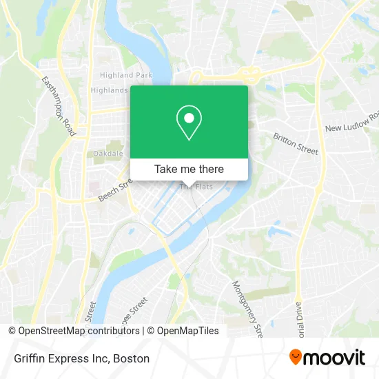
See Griffin Express Inc, Boston, on the map
Public Transit to Griffin Express Inc in Boston
Wondering how to get to Griffin Express Inc in Boston? Moovit helps you find the best way to get to Griffin Express Inc with step-by-step directions from the nearest public transit station.
Moovit provides free maps and live directions to help you navigate through your city. View schedules, routes, timetables, and find out how long does it take to get to Griffin Express Inc in real time.
Looking for the nearest stop or station to Griffin Express Inc? Check out this list of stops closest to your destination: Main / Dwight; Main / Appleton (2); Cabot / Race; Cabot / Canal; Holyoke Amtrak.
Bus: P21, G19, R29, T24, R22.Train: VALLEY FLYER, VERMONTER.
Want to see if there’s another route that gets you there at an earlier time? Moovit helps you find alternative routes or times. Get directions from and directions to Griffin Express Inc easily from the Moovit App or Website.
We make riding to Griffin Express Inc easy, which is why over 1.7 million users, including users in Boston, trust Moovit as the best app for public transit. You don’t need to download an individual bus app or train app, Moovit is your all-in-one transit app that helps you find the best bus time or train time available.
For information on prices of bus and train, costs and ride fares to Griffin Express Inc, please check the Moovit app.
Use the app to navigate to popular places including to the airport, hospital, stadium, grocery store, mall, coffee shop, school, college, and university.
Griffin Express Inc Address: 12 Crescent St street in Boston
- Insulation Contractor of New England,
- Way Finders,
- Iglesia Moradora de-Sion Inc,
- Holyoke Police Department,
- Holyoke Craft Beer,
- United Arc,
- Poder Y Uncion,
- Steam Building,
- Hcc Mgm Culinary Arts Institute,
- Iglesia Pentecostal Poder Transformador,
- Illusion Auto Sales,
- B & C Repair,
- Bermudez Auto Recovery,
- Cubit Building,
- Cubit Coworks,
- Nice Gift,
- Parkview Financial,
- Ekko Bar & Lounge,
- Phoenix Dance Academy,
- De Todo un Poco Restaurant & Bake Shop
Places Near Griffin Express Inc (Boston)
- Boston Children's Hospital, Boston,
- Castle Island, Boston,
- House Of Blues, Boston,
- North End, Boston,
- Seaport District, Boston,
- Faneuil Hall, Boston,
- Leader Bank Pavilion (Leader Bank Pavillion), Boston,
- Wang Theater, Boston,
- Boston Convention & Exhibition Center, Boston,
- Boston Common, Boston,
- Massachusetts General Hospital, Boston,
- Boston Medical Center, Boston,
- Prudential Center, Boston,
- Cheers, Boston,
- Td Garden, Boston,
- Mgm Music Hall, Boston,
- Quincy Market, Boston,
- Wilbur Theatre, Boston,
- Museum Of Science, Boston,
- Isabella Stewart Gardner Museum, Boston
How to get to popular places in Boston with public transit
Get around Boston by public transit!
Traveling around Boston has never been so easy. See step by step directions as you travel to any attraction, street or major public transit station. View bus and train schedules, arrival times, service alerts and detailed routes on a map, so you know exactly how to get to anywhere in Boston.
When traveling to any destination around Boston use Moovit's Live Directions with Get Off Notifications to know exactly where and how far to walk, how long to wait for your line, and how many stops are left. Moovit will alert you when it's time to get off — no need to constantly re-check whether yours is the next stop.
Wondering how to use public transit in Boston or how to pay for public transit in Boston? Moovit public transit app can help you navigate your way with public transit easily, and at minimum cost. It includes public transit fees, ticket prices, and costs. Looking for a map of Boston public transit lines? Moovit public transit app shows all public transit maps in Boston with all Bus, Train, Subway and Ferry routes and stops on an interactive map.
Boston has 4 transit type(s), including: Bus, Train, Subway and Ferry, operated by several transit agencies, including MBTA, Southeastern Regional Transit Authority, MetroWest Regional Transit Authority, Rhode Island Public Transit Authority, WRTA, Lowell Regional Transit Authority, Merrimack Valley Transit, Montachusett Regional Transit Authority, Cape Cod Regional Transit Authority, Brockton Area Transit Authority, Martha's Vineyard Transit Authority, the WAVE - Nantucket Regional Transit Authority, GATRA, Cape Ann Transportation Authority and Massport